Well, the Escapade is over, and rigs are pulling out all around us. In just a few minutes, our first Red Cross class begins. At the lunch break, we will have only a short time to move Odyssey from our primo spot here to another spot across the fairgrounds, so we will be stowing the satellite dish.
I'm hoping we will be able to get on line from our new spot, but we don't know what the tree cover is like there. We will see.
Friday, September 30, 2005
Tuesday, September 27, 2005
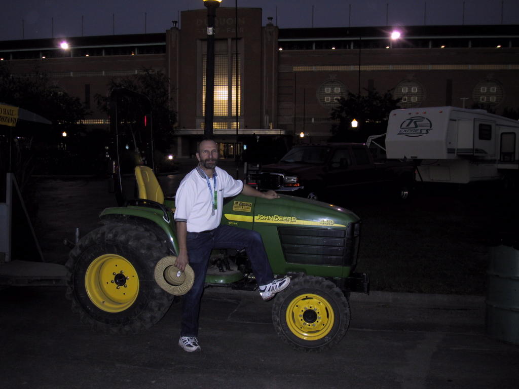
Escapade rally, Du Quoin, Illinois
We are at the Du Quoin State Fairgrounds (map) at our first Escapade.
We came over yesterday from Rend Lake in a caravan with other members of the Full-Timing Class of 2005, hoping to be parked together. Consequently, we spent nearly an hour in a staging area until the parking folks were ready for us (a caravan of 30 was ahead of us). By the time they led us in, the remnants of Tropical Depression Rita were hammering the fairgrounds with driving rain. We passed several rigs on our way in that were already stuck in the mud, awaiting rescue by one of the tractors deployed for the purpose. As we approached our designated parking area, I could see that Odyssey was going to sink up to her hubs if we went where the parkers indicated. I did not think their tractor was big enough to pull us out if that happened.
They had already broken our group into two pieces anyway, and we found a nearby patch of gravel, adjacent to the paved road, that looked perfect. A few words with the parking volunteers was all it took to secure the gravel site. It turns out to be an ideal site, since we are shaded by trees most of the day, but have a clear shot to the satellite through a nice gap.
A few minutes after we parked, the parkers directed a big fifth-wheel behind a ten-wheel, class-8 Freightliner truck tractor into the space next to us, and the whole rig promptly sunk in the mud, where it remained until they could pull it out this morning. The sheer number of privately owned class-8 truck tractors, many with full sleepers, pulling travel trailers at this rally is staggering. Many of these, including the one next to us, are only distinguishable from commercial semi tractors by lettering announcing the fact displayed prominently in the location normally used for ICC numbers and the like (and the fact that they are pulling otherwise unremarkable fifth-wheel travel trailers). The Escapees even has a Birds-of-a-Feather group dedicated to medium-duty and larger trucks used as tow vehicles.
The rally itself is nothing to write home about (blogging is another matter, so your suffering continues). While there are reported to be close to 800 rigs here, which is a huge rally, the seminars are lackluster, the exhibit hall is minuscule, and information and products of value to us personally are few and far between. It is unlikely we would have scheduled ourselves to be here if it was not for the Red Cross training that had been scheduled on both ends of the event (the first part of which was canceled). That being said, as members of the Escapees we are glad to have had the opportunity to attend the organization's signature event and see what it is all about. Also, we have met many nice and interesting people here, and this event for us is more about the people than the organized program.
On another subject entirely, we are once again saddened by the news coming from the gulf coast. While there appears to have been little loss of life, and we have spoken to our friends in Beaumont who are fine (though they evacuated to their property in Woodville, also battered by hurricane-force winds, and have no news of their home and business in Beaumont), the destruction appears devastating.
When we traveled along the gulf coast in January, we had a tire repaired in Abbeville, passed through Oak Grove and Creole, took the ferry from Cameron, and made a wrong turn in Holly Beach. I even posted here a humorous ditty about the bayou country. All those towns have been utterly destroyed.
Our hearts go out to the people of the gulf coast. We are hoping that we can help in a more substantive way after we complete our training next week.
Friday, September 23, 2005
Death of the camera
After I finally figured out how to do some useful things with the camera, like turn off the annoying beep, it up and died on me. Sean has isolated the problem to the backup battery, which we are hoping we can replace easily. It is one of those small, coin shaped ones that are often sold near the hearing aid batteries. So, no current photos until we find a battery or bite bullet and get a new camera.
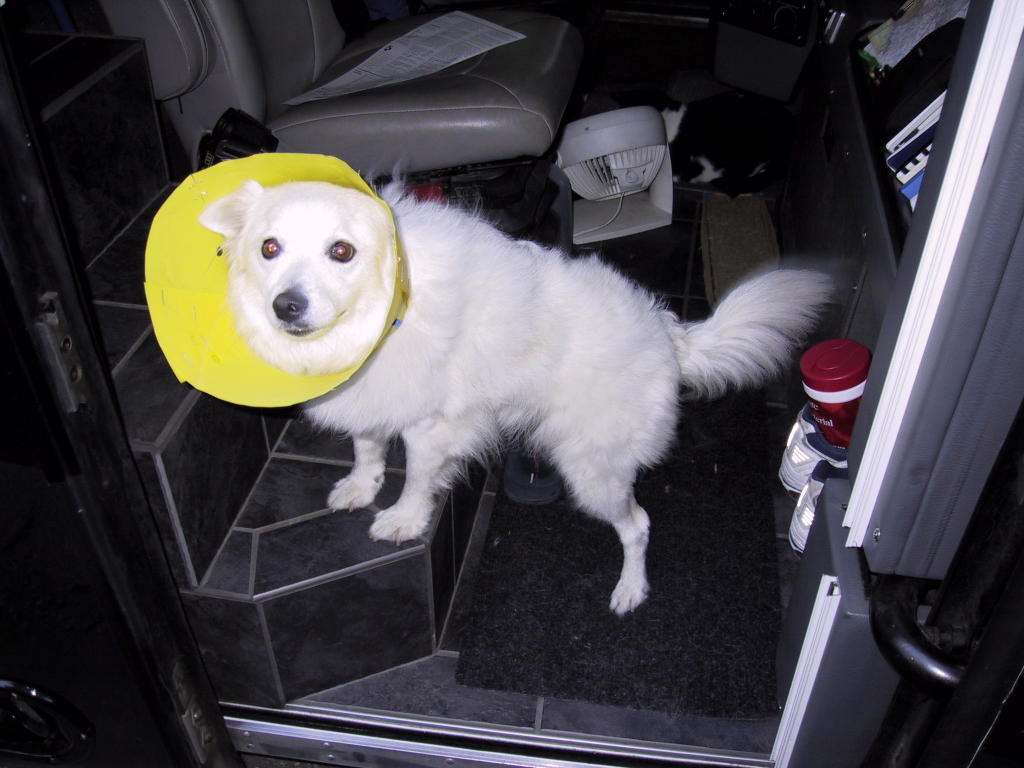
In the meantime, one of our friends here from the "Class of 2005" is posting pics on his blog, so when he has one of us and/or the group, I'll steal it, I mean borrow it, and put it up. I also have lots of unpublished pet shots to use if we get desperate, like this one:
In the meantime, one of our friends here from the "Class of 2005" is posting pics on his blog, so when he has one of us and/or the group, I'll steal it, I mean borrow it, and put it up. I also have lots of unpublished pet shots to use if we get desperate, like this one:

Rend Lake, on the Big Muddy
We are at a Corps of Engineers campground on Rend Lake, an impoundment of the Big Muddy River (map). We are here principally because a group of people we have met on the internet have congregated here in a pre-rally for the upcoming Escapade rally in Du Quoin, about 20 miles west of here.
The group is the "Full-Timing Class of 2005," a loose-knit group that came together spontaneously in an on-line forum called RV.Net, a bulletin board that Louise visits regularly. The theme here is people who began full-timing this year, and we squeaked in even though, technically, we hit the road near the end of 2004. (There is no "Full-Timing Class of 2004," as far as we know.) The group organized around the concept of having a rally in Quartzsite, AZ in January of '06, and somewhere along the line, morphed into an Escapees Birds-of-a-Feather group.
We will be here through Sunday morning, when we will all move over to the fairgrounds in Du Quoin for the Escapade. This is actually a pretty nice spot, with well-separated, wooded sites equipped with 30-amp electric service -- handy, since we are still running at least one air conditioner pretty much around the clock.
We arrived here yesterday, and staked out a spot that the volunteer at the gate had told us was available for our entire stay. However, when we hoofed it back to the gate to pay, his computer would not let him book us into the site for more than one night. Apparently, the reservations system run by a contractor (in Canada, I'm told) has a few quirks. They were able to fix the problem today and we are good through Sunday.
After driving back through Cairo yesterday morning, we discovered that our planned route of US-51 would put us on the interstate, so we elected instead to continue up the Great River Road, Illinois 3, until we had to jog over to De Soto on IL-149 to pick up our waiting mail. We then continued on 149 to 37 into Benton to approach the lake from the east. The more direct route from the west comes in over the dam, and there is a ten-ton weight limit on the spillway bridge.
Tomorrow is the big pot-luck dinner.
Tuesday, September 20, 2005
Where the Ohio meets the Mississippi
We are at Fort Defiance State Park, at the confluence of the Ohio and Mississippi rivers (map).
This is a dead park in a dying town. We are literally the only souls here in the campground, which is somewhat in disrepair. Signage in the park dates variously from 2000 to 2002. We did see someone trimming around the trees earlier, and there is evidence that the trash barrels are emptied periodically. And the power is on. We found two or three sites with 50 amp service, but chose one with a more favorable view that had only 30 amps. The power outlets are mounted eight feet above the ground, and I believe that even that is not enough to keep them above water when the rivers flood. I needed to stand on a chair to plug in. (I'm fairly certain that violates some NEC provision, but I'm guessing the city of Cairo is not going to cite itself.)
Even though there is no evidence the iron rangers are ever opened, we dutifully made out a check and stuffed it in the slot (the envelopes have long since been emptied from the dispenser, which contained traces of river mud). A sign says to pay at the Toll House, a structure associated with the Ohio river bridge to Kentucky (which has been toll-free since 1948) and now the park office, such as it is, but it was closed, with no evidence that it is ever open at any time.
The whole deserted nature of the place is exacerbated by the fact that the US-60/62 bridge over the Mississippi from Missouri is closed for repairs. It apparently closed yesterday and will remain so for at least 45 days. Too bad for us, since we had planned to arrive here that way. Instead, we had to detour up I-57 and backtrack down US-51 through the slowly dying city of Cairo, Illinois. The entrance to the park is just before the bridge portal, and to even get here required passing a giant "Road Closed in 500 Feet" sign. Perhaps the park gets more traffic when the bridge is open.
In any case, it is delightful to have this wonderful location all to ourselves. We walked up to the toll house (which, like the bridge approaches, is on the levee system) and read the various historical markers and plaques. We also set up the roof-top deck, and sat up there watching the towboats exchange barges on the Ohio. We can't really see the Mississippi directly from our site, but the Ohio is right out our front window. Tomorrow, we will walk down to the confluence and the 60's era Boatmen's Memorial structure there.
Even though the park is named Fort Defiance State Park, there are no fortress remnants here. For that matter, even the State Park part is something of a misnomer, as the state more or less abandoned the place years ago, and the city of Cairo stepped in to build the RV park, and continues the park's upkeep. In researching the place on the net, I came across a proposal to build a replica fort and generally improve the park's historic value as some kind of national memorial park named the Confluence of Freedom. However, there is no evidence that anything will be done with that proposal. US Grant built a fort here during the Civil War, and Lewis and Clark camped here en route to the Missouri.
In fact, it was only through some serious digging on the internet (including looking at satellite imagery) that I even knew there would be RV parking here. It is not listed in any of our guidebooks, which might also account for the utter desolation.
Today's drive up the Great River Road (mostly US-61) was uneventful and fairly short. We did stop for fuel, topping off at $2.499, the cheapest we have found anywhere in the last thousand miles or so. We also stopped for lunch at Lambert's Cafe in Sikeston, Missouri, home of the Throwed Rolls (really). The food was good, and so was the kitsch, even though the tourist-trap factor was high and that normally deters us. (Sure sign of tourist trap: bus parking, with four tour coaches already parked when we arrived sometime after 2. Odyssey fit right in.) The only problem was that we did not bring a big enough appetite to do justice to the place. The food just keeps coming.
It was just after Lambert's that we encountered the "Road Closed 12 miles Ahead" sign on US-60 and had to divert up I-57 to cross the river.
Tomorrow we will head up US-51 to De Soto, where our mail should be waiting, then jog over to Rend Lake for our pre-rally.
Ft. Defiance State Park in Cairo, IL at the confluence of the Mississippi and Ohio Rivers.

The view to the west shows the (closed) bridge over the Mississippi River.

The view to the north shows the bridge over the Ohio River. To the left, you can see the rest of the campground, completely empty. Note the electrical pedestals a good 7 feet above ground to keep from being submerged when the river(s) flood.
On the Mississippi in Caruthersville, Missouri
We are once again at a casino, this time in Caruthersville, Missouri (map). This is another riverboat casino, Casino Aztar, which is in an actual navigable vessel that, nevertheless, does not ever leave the dock.
After leaving the Corps of Engineers campground yesterday, we made our way across the White River through the White River National Wildlife Refuge, which has an excellent visitor center just off route 1. We then made our way over to the great river road via US 79 and Arkansas 218.
The great river road is not a single road at all, but a scenic byway designation for a collection of state and US highways, and even some local roads, that generally follows the Mississippi, at times coming close enough to afford a glimpse of the river.
Our route plan had called for the day to end around West Memphis, AR, but I really wanted to stay someplace where we could actually see the river. Louise pored over the guide books, which revealed not only no river-front parks, but no RV camping whatsoever along our route well into Missouri. We did note, though, that there were Wal-Marts in Osceola, AR and Caruthersville, MO, both cities being right on the river, and we thought we might get lucky.
Crossing into Missouri on US 61, we were close enough to I-55 to spot a billboard promoting this casino and its brand new RV park. Sure enough, our casino guide said "RV park coming soon."
I got my wish -- not only is the casino property right on the river (as it needs to be, since the casino operates with a riverboat gaming license), but the RV park is actually on the river side of the ten foot high levee/flood wall system. Access to the park is through a gate in the flood wall. (No danger yet -- the river is at least thirty feet below us as I type this.)
We suspended our usual disdain for commercial parks since this place is (1) almost empty, (2) right on the river and we have a riverside site, and (3) has 50 amp power and we still need to run our A/C around the clock. It also has free wi-fi, a fact we learned only after deploying our dish.
The place is pricey by our standards, at $20 per night, but showing our Good Sam card got us $2 off, and signing up for their player's club got us another $2 discount. Our one-night stay also included two free cocktails in the bar, so overall it was not a bad deal.
The casino itself is a crummy little place. Our curiosity about the name Aztar got the better of us, and I looked it up. Turns out Aztar is a spin-off from Ramada Inns of their casino business, and the holding company operates two riverboats under the Aztar name, the Tropicana properties in Atlantic City and Las Vegas (this latter one also being a rather distressed property, based on my last two stays there), and the Ramada Express in Laughlin.
Nevertheless, we had a pleasant and quiet stay here, and I very much enjoyed sitting by the river and watching the towboats go by last night.
Today we will continue along the river, crossing into Cairo, Illinois, where we hope to stay at Fort Defiance State Park, right at the tip of Illinois and the confluence of the mighty Ohio and Mississippi rivers.
Critters aplenty
Our campsite here along the Mississippi River is literally crawling with creatures. We have seen at least 5 large toads hopping across our grass, and one small green tree frog. The cicadas are huge and rest on the concrete parking pads. Crickets scurry everywhere. All are safe from Opal because her cone slows her down.
Yesterday at Lake Merrisach, I got up early to walk around the campground while it was still cool. I saw many Great Blue Herons, which were flying low across the water and honking their calls to each other. The park has a pond designated for "Kiddie Fishing Only," and I spent about 45 minutes sitting on the banks. I could see many small fish near the water's edge, and at one point something emerged from the muddy bank nearly at my feet, stirred up the water, and disappeared. I assume it had fish for breakfast. A young female Cardinal approached me saucily and we stared at each other for a good 5 minutes before I moved and startled her.
Across the little pond, in a grove of oak trees, I kept hearing an unfamiliar bird call, a sort of high hoarse chirping, and what was obviously woodpecker tapping. I walked across the foot bridge and on my way to the grove, saw a beaver on the water's edge. It didn't see me immediately, so I was able to watch this shy beastie for almost a minute. Then, bad Indian that I am, I stepped on a twig and the beaver dove out of sight.
There were about 5 woodpeckers in the grove and as they flew from tree to tree I was able to see that they were Red Headed Woodpeckers. Gorgeous! When I got back to the bus and looked in my Sibley's Guide to Eastern Birds, I learned that they were making the hoarse cries, as well. I also saw Blue Jays and Robins in the oak grove, and one Great Egret feeding in the pond, making short work of the little fish.
Monday, September 19, 2005

Arkansas Post Canal
Our stealth camping experience last night was peaceful and uneventful. As we suspected, the nearly-defunct shopping plaza attracted no attention. Even though the plaza was clearly built for retail shopping, only one retail store remains, a discount clothier. The few other occupants were all closed today -- a mortgage lender, the Louisiana State Lottery field office, and the Transportation Security Administration (really -- I guess they have to have an office someplace). You can tell a shopping center is on the skids when government agencies, notorious for low-rent accommodations, start moving in.
We had another first last night -- running one air conditioner overnight on batteries alone. We ran the genny, with all three roof airs, from when we returned from Olive Garden until we went to bed. At that point, the batteries were mostly charged, and we opened the windows and turned the FanTastics on. Even though the outside temperature had dropped into the 70's, the latent heat in the coach along with the outside humidity were just too much for me to be able to sleep comfortably, so I turned the bedroom air conditioner on medium. The wall thermostat night-time setting cycled it on and off, and I would estimate it ran about 50% duty from 2ish until 9ish when I got up and started the genny back up. In that period it drew about 200 or so amp-hours, about one half of our usable capacity, out of the batteries.
The deficit was easily replaced in the three hours of genny run time this morning, which we needed in any case to run all of the air conditioners as the day heated up. I am quite pleased with the system's performance.
Today we continued north on US-165 into Arkansas, and stopped in at the Arkansas Post National Memorial, on the Arkansas River just off our route. This is one of those gems that we did not even know existed, yet it was a very informative stop. I can not, in the space of this blog, do justice to the multifaceted history of this trading post. (The river itself moved away from the post years ago.)
Upon leaving the memorial, we continued north on 165, heading for AR-1 across the White River. It being the end of the day, we decided to find a nice place to stop, and our guides directed us here, to the US Army Corps of Engineers campground on Lake Merrisach (map).
Ironically, we are just seven miles due east of the Arkansas Post, however it was a drive of some 30+ miles by road. Tomorrow we will back-track half that distance to re-join our planned route.
This facility exists because the Corps built a channel, dam, and lock to connect the Arkansas river to the White River, a shortcut to the Mississippi. The canal cuts through the bayou that was formerly the bend of the Arkansas along which the post had been constructed. Just another skirmish in the Army's unending war with the forces of nature.
This morning we received some disappointing news. Due to the massive Katrina relief, instructors are in short supply, and more than half of our scheduled Red Cross training in Du Quoin has been canceled. Consequently, there will be no training in advance of the rally, and only four days worth afterwards. Our target date of 9/22 to arrive in Du Quoin has thus evaporated, even though we are already en route and just three days away. The good news is that, we are told, the training that is still being made available will qualify us for immediate deployment on the ongoing relief efforts.
Since there is not really much else we can do with the three extra days, we are going to continue with our present course and speed, and we will try to join up with a pre-rally for the "Full-timing class of 2005," a group with which we are also involved. We are already scheduled to be at the class of '05 rally in Quartzsite in January, and had expected to miss out on this pre-rally due to our now-canceled training commitment.
I will close today's post with a comment on the photo Louise has already posted of our site here. It's a great shot, but it looks for all the world like I am putting money in the parking meter! It's actually the 30-amp electrical pedestal -- one of the things that attracted us to this site, since we are still running air conditioners 24 hours a day.
Sunday, September 18, 2005
Saturday, September 17, 2005
Monroe, Louisiana
We are stealth camping in Monroe Louisiana, at the mostly defunct Pecanland Plaza (map), across the street from the bustling Pecanland Mall.
I say "stealth" because there is no going concern here (at least, one open on weekends) from whom to ask permission. We are taking the absence of "No Overnight Parking" signs as a good indicator -- the mall across the street has posted one at every entrance.
We parked here because I got a craving for Olive Garden, and there is one on the periphery of the mall. Monroe is one of the few "cities" on our route to Du Quoin, our route plan called for us to stop somewhere near here anyway, and I surmised that there might be an Olive Garden and perhaps some suburban boondocking alternatives such as Wal-Mart. None of the usual suspects were close enough to the restaurant, though, so we scouted until we found this parking lot.
The mall should be closing in another twenty minutes or so, and, with luck, no one will disturb us tonight.
Today's drive was uneventful, just a straight shot up 165. We did fuel up -- it turned out that Cushatta had it's own gas station, with $2.569 diesel, one of the lowest prices in the state.
Tomorrow we will leave Louisiana for Arkansas.
Kinder, Louisiana
We are at the Coushatta Casino Resort in Kinder, Louisiana (map).
Like many casinos, this one allows free RV parking in a designated area. However, they also have a full-service RV park, and that is where we decided to stay. It is still very hot and humid here, so the 50-amp service came in handy to run our air conditioners, plus they have a coin laundry and a pool, and we availed ourselves of both of these yesterday afternoon. I have no idea what the casino is like; since we are paying retail for our space, we did not feel the need to even go inside.
The RV park, which they have named "Red Shoes" after a Coushatta chief, has around 100 RV spaces, but it also has an equal number of "chalets," which are essentially cabin-style single-wides for rent. We're close enough to the disaster zone here that quite a number of the chalets seem to be occupied by evacuees and FEMA workers. There was even a large bucket of free laundry detergent in the laundry room labeled "evacuees only."
Today we will continue north on US-165, through Alexandria. I am hoping to find some inexpensive fuel before we leave the state, as Louisiana has the second-lowest average diesel price in the country. Ironically, the lowest fuel prices are in the areas around and south of Lafayette and Baton Rouge, and we are now moving further away from there.
Friday, September 16, 2005
A week of unscheduled downtime
We are still at the Beaumont Elks.
When we landed here Monday afternoon, after some unscheduled maintenance, we had hoped to check in with the local Red Cross shelter to see if we could help out for the week. However, as we turned in on Monday night, we both felt symptoms of impending sickness.
Sure enough, on Tuesday morning, I had a sore throat, and Louise was down for the count. I never progressed beyond the sore throat stage (though it is still a bit sore today), while she had a full-blown flu.
In addition to feeling too crummy to do anything, we certainly did not want to bring our virus to a shelter, so we have remained cooped up in Odyssey right here at the lodge.
Now that she is starting to feel a bit better, we need to be heading toward Illinois. On top of that, we are completeley out of groceries, and our waste tanks are full, since we have literally not moved from this spot since Monday, and we had not planned to be stopped for this long.
We are in the process of packing up right now, and will head out shortly. Our route will take us back through Louisiana and up into Arkansas.
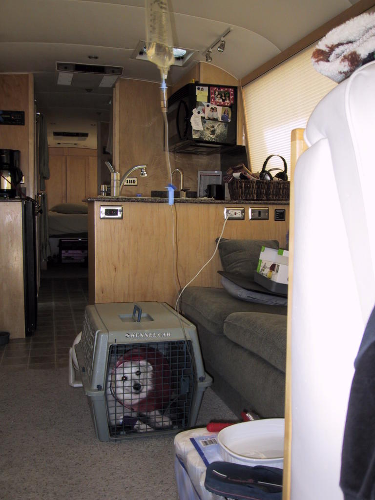
Opal, meanwhile, has made a nearly complete recovery. She is her usual self, except for the last vestiges of the skin condition, which continues to make her itch. The pathology on that came back yesterday, but was completely uninformative, so we are chalking it up to whatever toxicosis caused the other symptoms. In the meantime, she will need to wear her cone until the itching stops.

When we landed here Monday afternoon, after some unscheduled maintenance, we had hoped to check in with the local Red Cross shelter to see if we could help out for the week. However, as we turned in on Monday night, we both felt symptoms of impending sickness.
Sure enough, on Tuesday morning, I had a sore throat, and Louise was down for the count. I never progressed beyond the sore throat stage (though it is still a bit sore today), while she had a full-blown flu.
In addition to feeling too crummy to do anything, we certainly did not want to bring our virus to a shelter, so we have remained cooped up in Odyssey right here at the lodge.
Now that she is starting to feel a bit better, we need to be heading toward Illinois. On top of that, we are completeley out of groceries, and our waste tanks are full, since we have literally not moved from this spot since Monday, and we had not planned to be stopped for this long.
We are in the process of packing up right now, and will head out shortly. Our route will take us back through Louisiana and up into Arkansas.
Opal, meanwhile, has made a nearly complete recovery. She is her usual self, except for the last vestiges of the skin condition, which continues to make her itch. The pathology on that came back yesterday, but was completely uninformative, so we are chalking it up to whatever toxicosis caused the other symptoms. In the meantime, she will need to wear her cone until the itching stops.
Monday, September 12, 2005
Beaumont, Texas
Well, we actually did make it to Woodville Friday afternoon in time for the birthday festivities.
We rose early on Friday, mostly because of anxiety about Opal and her condition. Given the situation, we thought it best to get under way, and we broke "camp" at the Wal-Mart before eight, possibly a record for us.
A station in town had diesel at a good price, and we decided to fill up before getting back on the parkway. We pulled up to the pump and went inside to pay, only to find that the entire town of Kosciusko could not accept credit cards, with the possible exception of Wal-Mart. I'm not sure I understood why -- probably the local merchant bank was still having telecommunications problems post-Katrina.
In any case, it was cash only, and we were down to our last $50 or so, whereas we needed about $200 worth of fuel. A gentleman sitting in the c-store/cafe reading the paper and drinking his coffee overheard my exchange with the cashier, and offered to cash our personal check so we could buy fuel. There is nothing like southern hospitality.
Even with the fuel stop, it was hardly past eight when we rolled back out onto the Natchez Trace Parkway. The road was absolutely deserted, and we dialed the cruise in at the posted limit of 50mph and sailed all the way to Jackson.
The parkway is incomplete through Jackson, and the work-around involves a brief westward jaunt on I-20. Our routing software had suggested that remaining on I-20 all the way to Shreveport, then heading south, would be a faster alternative, even though the parkway was more direct by some 70 miles. However, I-20 was in such bad shape that we had to drop our speed to less than 60mph just to make it tolerable. When the exit for the southern portion of the Trace came up, we bailed off the interstate, and were quite glad we did so. The pavement remained smooth and empty all the way to Natchez.
After crossing the Mississippi into Vidalia, we followed US-84 west to LA-28 into Alexandria, the crossroads (and center) of the state. In spite of rumors and dire warnings about fuel shortages and gouging in southern Louisiana, we saw the lowest diesel prices in Vidalia that we have encountered for weeks: $2.599/gallon. We have not seen that price since, and I am sorry we didn't top off there.
We followed LA-28 to its end in Leesville, intending then to follow LA-8, the Nolan Trace Parkway, all the way to the Sabine river and Texas-63. Turns out, though, that the bridge over the Sabine at that location, while a truck route, has a clearance of only 12'3". Fortunately, it was so posted in Leesville, so we had ample opportunity to detour south to US-190, which took us all the way to Woodville. This detour ate up 30 miles of what we "saved" by bailing off I-20, but we still made Woodville by 6:00pm.
You may recall that we were pushing to Woodville because the vet there was only open till noon on Saturday, and we thought Opal would at least need another liter of ringers. However, her condition improved markedly throughout the day, and by the time we parked, she was her usual self again, other than being extremely itchy from the skin condition and infection. We also discovered that her paw was soaked, and, upon inspection, we found that the drip line had snapped off at the catheter. We removed the catheter and discarded the remaining 300cc's or so of solution. By Saturday morning, she was so chipper and drinking so many fluids that we decided the drip was probably not doing anything further for her.
We left Odyssey in the parking lot at the Woodville Wal-Mart (map), and our friends picked us up by car for our weekend at their ranch, which is pretty much inaccessible to the bus due to low-hanging trees and soft spots in the road. We had a nice visit, tooling around on the ATV's, swimming in their private lake, and even shooting a few clays. We returned last night to the coach and spent the night there at the Wal-Mart.
We had intended to devise our plan for the next week before leaving that spot, but, once again, circumstances supervened. When we awoke this morning, a hissing sound was coming from the neighborhood of the toilet, and we traced it to the air pressure regulator. This device regulates the air to the toilet down to the required 60psi from the 80-120psi that is normally found in the coach air system. It is possible that this regulator has been one of the sources of leakage that we have been trying to track down for some time; in any event, this morning it was leaking catastrophically, to the point where we had to close it off to keep the coach from losing all air pressure, which made the toilet unusable.
Now we have many backup systems and contingency plans, but a working toilet is pretty much a requirement unless we are in the deep backwoods or parked next to a restroom, and even then, who wants to have to trek someplace at 3am just to take a leak. So the first order of business this morning became finding either a rebuild kit or a replacement for the regulator. The closest item turned out to be at Grainger, and the nearest Grainger was here in Beaumont, so we set a direct course and headed south, with only a brief stop at the Big Thicket National Preserve visitor center en-route.
Even though I had pre-ordered the regulator on-line (selecting "Will-Call" instead of shipment for delivery), we nevertheless had some hassle at Grainger picking it up. Grainger only sells to businesses, not retail to individuals, and somehow our previously entered business information got deleted from our on-line account. After signing triplicate forms in blood, they gave me my $10.45 part (sheesh), and we fixed the air system right there in our on-street parking space (in case I needed any other parts).
That taken care of, we made our way here, to the Beaumont Elks Lodge (map). They are well set up for rigs here, with both 30 and 50 amp pedestals, and we are happy to have the juice to run all our air conditioners in the south Texas heat and humidity.
Tomorrow we will turn our attention to further plans. We are hoping to volunteer at one of the shelters, possibly even the one here in Beaumont, but we need to find one that is in need of walk-in help. Until we complete our official training at the end of this month, it is the only way we can assist.
Friday, September 9, 2005
Kosciusko, Mississippi
Once again we are at a Wal-Mart, this time in Kosciusko, Mississippi (map). If you zoom the map in really close, though, it looks almost as if we are staying right on the Natchez Trace Parkway. We have a nice view of the wooded park strip out our front window.
As I noted earlier, we picked Opal up at the vet this morning. She is on an IV drip of Lactated Ringers, and he also gave us three other scripts and kidney-friendly prescription food. She is much more alert than when we dropped her off, but she is still quite ill, and we do not know yet what the underlying cause is. Organo-phosphates have pretty much been ruled out. The skin biopsy the vet took will not be back until next week, and, until then, we are at a loss as to what to do.
We hung a fresh liter of ringers this afternoon, which should last her into tomorrow. We will probably leave her with a vet in Woodville during our visit, so she can continue IV fluids as needed and have closer observation.
We were supposed to be in Woodville, Texas tomorrow evening for a birthday party. Even though we originally set a very leisurely pace, with plenty of opportunities to change to more expeditious routes, circumstances have conspired to foil that plan, and it looks as if we will be a full day late.
We were, of course, way-laid for a full 24 hours with Opal at the vet. Even so, I set a schedule to get us to Woodville early tomorrow afternoon, with some breathing room. However, the logistics of having an ill dog aboard meant frequent stops. On one excursion from the parkway, our right side drivers dropped into a hole as we made a turn, which unseated the air bag. We realized this once we were back on the parkway at speed, and we had to drop our speed down to 30 and limp 30 miles to Florence, Alabama, where we found a truck shop to help us with it. Between the low-speed operation, the 30+ mile detour, and the 40 minutes or so in the shop, the little air bag fiasco cost us two hours. An ironic footnote is that the last time we unseated a bag, we were en route to visit these same friends, and had to tell them we'd be a day late that time too.
Later on, on a routine check on the dog, we realized her IV had run out, and air had infiltrated the drip line. We spent a good half hour or so parked in a turnout dealing with clearing the line and hanging a fresh bag.
In the end, we just ran out of daylight, and had to end our day here. There is actually a free park service campground on the parkway 30 miles north of here that would have been an even better choice, but it is still closed after Katrina. So we pressed on, knowing there was a Wal-Mart here close to the parkway (little did we know just how close).
In any case, we are nine hours driving time from our destination, and that assumes no further canine or mechanical issues
We will try to get an early start tomorrow anyway, because the vet in Woodville is only open till noon on Saturday.
Thursday, September 8, 2005
Doggy Update
Just got off the phone with the vet. Opal's condition has improved quite a bit, and she is snipping at the vet staff. They still don't know what's causing the condition, but she has responded well to the IV fluids. They have also given her Dexamethasone to assist her immune system.
The doctor now believes that the skin issues are related, and he has taken a biopsy of the skin condition for evaluation by an outside lab. It will be at least another day before we have those results.
Given our schedule, and the fact that they themselves are now in a hurry-up-and-wait phase, they are going to release her to us so we can move along, but she will still have the IV catheter and we'll give her another bag or so. I'm not sure what they have on the drip -- probably normal saline.
They will call us when the pathology comes back, and, if indicated, we can take her to someone in Mississippi or Texas.
Just wanted to update everyone, since we have been receiving words of concern and support.
We are going to stow the dish now, and I will post again from our next stop.
Wednesday, September 7, 2005
Waiting on the Vet
Well, we did not make it far today. Opal's condition did not improve overnight, so we began making calls to vets first thing this morning. Unfortunately, the nearest clinic, just a few miles from the Meriwether Lewis campground, was without a doctor, who was apparently recovering from a broken leg.
Rather than backtrack to Columbia or Nashville, we opted to continue south on the Natchez Trace for about 20 miles, then divert 15 miles or so east to Lawrenceburg, TN, a town with four veterinary clinics.
The doctor is almost as stumped as we are. He did take blood, urine, and stool samples, and analysis reveals renal failure, dehydration, and other indicators consistent with some kind of toxicosis. She also has constricted pupils, the combination of which the all-knowing internet tell us may be from organo-phosphate poisoning. Organo-phosphates are present, among other things, in flea medication, and we are now wondering if the flea treatment perhaps entered her blood stream through the open wound she chewed on her back.
In any case the treatment is IV fluids and Atropine, and she is being held overnight at the vets for further treatment and observation. We should know more first thing in the morning.
We are scheduled to be in Woodville, TX Friday evening, so we are hoping Opal will be well enough to be released to our care in the morning. That will still leave us most of two days to do the ~600 miles. From where we are right now, the Natchez Trace is still the most direct route, though the 50mph speed limit means it is not the quickest alternative.
Turns out there is a very nice state park in Lawrenceburg, just a couple miles from the animal clinic. We are here at the David Crockett State Park, along Shoal Creek (map). Ol' Davey apparently had a home here and a business milling grain, making black powder, and distillin' spirits. The park is very nice, and even has a restaurant where we ate lunch while waiting for the results of the blood work.
I do need to add one administrative note. We have been getting a good bit of spam in the comments section -- nonsensical comments with hyperlinks to who-knows-what snake oil web sites. Hopefully, you have been spared these (if you even bother to click the links that take you to the comments) because we try to delete them as soon as they come in. It's become a pain, though (plus, we are often off-line when they arrive), and so I have enabled "word verification" for comments. This means that, should you wish to post a comment, you will be shown a word in graphical form (usually wavy letters) that is difficult for non-human spam-bots to read, and asked to type that word into a box on the comment form. Hopefully, this will cut down on the spam considerably.

The free campground at the north end of the Natchez Trace Parkway. This is the view out our upstairs windshield; not another soul in sight. One large motorhome is camped around the bend, and some tenters are through the trees to the right. It was very dark, but not quiet. Some sort of insect buzzed and chirped all night, but I have no idea what is might be. Perhaps one of our Tennessee readers can fill us in.
Tuesday, September 6, 2005
Worried about Opal
Our dog, Opal, is in serious distress at this hour. We are not sure what the problem is -- she is lethargic, staggering, unresponsive, and has no appetite. Also, she seems to be extremely sensitive, and she has snapped at us a few times when we have touched her skin.
A couple of days ago, she started itching, and developed a "hot spot" on her back, so we fitted her with a cone. The infected hot spot area and her inability to groom has caused her to get quite stinky, and yesterday we bathed her with medicated shampoo, in the hopes it would give her some itch relief, as well as make our lives a bit more tolerable. So far, nothing particularly unusual.
This morning, she had another episode of barfing and diarrhea before we could let her out, and we chalked this up to colitis, with which she has been previously diagnosed. After cleaning up, we made sure she was well hydrated and had finished all her business, then put her in her kennel as we normally do for driving.
After that, she essentially refused to come out of her kennel at any stops, whereas she is usually quite eager to go for a walk. Again, we chalked it up to her feeling crummy from this morning, and we left her alone.
Now that we are in the middle of nowhere, and locked down for the night, we have discovered the more serious nature of her symptoms. We're kicking ourselves, because we were in Nashville earlier today and stopped at Petco to get her a fresh cone, and there was a vet right in the building to whom we could have taken her.
Ironically, the last time she got seriously ill was the day we left Carlsbad Caverns (this morning we left Mammoth Cave).
At this point, we are monitoring her closely and feeding any symptoms into search engines to see if we can figure things out. If things deteriorate, we can try to bring her somewhere, but that means backing out of here in the dark, and navigating Odyssey down backroads for, likely, quite some distance, assuming we can even find an on-call vet at this hour within 50 miles.
Speaking of which, I should tell you that we are on the Natchez Trace Parkway, at the northernmost of the three Park Service campgrounds thereon, Meriwether Lewis (map). With all the fretting about Opal when we arrived, we have not yet walked over to see the Lewis grave site and whatever else is here.
That being said, I can tell you that the parkway is quite beautiful. We stopped at a couple of the historic and scenic points on this first 65 miles. The roadway itself is also a very relaxing drive -- curvy, but posted at a leisurely 50mph.
Access to the parkway is free (though restricted to non-commercial use), as is camping in the three campgrounds along the route. At last report, the other two were still closed due to storm damage, so we will have to depart the parkway for alternative arrangements if they are not open by tomorrow night. Of course, if Opal does not improve, we will likely be leaving the parkway first thing anyway, to find a vet.
I mentioned that we passed through Nashville. While there, we stopped in at Music City RV to look at another coach that had been converted by Pegasus (see our main site for the long story). The coach is billed as a Neoplan, but consensus on the Neoplan group is that it is probably a Drögmöller. In any case, it was interesting to look at it, and I now have a report to make back to the group.
Monday, September 5, 2005
XYZZY
You are in Debris Room.
If you understood the title of today's post, and the line above, you are likely a geek with a misspent youth, much like myself.
Today we crossed the Markland Dam into Kentucky, traveled very briefly east back along the Ohio to Warsaw, then south on KY35 past the Kentucky Speedway and the small town of Sparta, eventually rejoining US-127. We followed that south into Lawrenceburg where we picked up the Bluegrass Parkway (not to be confused with the Blue Ridge Parkway) west to US 31-E, marked on our maps as scenic. That took us south through the birthplace and boyhood homes of Abraham Lincoln, and we stopped at the birthplace memorial.
Continuing south on 31-E, Louise observed that we would pass withing striking distance of Mammoth Cave National Park. This is a place I have always wanted to visit, ever since that #@$% game I alluded to at the beginning of the post ate my brain my first year in college. So naturally, we diverted west to see it. Of course, we only got to tour part of the more well-known and public parts of the cave system, and not Bedquilt Cave upon which the original Adventure game was based.
We arrived at the cave just in time to take the 3:45pm "Historic Tour," a two-hour, two-mile trek through the first parts of the cave to be discovered. Unlike some of the caves we have toured recently, these rooms were all dry, and undecorated. Still, it was impressive both in size and in history.
While I may never get to see the real Bedquilt, no matter how many times I say XYZZY or PLUGH, I was glad to finally be, at least, in the same cave system. Even just scratching the surface (so to speak) of this gargantuan cave system, as we did today, provides a glimpse into another universe.
Since we left the cave after 6pm CDT (and our bodies are still on EDT, where we were this morning, so it felt like 7pm), we decided to stay here at the lovely park service campground near the cave headquarters (map). The place is mostly empty, though I suspect they were pretty full over the weekend.
Tomorrow we head south to Nashville and the Natchez Trace Parkway. Large sections of the parkway were closed last week due to storm damage from Katrina, but the park service's Morning Report on Saturday indicated that it has now been reopened. The parkway travels an interesting and historic route, and while the storm may have taken some of its beauty in the short term, it will also be interesting to see the damage as it stands today.
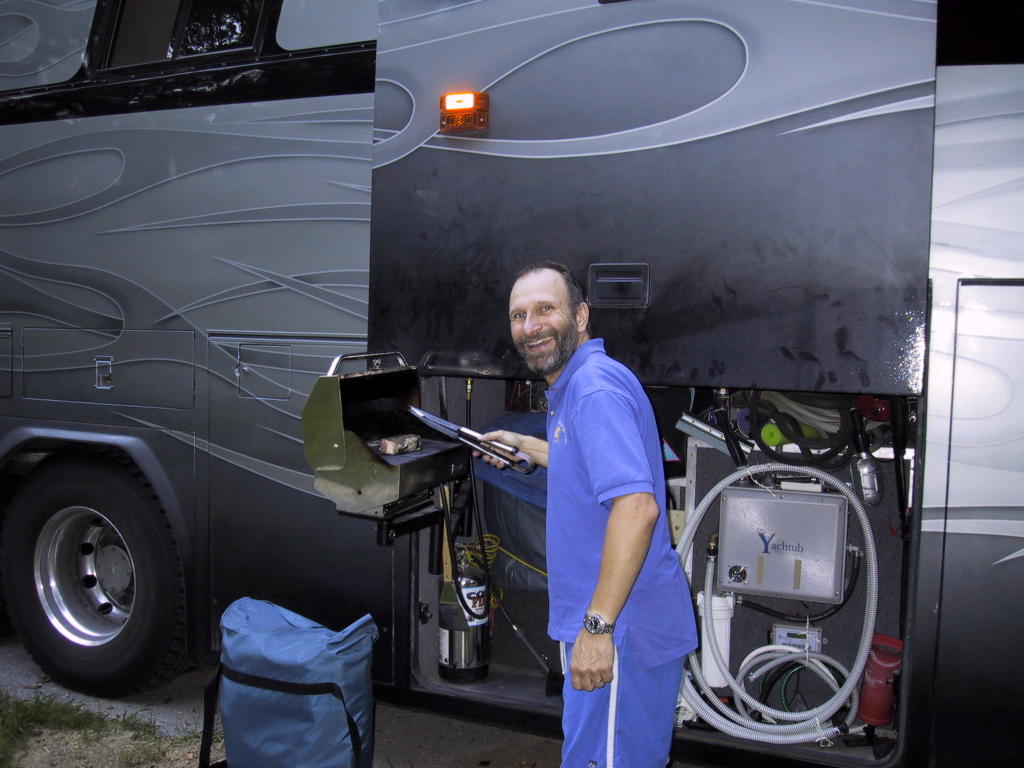

Along the Ohio River
Before I continue with the routine posting of our travels, I want to udate you on the situation with our main web site, OurOdyssey.US, and the provider that hosts it, DirectNIC.com.
It turns out that DirectNIC has been up, for the most part, throughout the disaster. Hosted sites were off-line briefly a couple days ago when the last upstream bandwidth provider finally succumbed to lack of diesel fuel, and all connectivity to DirectNIC was lost. That situation was remedied in short order and our site is back on line. In the course of reading about all this, I have been following the blog of DirectNIC's disaster operations specialist, here: http://mgno.com/
I have to say, it is fascinating reading, and paints, in some respects, a very different picture of things than the mainstream media. Just to be clear: these folks are still in downtown New Orleans, in a skyscraper, keeping a telecommunications facility running. They are running on generator power, and are having to deal with their own provisions and sanitation issues. Thus far, they have been able to get supplies and diesel fuel brought in.
In addition to the blog text, follow some of the links to the thousands of photos taken with both their handheld cameras and the streaming web cam that they have been moving around the building. Also, there are some links to other discussions, including postings from people in contact with survivors who are still awaiting rescue.
As for our own situation, we are parked at the Belterra Casino in Florence, Indiana (map). It is still the holiday weekend and we are still in assault mode. There are perhaps six or seven other rigs with us here in the parking lot.
This casino is somewhat of an oddity. It is a $200+M facility with some 600+ hotel rooms, a conference center, spa, golf course, pool, five restarants, etc. but it is, essentially, in the middle of nowhere. Apparently, it is not generating the revenue the owners had hoped (duh!), unable to compete with less elaborate but more convenient casinos closer to Cincinatti and other cities in the region. From the number of people here on a holiday weekend, I would have to concur with the assessment.
The casino itself is on a riverboat on the Ohio called the Miss Belterra. It is connected to the rest of the complex by a massive gangway that effectively masks the fact that one is boarding a vessel. The boat remains docked at all times now, but there was, apparently, a time when it needed to actually be cruising for gaming to be allowed.
In an interesting side story that does have some bearing on the property's financial troubles, the riverboat was involved in a maritime collision on the Mississippi while it was being delivered from the builders to the property, delaying the opening of the casino portion of the resort by several months. While the pilot of the barge she struck was found to be 90% at fault in the collision, maritime law limits the liability of any vessel to the value of the vessel itself and its cargo. The value of the barge/towboat and its load of concrete was far short of the damages done to the $15M Miss Belterra, and the casino partnership had to eat the difference.
Speaking of eating, we went in to the hotel for dinner, as is our custom when parking for free on their property. Not one single restaurant on the property makes any accommodation for non-smokers. Within two minutes of being seated, we were overwhelmed by the cigarette smoke, and had to leave. We ended up cooking our dinner in the parking lot. At least we tried to be good customers... we will likely send an email to the management explaining why they lost our business, although I don't expect it will make much difference here, just a stone's throw from tobacco-growing country.
Sunday, September 4, 2005
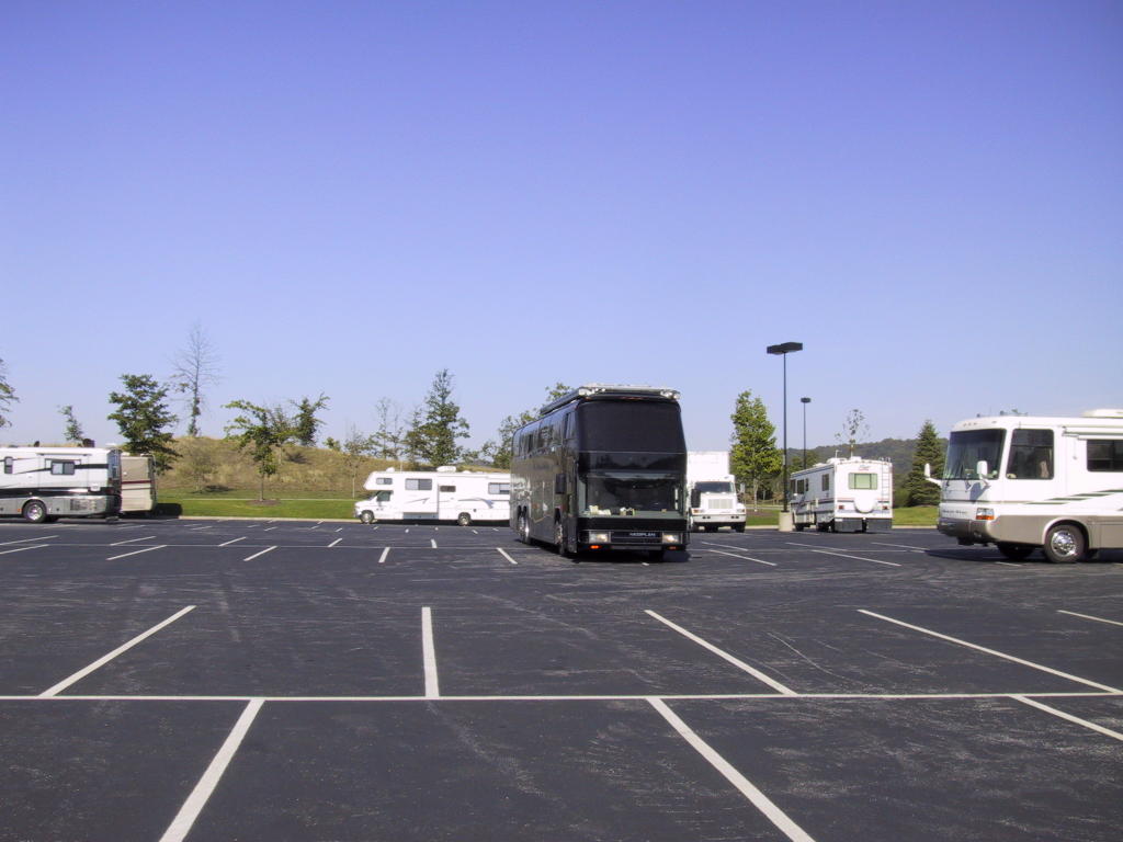
Saturday, September 3, 2005

Bryan, Ohio
Continuing with the holiday-weekend urban-assault camping theme, we are again at a Wal-Mart, this time in Bryan, Ohio (map).
After a fairly leisurely start this morning, we made our way to the Thayer Cemetery in Northville. In spite of some low trees and a dirt road, we made it without any real problems. We had no trouble finding the markers we sought in the very small cemetery, which turned out to be located adjacent to (so we were told by a passing security guard) the oldest remaining one-room schoolhouse in Wayne county. The schoolhouse was boarded up, but otherwise appeared to be intact.
From there we made our way to a gas station in Ann Arbor that my various internet resources told me had some of the cheapest diesel still available in a large radius, at $2.759, and we put in another 165 gallons, nearly filling the tank. I am hedging, since fuel is still going up, even though we will soon be in Kentucky, where it is traditionally cheaper.
We then skirted out of town to the southwest on US-12, picking up US-127 which brought us here. We will stay on 127 south tomorrow most of the way through the state, until just north of Cincinatti, when we will find some way to skirt around the city to the west. We are looking at either the Anderson Ferry, just west of the city, or the Markland Dam.
We are bound for Nashville, and the northern terminus of the Natchez Trace Parkway. We are hoping that most of the parkway will be reopened by the time we get there -- most of the downed trees have been cleared, and they are still working on some down power lines.
Near Ann Arbor
Yesterday, after crossing the Mackinac Bridge (RV speed limit: 20mph!), we followed US-23 down the eastern shore of the lower peninsula, merging back onto I-75 at Saginaw Bay.
As we drove along the coast, we noted that the vast majority of resorts, motels, and campgrounds already had their "No Vacancy" signs out. As is often the case on holiday weekends, we have resigned ourselves to a few days of urban assault camping.
We had a nice visit with Steve from Cushing-Malloy Printers, one of Louise's suppliers when she owned Information Publications, here in the Ann Arbor area. Since we have some additional business in the area, we then headed here to the Wal-Mart in New Hudson (map).
The additional business is to track down some grave sites at a nearby cemetery for Louise's step-dad. After that, we will head south and west, threading our way between major metropolitan areas as we leave the great lakes region.
It was pointed out to us this morning that our main web site, OurOdyssey.US, is off-line right now. The ISP that hosts the site for us is located in New Orleans, and their facility is completely off the air right now, naturally. I do not have any schedule for when the site may be back on-line. The links to those pages, on the right margin of this blog, do not work at the moment. Our companion photo site, Odyssey.SmugMug.com, is still working.
Friday, September 2, 2005
Mackinac Strait
We are parked at the Straits State Park, on the north side of Mackinac Strait (map). As with our experience last night, this park is more like a commercial park than the public parks with which we are more familiar (and comfortable). However, it is ideally located for a jaunt over to Mackinac Island.
We started our day with a visit to the Soo Locks, arriving just in time to see the freighter Indiana Harbor, one of thirteen "thousand footer" bulk ore carriers plying the great lakes, locking through in the down water direction. She was just nosing in to the canal when we arrived, and she was just slipping out of the lock when we departed a full hour later. Lowering the huge ship 21 feet in the lock itself took a mere ten minutes.
From Sault-Ste.-Marie we blasted across the U.P. on I-75 to St. Ignace and this park. We made camp, broke out the bicycles, and headed down to the ferry dock, where we boarded the hydro-jet powered ferry Nicolet for the roughly 16 minute trip to Mackinac Island. These ferries are very fast, making the whole run on-plane. Older, full-displacement boats used to take 45 minutes to make the trip, and in today's need-it-right-now culture, that's just too slow -- fuel consumption be damned. Ironic, considering the purportedly slower pace of life on the island itself. The piper must be paid, of course, and they raised the fares today due to Katrina-induced fuel price hikes.
Nevertheless, we are very glad we made the trip. The downtown area of Mackinac Island is chock-a-block with cheesy tourist trap shops and eateries, historic though their quarters may be. Also, plenty of horse droppings from the numerous horse-drawn jitneys and carriages on this motor-vehicle-less island. However, in just a few minutes we left that all behind as we rode the 8-mile perimeter road around the island, much of which is now a state park.
After completing our circuit of the island, we headed to the 118-year-old Grand Hotel for dinner. The hotel is a local institution and the grand dame of the region, and we thought dinner and cocktails would be an excellent way to experience it and get the flavor of the hotel without checking in as overnight guests. We did come to the island prepared, bringing appropriate evening attire as required in all public areas of the hotel after 6pm.
We are very glad we did this, because the Grand Hotel is a piece of history that begs to be experienced. However, at $75 p.p. prix fixe, dinner and the attendent service thereof was nothing to write home about. (Apparently, though, it needed blogging.) The buffalo flank steak, I will admit, was quite good, and nicely prepared, but everything else was merely adequate.
To be fair, outside walk-ins for dinner are uncommon, and dinner service is included, as all guest rooms are on the Modified American Plan. (By dining at the hotel, we did avoid the $10 per person charge for non-registered-guests to even enter the premises. Keeping the tourist riff-raff out, I suppose. If you want to see the Grand Hotel, show up in a jacket and tie and tell them you are there for dinner.)
Before dinner we had a round of cocktails in the appropriately-named Cuppola Bar at the very top of the hotel, with a magnificent view of the strait and its suspension bridge.
We caught the last boat off the island, at 9pm, and returned to the comfort of our own home (much to the dog's relief, so to speak), after the not-insignificant uphill pedal from the dock.
Tomorrow we will cross over the Mackinac Bridge and blast down to Ann Arbor, to catch up with a former business associate of Louise before his office closes for the long weekend.
Thursday, September 1, 2005
We took a high speed ferry out to Mackinac Island. The sister boat passed us in the middle of the straight, with a nice view of the bridge beyond.

The Grand Hotel, where we had dinner.

Bicycling on the 8-mile loop road around the island. No private vehicles are allowed on the island, so we saw only other bikes and horse-drawn buggies.


The Grand Hotel, where we had dinner.

Bicycling on the 8-mile loop road around the island. No private vehicles are allowed on the island, so we saw only other bikes and horse-drawn buggies.
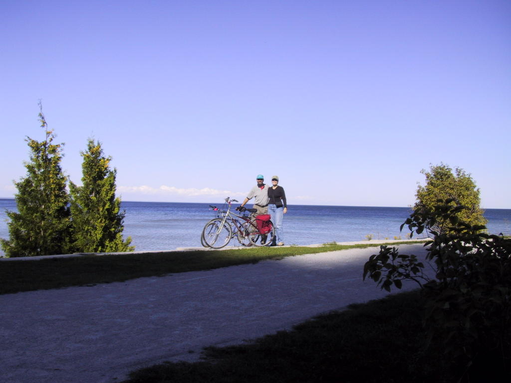

Whitefish Bay
We are parked along Whitefish Bay, at the Brimley State Park (map). The park is surprisingly crowded, full of young familes (most, it appears, from Canada).
Yesterday we had a nice drive along the Whitefish Bay National Scenic Byway, after visiting Tahquamenon Falls (of, among other things, "Hiawatha" fame).
Today we will head into Sault Ste. Marie to see the Soo Locks.
Yesterday we had a nice drive along the Whitefish Bay National Scenic Byway, after visiting Tahquamenon Falls (of, among other things, "Hiawatha" fame).
Today we will head into Sault Ste. Marie to see the Soo Locks.
Subscribe to:
Posts (Atom)