Showing posts with label Passages. Show all posts

Thursday, May 15, 2025

OBX

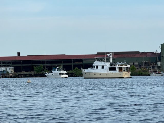
We are underway across Pamlico Sound, headed for the Old House Channel and Wanchese, where we will have the stabilizers serviced. The yard probably can't start until Monday, but today's the window to cross the sound. It's a long day -- there are no decent anchorages between Ocracoke and Roanoke Island.

Vector steaming toward the Cape Fear River. Photo: Bill Parks

When last I posted I was just an hour and a half into my 2000-0300 watch offshore of Cape Romaine. The rest of the passage was quiet and comfortable; neither of us saw any traffic at all. The ocean was calm when I posted, and got calmer through the night. The Starlink dropped out once we crossed the 12nm line, and I moved our AT&T hotspot up to the soft top to get better range.

This group of dolphins swam with us for over ten minutes on our passage.

Not long afterward, even that started fading in and out. Realizing that on the rhumb line to Cape Fear there would be no coverage at all when Louise came on watch, I adjusted course to bring us back in range for at least part of the trip, adding 3/4 of a mile to the crossing. We were in the countercurrent for most of the crossing of Long Bay, and we still had plenty of time to the Cape Fear channel when I came back on watch.

As we approached the inlet we were hailed by a motor yacht coming out, and that turned out to be our friend Bill on the Blue Merle II. He was coming out with a hired skipper on sea trials for a survey, so I am guessing they've had an offer on the boat.

The Blue Merle II. That's their dog in the graphic.

We arrived to the entrance more or less at max ebb, and it was an uphill fight to get in. But this was the calmest we'd ever seen this channel, and we just pulled off-channel at the first safe spot, right off Bald Head Light (map) and dropped a lunch hook to wait out the current. That spot had us seaward of the Bald Head harbor entrance and so we did not have the enormous wakes from the fast ferries that plague the more protected anchorage further in.

We both had good naps, and lunch, before slack tide arrived around 1:30 and we weighed anchor. Just as we were pulling back into the channel we were again passed by the Blue Merle. Bill offered to meet us for dinner in Wrightsville Beach, but we are always complete zombies the day we arrive from offshore, so we took a rain check. They keep the boat in Wilmington, which is a short drive from Wrightsville, and we had seen it in the harbor there when we stopped last season.

Our lunch hook spot to wait out the ebb. That's the Bald Head lighthouse, which I climbed when we stayed here a decade ago.

Now with the flood behind us we continued upriver to Snows Cut and thence to Carolina Beach and north to Wrightsville Beach. We had the hook down in our usual spot in Banks Channel (map) by 5:40, and immediately splashed the tender and headed ashore to Tower 7 Baja Grill for dinner. This is a popular joint, and if you're not in by 6 there will likely be a wait for a table.

After dinner we walked over to Robert's grocery for beer, but opted to wait on other provisions until I could walk to the Harris Teeter in the morning, when I would have just enough time before we got under way for Mile Hammock with the tide. On our way in we had noticed that the Blockade Runner hotel, a long-time fixture of the waterfront, is now a Marriott property called Trailborn, and I tried to learn if that meant they'd have a better restaurant or dinghy policy, but got nowhere.

Louise snapped this bald eagle on our way to Mile Hammock.

After returning home we discussed whether to stay an extra day. That would let us recover a bit more from the overnight passage and make my provisioning trek into town less rushed. The fact that I crashed into bed before midnight spoke in favor of the extra day, but we woke in the morning to some text messages that sealed the deal.

Our friends Tim and Crisálida had left Fort Lauderdale on Tuesday, bound for Norfolk in their sailboat, s/v Paquita. We, and they, expected them to be offshore the whole way, and we'd wave to them virtually as they sailed past us, but sometime after midnight, Tim texted me that they were coming in at Cape Fear. That would put them just a day behind us, but a short while later another text said they had changed course for Masonboro inlet instead. They'd be in the anchorage before we finished our morning coffee.

We watched them come in and get squared away, and before they turned in for the requisite post-passage nap, they invited us to dinner aboard. Now with a day off, I spent the morning wrapping up the plotter display repair, installing permanent 12v wiring to replace the jury-rig that had gotten us going on Wednesday morning. After lunch I made my pilgrimage to Harris Teeter by way of Beach Bagels, and later in the afternoon I went back ashore with the trash and for a nice walk all the way to the fishing pier and back.


Paquita, motoring up to Mile Hammock.

We headed over to Paquita a little before dinner time with a fresh salad in hand and a few beers. Tim fixed spatchcock chicken on his kamado grill, and we had a lovely evening over excellent food, way too much wine, good company, and lots of laughter. I only regret that none of us thought to take a photo the entire evening.

I half expected Paquita to go right back outside in the morning for the crossing of Onslow Bay, but the weather was too sloppy even for a sailboat (and way too sloppy for us), so they opted to take the ICW route. Tim was having trouble with both his depth sounder and his tablet app that shows the Army Corps of Engineers depth surveys, and they decided to just follow us out of the anchorage in the morning, across the tricky spot where the Motts Channel meets the ICW.

They ended up following us the whole way to Mile Hammock, which turned out to be a good thing when we had to pass an oncoming tug and barge that needed center-channel and took most of it. I was running well outside the marked channel using the survey data alone. Tim has since got his surveys working again. In addition to the barge, we had the usual amount of weekend traffic, but its manageable here, whereas in some places like SE Florida and Myrtle Beach it often keeps us in port until Monday.

A Camp Lejeune local caught Vector in the anchorage. Photo: Tommy Blanton 

We had the hook down in Mile Hammock Bay (map) on the Camp Lejeune marine corps base by 3pm, only the second boat to arrive. Tim had some electrical system issues just before arrival, but made it safely into the anchorage even though he had to drop anchor by gravity; we had rigged fenders in case they needed to raft to us.

I dropped the dink and headed over with my tool bag to assist. It turned out to be a wonky Perko battery switch -- Tim had already isolated the problem by the time I arrived. I could see the plastic case was slightly deformed from ohmic heating. I've taken these kinds of switches apart before to clean and grease contacts, but it involves drilling out rivets, and Tim opted to just order a replacement.

Tim caught us in his sunrise photo as they weighed anchor. Photo: Tim Boehmer

We spent about an hour digging through the panel and bypassing the switch (there is another switch closer to the batteries), removing some obsolete wires in the process. I left with homework to try to source a breaker to replace one that looked to me to be getting brittle. No sooner was I back at Vector than we turned right around for another delicious meal aboard Paquita, this time a pot roast that had been cooking all day, and another salad we brought with us. I'm really glad I scored the penultimate package of romaine at Harris Teeter.

It was really great to get to see them two nights in a row. Especially so because they will likely have already departed on their Atlantic crossing by the time we catch back up to their interim destination of Rhode Island. They will be doing the Atlantic Loop, crossing to the Med, spending a season there, then crossing back to the Caribbean. We will be following their journey with great interest. Once again, we forgot to snap a photo.

The lobby of the historic post office used to house the NPS visitor center for the Shackleford Banks. The Park Service closed up shop and now the building is just the Beaufort Town Hall, but the lobby is still open, with restrooms, and still sports many park posters and graphics.

Paquita left first thing in the morning, wanting to put as many miles behind them as possible. We had a more leisurely start, decking the tender and weighing anchor at 8:15 for the 9am bridge lift. It rained most of the day, and a mid-day thunderstorm brought us face to face with a boat anchored in the channel with its navigation lights on. It took us a while to understand he was anchored and not headed right for us on the wrong side of the road, and I gave him a lecture after we dodged around him. The thunderstorm ended up being a non-event.

We had the anchor down in Beaufort, in our secret spot crammed between a daybeacon and a range light (map), before 3pm. Louise was feeling crummy most of the day, with the beginnings of a bad cold, but she pulled herself together for dinner and we tendered ashore and walked to the Front Street Grill. This after first walking out of Black Sheep, which was packed with kids; we were halfway down the block before we realized it was Mothers' Day.

Beaufort has a new payment system for parking. And the rates went up. Dinghies are still free.

Front Street is a bit more upscale and spendy, so it was a more adult experience, and I had a very nice filet that was the day's special. We've spent a lot of time in this town, including once when we spent a whole week and I walked pretty much everywhere. We've eaten at all the restaurants at one time or another, and its just a very familiar and comfortable stop.

We had figured to spend just a single night, but by bedtime, Louise was so miserable we started to think about staying in quarters another day. Apart from that, my Monday project was to start calling boatyards, starting with the nearby Jarrett Bay Boatworks just outside of town, to arrange a haul-out to replace our stabilizer seals. The port fin started squealing when we were still on the west coast, which is a sure sign the seals need maintenance.

This view of Vector provided by the Town of Beaufort.

I had figured to call Jarrett Bay first thing, and make my other calls underway, but staying planted for the day I just made them all in sequence in the morning. Jarrett Bay did not return my call until late in the afternoon, which aced them out of the running. Hoping to go offshore around the Delmarva peninsula, I looked at every yard from Beaufort to Hampton for the magic intersection of a 70+ ton lift, technicians who can work on stabilizers, and availability on the schedule. I also asked for recommendations online.

By the end of the day we had nailed down a yard in Wanchese, on Roanoke Island, Safe Harbor Outer Banks, who had the lift, help, and time. They even had the parts on order before the day was out. This fit in with our hope to take the Pamlico Sound route on this pass and avoid the slog up the Alligator River. That did mean we needed a two-day weather window on the sound to make the trip.

No motorized vessels. I will need to kayak over the next time I want a pizza.

Louise was down for the count the whole day, and she even tested as part of a study she is in; the tests were negative for COVID, flu, and RSV, so really just a bad cold. I ordered a takeout pizza at dinner time, landing at the Fishermen's Park dock, which was a lot closer to the pizza joint, No Name. I was on the street before I learned the dock did not allow motorized craft, but I figured no one would notice me for ten minutes on a cold rainy day anyway. I would not have minded a longer walk, but I only had a short gap in the rain, and I did not want the pizza to get cold.

The weather on the Neuse and the sound was not forecast to be favorable on Tuesday, and so we planned a short day just to the mouth of Adams Creek. An 8am departure would have given us a fair tide, but I wanted to walk some more and it was pouring all morning, so we stayed put until 2. I had a nice walk around 11, but we ended up with 1-2 knots against us the whole ride, and what would have taken two hours at 8 took over three at 2. Oh well. We dropped the hook in a familiar spot in Adams Creek (map) and had leftovers aboard.

The minuscule dinghy dock at the Community Store is hidden behind other docks, so they put up a sign.

Yesterday was perfect cruising weather, and we weighed anchor and launched into the middle of the northbound conga line of loopers and snowbirds. It was a fairly long day to the Silver Lake anchorage in Ocracoke, a pace we've not been in four years. The entrance channel, Big Foot Slough, is notorious for a narrow, shallow chicane that the enormous car ferries have to navigate, and you never want to meet one there. As we approached we heard the ferry call a sailboat; the latter turned out to be aground. We watched the ferry pass them close aboard.

We have good surveys now, and I always put a track on the ferry, so we had no issues with the chicane. The sailboat had freed itself by the time we arrived. It's a good 45 minutes from the channel entrance to the lake, where we had a tight squeeze into the anchorage among the ten boats already there (map). I tendered ashore stag to reacquaint myself with the lay of the land. There are dinghy docks at the National Park Service marina near the ferry terminal, and at the Community Store.

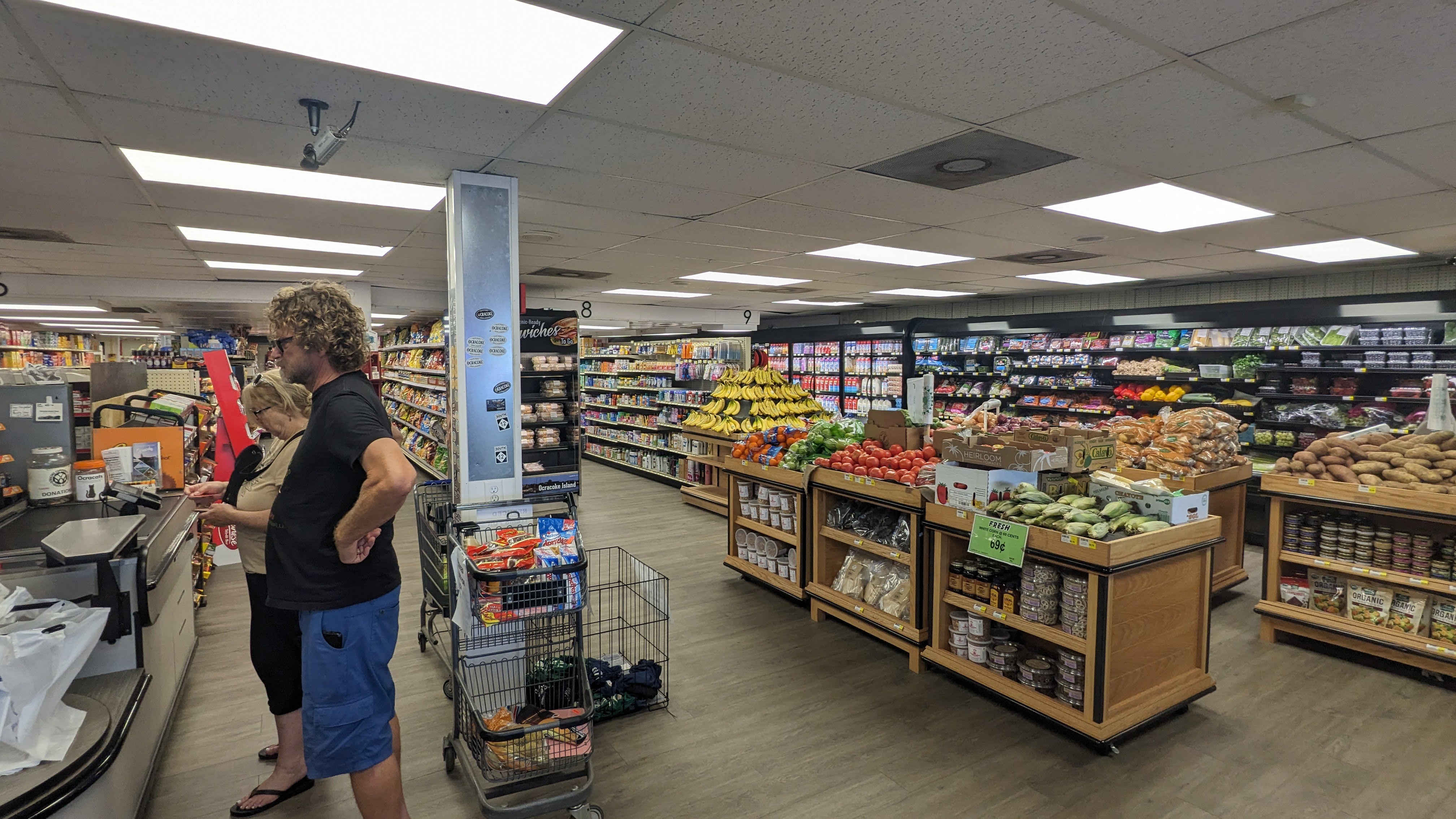
The Ocracoke Variety Store was well-stocked, if a bit pricey.

Louise was feeling up to dinner so long as it was close, so we headed ashore at the Community Store and went to Dajio right across the street, which was decent and had a couple of nice drafts. After dinner I dropped Louise back at Vector and returned ashore for a longer walk. I walked all the way through town, stopping in the well-stocked grocery-cum-hardware store, and ending at Howard's Pub, where we had parked Odyssey on our first visit to Ocracoke nearly two decades ago. From there I took the town,s free tram back, really an oversize golf cart, learning that it could get us to pretty much any joint in town with just an easy stroll.

I had checked in with the yard before they closed, and they allowed that Friday was unlikely and the haul-out would be Monday. Louise checked the weather and it looked like we maybe should just stay in Ocracoke another day, with another window on the weekend. We left the tender in the water. When we got up this morning, however, forecasts had again changed, and while there might be another shot on Sunday, it's risky, so today was the day.

The tram runs at least every 20 minutes (I found it more frequent) and will get you anywhere in town.

We decked the tender and got back underway before 8am for the nine-hour trip. The sound was pretty flat all morning, but as I type here after lunch, we have rolling 1-2 footers behind us. The plotter says we will be in Wanchese before 5pm, but after the yard closes for the day, and we have exactly one possibly anchorage opportunity along the Old House Channel, but until we get there around 3:30 we won't know if it will be comfortable at all.

My preference is to anchor tonight if we can, and arrive to the yard tomorrow fresher and during business hours, but we're ready to come in after hours if we have to. With any luck they will have all the parts in hand to get the stabilizers done Monday, and I also asked them to order a five-gallon pail of paint (the smallest it comes) to freshen up the bottom, which I hope can be done by Tuesday for a Wednesday launch. But things in a boatyard gang aft agley, to plagiarize Burns.

I took this pic of Howard's Pub for old time's sake.

While we've been through Pamlico many times, we've never taken the Old House Channel around the east side of Roanoke Island, and there is a reason: From Manteo north, the channel is 6-7' deep. We need a confluence of good weather, favorable wind direction, and high tide (what little there is here) to even try it. I'm hoping we can get through, whenever we leave the yard, because it is a very, very long way back out to the south.

Update: We are anchored between a pair of small islands right off the Old House Channel (map). It's comfortable here even though it's blowing 15-20 knots, but we had no way to know that until we got here. A storm may blow through this afternoon or evening with hail and gusts up to 50kt, and we're happy not to be trying to dock in that. We'll continue to Wanchese tomorrow.

Wednesday, May 7, 2025

A trio of ocean hops

We are underway northbound in the Atlantic Ocean, about 15 miles east of Charleston, South Carolina as I begin typing. Today is our third successive hop in the Atlantic, and at this writing it looks like we'll be out here overnight, bound for Cape Fear.

When last I posted, we were anchored off St. Simons Island, where we hoped to meet up with friends for lunch. We settled in for the night expecting a quiet morning aboard. But at 4am a thunderstorm rolled through, kicking off with a 61mph gust of wind. That plowed our anchor through the soft mud some 40', and we staggered upstairs with the alarm blaring. The gust was over in mere moments, and realizing the anchor was still well set and we had stopped moving, we just adjusted the alarm and went back to bed.

61mph (53kt) wind gust recorded on our anemometer. Coincidentally the outside temp is also 61.

Our anniversary gift to ourselves was just being able to sleep in after being so rudely awakened. We had a video call scheduled with our newly-engaged niece in California at noon, and we agreed with our friend John to meet up whenever that call was done. We had a quiet morning aboard, finishing up the last of the sourdough bread our friend Karen made for us for breakfast, having defrosted it to have with dinner Saturday night. I puttered around fixing a few things in the morning, and we splashed the tender so we would be ready to go when our call was over.

The call with our niece and her new fiancé started out more or less as expected. I am her uncle by marriage, but Louise has known her her whole life, and so we were not surprised when they asked us if Aunt Louise would make a toast at their wedding next year. What was surprising, however, is that next they asked if I would officiate.

Out track plot the next morning. The top and bottom lobes were the limits of our swing; lobe on the right is where the gust pushed us. We love our Bruce, but if you pull it hard enough in pluff mud it just plows through.

I am honored to do it, but I must confess also to a certain amount of nervousness. Of the "don't mess it up" kind. Louise and I had asked a motorcycling buddy of ours to officiate at our wedding, and even though he was a mail-order minister with some experience, our ceremony was probably the largest he'd done, and he married Louise off to "Sean Lawrence Welk." It was all I could do not to immediately say "ah one, and ah two." Anyway, I have more than a year to study up and practice.

After our call and with some new dates on our calendar, we hopped in the tender and zipped off to Gascoigne Park to meet up with John. Laura Lee was unavailable. We had a very nice lunch at the Mallery Street Cafe, with much catching up, and afterward John swung us by the Winn-Dixie so we could pick up a few things. It was great seeing him, as always.

The last of Karen's wonderful sourdough. This was actually from dinner Saturday; there were still three pieces left for breakfast Sunday.

The busy morning and the lunch date had us off to a late start, but we wanted to get some miles in, so as soon as we got home we got underway. I had figured to stop at the Altamaha River, where we might have tendered in to Mudcat Charlies at the 2-way Fish Camp for our anniversary dinner.  But after a big lunch neither of us was hungry, and fried food and bottled beer did not call us, so we decided to press on to a further anchorage and just have a light snack on board.

Late in the afternoon we had a favorable tide to transit one of the shallowest stretches of the entire ICW, less than four feet deep at low tide, the Little Mud River, and with no dinner plans we ran the extra few miles to get it behind us. We had the anchor down just after 6pm behind Wolf Island on the South River (map), the same spot we had chosen in the other direction when we had to wait for favorable tide to cross the shallows.

This ICW daybeacon at Doboy Sound was knocked over somehow and lying flat. I filed a report.

As we enjoyed our snack and a beer, we discussed the possibility of going outside right there at Doboy Sound. It looked like we might have favorable conditions that would improve over the next two days, and if we got lucky we might be able to run outside to Georgetown or even Morehead City over one or two nights. I spent an hour or so researching the Doboy Inlet, which would be new to us.

Monday morning the forecast still looked just acceptable for the outside run, and with lots of bailout options we decided to try our luck. We did not have enough tide to just run down the South River to the sound -- there's a 5' bar at the river mouth -- so we went the few extra miles to take the ICW to where it intersects Doboy Sound.

I had to divert to go around this anchored shrimper on Doboy Sound.

The inlet proved to be no problem, but I was thankful for all the information that had been posted about it online. I recorded our tracks and published them for other mariners to use; these tricky, poorly charted and often poorly marked inlets can be challenging and even hazardous to the unprepared. Now we have a good track for the next time we need to use it.

Things started well, but contrary to forecast, conditions worsened throughout the day, with seas three feet on five seconds by mid-afternoon. The wind had picked up considerably, and, also counter to forecast, we were fighting a knot of counter-current. We decided to bail out to Wassaw Sound, near Savannah. We've been that way before, but that was nine years ago, so I again spent some time researching the inlet. Fortunately, we arrived at mid-tide.

Sunset at Romerly Marsh Creek.

We also arrived mid-ebb, and we fought our way up the Wilmington River against nearly two knots. This river is where it all started for us, when we bought the boat from John in Thunderbolt, a few miles upriver. It was such a hard slog that we stopped at the very first anchorage that would be comfortable, a side channel known as Romerly Marsh Creek (map). We were out of the swell here and had a comfortable night.

In the morning we again had a choice to make -- continue upriver to the ICW, or go right back out the inlet. It was again mid-ebb, and outside weather looked acceptable for a day run. We decided to go back out on a fair tide and make Edisto Island. I again recorded and published our tracks into and out of Wassaw Sound.

We can still see the SpaceX launches here. In the binoculars it's a well-defined streak and not this little dot that my cell phone captured.

We were hoping for a fair tide arrival as well, but we again found ourselves pushing into over a knot of current, doing 5.3 knots while making turns for 6.5. That actually improved throughout the day, and we just caught the last of the flood on the South Edisto, another new inlet for us. We have better charts nowadays, and found the inlet wide and deep, with the ancient NOAA soundings completely out of date.

We dropped the hook in an off-channel shoal near the entrance to Big Bay Creek (map). We tendered into the creek and tied up with permission at the Marina at Edisto Beach, and walked down to High Tides for dinner. The food was decent and they had my cherished Pluff Mud Porter in cans. The marina restaurant, Presley's, would have been more convenient, but they're dark Tuesdays, and we needed the walk anyway.

Cheers from High Tides, Edisto Beach. Louise and some scruffy guy who could not be bothered to shave.

This morning found us with the same decision as yesterday -- ICW or back outside. But before we could even make it, I had to fix the chartplotter, whose display started blinking off and on just as I went to the pilothouse to look at tide schedules. It had the appearance of a loose or intermittent power cord, and so I rooted through my box of orphan cables looking for the right type. I found one, but that was not the fix.

We have a plan "B" for this problem, which involves unbolting the TV from the guest stateroom and substituting it for the PC monitor, but that takes time, and we needed something working right away or the outside choice would not be an option at all. I have a little 4" HDMI monitor that I use for setup and troubleshooting our Raspberry Pi systems and the backup plotter computer, and I was able to rig this in place. The plotter software amazingly worked on the tiny monitor, although some of the data like ETA was omitted from the screen.

My plotter arrangement for the morning.

Today's outside forecast had improved, and we'd need to wait for the inside route until the flood, as we'd need tide for a couple of shallow stretches. So with the plotter now working, back out we went, whizzing out to sea with two knots behind us. So far it's been a good run. After lunch I tore into the defunct monitor, hoping to find a simple loose wire.

What I found instead was a fried power supply. It's a simple supply that turns 120vac into 12vdc, and that led me to discover that this monitor has an unadvertised direct 12vdc input. I removed the fried power supply altogether, attached a cable with a mostly correct plug on it to the DC input, connected it to 12v, and voila, we're back in business. I was glad, because I really did not want to haul the TV up from downstairs and jury-rig it into position.

Penny for scale.

This monitor is only eight months old, and normally I would complain to the manufacturer. But long-time readers may remember that this monitor was such a piece of junk to begin with, that after replacing it once with no real improvement, they just refunded my money and told me to keep it.We'll see how much longer my "free" monitor will keep working.

We had our sights set on Charleston Harbor when we left this morning. But as we approached the turn-in towards the harbor entrance off Folly Island, we decided conditions were right to just keep going overnight to Cape Fear, with a daytime bailout option at Five Fathom and a late night bailout at Winyah Bay.

The fried power supply, sitting atop our log book. Looks like two caps are blown, and I was noodling on how to fix it when I discovered we could just use DC power.

As I wrap up typing, Louise has already hit the berth, and we're on the final leg from Cape Romaine to Cape Fear. We had a bit of a fire drill right after dinner, when a project to backflush the waste tank with seawater and detergent overflowed into the master head, leaving me on my hands and knees cleaning everything with disinfectant and enzymatic cleaner. Thankfully, it mostly smelled like detergent.

We're about an hour from the Winyah Bay entrance, and the plotter says it's 12.5 hours to the Cape Fear River, which will put us at the entrance just as I come back on watch at 0900. That will also put us there mid-ebb, so we'll bash our way in against three knots, and drop a lunch hook at the first safe spot to wait it out.

Sunday, May 26, 2024

Holiday chaos

We are under way northbound in the Atlantic Ocean, headed for Masonboro Inlet. Actually, to be honest, as I start typing we are running just south of eastward, on a long slog out around Frying Pan Shoal, just to avoid the absolute chaos that is the Intracoastal Waterway on Memorial Day Weekend. The plotter is projecting an arrival in Wrightsville beach, where there will also be chaos, just before 7pm, and we will have dinner under way.

Things did not go to plan after my last post here. The rest of our outside passage was calm and uneventful, right up until we were approaching the Winyah Bay entrance channel, maybe a couple of miles out. Seas were inexplicably building into a confused maelstrom of three-footers. At first we thought it was a "rage" -- a sea condition caused by stiff wind in opposition to strong current at an inlet, but the conditions were not right for that.

The calm after the storm. Last night's sunset in Little River.

And then we noticed what was happening right in front of us. A giant conga line of big sportfishers, all doing 30 knots, all headed for the Winyah Bay entrance at once. We could not get a count, but we figured by the end of the day there were at least 50 of them, turning the Winyah Bay entrance into a Category 3 storm. With no choice but to plow ahead into the fray, we scrambled to dog everything. Louise managed to get the in-process dinner secured and latched everything above decks, but we could not get the belowdecks portlights dogged in time to avoid a cascade of seawater through every single one.

After wrestling the boat through this nonsense and around the turn into the channel, and once past the end of the south jetty, I was able to engage the autopilot long enough to figure out what just hit us. It turned out to be the 56trh annual Georgetown Blue Marlin tournament, which attracts big-money boats from all over. Louise found the rules online someplace; hooks need to be out of the water at 3pm, and thus all the boats end up arriving at the inlet in perhaps a 20-minute span.

This picture does not really capture the three-foot waves. It's sportfish all the way down.

The bulk of them had already passed us by the time we steamed in the inlet a half hour later, and we proceeded into the Western Channel for our planned anchorage. The tournament still had two more days to run, with hooks-in at 7am, so we went right past our first option, protected from the ship channel only by a shoal, and headed all the way to the ICW junction, where a low island would separate us from what we figured to be a 5:30am exodus of the same fleet. We had the hook down in a familiar spot (map) just before 6pm.

In most conditions, this is a comfortable and protected spot. But as we were setting the hook, we realized that the enormous amount of energy generated by 50 sportfishers leaving the bay on full plane could easily make its way past the half mile of protection afforded by the island, making for an unpleasant awakening in the morning. We decided to make this a "dinner hook," not even setting the snubber, so we could eat our dinner in peace and regroup with another plan.

The sportfish were all coming out of Georgetown Landing Marina, on the Pee Dee. Our options to get away from them were either to go a mile or so past them up the Pee Dee, or past the bridge on the Waccamaw, or to roll the dice on finding a spot in Georgetown itself, the closest option at an hour further along. Fortunately, the tide was favorable for us to enter the harbor.

Vector headed up the Sampit. Photo: Chris & Cherie, Technomadia

A half hour after we set the anchor we were back under way, headed for Georgetown. Even at a favorable tide, neither one of us was looking forward to picking our way through the narrow and shallow entrance, and then hunting for a spot in a very tight and equally shallow anchorage at the end of the oxbow. So instead we veered left into the Sampit River, where a crowd-sourced database we use for anchorages said there was a good one near the turning basin for the quay at the nearby steel mill.

Normally I do a lot more research on these kinds of anchorages before arrival, because I don't trust crowd-sourced information in the boating world, but we had not expected to be in this spot at this time, and I did not have the wherewithal under way. In my mind the quay at the steel mill was disused and there was not a lot of commercial traffic down the Sampit. The reality was quite different; there was no room at the suggested spot to anchor without swinging out into the federal turning basin, and the quay showed signs of occasional use.

Y-Not and Vector anchored in Georgetown. Photo: Cheris & Chris, Technomadia

We continued past the turning basin and under the bridge for better hunting grounds, but what we found was deep river lined with all manner of going commercial wharves with tugboats, crane barges, and the like. We could not tell from looking how far upriver we'd have to go to find a spot to drop the hook, and with over a knot of current behind us, we could well run out of daylight to make the known anchorage in the Georgetown oxbow. We made a quick about-face and cranked up the rpms to get back to the Georgetown entrance.

We got very, very lucky. The anchorage was as empty as we've seen it, and we found a spot with just enough swing room for the night's projected light and uni-directional wind where we set the hook (map), exhausted. Y-Not, who had been waiting nearby on a lunch hook to see where we would end up, came in shortly after us and anchored another hundred yards further along.

Happy crews at the Georgetown Harborwalk. Photo: Chris Dunphy

In the morning and fully recovered, we made plans to meet Cherie and Chris for brunch ashore. Our original plan for the day had been to come in and tie Vector up to the courtesy dock, and we briefly thought about weighing anchor and doing just that. Stymied by a center console taking up the only face dock, we instead splashed the tender and we all met up at the dinghy dock. We had a nice brunch at the Thomas Cafe over a lot of catching up and laughter.

After brunch we had just enough time left on the tide for me to get my errands done, and I returned ashore with the e-bike. First stop, CVS, which contains a "UPS Access Point." We learned from friends Erin and Chris that UPS will ship your stuff to one of these Access Points where you can pick it up without charge, unlike many UPS Stores which charge for this service. It worked like a charm; I had emailed a UPS label to the Eau Gallie Yacht Club, where a package I was waiting on missed us by a few days, and it was waiting for me at the CVS. Afterward I rode a mile further to Walmart for a couple of essentials that we get only there.

I could not resist snapping this syrup pitcher at the Thomas Cafe.

We made our way out of Georgetown with just enough falling tide to squeak out of the harbor. It would have been perfect just to stay there for the entire holiday weekend, but the forecast was for thunderstorms with 25kt clocking winds overnight, and there is just not enough swing room there for Vector in those conditions. Unfortunately, that put us against the current the rest of the day to go north on the ICW. Absent the Blue Marlin tournament, we would have gone downriver instead to the same place where we had dinner, for an open water passage the next day, but we were again unwilling to risk the 6am tournament wake-up.

With no particular rush and so much adverse current, I ran a slow bell up the Waccamaw, figuring to stop at an early anchorage just five miles upriver, a familiar spot behind Butler Island. That would have been pleasant enough, but we were feeling aced out of a nice restaurant dinner in Georgetown by the weather, and we also wanted to be a little closer to Myrtle Beach in case we got a window to run the gauntlet. Thus I spent some of the time under way to Butler looking at other options further along the Waccamaw.

CVS manager fiddling with the UPS app to give me my box.

A nice anchorage we've used before is a short tender ride to the Reserve Harbor Marina, but when I called they told me their restaurant was "members only." A few more miles upriver is the Wacca Wache Marina, whose restaurant has recently changed hands and seems not to be reviewed, but that seemed like a good option, with a nice but tight anchorage across the river. With plenty of daylight we set our sights on that, running a slow bell the whole way.

We arrived to find the entrance bar to Cow House Creek open and available, reports of a permanently moored boat there notwithstanding, and we had the hook down in the very tight space (map) a little after 4. The heavy current kept us fixed in position just 20 yards from the cypress trees ashore.

Anchored just a boat length from the trees. If we had swung that way we would just miss them. The water is deep right to the edge.

We splashed the tender to head ashore for dinner just as the live music was starting from the nearby Wachesaw Plantation Club, perhaps for a wedding. We tied up at the marina dock and walked into Walter's on the Waterway for dinner. They had a very nice patio, with a musician playing some light jazz, but it was too hot to want to sit outside. The food was nothing to write home about, but they had a selection of bottled beers, and it's the only game in town. After dinner we strolled the marina and the public boat ramp next door before heading home and decking the tender.

A short while later the predicted storm arrived as forecast, pleasantly dropping the temperature ten degrees. The frontal winds arrived just as the current was reversing, which can be a recipe for the anchor tripping, and I briefly manned the anchor watch until the worst had passed and we were safely set in the other direction. The storm put an abrupt end to the live wedding music. We had a comfortable night, with the loudest sound being the frogs just across from us. Y-Not reported 35 kt clocking winds in Georgetown and they, too, manned an anchor watch; Vector would have been in the mud had we stayed.

Coming home from dinner, Vector looks like she is steaming out of the creek.

Yesterday we weighed anchor on the flood to have a fair current upriver to Enterprise Landing, which is where we figured to wait out the holiday craziness in Myrtle Beach before continuing on. There is protection there in a quiet oxbow or a side channel, away from the major traffic of the ICW but still likely seeing some weekend tomfoolery. There is at least a boat ramp where we could get ashore to walk a little bit.

Under way we kept our eye on the weather, hoping for afternoon rain showers that would attenuate the onslaught of jet-skis, pontoon rentals and center consoles that we knew would otherwise clog the waterway. An earlier forecast had at least suggested the possibility. What we found instead was an ever-increasing chance of violent thunderstorms for the evening, with nothing to stave off the afternoon hordes. The prospect of enduring moderate weekend traffic all afternoon and then having a big storm hit in a tight oxbow soured us on the idea of stopping at Enterprise, and by the time we arrived we had girded our loins and determined to run the gauntlet of Myrtle Beach and just get past it.

The early part of the run was just run-of-the-mill Myrtle Beach traffic, with a little pile up waiting for the Socastee Swing bridge. We had the Rock Pile to ourselves, and the craziness did not start in earnest until just a couple miles shy of the Little River swing bridge. And crazy it was. Imagine 5mph bumper-to-bumper traffic on the highway and you will have a pretty close analogy, It tested my boat handling, for sure -- bro dudes in center consoles backing out of boat ramps have no clue what it takes to stop 55 tons of steel moving at five knots. Thankfully we had just a brief wait for the bridge and the conga line started to spread out a mile or so later.

This is the school bus (really) crossing our path on the Waccamaw.

With the zoo mostly behind us, we turned outbound on the Little River for the anchorage. We talked about going to the protection of Bird Island, but the anchorage in there can be tight, and we were concerned about swing room for the very storm that had us passing up the tight anchorages at Enterprice Landing. Instead we anchored well off-channel in a familiar wide spot of the river (map), protected from the ocean but not the prodigious wakes of sportfishers, center consoles, tour boats, and the Big M Casino all coming and going via the inlet. We knew that would taper off before bed time, however.

What we did not expect to find was a couple dozen boats partying on the beach right across the river. A pair of Krogens and a big Hatteras that had been gaining on us up the ICW passed us in the river and anchored at Bird Island. We had a nice dinner aboard, and the evening's entertainment was watching the comings and goings, as well as all the beach party boats scrambling to pack up and leave when the thunder started. One big patio boat was so firmly aground on the beach that TowBoat had to pull them off, and a center console fouled its stern anchor on the bottom and was the last boat out, in the pouring rain, as dad kept working at freeing the anchor by standing in the water next to it and worrying it out, which took over an hour.

We thought we'd have the whole anchorage to ourselves, just as we like it in this kind of a blow, but just before the storm hit an express cruiser anchored a hundred yards from us. We watched in horror as they set both bow and stern anchors on a too short a scope, wondering just what they were thinking. Setting a stern anchor can increase the loads on the ground tackle astronomically. The two occupants then retreated below decks, where they remained as the wind hit and dragged them all the way across the anchorage, then across the channel, and up against the shoal on the other side of the river. I called three times on the radio and then sounded the horn to no avail before finally making a Sécurité call to warn other traffic.

Beer can island.

It was all over in a couple of hours and then we were alone, in a flat calm anchorage. We had a very calm and restful night, at least up until the fishing boats started going out this morning. Not quite the level of the Blue Marlin tournament, but unpleasant nonetheless. Given the amount of wind we actually saw, in hindsight we would have been better off at Bird Island.

With good conditions on the outside, we were weighing anchor by 7:30 and headed out the inlet before we even decided whether to head for Cape Fear or all the way around the shoal. I spent the first half hour after turning at the sea buoy working on charts, tides, and currents to figure it out. While it's 17 miles longer to get to Wrightsville Beach this way, we avoid a dozen miles against two knots of current in the Cape Fear, plus having to squeeze in to Carolina Beach for a night to wait out the holiday traffic. This will put us into Wrightsville two days earlier and the driving is a lot easier.

As I wrap up typing we've already rounded Frying Pan Shoal via the slue channel and are on a due north heading to Masonboro Inlet. Weather is unfavorable for the outside run from there to Beaufort, so it will be a two-day slog up the inside, through the problematic Onslow Beach Bridge. We don't want to be under way on Memorial Day, so we'll just sit tight in Wrightsville for the day. Just as well -- we need the break.

Monday, November 6, 2023

The longest night

We are underway southbound in the Atlantic Ocean, running about seven nautical miles offshore of Myrtle Beach, South Carolina as I begin typing. Our destination is downtown Savannah, Georgia, on our first overnight passage in almost nine months, since leaving Fort Myers Beach for Key West. We're bracing ourselves for a difficult night, for reasons I will relate shortly.

Sunday afternoon a week ago, seas on the Pamlico continued to build, and we questioned whether we had made the right decision. We had to come in as close as depth would allow to the lee of Cedar Island, but once there things were flat enough for a comfortable night. We dropped the hook further west of the ferry terminal this time (map) and were undisturbed by the lights, sound, and wakes of the ferries.

Sunset over Cedar Island from our anchorage.

Monday morning we weighed anchor and made our way into the Neuse River and then down Adams Creek to Beaufort. We arrived to Taylor Creek downtown to find the anchorage absolutely packed with cruising sailboats; the power boats, it seems, all tied up at the town docks instead. No matter how full the anchorage gets, "our spot" nestled between a daybeacon and a skeleton tower for a range light (map) is almost always available, and we dropped the hook there before 3pm.

I sounded the anchorage in the dinghy to see if we had enough depth to our south when the forecast northerly blow would arrive overnight, and as a result we relocated about ten yards closer to the channel. In the evening we headed ashore for dinner at Finz Grill, a new venue for us. The food was decent and they had some nice drafts. Their deck would have been a more pleasant space, but it was a bit chilly and we opted for an inside table.

Sunrise over Pamlico Sound from the same spot.

Tuesday we had figured to just stay put and have a down day, with no outside window in sight and pleasant temperatures finally prevailing. When Louise started the generator in the morning to turn the heaters on, she noticed the thermostat in the forward berth reporting the temperature under the berth, where the return register is located, as 81°F. With a seawater temperature of just 65°F, we knew something was not right.

Under the berth are located the bow thruster, the washdown pump, and the batteries that serve the thruster, windlass, and pump, along with a charger for those batteries. But all those items had been switched off since dropping anchor some 15 hours earlier. That meant the heat was coming from the batteries themselves, or the DC side of the charging circuit (the charger was turned off at its AC breaker).

Vector nestled between a marker and the range light as the sun sets over Carrot Island.

Unexplained heating in an electrical system on a boat is not something to be taken lightly, and so my down day quickly devolved into climbing under the berth in my work clothes to investigate. The entire bay is covered in a fine layer of graphite dust that sheds from the thruster brushes, and it's tricky to avoid tracking that all over the house. One possible explanation for the heating, of course, would be that same graphite layer making a high-resistance connection across the battery terminals. The thruster batteries have been showing signs of failure since we left the yard, adding to the concern.

I ended up removing the charger altogether and taking it apart on the bench. It had plenty of graphite in it, unhelpfully deposited there by its own forced-air cooling fan. I also found a partially melted capacitor. Oddly, it was still charging the batteries right up until I removed it. While I am sure I can replace the bad capacitor, and maybe remove most of the graphite with cleaner, there's not a lot of percentage in fixing a 20-year-old charger and then subject it to more abuse. I cleaned it as best I could, carefully removing the melted bits of cap, and reinstalled it until I could replace it. That cured the heating issue, and I ordered a sealed (IP67) but smaller unit as a replacement for delivery to our next stop.

The inside of the charger, covered with brush dust. Blown cap is center frame.

Tuesday was Halloween, and when we went ashore for dinner we encountered a few costumed children in town. We landed at Mezcalito for dinner, where the entire staff was costumed, along with a few of the patrons. El Día de los Muertos is a big deal in Mexican culture, and a festive atmosphere on the eve is part of that. I could not capture any decent photos, but we enjoyed being there, as well as watching the children trick-or-treating.

In the middle of dinner the couple seated at the next table reached out to say hello. It turned out to be one of our former Red Cross Disaster Technology colleagues, Bill, with whom we worked in North Carolina after Hurricane Irene, way back in 2011, along with his wife Nicole. They, too, have a boat, which was at the Town Dock, and he's been messaging me as they follow along here. It was great to bump into them and to meet Nicole.

The feral horses of the Rachel Carson preserve come within a hundred yards of Vector.

We ended up spending one more full day in Beaufort, to give ourselves a more favorable tide for the next leg to Camp Lejeune and to wait out the wind. It was too cold to work outside or go ashore for kicks, so I got a few things done around the boat. We met up with Bill and Nicole over dinner at Black Sheep, with things having warmed up just enough for the tender ride not to be a misery. It was great to have the time to catch up.

Thursday morning we had an early 6:45 departure to make the 12:30 bridge opening at Onslow Beach. The bridge is under construction, and the rest of the day a work barge reduces the channel width to just 20'. That's normally not a problem for us, but we preferred to avoid threading the needle with just two feet on either side in stiff winds with our brand new paint job. We made the opening with time to spare, and had to station-keep in stiff current.

We're in the middle of the snowbird migration and the anchorage is packed. We're the only power boat.

Making such an early bridge opening put us at Mile Hammock just after 1pm, and with only one other boat already anchored we dropped our hook right in the middle of the bay (map). The bay is completely surrounded by Marine Corps Base Camp Lejeune, and when we arrived some marines were out practicing man-overboard drills and whatever else they do in their jet-drive RIBs. It was an early end to the day but there is really no place else we can get from there in the daylight. By nightfall there were over a dozen boats anchored.

Water-borne jarheads.

Friday, after the usual slog through two poorly-spaced bridges, we dropped the hook in our regular spot in Wrightsville Beach (map). Once again we re-positioned our anchor not long afterward, this time on account of an unoccupied anchored sailboat that looked like it might have an excessive amount of rode out. Still, we were set in plenty of time for me to go ashore with the e-bike for errands. Those included dropping off an old radar display I had sold on eBay, picking up my shiny new Victron battery charger from the Amazon locker, and loading up on provisions at the Harris Teeter store.

I was back at Vector just in time to drop everything off, pick up Louise, and head back ashore to beat the Friday crowd at our favorite local joint Tower 7 Baja Grill. We were a bit stunned to find it closed for a private event, apparently a wedding for a former staffer. It took us a moment to regroup, and we walked over to the South Beach Grill instead.

Sunset over Mile Hammock anchorage.

The current started reversing after we returned home, and we both kept a wary eye on the unoccupied boat, still unsure of their scope. We swing differently from sailboats to begin with, and our heavy chain compared to the rope rode they were using can exacerbate the difference in swing rates. We were nervous enough out it that after Louise turned in for the night, I set a ten-minute timer on my watch and got up to check the distance every ten minute for another half hour. The gap was opening, and, satisfied we were not overlapping, I turned the timer off.

So I am sure you can guess by now that a jostle at 11:30 or so made me jump out of my seat to see that it had untangled from whatever it was lightly hooked on and covered the 200' between us to come alongside, the first time for us in a decade of cruising. It was a ratty boat and likely had a screw protruding from the rub rail, so we now have our first scratch on the new paint (well, other than the ones we had before we left the yard). It's small and not through to the steel, and can't really be seen from ten feet away -- I could not even capture it with the camera -- so no big deal, but I had a fraught night.

Vector silhouetted against the sunset in Banks Channel, Wrightsville Beach.

Of course, Louise had to gear up and come help me fend off, then back away, weigh anchor, and re-set in the dark. We found a different spot that was an even tighter squeeze (map), and it's a good thing we know this anchorage by heart. In the morning I calculated that they were on 200' of scope, in a dozen feet of water and a very tight, popular anchorage.

Before she had headed off to bed, Louise, the consummate weather router, had projected that we might be able to make an outside run today at least as far as Charleston, and so we opted to just spend another night in Wrightsville Beach. With more pleasant temperatures I walked to the Blockade Runner mid day and learned they have just instituted a new menu in their restaurant that makes it more appealing. Of course, at dinner time, we had to get our Tower 7 fix.

From on deck in Banks Channel. This little power cruiser near us is a Rangeboat.

After dinner we realized this window could get us well beyond Charleston, with Savannah being a longer overnight option, and Jacksonville a two-night proposition. As much as we like Charleston, the option to bypass a huge number of problematic shallow spots and do a lot less work at the helm proved too great. But we had to pick a destination, because Savannah was a morning departure, whereas Jacksonville, like Charleston, would be an afternoon departure.

Complicating things right now is our sleep schedule. In normal times, I'm up to around 2am every night, with Louise sound asleep before 10. That makes our overnight watch schedule a cinch; she retires early at 8pm and I take the watch to 3am. She rises early and takes over until 9am when I come back on watch. But six months in the boatyard, waking at 6am, has thrown my own timing off, with a series of early-morning departures coming down the coast slowing the return of my normal circadian rhythm. Having Daylight Savings end just a day before passage is not helping matters.

Dolphins in our bow wave never gets old. This one was among a group in the very murky Adams Creek. Today on the ocean we had a couple of different groups, including one with three very playful spotted examples. Here in the ocean we can see them well below the surface.

I managed to make it past 2am Saturday night, but just barely, and then, of course, it became 1am. We had a leisurely morning yesterday, going ashore on the ICW side and walking to the Sweet N Savory Cafe for brunch and to pick up a couple of last minute items at Harris Teeter. We weighed anchor with a favorable tide to take us to Tina's Pocket (map), the closest comfortable anchorage to the Cape Fear river for a morning departure.

I was able to stay up until 2:20 last night with great effort, but I was still up before 7 this morning. That let us get an earlier start down the river, which proved to be a good thing because the anchor roller jammed as we were weighing and we had to fiddle with it. All of which leads me to say, it's going to be a long night. I got a little nap in earlier, and I hope to grab another after dinner and before I take the watch alone.

Sunset over Southport from our anchorage in the Cape Fear River last night.

That tipped the scale in favor of Savannah, rather than the two-night passage to Jacksonville, normally not a big deal for us (the second and subsequent nights are always easier than the first). Plus, we have good friends there and it will be great to see them if the stars align. We left the Cape Fear by way of the Western Bar Channel and have been holding about 7nm off the coast, giving us a nice counter-current push; at this moment the plotter says we should arrive at the Savannah River with the flood and be downtown by dinner time. We shall see if this project holds through the night.