Showing posts with label Turks&Caicos. Show all posts

Sunday, May 13, 2018

Back in the Bahamas

I am typing under way between Providenciales, Turks & Caicos, and Acklins Island, Bahamas. At this moment we are about halfway between Mayaguana, on our starboard, and Little Inagua, off our port. Both are over the horizon, as is Provo, some 30 miles behind us. I can still see the glow of light above Provo, and we only fully lost Internet coverage ten miles back.


One of our final sunsets in Grace Bay.

Shortly after my last post, I tendered ashore to pick up our guest. Amanda managed to snag a shared ride to Seven Stars, where I suggested we meet in the lobby; apparently the resort has a rep at the airport who was able to connect her with another couple. I collected her straight from the taxi at the porte cochere and we walked the labyrinthine pathways down to the beach. Fortunately she brought backpacks instead of a suitcase, which facilitated "walking the plank," aka the narrow concrete beam which is all that remains of the pier we've been using. Nothing went for a swim as we loaded her gear and the two of us into the dink.

As if making our house guests walk the plank (still better than the alternative - a beach landing in the surf) was not inhospitable enough, what happened next really put a fine point on it. I started the engine and made ready to cast off. I put the lever in forward, and we did not move. Reverse did nothing either. Phooey. Must be the gearshift linkage again, seeing as that was the last thing to break, and the throttle was still held together with zip ties (Amanda offered to bring us the part, but I called every Mercury dealer in SE Florida and no one had it). We tied back up and I took off the engine cowling.

Hmm. All looks good in there. The gearshift seems to be working as I move the lever into both forward and reverse. This is strange. So I glanced down at the "lower unit" (the part of an outboard that contains the transmission) to discover... the propeller was gone. Wow. There's no way I can paddle back to Vector; we'd be blown halfway down the bay and out to sea before I could cover even half the distance. I radioed Louise and told her to start inflating our two-person kayak, a twenty-minute process, while I contemplated what to do next. The kayak could get us and all the gear to the boat, in three round trips. Or it could be used to bring me the mask and snorkel I might need to find the propeller and its hardware.


Surfacing, recovered propeller in hand. Photo: Amanda Baker

Realizing the propeller most likely came off when I engaged reverse while approaching the dock, we moved the tender aside and I could see it, lying on the bottom in about nine feet of water. Getting the propeller in the crystal clear water would be a cinch. But the propeller nut and thrust washer were both also missing, two little black specks among many littering the bottom, and also easily buried in the sand.

Of course, I was not wearing a swimsuit. Meeting Amanda in the lobby of a nice hotel, I had put on a fresh pair of khaki shorts and a nice Hawaiian shirt before heading ashore. In the TCI, it is considered quite rude to wear swimwear anywhere except the beach and the pool. So I stripped down to just my shorts, removed my belt, emptied my pockets into the dink, and dove in for the propeller, which I snagged on the first try. It was ripped to shreds; as it backed off the shaft a blade hit the combination anode and trim tab, which broke off entirely and split in two.


This blade is peeled open. The other two have chunks missing.

Reasoning the nut and thrust washer landed near the prop, I made another dive and managed to grab both. I felt sure I would not be able to see well enough to find them without a mask, but the water is crystal clear here. I would never have been able to do this before I had laser eye surgery a few years ago. I was able to get the thrust washer, propeller, and nut on well enough just by hand to get us back to the boat, so long as I did not engage reverse, and after 20 minutes of monkeying around at the end of the pier we were on our way, Amanda having a story to tell her kids. She snapped a photo of me popping up with the prop in my hand.

Sadly, this was the brand new propeller I installed in Fort Lauderdale before we left. I had saved the old propeller, which had various chips and other damage that I had repaired over the years, and after relaxing a little back at the boat I installed that prop and properly tightened the nut with a wrench. I went back to the pier with mask and snorkel to make sure I did not leave any hardware on the bottom; all I found were the two broken pieces of the zinc trim tab. After a somewhat trying afternoon, we enjoyed cocktails on the flybridge and just tendered right back to Seven Stars, where we had a nice dinner at their outdoor beachfront restaurant, The Deck.


What's left of the trim tab, in pieces. Fortunately, the zinc base of unit is still bolted to the motor, providing some cathodic protection.

Tuesday I was prepared to go snorkeling, or kayaking now that it was inflated, or engage in one of the numerous water sports or beachfront activites available ashore, but Amanda mostly wanted to relax. We did go ashore mid-day to walk around the Grace Bay shopping district, stopping at the nice grocery store where Amanda wanted to pick up a few food items for lunch and another bottle of white wine. I grilled a couple of steaks for dinner and we had a relaxing afternoon and evening aboard. Wednesday was much the same, with the addition of swimming off the back of the boat, and we tendered ashore for a pizza dinner at Pizza Pizza.

Amanda's flight was Thursday afternoon, and we opted to have a final lunch at The Deck before seeing her to a cab at the lobby of Seven Stars. One final walking of the plank with full kit; to borrow a phrase, it's not just a visit, it's an adventure. She scored a window seat up near the pointy end and sent us some nice photos of Vector in Grace Bay from the air.


Lunch at The Deck.

We try to have only one big restaurant meal in a day, and lunch was it, so we had our usual lunchtime snacks for dinner, and tendered ashore for sunset cocktails at the Infiniti Bar in the Grace Bay Club. It was very nice, but I'm glad we only went for drinks; two cocktails came to over $40 with tax and tip. They did supply complimentary bar snacks, however. The evening marked one full month since we arrived in the TCI on April 10th.

Friday morning a swoopy 72' Azimut yacht came in the cut, down to where we were, and dropped their hook just a hundred feet away. They immediately cranked up their music, even though it looked to us like only the crew was aboard. Not long afterward, a French ketch, Wind's Way, arrived and dropped another hundred feet west of the Azimut. In the afternoon the French couple, whose names we never caught, came over to ask some questions about the anchorage. We gave them the skinny on groceries, public access from the beach, and dining, but I could not tell them where to get a SIM card short of taking an expensive taxi ride to the big grocery store on the main highway.


Vector, between the palms, as seen from the Infiniti Bar.

Late afternoon at high tide the Azimut left, presumably headed to one of the marinas in order to board guests -- no walking the plank for them. We enjoyed cocktails aboard and then headed ashore to Lupo, the Italian restaurant behind the four-diamond Regent Grand, for our anniversary dinner, which we'd deferred for various reasons. It was quite casual, but good. Little did we know it would be our last meal ashore in TCI.

Louise checks the weather daily looking for a departure window. She uses several sources, including Passage Weather, Wind Finder, Wind Guru, Windy, and a subscription passage weather service from Chris Parker. A week ago it looked like we might have a window Thursday through Saturday, but by the time Thursday rolled around that window had evaporated. When we spoke with Wind's Way after their arrival Friday we learned our decision to wave off had been correct -- they got slammed. But they'd been pinned down in a lousy anchorage in Mayaguana for weeks, and elected to pound through it rather than be trapped for yet another week.

Friday afternoon we discussed whether we wanted to clear out and make a run for it Saturday, what the original three-day window had narrowed to. But Friday's forecast showed a better window coming on Monday, and we opted to just wait for that, clearing out first thing Monday morning. As these things often go, however, the Monday window had evaporated entirely by Saturday morning.

In what can only have been a harbinger of the end of our stay in Provo, I spotted our first dolphin here, swimming just yards from the boat, while having my morning coffee. It turned out to be JoJo, a local celebrity because he basically lives in Grace Bay and interacts with humans. He swam around the boat, under our keel, up to the tender, and then stuck his head out of the water right where we were standing, to say hello. By the time I grabbed a camera all I could get was a shot of him as he turned to leave. We've been seeing signs about JoJo all over grace bay, including one over at Hemingway's with a little bell to ring if you spot him.


JoJo the dolphin swimming away after a brief visit.

The latest forecast showed a barely acceptable window still remaining Saturday and overnight to Sunday, with things taking a turn for the worse Monday, and nothing on the horizon for at least a week. While I would be happy to spend another week in Provo, hurricane season is fast upon us, and we need to be moving in the right direction. Also I have committed to some Red Cross training in early June, and, having to put a stake in the sand, I had provided Nassau as a departure airport.

After lots more study of the weather and much discussion, we decided Saturday morning to make a run for it. The window was no longer big enough to make Great Inagua in three or even two hops, and even if it was, there we'd be trapped for a week or more. Even stopping in Mayaguana posed the risk of being trapped in the very exposed harbor for weeks, as happened to Wind's Way. We decided the best course was the overnight run all the way to Acklins Island, where, once in the lee, we might be able to make further progress Monday and beyond.

That, of course, meant clearing out on short notice on a Saturday. I called Customs around noon, and they offered that they could meet me at Turtle Cove Marina at 4pm. That gave us three hours to get ready to depart. Good thing, because I had quite a bit to do.


Grace bay from the air. Vector is the tiny white dot just off the beach, left of center frame (click to enlarge). You can clearly see the coral reefs protecting the bay. Photo: Amanda Baker

For starters, I had to fuel the tender. It had enough gas to make another couple of trips to our private little pier, which was just a hundred yards away. But the marina was at the other end of the bay, a seven mile round trip. Adding fuel from a six-gallon jerry can and mixing in the correct amount of two-stroke oil without getting fuel or oil all over the dinghy or myself is about a fifteen minute process. The good news is we're fueled up now for the next several stops.

I also wanted to use our remaining very fast Internet to update charts, and also upload most of the photos for this blog post, in case I only had low-speed access later. And I went online to add more data to our Bahamian SIM card, since there'd be no way to do that in the Bahamas without, ironically, a working SIM card. I left early for my meeting, at 3pm, since I had to pick my way through a coral reef without detailed charts in the dinghy. I arrived just ten minutes early.


Louise and The Pretzel go for a swim.

Just before I left for Customs, we monitored radio traffic from a pleasure vessel inbound to Turtle Cove. He had nearly a seven foot draft, and the necessary high tide would not be until 7:30pm, when the marina is closed. They had to tell them they'd need to try after 7:30 in the morning, leaving them stuck for the night. They were contemplating anchoring outside the reef, so we called them to let them know they could easily get in to our anchorage for a comfortable night, and head around to the other cut in the morning.

That boat turned out to be a Nordhavn 57, Time 2, from South Africa. Mike and Lynn have cruised that boat all over the world, and it would have been wonderful to have cocktails or dinner one evening and hear their story. I regret that we were just ships that passed in the anchorage and did not get a chance to get together. While I was running to Customs, Louise spoke with them on the radio and gave them lots of good information about the anchorage and the town, since they, too, will be pinned there for a while. They offered us what was left on their Bahamian SIM card, but I had no time to swing by and get it.


Time 2 anchored near Club Med, as we passed them on departure.

Clearing out with Customs and Immigration was painless. In addition to the $50 exit clearance fee, I also paid $30 in overtime ($15 to each department) for the weekend visit. I said goodbye to the marina staff, and then slammed my way back upwind the three and a half miles to Vector. We decked the tender and we under way just a little after 5pm.

We had an early dinner in the pilothouse. After we rounded the corner at Northwest Point, we found ourselves in five footers on a relatively short 7-8 second period, but with both wind and waves behind us, the motion was tolerable. The seas did make the decision for us about which end of Acklins to target; the northeast corner has a much more protected harbor, good cell coverage, and a shorter trip, but the direction was too much north of west to be comfortable, putting those five footers on the quarter. We opted instead for due west to the southwest corner, a more comfortable ride.

Outside the limit we discharged our now nearly full waste tanks, and were both relieved when the replacement macerator pump did its job. With no remaining spares, we'll be holding our breath every time now, so to speak. Louise turned in around 8:30, and I did whatever I could on the Internet before it faded out. Seas continued to build throughout the evening; I quit typing this post not long after I started because it was too rough to type, and I picked back up again this morning after I came on watch.


I donned a mask to check the running gear but these fish beat me to it. They were just hanging out by the prop.

We changed the watch at 0300 as we normally do, and I collapsed in bed. Louise had been running the portable AC in the stateroom, which I found too cold, so I turned it off and opened the portlights instead. About an hour later I was rudely awakened by a large splash of water in my face, as if from a bucket in one of those old cartoons. Louise came running downstair because she heard the noise, which she described as a pail of marbles. I was wet, and my pillow was wet, and it was clear a wave had hit the boat and splashed in. I sleep on the starboard side, which was also the windward side, so I closed and dogged the starboard portlight and went back to bed.

That lasted only a few minutes, until the bilge alarm went off. I popped the center bilge open to see water running in from the port side aft. I turned all the lights on and only then did I discover that the entire port side of the stateroom was covered in salt water. Apparently a rogue wave had actually hit the port side of the boat, with enough force to send a few gallons of water into the boat, nearly taking out the bug screen in the process, and to have hit me on the starboard side of the bed. The port side of the bed was soaked, and the floor was covered in water from wall to wall. It had finally worked its way below the flooring, through the subfloor, and into the bilge.

Additional casualties were a bunch of Louise's sweaters and several pairs of my shoes, all in shelves under the port portlight, and a basket of quilting fabric that had been moved into the stateroom temporarily while we had guests. We did our best at 4am in a rolling boat to clean it all up, and I again returned to my wet bed, but I didn't get much sleep. Sometime in the next couple of days we'll need to drag the flooring up on deck and hose it off with fresh water, clean the subfloors, cabinets, and bed frame as much as we can with wet towels, and vacuum out the bilge. Louise had to do a load of laundry on the way into Acklins this morning to get the salt water out of the bedding.


Castle Island Light as we approach the south end of Acklins. It took ten minutes to upload this one photo.

Update: We are anchored off the southwest point of Acklins Island, in an indentation known as Datum Bay (map). Winds are still 20kt or so, and we had seven foot seas right until we turned the corner. But we are in the lee of the island now, and the bay is calm enough for a decent night sleep. My cell phone is barely functional here; we have Internet coverage intermittently at just above dial-up speed (for those readers who remember back that far), so it's a good thing I had pre-loaded the photos. In the morning we will try to move north to Long Cay; we'll see if the seas cooperate as we pass along west of the Bight of Acklins. The Bight itself is too shallow for us to transit.

Monday, May 7, 2018

Island Time

We are anchored in Grace Bay, off the Seven Stars resort and just a hundred feet or so from where we anchored before we left for the bank (map).  While it's been blowing 20-25kt here more or less the entire time since we arrived, the water is calm and we have had a comfortable stay.

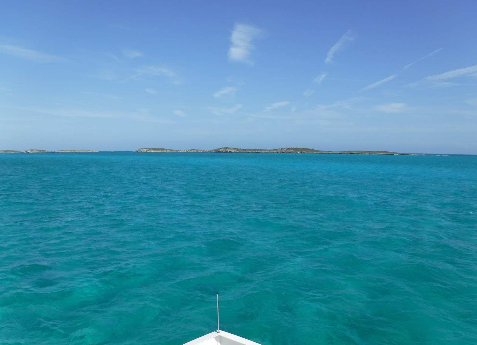
Our night off Bay Cay was uneventful, if a bit rock-and-roll. But we knew things there would just get worse as the winds continued to pick up out of the east and southeast. Thursday morning we weighed anchor right after coffee for the five-hour trip around the end of the island. Seas were behind us heading out "the funnel" and we had a good ride, and even the northbound leg was tolerable in the lee of the island.

Between the Sandbore Channel and Northwest Point we were in deep water, thousands of feet, and three miles offshore, so we elected to discharge our waste, in anticipation of being pinned down an unknown time in Grace Bay and the possibility of visitors. But when I went to start the macerator pump, it just made spinning noises and pumped nothing. Crap. At least we still had two thirds of our capacity available, so not an urgent problem.


Vector at anchor off the beach at Grace Bay, under a characteristic sunset.

As we rounded Northwest Point we found ourselves in fairly steep six-footers. Between the easterly fetch of the entire Atlantic and the rather steep slope of the shelf, huge amounts of energy were directed into a small area. But as we completed the turn and drove back off the shelf seas improved considerably, and just got better and better as we continued further into the lee of the bay.

Stubbs Cut was, in fact, calm, and we crossed the reef on autopilot, taking manual control through the more shallow coral field closer to shore. We didn't really notice the considerable swell until we dropped the hook. Still, it was not bad, and the swell only rolled us gently our first night in the anchorage. I think there was a bit more northerly component that first night.

A rainstorm followed us into the anchorage, and, in fact, I was tracking it on radar to make sure it would not catch us off guard. We got the hook set just before the heavens opened. The beach was uncharacteristically empty, with all the umbrellas folded up and even many of the lounge chairs at some resorts stacked and locked. We had a quiet dinner on board.


Empty beaches from our anchorage. It almost never looks like this.

Friday was our anniversary, and I joked that the traditional gift for 15 years is a macerator pump. I spent the day in the bilge swapping the failed pump out for the on-board spare, which in turn I had rebuilt after the last failure. It seems we get three years on a pump. I tested the installation with a coffee can full of clean salt water before making the final connection to the tank, and all is working again for when we next get offshore.

It was still a bit whipped up here in the bay when evening rolled around, and we decided we'd defer any kind of anniversary dinner ashore to an evening with better conditions. We left the tender on deck and had leftovers for dinner.

Saturday that particular piece of the storm had passed, and it was sunny and calm. Rain was in the forecast on and off, and instead of waiting for dinnertime, we seized the opportunity to get ashore while it was pleasant. We enjoyed a nice lunch on the patio at Solana, the beachfront restaurant at the Ocean Club resort next door.


Lunch at Solana. That's Vector center-frame, between the pillars.

Yesterday we spent most of the day getting the boat ready for guests. Louise has to first "convert" the forward stateroom from a quilting studio back to a guest stateroom. She wrote about the reverse process in this post (since then we have built a dedicated custom-fit table for the machine, also removable).  I have to make room for many of the conversion bits in the engine room, and then the room has to be cleaned and made up for guests. It's an all-day affair. We ended the day with unexpectedly good Mexican food at Skull Rock Cantina across the street at Ports of Call.

Speaking of Ports of Call, it is probably the least expensive resort here on Grace Bay, at $250 a night, owing to the fact that it has no beach frontage of its own. Instead, they cleverly located immediately across the street from one of the few public beach access points, shoehorned between Seven Stars and Ocean Club. They set up a stand on the beach end of the access where they supply their guests with beach chairs, umbrellas, and watersports items as needed; at 5pm they pack it all up and lock it in place.

Every resort along the beach also has a water sports stand, and neat rows of beach chairs serviced by uniformed staff. Beachfront resorts here start at $500 a night and go up from there, well into the $3,000 territory. It makes our $120 clearance fees and $300, 3-month cruising permit seem downright cheap. I have yet to find a stand that will supply water sports items, such as paddleboards or Hobie Cats, to people who arrive via the public access, which seems little-used. Jet skis are banned here in the National Park, so all the water sports items are sail or human powered.


Saturday we watched a wedding on the beach morph into a loud reception under a tent. After dark they put on a fireworks show. Unlike the US, there was no security zone and no patrol boats for these fireworks launched over the water. We were lucky to be a safe distance.

Other than the mostly destroyed pier that we're using to land the tender, and an intact pier a mile away that belongs to Club Med, there are no docks or piers here, yet boat tours of various kinds are ubiquitous. There are the parasailing boats, snorkel tours, and party boats that consist of a bar on the lower level, a sun deck on the upper level, and a pool slide from the upper level into the water.

Most of these boats come down from Turtle Cove Marina where we spent our first two weeks, and we saw them coming and going there with just their crews. I thought it odd at the time that every boat had its swim/boarding ladder attached to the bow, rather than the transom as is usual. Now I understand it: the way all of these boats load and unload their charges is by putting their bows up against the beach and then lowering their ladders.

All these boats come zooming by us on full plane, but it's not frequent enough to be a problem. Also the sailing snorkel tour boat from Beaches, on the next bay west, comes past us twice a day. We're always amused to hear the local accent calling "Beaches base" on the radio... I will leave it at that.


The Beaches cat passes close aboard.

In a short while I will take the tender ashore to meet our friend Amanda, who is flying out to spend a couple of days with us. Generally we have a standing offer with all our friends and family to come spend a few days on the boat any time, but the logistics and expense of flying someplace like the TCI or even the Bahamas on short notice make it impossible for most. Amanda has the luxury of flying here free on a space-available basis, and when we had to extend at least another week on account of the weather, our schedules aligned and she hopped on a flight.

The monstrous storm that has been hovering over the Bahamas (and here) for the last few days is finally moving on, and we're scanning for a weather window to make our way west. We need three days to make the hop from here to Great Inagua via West Caicos and Little Inagua. With a little luck we might leave as early as Thursday or Friday.

Wednesday, May 2, 2018

On the flip-flop

I am typing under way across the Caicos Bank. This time we are westbound, on our way back to Providenciales. We have officially "turned around," and will be mostly westing from here on out. With relentless easterly trades, this is the "comfortable" direction.

We spent the last three nights anchored off Cockburn Harbour, South Caicos, at first right off the town dock (map). That proved much too rolly with the swell coming in the inlet, and we moved after one night to a spot across the harbor near Long Cay (map), which we shared with five sailboats who all arrived within a day of us.


Six Hills Cay from our anchorage before departure. Note the "cave" to the right, and the undercut all the way around. We never tire of this turquoise water.

We had a miserable run to the harbor on Sunday from our very pleasant digs at Six Hills. Notwithstanding a forecast that appeared so calm as to tempt us into crossing to the Turks, as soon as we hit the cut we found ourselves pounding into short-period six-footers. I dared not try to turn the boat around for an about-face for fear of taking a massive roll as we came broadside to it, so we pushed on through into open water.

The turn north toward South Caicos did have us beam-to the seas and wind, and I increased throttle to 1800 rpm to help the stabilizers try to keep up with it. Fortunately we were outside only a half hour. Vector took it all in stride, but much less so the crew, and so we ended up dropping the hook at the first suitable spot, near the docks. Fortunately we surfed the entrance on rollers rather than the breakers we had going out.

Two sailboats, Force and Another Adventure, came in the inlet after us, likely having crossed the entire bank before circling around Long Cay. We recognized them as part of the fleet that had left Georgetown with us. A third boat that was traveling with them, Colorado, was too far behind, and ended up anchoring for a night where we had, at Six Hills.

The rough passage made for a long day, and we enjoyed a bbq dinner on deck before retiring early. The swells built throughout the night, and by morning we had had enough of the rolling. We moved across the harbor to the lee of Long Cay, where the sailors had wisely anchored. It's shallow over there and we had to hunt around a bit, something we were reluctant to do the previous day.

Thus comfortably settled, I dove in to some projects that have been lingering, chief among them fixing the throttle/shift lever on the tender. This is separate from the emergency repair I made to the shift linkage in Provo, although both broke nearly simultaneously.


Why is my lever loose? Oh, because it fractured at a weak point in the aluminum casting.


I drilled a hole in the outer section, and drilled and tapped a matching hole in the aluminum inner part.


This stainless machine screw and washer should hold it all together for the foreseeable future.

The lever was still usable, as long as I was careful not to pull up on it, but I thought it best to fix it before going ashore. I have no choice now but to nurse this tender along until we return to the US, but we are definitely ready for a newer, more reliable tender.


Since someone asked: This is an example of the plastic part on the shift linkage that broke. It's called a rod-end bearing or "heim joint."


Here's the jury-rig, involving two nylon zip ties. This is the throttle linkage. I had to move the broken piece here from the shift linkage (where my finger is pointing), which is harder to reach and also under much more stress.

After wrapping up the tender repairs and a couple of other small projects including fixing the turn signal on Louise's scooter, and changing the activated carbon in the waste tank vent filter, we splashed the tender and I jumped in for a swim. The water was a couple of degrees cooler here, but after working outside in the sun it felt good. After cocktails on deck we loaded up our accumulated trash and headed ashore.

The brightly colored and very nice town dinghy dock was destroyed in the storm, and so dinghy landing is at the Seaview Marina, a basin just two feet deep where the commercial fishing fleet, the principal industry of the island, is located. On our way in we had to skirt around the tanker delivering the island's fuel supply; with his 7' draft he has to anchor well off the dock and pump the fuel ashore via a floating pipeline. We had watched him arrive and anchor earlier in the day.

After tying up and making note of the Sunset Bar and Grill across the street, we walked the length of the town, down to the resorts on the southeast corner of the island. We stopped in to check out the local grocery store, also operated by Seaview. They had a decent selection and even some hardware items, but it is much more like the stores in the Bahamian out-islands than the very nice grocery stores in Provo. Today as we were leaving we saw the RoRo ship arrive with containers, we presume to include the regular refrigerated replenishment for the store.


That's the Sunset Grill on the right. This boat is on what passes for yard stands here.

We would have eaten in the highly rated Blu at the East Bay Resort, but they didn't even open until 6:30, and we did not want to be walking back along the narrow streets into town after dark. Instead we walked back along the waterfront to the Sunset Grill, where we found the dozen or so folks from the five sailboats just wrapping up cocktails and snacks. We had a nice, casual dinner and enjoyed meeting a couple of the crew.

Yesterday we had a relaxing day on the boat. I got a few more things done and enjoyed another nice swim in the crystal clear waters. Had we realized we'd be leaving this morning, we would have taken the tender to the nearby "Admiral's Aquarium" snorkel site and/or the tiny beach on Long Cay; we'll have to save those for another visit. We had a nice sunset dinner aboard on the aft deck. Our evening was capped off with fireworks from one of the resorts, we presume in honor of May Day and International Workers' Day.


Vector and her five companions, at right, in the anchorage along Long Cay, as seen from South Caicos.

This morning we awoke to calm seas in the Turks Passage. We spent a bit of time looking at the weather to see if it made sense to cross over to Grand Turk for a visit. You may recall from my last post that the anchorage there is only viable in settled weather, and it looks like we'd have that for not even 24 hours. Later in the day we heard from Bumfuzzle, who was there and already starting to experience a swell moving in from the northwest.

Looking at the weather for the next five to seven days, it did not look like there was going to be a window to spend any time in the Turks without the possibility of getting trapped there with limited anchorages. We faced the decision to either remain in South Caicos for several days to see if the forecast improved, or else seize the window to curl back around to the bank and head west.

As much as I'd like to spend some time at Grand Turk and Salt Cay, we've now made commitments to be back in Nassau the second week in June. That's a comfortable trip in a comfortable time frame from here right now. But remaining in South Caicos waiting on weather could well keep us there two weeks or more. Ultimately, we decided the prudent course was to use today's window to make our way back to Provo.


Sunset from our anchorage at Long Cay. That's our neighbor, Chak Matay, who was traveling with the trimaran We Don't Neaux.

Update: We are anchored just west of Bay Cay, one of the "Five Cays" south of Provo (map). We had an excellent crossing in perfect weather, dropping the hook here just after 5pm and having a beer on the flybridge shortly thereafter.

We had a little roll here right after anchoring, with the tiny cay providing only a limited lee. We enjoyed a nice sunset dinner on the aft deck, watching the distant thunderstorms pass us by. But now as I resume typing, close to 10pm, the winds have built to 25 steady gusting to 30, and we've secured the decks for storm conditions. The boat is moving and we need to keep "one hand for the boat" as we move around, but we are comfortable.

It will be a wild and wooly night. If the weather cooperates in the morning, we will weigh anchor and steam around the west end of the island back to Grace Bay. If we are to be pinned down here for a week or so by weather, we want to be on the leeward side of the island, and it helps to have access to shore, restaurants, groceries, and other services close at hand.

For anyone not paying attention, this storm system is a monster, sweeping in from the Atlantic and threatening the entire Bahama chain with tropical storm conditions. Ironically, we'd be better off further into the Caribbean at this point, but Vector is a good heavy-weather boat and we have numerous options here to shelter from the worst of it.

Whenever the weather is ready to let us leave, we will clear out here in Provo and head over to West Caicos for a night to stage for departure. From there we will head west, either to Little Inagua (en route to Great Inagua) or to Mayaguana in the Bahamas, depending on conditions.

Sunday, April 29, 2018

Skinny dipping

We are anchored off Six Hills Cays on the Caicos Bank (map), part of the Admiral Cockburn National Park. Yesterday morning we weighed anchor around 9:30 after a leisurely coffee, bound for Long Cay on the edge of the bank. But adverse current, heavy chop, and a stiff wind had us doing just 5.3 knots at our usual 1500 rpm, and the plotter said we would arrive at 7pm, just before sunset.


Sunset from our aft deck, as we dined. This never gets old.

We ended up increasing to 1600 rpm to get our speed up, and set our end-of-day sights here instead, about three miles short, and the first lee available on our route. It turned out to be an excellent choice; with the wind a bit south of east, we have excellent protection here, in calm water with just a bit of swell circling around the cays.


Crossing the bank. This is the view to the horizon in all directions. We're in 16' here and we could see every coral on the bottom, and a pair of sea turtles, too.

This is also some of the clearest water we've been in. We can clearly see the bottom some dozen feet below us, and our underwater light illuminated it as well. The water here is now 84°, and with no current pushing us away from the boat here in the lee, we went for a nice swim after we arrived. We have the place entirely to ourselves; the nearest soul is six miles away in South Caicos, so no swimsuits required.

This is a sharp contrast to Sapodilla Bay, where, while clean, the water was murky enough that we could barely make out bottom features, I think due to some kind of suspended fine sediment. Even in Grace Bay I had a hard time finding my reading glasses on the bottom, 15' down, after dropping them while working on the tender. I did go fetch them once I spotted them.


The beach at Sapodilla Bay, just before we left. It's a long way; this is as close as we can get.

The tender work, by the way, which I neglected to mention in my last post, was to jury-rig the shift linkage, which broke on our way home from our massage in Grace Bay. Fortunately it gave up just as I was trying to maneuver alongside Vector, and it broke in neutral rather than in gear. I grabbed the painter, jumped off the dinghy, and swam us back to the big boat before we could drift too far away. It's now held together with a pair of zip ties; a proper repair will have to wait until I can get parts.

We had the hook down here just in time for cocktail hour, and had a lovely dinner on deck in this beautiful location. From here we can make out the buildings (and lights) of Cockburn Harbour on South Caicos, about six nautical miles distant, and we have an excellent cell signal from there as well. Six Hills Cays themselves are uninhabited, and the only sound we hear is the surf battering the rock shore of the cays.


Approaching the Six Hills Cays. Three hills are on the closer cay, dead ahead, where we anchored, and the other three are on the cay at left, separated by a narrow cut.

This afternoon we will weigh anchor and cruise off the bank into the Turks Passage, turn north, and come back onto the back at Cockburn Harbour. We had discussed making the crossing to Grand Turk, but the anchorage there is good only in settled weather, and we need to hunker down for a few days as this storm system passes. We'll do that in the greater protection afforded at South Caicos.

Friday, April 27, 2018

Cruising the TCI

We are under way from Grace Bay, Providenciales, bound for the Caicos Bank. We'll end our day just six nautical miles from where we started it, but it's a 31 nm cruise around the west end of the island. We've been under way just a half hour as I am typing this paragraph, yet we're already in water thousands of feet deep. Soon after clearing the reef the bottom falls off into a wall, and the edge of the shelf is lined with dive boat moorings for the spectacular wall diving here.

It's been two weeks since my last post and I have quite a bit to report. For starters, we are still here in the Turks & Caicos after arriving three weeks ago, and we are very much enjoying our time here. Not long after I last posted, we took a long, hard look at weather and conditions east of here and made the decision to end our Caribbean cruise here in the TCI rather than press on east, just to have to quickly turn around and head back.


Vector at anchor in Grace Bay, off Seven Stars resort. Tender is tied to the remains of the pier at left.

The remainder of our first week passed very quickly. I enjoyed my massage on the beach, and we had a nice dinner that Saturday evening also on the beach, at Hemingway's Restaurant in the Sands resort. Over the weekend we also rode the scooters out to the southwest corner of the island, passing the government docks and taking in the turquoise views over Chalk Sound. On the way back we stopped for gas at $5.25 a gallon, the going rate here.


Massage area with the blue curtains to the left, from Rickie's. Pier belongs to Club Med for their dive and snorkel boats.

By Sunday evening the weather forecast was still not showing us a good window to Puerto Rico, and we resigned ourselves to dropping the $300 for a TCI cruising permit. That would give us a lot more breathing room on departure, and a chance to see some of the other islands in the TCI.


Da Conch Shack, the local tourist trap on this end of the island.

Monday we rode out to the northwest corner of the island. Well, at least to where the pavement ended. An unpaved road continues several miles to the Northwest Point Resort, but that's the only thing out there, and it's closed until June due to hurricane damage. On the return ride we stopped at Da Conch Shack on the beach for a beer, then headed "downtown" towards the airport for a traditional thin-crust pizza at Mother's, a decidedly local joint.


Cocktails at Da Conch Shack. Those are conch shells piled off the beach behind us. Off-frame is a vendor selling numerous conch-shell art and craft items.

Tuesday morning rolled around and I met up with the Customs officer to buy our cruising permit. What I got from that meeting was that he would gladly have extended our temporary permit as long as needed to clear the weather, but that would have limited our ability to cruise the other islands, so I went ahead and bought the permit. I also took another week at the marina.

That evening we met up with the crew of Bumfuzzle, Ali, Pat, Ouest, and Lowe, meeting aboard Vector and then walking over to Shark Bite for drinks and dinner. We really enjoyed meeting them and comparing cruising (and RVing) notes. With two little kids it was a fairly early evening, and we were back aboard Vector shortly after sunset.

And so it was that were were relaxing in the saloon, Louise surfing the net and I watching some old TV episodes on my hard drive, when there was a knock on the hull around 9:30 in the evening. It turned out to be our good friends from the Boston area, Ken, Jean, and daughter May. It was clear out of the blue, and so out of context it took a moment for it to register in my consciousness.


Sunset over the Club Med dive boat, from Rickie's.

Apparently they vacation in Provo annually at this time, staying a couple of miles east, near Grace Bay. They had come down to Turtle Cove to eat at one of their favorite places, The Tiki Hut, but it's been closed since the storms and we've been watching the excavators tear down most of it while we've been here. So instead they walked next door to Mango Reef, right at the marina, and after dinner decided to stroll around looking at the boats.

That's when they ran right smack into us. Apparently, we were out of context for them, too, because it took them a while to agree that this is really the boat they had been on back in Boston Harbor three years ago. We enjoyed a brief conversation on deck before they had to leave, as it was May's bedtime, but we agreed to meet for dinner the next day, and we had a lovely time catching up over several hours at Baci, a short walk from the marina.

The marina's Internet connection went to pot sometime Wednesday, and knowing how "island time" affects repair schedules, Thursday I went over to the office of Flow, the local phone company, to buy a SIM card and some LTE airtime, which we were going to need anyway once we shoved off. They have an office inside the very nice IGA grocery store, which we had visited earlier in the week. This store rivals anything you might find in a mid-sized suburb in the US, just with somewhat higher prices. They even have a large section of the usual beach-town items like snorkel sets, umbrellas, boogie-boards, and the like, again at reasonable prices.


Beach toy aisle at Graceway IGA.

Digital data, unfortunately, is not one of the reasonably priced things in this country, and I dropped $50 on just 5gb of pre-paid LTE data. That ought to get us through our whole stay if we are conservative, and as soon as the marina network came back online we switched back to it. By contrast, 15gb in the Bahamas is just $35, and in the US, prepaid customers typically get 10gb for $45.

Thursday evening we rode our scooters over to nearby Bight Park for the weekly "fish fry." This event, popular with tourists and locals alike, is roughly akin to many street festivals in the US such as art and wine fests or even farmers' markets. The parking lot is closed off and filled with food trucks and stands of every description, and artists and craftsmen selling their wares. A stage is rigged at one end and there is live music. Most of the restaurants on the island are represented in the food area. We grabbed some jerk pork and tacos from one of the stands and a couple of local drafts from the beer truck, and we again ran into Ken, Jean, May, Ali, Pat, Ouest, and Lowe. It was an enjoyable evening and I am sorry we did not also go the week before.


Sunset from "The Deck" at Seven Stars.

Friday evening we ended up back at the Seven Stars resort, this time to dine at their beach bar, The Deck. It was very pleasant, and we could see a boat in the anchorage, making us pine to be out of the marina. Saturday we rode out to the east end of the island, checking out the Blue Haven marina on the Leeward Going Through channel, and hoping for a light meal in their bar and grill. It was inexplicably closed, and we went instead to Rickie's Flamingo, on the beach, where the massage shack is located.


Rickie's Flamingo. Prototypical beach bar.

It was raining Sunday evening and so we just strolled across the parking lot to Mango Reef, for the second Sunday in a row. But we hatched a plan, after I spent a good part of the day researching it, to visit North Caicos and Middle Caicos Islands on Monday, which we hoped would be our last day in the marina.

Monday morning we rode our scooters east on the main highway to the end of the island and Walkin's Marina, where we caught the 9:30 ferry to North Caicos. "Ferry" perhaps conjures the wrong image, as this is really a speedboat powered by three huge outboards and holding perhaps two dozen passengers. We made arrangements with the ferry company, before departure, to rent one of their cars at the other end.

The ferry does 30 knots for much of the 25-minute trip. While a boat ride is something of a busman's holiday for us, the water around North and Middle Caicos is much too shallow for Vector, and we got a kick out of traveling at five times our usual speed. Even our dinghy goes only half that fast. The rental cars are staged at the landing, and within a few minutes we had our right-hand-drive Honda Fit, a pregnant roller skate unFit for sale in the US.


Honda Fit. The other side is covered with scratches from hitting numerous bushes that encroach on the road; I added a few myself.

While Provo is very much in the first world -- the restaurants, stores, and resorts are nearly indistinguishable from, say, the Florida Keys -- North and Middle Caicos are much more reminiscent of the Bahamas. The combined population of the two islands is just over 2,000, or one tenth that of Provo, even though both these islands are larger in area. A single road runs the length of both islands, which are connected by a causeway.

We spent the entire day driving the length of the islands. We had lunch overlooking the Atlantic Ocean at the Mudjin Bar and Grill on the grounds of the lovely Dragon Cay Resort on Middle Caicos. And we drove the dirt road all the way to the southeast end of the island (map) in hopes of a deserted beach, but it was covered in washed-up vegetation and unappealing. We had brought our snorkel gear just in case.


Mudjin Bar and Grill. We ate on the deck; it's quite windy here on the windward side.

We visited every settlement on the two islands before making our way back to the landing for the 4pm return ferry, opting not to wait for the final 5:30 departure. We had a light dinner at home after a very full day.

Tuesday morning we deemed the weather acceptable to try to make our way back out the reef. We prepped the boat, offloaded trash, decked the scooters, and checked out of the marina after a two week stay. Once again high tide was late afternoon, and so we did not drop lines until 3pm, when the pilot boat again guided us out.


Bambarra Beach on Middle Caicos. It's shallow a long way out.

Just after clearing the reef at Sellars Cut, we proceeded east along the reef to the much wider, deeper, and easier to manage Stubbs Cut leading to Grace Bay. This is where we had intended to come in two weeks earlier to anchor after our passage, until we were waved off by DEMA. In the interim we did more research, and asked around, to learn that no permit is needed for vessels under 18 meters in length. We navigated through the deepwater channel toward the beach, and dropped the hook in 15' of water off the beach at Club Med (map).

Once anchored we began to feel much more like real cruisers again, and we enjoyed a nice dinner on the aft deck for the first time since the Bahamas. We had a lovely view of the beach and the bustling water sport activities, and even enjoyed some pleasant music coming from one of the beachfront restaurants. We inflated our giant pretzel (the one on Louise's blog header) and swam off the back of the boat. We also became something of an emergency rest stop for a couple on paddleboards who had managed to be swept a bit further out than planned; we enjoyed meeting Roberta and George as they rested by holding on to a line we dropped to them.


Dinner on deck, our first in weeks.

It was blissful, or even sublime. Right up until around 11pm, when the open-air disco at Club Med ramped up for the evening. It's a good thing that it was "our" kind of music, because it went unabated to 2am. Louise had to put her earplugs in when she retired right after it started. I was watching videos most of the evening with headphones on and so was not greatly disturbed.

We did not want to put ourselves through that another night, so Wednesday morning we weighed anchor and moved a half mile west and a bit closer to the beach, dropping the hook off Seven Stars resort (map). This proved to be a much quieter but also calmer spot, and we enjoyed another couple of nights. This was also close to the remains of a pier that we could use to land the tender, a much more comfortable option than beaching it, even if it meant walking the narrow beams back to shore.


The local brew, Turks Head. Louise prefered the lager, I-Ain-Ga-Lie, and I liked the amber, Gon-Ta-Nort.

Wednesday evening we went ashore for dinner, walking through Seven Stars to the street and over to Bella Luna, a nice Italian place in town. Afterwards we walked to the Graceway Gourmet grocery store, a smaller, more upscale cousin to the IGA out on the highway. They had everything we needed and then some.

Yesterday we tendered back over past Club Med to Rickie's Flamingo and the massage shack, where we had both booked 1pm sessions. The massage place is on island time and our massages actually happened at 2pm, but we were able to enjoy a drink at Rickie's while we waited and I even went for a swim at the beach.


Grace Bay beach from our anchorage.

We had our final meal in Grace Bay at The Deck, this time with Vector as a backdrop. It was a very pleasant visit, and if we ever return to Provo I would head straight for this anchorage and spend the whole time here off the beach. With groceries and a dozen restaurants an easy walk or tender ride, it's hard to beat.

As I wrap up my typing we are just about to make our turn east into the Sandbore Channel leading to the Caicos Bank. Tonight we will be anchored in the Sapodilla Bay area, just across the island from where we've been since arriving. In the morning we will weigh anchor and explore the bank. We found the cell coverage on Middle Caicos to be spotty, so I am not sure when we will next have coverage.

Update: We are anchored in Sapodilla Bay off Provo, on the bank side (map). We are just seven miles from where we started this morning, and four miles from the marina where we spent two weeks. There is a bit of swell here, as our draft prevents us from tucking in behind the point, but we are comfortable.


The transition from the deep blue ocean to the turquoise bank is abrupt. The photo does not do it justice.

Crossing on to the bank was mesmerizing; the water went from hundreds of feet deep (our sounder only reads to 300 or so) to thirty feet deep in the span of a football field. Deep blue to turqoise in the blink of an eye; I tried to capture it but the camera does not do it justice. Right there at the crossing, on the north end of West Caicos, are the 30-odd buildings of what was to be the Ritz Carlton resort.


The never-completed Ritz Carlton Molasses Reef Resort on West Caicos.

The entire project ground to a halt in 2008 with the collapse of Lehman Brothers, who was financing the project. New developers would like to take over, but the ravages of a decade mean the buildings will likely have to be razed first. The island is otherwise uninhabited, mostly a national park.

It's too rolly here for us to want to stay more than one night. In the morning we will continue on the bank in hopes of finding a lee someplace.

Friday, April 13, 2018

Provo

We are docked at the Turtle Cove Marina, on The Bight of Grace Bay in Providenciales (map). Providenciales, locally shortened to "Provo," is the name of both the community and the island it inhabits, on the Caicos Bank. It is the northwesternmost  and most populous island of the Turks & Caicos Islands (TCI).

When last I posted, we were passing along the north coast of Crooked Island, and things were a bit smoother and also faster as we continued along to Acklins Island. But as soon as we passed the islands and made our turn towards the southern tip of the Plana Cays we were again in steep head seas, with lots of pitching and a loss of a half knot or so of forward way.

The Plana Cays are uninhabited and unlit, and even though we passed within a mile of the shore I could barely make out a land mass through my glasses. The moon had not yet risen, and all I could see were stars, a handful of lights on Acklins Island astern in the distance, and an offshore tug well to starboard steaming back from San Juan. Even this close to the cays, we were still in thousands of feet of water.


Our digs in Provo, as seen from the Magnolia. Vector is just right of center frame, and the reef is just below the horizon.

We changed watch between the Plana Cays and Mayaguana. Louise had the advantage of a little moonlight on her watch; moonlight considerably lessens the number of trips out onto the deck to scan the horizon. She also got a little Internet from Mayaguana as we passed, and I caught the last of it in the morning after waking up.

By midday the seas had lessened somewhat, and there was a steady improvement as we approached the Caicos Bank. By the time we crossed the territorial limit it looked like we could safely traverse the reef, and we opted to continue to the north side of Provo rather than circle around to come in on the bank. It's more protected there, and the water is prettier, but we would have no choice but to anchor, and the town is really on this side of the island.

Using all the resources available to us (while we still had Internet), we had selected a couple of marked anchorages inside the reef that could be safely navigated without use of a pilot. As we came in radio range, we made the mandatory call on the VHF to Provo Radio, who provides clearance to enter the country and the harbor.

Provo Radio took our details and asked for our destination, and when we gave them the anchorage they notified us we would need a permit to anchor from the Department of Environment and Maritime Affairs (DEMA). I presume this is because the anchorages within the reef on this side are all within the boundaries of the Princess Alexandra National Park. Nothing we had read to this point had warned us about this, including the comprehensive cruising guide in our chart book and the several anchorage markers on the Active Captain database.

To get the permit one calls a marina, and the marina put us in touch with the DEMA representative. He informed us that the permit would cost $100 and we would need to go to the marina to get it. Our plan to drop the hook for a night was falling apart in the last ten miles of our passage.

We always anchor after an overnight passage, even if our ultimate destination is a marina. This allows us to get some decent rest and sleep on a mostly unmoving and quiet boat before having to negotiate possibly tricky entrance channels and execute the most complex evolution we ever undergo: docking the boat. By contrast, dropping the anchor is a walk in the park. It also allows us to defer negotiating possibly shallow channels until the tide is favorable, if it is not upon arrival.

With the only uncomplicated anchoring being offshore and outside the protection of the reef, we instead accelerated our inquiry to the marina. While almost everything here in TCI is expensive, marina rates seem to be the one exception, with our guide saying this one was $1.05 per foot, with a discount for stays of a week. We had already contemplated taking a slip here so that we could offload the scooters to get around town, and also to be in the more protected basin during this unsettled weather.

By a complete accident of timing, we were arriving at the reef just an hour before high tide and an hour before the marina closed. They confirmed what we knew about the rates and that they had space, and we asked them to send the pilot boat out to escort us through the very tricky reef entrance. As it turned out we arrived a few minutes ahead of the pilot and had to circle offshore in the swell.


Following the pilot boat. You can't make out the breakers on the reef in this shot.

The transit through the reef was something of a nail-biting experience, starting with "surfing" the swell into the very narrow opening in the reef, which is immediately followed by a sharp turn to starboard. Our depth sounder indicated just seven feet of water at numerous spots, and this is at nearly high tide. At one point it registered six, which is our draft, but nothing touched and it's possible it was reading the top of some grass. The two men in the pilot boat kept a sharp eye on us the whole time and gave hand signals and radio instructions as needed.

We were at the dock and tied up a little after four with the Quarantine flag flying. I walked to the marina office with our papers and cleared us in with Immigration and then Customs. It was a painless process and we have a seven-day temporary permit for $50. If we stay longer we will need to buy the 90-day permit for $300. In the chaos of the day I forgot to ask about the scooters and I had to call Customs back the next day. They granted permission to offload them so long as we took them with us when we left.

We had been prepared to grill something for dinner in the anchorage, but after adding two hours and the hair-raising reef transit to our passage, and another half hour clearing in, we just stumbled across the parking lot to the Mango Reef restaurant for dinner, which was quite good. We washed it down with drafts from the local Turks Head Brewery.


The festively lit Mango Reef bar and restaurant, on the marina property.

Wednesday we did ... nothing. It always takes us a day to recuperate from overnight passages, especially uncomfortable ones. We tidied up the boat a bit and surfed the Internet on the marina's rather limited WiFi. We did not even offload the scooters. We did leave the compound, though, walking down the block to upscale Italian restaurant Baci, which overlooks the marina from the island side.

While the TCI is geologically and perhaps even geographically an extension of the out islands of the Bahamas chain, culturally and economically it is a world apart. Restaurants here, while having a distinctly tropical flair and a generous proportion of al fresco seating, could easily be mistaken for restaurants in, say, Miami, with western menus and ingredients. And there is no shortage of them, with four restaurants just within walking distance of the marina.

Yesterday we offloaded the scooters, and I spent some time getting them prepped for use after a month sitting on deck. Our plan was to ride into "town," by which I mean the main tourist district of Grace Bay, in the afternoon and then have dinner someplace there. By the time we were ready to leave, though, storm clouds had rolled in and rain was threatening, and we opted instead to again walk to dinner, at the Shark Bite Grill right next door to Baci.

Having missed our chance yesterday, this morning we rolled out fairly early to explore Grace Bay. We proceeded carefully, as it takes some time for the brain to fully register driving on the opposite side of the road, especially on two wheels. We made it as far as Rickie's Flamingo Cafe, on the beach past the main tourist district.

We arrived before opening time and walked out to the beach. I had read a tip on Trip Advisor about an obscure massage shack on the beach next to Rickie's, and we eventually found the proprietor. I booked a massage for tomorrow morning; at $65 for an hour it is less than half the going rate at the numerous resort spas dotting the island.

Returning back through town we pulled into the luxurious Seven Stars resort, perhaps the grand dame of Provo beach resorts, and after being waved through the gate we found our way to the restaurant for a sumptuous buffet breakfast. Afterwards we walked around the resort to see what $490 per night buys you here. The grounds are beautiful and I am sure the service is impeccable, but we were happy to return to our $47 per night marina slip, less than a tenth the price, and counted ourselves fortunate to have escaped with a bill of $30pp for breakfast.


Louise on the immaculately groomed grounds of the Seven Stars. The difference in water color between the pool and the bay behind it is subtle.

We made that our big meal of the day, and this evening we walked up the hill to the Magnolia Wine Bar and Restaurant for cocktails and a light bite on the deck in their bar, with a sweeping view over the marina and out to the bay and reef beyond.

We were the only transient boat when we arrived, but Thursday the somewhat famous Bumfuzzle pulled in, and today the enormous live-aboard dive boat Aggressor II is at the dock for their turn-around. The marina is still recovering from the effects of Hurricanes Irma and Maria, and there is ongoing construction and repair all around us.

We booked our slip for the full week, since it will be at least that long for the weather to pass, and that got us the reduced rate of 90 cents per foot per night. Power here is 60 cents per kWh but we arrived with full batteries and we've been able to get by without air conditioning thus far. When Tuesday rolls around we will have to decide if we can move along to another country, or if we will need to buy a TCI cruising permit. That would give us time to cruise the other islands on the Caicos Banks, and possibly stop in Grand Turk and Salt Cay before moving on.

The next leg is a big question mark. From here we can proceed to the north coast of the Dominican Republic, or we can bypass the DR and go straight to Puerto Rico. Either of those options has us on the very dicey northern route across the Mona Passage. Alternatively we can steam some 350 miles around the western end of Hispaniola, where we can make no stops in Haiti due to insurance restrictions, to make the south coast of the DR for a more comfortable ride to Puerto Rico. We'll be gathering weather information and cruising advice over the next few days before making a decision.