Sunday, February 22, 2015

Our window arrives


We are at a favorite anchorage, in north Lake Worth just off Old Port Cove marina (map). I had originally planned to anchor off Prosperity Farms, a bit quieter location, but we needed to pump out when we left Soverel Harbour, and Old Port Cove has a high-speed pumpout available for just $5. Our view consists of expensive housing units, and Tiger Woods' 155' yacht, with the unintentionally ironic name Privacy, which is for sale for a cool $25M.


One of our final sunsets at Soverel Harbour.

It's a ten-minute dinghy ride from here over to Blossom at the North Palm Beach marina, and we've been tendering over there to join up for dinner and some last-minute grocery shopping. Today we had to dinghy over to the landing under the Jack Nicklaus Boulevard bridge, for a final stop at Publix for more cat food, and the ATM at the CVS next door to replace some cash I unexpectedly had to shell out here pre-departure. Cash is much harder to get once we're in the islands.


The haul from the penultimate provisioning run, consisting mostly of fresh produce.

I also managed to find a straw hat at, of all places, Publix; I've been looking for one for the past month to keep the sun off my ears in the islands. The boat is now hexagonally close-packed with provisions and supplies, so even though we stood there for ten minutes, surrounded by the excess of a typical American grocery store, we could not think of a single other thing we could use in the next three months to fit aboard. We're as ready as we can be.


A bilge full of beer.

That's good, because our weather window has opened, for just a single day: tomorrow. In a few minutes we will deck the tender and chug down the ICW to somewhere near the inlet, to save a bit of time in the morning. If all goes well we will weigh anchor in the pre-dawn hours and be on our way to the Little Bahama Bank, where we plan to anchor off the White Sands shoal as our first stop outside the US.

Once we are five to ten miles offshore, our cell phones will stop working until we return to the US, probably sometime in May. Email will be the best way to reach us while we are away, but I expect we will only be able to access it every week or two for a short while.

I posted here a few days ago about how to follow us once we leave US waters, and I'll try to remember to kick it off by posting our location tonight via Spot.

Tuesday, February 17, 2015

Stocking up


We are docked at the Soverel Harbour Marina, on the ICW just north of the PGA Boulevard Bridge, in Palm Beach Gardens, Florida (map). We arrived last Wednesday afternoon after a very pleasant and unhurried cruise from Stuart down the ICW. It was a bit tricky maneuvering into our slip, at the very end of a circuitous fairway, but we were docked in plenty of time to get our Enterprise rental car before their office closed.

Having a car meant we could drive over to North Palm Beach Marina to meet up with Blossom for dinner, the first of several during our week-long stay here. We drove down to Lake Park, and, ironically, ended up dining at the very same place to which we all had walked when we were docked there for Trawler Fest a year ago.

The main impetus behind the rental car was to head down to the Miami Boat Show on Thursday. For a while it looked like I'd be going solo -- Martin and Steph were both too wrapped up with Blossom projects to take the day away, and Louise had no interest in the show itself. But at the last minute she decided she'd come along for the ride, and maybe get some provisioning done with the car while I was at the show.

Other than an hour mid-day, when Louise and I met up with our good friend Steve and his daughter/assistant Katie for a pleasant lunch off-site, I spent the whole day at the Miami Beach Convention Center covering as much of the show as I could. I had a small list of items I was trying to find there, but came away only partly successful.


A tiny fraction of the organized chaos that is the Miami Boat Show.

Chief on the list was new boat insurance, to cover a possible excursion to Cuba later this year (more on that in a separate post). As it turns out, though, yacht insurance is not well represented at the Miami show, and I struck out on this front. Also on my list was getting some technical questions on the engines and transmission answered, and here I was much more successful, at least in regard to the engines. Our transmission manufacturer, ZF, was notably absent from the show, but Steve put me in touch with them afterwards.

I got some good information about charts in the Bahamas and Cuba, and nailed down the correct type of emergency "man overboard" beacons we'd like to have before getting too far offshore. I also picked up some more LED strip lights to replace some that are failing prematurely from exposure to the elements. In all it was a decent show, but not nearly as beneficial as it was for us last year. Still, it was worth the effort and expense to go.

A full-day excursion to the show meant renting the car for two days, or else having to miss a few hours of the show. So we had the car for most of the day Friday, too, and we started the day with a visit to a nearby vet to get Angel's International Health Certificate. We spent most of the afternoon with Martin and Steph on a Costco run; we had let our Costco membership lapse when we lived on the bus because we simply had no room to store the size packages that Costco sells. Gearing up for the Bahamas, though, it's just the ticket, and we came home loaded up with fresh meat, wine, dry goods, and other provisions.


One of the "house" cats at the vet's office, looking a lot like a throw rug.  This cat was huge, as were the two others we saw; all were super friendly.  Angel was not amused.

We had unloaded one scooter when we first arrived, and after we returned the rental car, we took turns running errands and making provisioning trips on the scooter. Most of the week has been spent provisioning and getting the boat ready for three months out of country. Here are just a few of the things we've loaded aboard:

  • Gasoline. I ordered a pair of six-gallon cans from Amazon, and I've filled both of those as well as the two-gallon can we already had. I also used the two-gallon can to top up the tank on the tender, which took four gallons, so there were three trips to the gas station just with the smaller can. We now have 14 gallons of extra fuel on top of the eight or so in the tender itself, which ought to last us several weeks. We'll probably still have to find gas somewhere in the islands, too.
  • Beer. Rum is everywhere in the Bahamas, but beer is scarce and expensive. We loaded some 200+ cans/bottles aboard. I ended up making racks in the bilge to store it, to get it out of the way and keep the weight down low.
  • Wine. Again, expensive in the Bahamas. We bought perhaps a dozen bottles between red and white, and I loaded another nine liters of the boxed variety.
  • Canned goods. Lots and lots of cans -- we expect our fresh produce to last a couple of weeks, and then we'll be into frozen and canned veggies.
  • Pickled items (pickles, peppers, beans, etc.), for the same reason.
  • Frozen vegetables.
  • Meat. I bought an entire tenderloin at Costco and sliced it into individual portions for freezing. We also bought a tray of lamb chops, a couple of pork loins, and a metric ton of chicken and stew meat for the crock pot.
  • Ultra-pasteurized milk. The fresh stuff will be gone in a week or two, and we take milk in our morning coffee.
  • Motor oil. Eleven gallons are now stowed in the bilge, enough to change the main and generator oil once each, with some for make-up.


Eleven gallons of 15w-40 squirreled away in the bilge, starboard of the engine stringer.

We have yet to stock up on fresh produce; that will happen just a day or two before we head offshore. No sense in having the clock ticking on that stuff too soon.

Today was our last full day in the marina, and I had Dockside Petroleum send a fuel truck; we took on 520 gallons of diesel at a very competitive price. We now have a full 1,200 gallons aboard, which is more than plenty for three months in the Bahamas, and will preclude our having to fuel there at island prices.

Yesterday and today were a mad scramble to gather up items from far and wide. I needed Bahamas charts and some repair items from West Marine, Louise needed fabric for quilting projects, and there were the inevitable lists for Home Depot and Walmart. I also made a run on Trader Joes and spent an hour in the T-Mobile store straightening out a SIM card issue with our iPad, which we use as a backup for navigation.

In and among all this, I spent a good deal of time setting up the new Iridium satellite phone, one of the many things we had delivered here to the marina in anticipation of our stay. Squaring away all of the minutia of our lives for an extended absence has occupied what remained of our time; we'll be out of the country and mostly away from the Internet when our taxes are due, for example.

Lest I sound like I am complaining, I should also point out that we've mostly enjoyed dining out in the Palm Beach area each evening, and tonight, while the northeast shivers, we dined al fresco, in short sleeves. It's been a mostly pleasant stay.

That said, we're ready to leave. For one thing, our slip backs up to a cigar bar, which, besides the cigar smoke, has been loud almost every evening, with live music into the wee hours on the weekend. For another, the sense of entitlement in this general area is palpable, and it's not a vibe that agrees with us (yeah, I know: says the guy typing from his yacht, in the marina).

We booked a week here, on a weekly rate that was much more attractive than the daily transient rate. Our week will be up tomorrow. Blossom is not quite ready to depart, and weather does not look good for a crossing anyway until after the weekend. So rather than extend our stay here at a higher daily rate, we'll shove off in the morning and go anchor someplace.

The dock served it's purpose: we needed an address to have some things shipped (gas cans, satellite phone, our accumulated mail, etc.), and a place to do some of the "heavy lifting" of provisioning for an extended cruise. What's left to do can be done at anchor, and we have a couple of options for tendering ashore for the final provisioning of fresh produce.

Cigar bar notwithstanding, this marina has certainly been convenient. There are three restaurants right on the property, along with a gourmet market, and most shopping is a moderate walk, an easy bike ride, or a slam-dunk on the scooter from here. It's really a hidden gem. It's a "dockominium" -- each slip is privately owned, with owners putting their unoccupied slips into a transient pool -- and not well publicized to the transient ICW crowd. The loud surroundings, particularly on the weekend, is really the only downside. Staff have been very attentive and there is full-time security on site.

We'll linger here till mid-day sometime and then head over to Old Port Cove. They have a pumpout there, which we sorely need.  We'll probably end up dropping the hook not far from there, in the northern bight of Lake Worth, an easy tender ride to Blossom or to the Publix grocery store.

Sunday, February 15, 2015

Bahamas bound: updating blog settings

A quick time-out here from my usual posting format, wherein I tell you where we are and what we've been up to, to do some blog and social media housekeeping.

As I have mentioned here previously, we are getting ready to head offshore to the Bahamas, our first destination outside of the US. As exciting as that is, there has been a great deal of work involved, from provisioning food and beverage (we now have some 100+ beers stowed in our bilge, about half of plan), to taking care of maintenance, to putting our taxes, finances, and insurance in order.

One of the checklist items has been to deal with communications and Internet access once we leave the country. We have a multipart strategy on this front, and I've spent several days lining everything up, then configuring and testing the hardware, software, and web services involved.

We do, of course, have both VHF and SSB marine radios aboard, and so we'll never be out of range of help. And the SSB, on a good day, will even allow us to do some very low-bandwidth text-based email and weather. But otherwise, those radios don't really help us to stay in touch with our family, friends, or extended community here on the 'net. Worse, over the last decade we've become accustomed to, perhaps even reliant upon, Internet access to deliver our weather forecasts, world news, and even troubleshooting information for various systems aboard.

We hope to have Internet access occasionally through marinas or other WiFi hotspots ashore. On our cruise around South America a few years ago we became veterans of public Internet kiosks and storefronts, and we'll take advantage of those when available. But in the Bahamas, we expect to mostly be anchored out, away from WiFi signals or even enough civilization for a kiosk.

Our next option is a cell phone from the local provider in the islands, Batelco. My Sprint smart phone has a slot for a GSM "SIM" card and our first attempt will be to pick up a card at the first Batelco office we pass, and see if that works. If not, we'll likely buy a low-end smartphone from that same store. This should get us limited email and web browsing any time we are in range of one of their cell towers.

Even cell towers are few and far between in a nation of 700 mostly tiny islands spread over some 180,000 square miles of ocean. And so we expect we'll go days or sometimes weeks with no access to a working cell signal.

For those days, we've purchase a satellite device that works on the Iridium global satellite network. Rather than buy a traditional phone handset that would require us to be outdoors in open sky (or to use an external antenna) to make or receive calls, we opted for a newer technology, the Iridium Go device. I won't bore you with the details, as you can just click the link, but we can place this device on the boat deck whenever we need to use it and then use our smartphones to make calls, send and receive text messages, get weather reports, and do very limited browsing from the comfort of our salon.

The very limited bandwidth, along with the high cost of satellite air time, necessitated some changes in our social media strategy. For starters, my trademark overly wordy blog posts will mostly have to wait until we have WiFi, or maybe cellular access, on an occasional basis. If there is something to be said of an urgent nature, we do have the ability to post here via email, but that's clunky and still expensive over satellite.

Fortunately, social media is well-suited to brief, one-way status messages of the sort that are easily sent by satellite. In order to take full advantage of this capability, we've created a Twitter account just for the boat. If you use Twitter, you can follow us there at @my_Vector (anyone can see our tweets; you do not need to open an account).

I've pointed our Spot satellite messenger to this new account, as well as to my personal Facebook page, and Spot "check-in" messages will likely dominate this feed. These messages all look alike, with a url-shortened link to our current GPS position followed by "All is well aboard m/y Vector." Spot's advantage is that I can send as many of these messages as I'd like without additional fees. The disadvantage is that, once set from the web, I can't change the message text; only the position coordinates will change. When it's in use, you can access the recent history of all our Spot position reports here.

We've also set the Iridium device up so we can post tweets to this account. I expect we'll do this whenever we have news to report. These posts do not cross-post to Facebook. I can post to Facebook over the satellite, too, but that requires more air time. So if you want the most up-to-date news of our whereabouts or status, check the Twitter feed. Note that we will not see any replies to tweets until we again have access to a higher bandwidth connection.

In order to avoid duplicate posts, I've disconnected the blog from my personal Twitter feed, @slwelsh. So follow @my_Vector if you want to be notified of blog posts via Twitter.

If all goes well, this post will show up on Twitter and Facebook within a day.

Monday, February 9, 2015

Comfort in the familiar

We are anchored in the St. Lucie River in Stuart, Florida (map), about halfway between the old Nordhavn/PAE docks where Blossom was commissioned, and the Apex Marine docks where we spent a few months this time last year. It is now a familiar and comfortable place for us; we've even anchored here before.


Another fantastic Stuart sunset over the water, from our deck; we never tire of these.

We spent our final night of our Okeechobee Waterway crossing at Indiantown Marina, near the eponymous community (map). That made for a nice stop after the lake crossing and locking through at Port Mayaca, a drop of just a couple of feet. It's a real cruisers' marina, with lots of pleasant outdoor spaces for gathering, including fire pits, and a fairly well-stocked chandlery on site, to complement the small yard operation and the much larger DIY work around the enormous haul-out facility. Blossom and Vector shared the fuel dock for our overnight stay.


Pleasant outdoor space at Indiantown Marina.

The four of us ended up walking a little over a mile into town after sunset cocktails, to dine at the local Italian establishment. The food was decent and we all enjoyed getting out and stretching our legs.

Wednesday we made the final push through the waterway to here, with Blossom continuing on another few miles, through the Roosevelt bridge and anchoring near The Crossroads for a head start on their final leg to Palm Beach. Technically, we are still on the Okeechobee Waterway here, being at about mile eight or so, but we've closed the loop, and the final eight miles are now well-trodden ground for us.


CoE St. Lucie Lock Campground, from the lock.

The final lock of the trip was the St. Lucie lock, familiar to us from having stayed in the adjacent Corps of Engineers campground several times. This lock lowered us a full 13 feet, our biggest lockage ever, and required both of us to tend the lines on the long trip down. That meant I could not get a shot of the water pouring out of the ajar lock gates ahead of us.


Vector awaiting lockage.  I'm working the foredeck while Louise has the aft.

Martin got a nice shot of us in the lock, with both of us on deck waiting for the drop to start. Louise also got a nice pair of shots of Blossom, showing quite clearly the difference in water level from start to finish.


Blossom in the lock, with the upstream gates closing behind her.


And the same view after lockage -- quite a difference.

We splashed the tender shortly after arriving here, and we've been enjoying going ashore daily for errands or dinner. The city has a free dinghy dock at a nearby park, with easy access to groceries, the county bus, several shops, and other services. There is also a free city dock right downtown, and we availed ourselves of that to walk to one of the many fantastic eateries in town.

This is the first place we've been able to test out our new shoreside, dinghy-accessible transportation, namely the pair of full-size folding bicycles we bought back in Baltimore. We've used the bikes elsewhere already, notable Key West, but this was our first time actually tendering them ashore.


Bikes folded and nestled in their "rubble bag."  Dark bag to the left is their cover when stowed on deck.


Using the crane to lift the bikes off the deck.

Louise had picked up a large reinforced polyethylene bag for the express purpose of loading the bikes on and off the dinghy, and protecting the dinghy from them in transit. The bag is actually made for the lifting/hauling of rubble, and it's quite beefy. It turns out to be just the right size to lift both bikes simultaneously, in their folded aspect, and the whole kit and caboodle fits nicely amidships in the tender.


They just fit amidships, with room for the two of us in the bench seat.


OK, so I do have to stand to see over them when in close quarters.  I can see around them in open water.

Once ashore we muscled the whole bag onto the quay, set the bikes back up (really just a single hinge pin), and folded and stowed the bag under the dinghy seat. We were a bit leery of leaving the bikes unattended overnight at the city park, so when we finished with them for the day, we locked them to the bike rack at the nearby marina, where there is a lot more traffic and more eyeballs on them.

The bikes made an easy chore of the ~5 mile round trip to the UPS store to pick up our mail, which we had sent there from our mail service. I had parts for maybe a half dozen projects waiting for me in there, and I've been making progress over the last few days, now that I have them in hand.

As tempting as it is to dive right into project-land and elaborate on those, I want to save them for separate posts to which I can link back later. So for now I will just say that I replaced the crumbling flybridge stabilizer control switches, and resuscitated the old Northstar chartplotter and then mounted it at the flybridge helm. I also added an external speaker to the chart PC so we can hear the alarms better, and I've now got more LEDs to start adding some DC lighting to some heretofore unlit places on the boat.

In addition to boat projects, we are now in full-on Bahamas prep mode. Louise has been working on the provisioning lists, and making some grocery runs to support that, while I've been busy buying and downloading updated charts of the region for our main plotter. I did manage to make time for a massage today, my first ever Ashiatsu. Louise has an appointment tomorrow.

Tomorrow is our last day here in Stuart, and we're a bit sad to go -- we just started to settle back in. But we need to move south to Palm Beach Gardens, where we've booked a week at a marina. That will let me rent a car for a one-day run down to the Miami Boat Show on Thursday, and we'll use that same car to get Angel to a vet for her Bahamas health certificate on Friday.

If all goes well, we will wrap up our marina stay just as Blossom is getting their service work completed next Tuesday or so, and we'll then just be waiting on a weather window for the crossing to the Bahamas. More on that as the time draws near.

Tuesday, February 3, 2015

Lake "O"

As I type this, we are somewhere in the middle of Lake Okeechobee. This vast, freshwater lake constitutes the headwaters of several rivers, provides the operating water for the locks of the Okeechobee Waterway, and is the sustenance of the sugar industry and other agricultural interests in central Florida. The lake is so large that it has its own wave forecast; today we have quite a bit of chop, from north winds with some 25 miles of fetch.


Lake O.  The north shore is over the horizon, and only a navigational marker is visible.

We've spent the last two nights at Roland Martin's Marina in Clewiston, FL (map). Long-time readers may remember that we've passed through Clewiston many times in Odyssey. On this visit, Steph and I ran out to Walmart in the marina's courtesy car, and I noticed that signs now only prohibit overnight parking for trucks; there were several rigs in the lot that looked to have spent the night.


Blossom locks through behind us.

We had a pleasant cruise Sunday from Calusa Jack's. The western half of the Okeechobee canal system is quite picturesque, passing through state parkland and pastoral farms and ranches. We did transit three locks, with the familiar W.P. Franklin Lock and Dam first up. We remembered staying in the Corps of Engineers campground there.


A familiar campground, as seen from the lock.

This was a good first lock to tackle, with a lift of just a couple of feet. The Corps here floods the lock chambers by opening the upstream gates a bit, so the higher the lift the more turbulence there is in the chamber. That makes for a bit of swinging around, but with such a short lift, Louise was able to tend both lines while I remained at the helm.


Locking up.  If you zoom in you can see the water rushing in, between the slightly open gates.

Between the locks the canal was wide, with good depths almost all the way across. At times the water was glass calm. We saw virtually no other boat traffic at all, apart from the occasional skiff or bass boat out fishing. We passed through the communities of LaBelle and Fort Denaud, and a pair of drawbridges.


Glassy water.  For us, anyway -- Blossom was behind us.

For the most part, I drove visually. The charts are off enough here that the plotter showed us driving on land for a good part of the day. At one point we were cruising along in 20' of water in the north half of the channel when, all of a sudden, the depth alarm screeched and we could feel the boat slow considerably as we ran over something, we knew not what. I immediately shifted to neutral and chopped the throttle, but by the time I could even react we were over and past it and drifting forward again in 20'.

At that point I looked at the chart and we noticed we had passed about 50' north of a red marker, that should have directed us to pass to the south. We both looked back, and saw no marker at all. In a panic and thinking that, perhaps somewhat distracted, we had actually run the marker over, we went to have a look at the bow, but there was no evidence of an allision. Discovering no damage or issues with stabilizers or other gear, we shrugged and continued on.

I learned later that the marker had been removed in September and deleted from official charts in November, and my raster charts show it absent. Apparently the NOAA vector charts have not yet caught up. Presumably the marker was there in the first place to mark whatever we hit, so I'm not sure why it was removed. I'm guessing all we lost was a little paint, though.


Islands in the stream...

At one point we came upon an "island" dead ahead of us, in the middle of the channel. Great rafts of this sort of vegetation break free in the lake, meander down the channels, lock through downstream, and end up in the canal. They can tangle props and stabilizers, so we passed this one to port; fortunately, it had drifted away from center by the time we reached it.


A little closer view from our port side as we passed it.

The Ortona lock had a lift of over eight feet, and we had a much more turbulent ride. With that much lift and turbulence it took both of us to tend the lines, so I did not manage to get any photos of the impressive influx of water as the gates opened. Neither did I capture the faces of the two folks on the tiny bowrider in the lock ahead of us as Vector and Blossom maneuvered in. Priceless.


Sign adjacent to Moore Haven lock.

We made it to Moore Haven by 2:30.  The city docks were completely empty, as was the marina next door, and we could easily have stayed. But on the way we learned the one decent restaurant in town, a Mexican joint, was closed Sunday, and Blossom had already decided they'd like to press on to Clewiston to have a full day off of cruising on Monday. So we headed straight into the lock and emerged into the lake.


The gateway to Lake O, ahead of us.

I say the lake, but, really, from Moore Haven to Clewiston you are in a channel, with the CoE having dumped the dredge spoils on the inside of the route and built large dikes on the outside. Depth in the channel depends on the lake water level; right now the "controlling depth" is just 8.6', which makes for some tense moments. We wandered all over the channel at times looking for the best water.

It did not help that right in the middle of the route is a giant construction project that has a structure coming right out to mid-channel. In order to pass safely it is necessary to navigate immediately adjacent to the structure, and even then we passed over one shallow spot of about 9' depth.


Blossom, a much larger boat than Vector, passing the construction behind us. She's dwarfed by it; if you zoom in you can see she has fenders out, just in case.

We made it to Clewiston with plenty of daylight to spare. Clewiston is actually outside the dike, and it is necessary to transit yet another lock to reach the marina there.  This lock, however, is typically open at both ends when the lake is at normal levels, as it was this time. Still, it is the narrowest of the locks, at under 50' wide (about 15' either side of Vector), and, coming from Moore Haven, requires a
sharp right turn to enter. I was too busy keeping the boat away from the lock sides to take any photos.

After we got the boats squared away, we headed over to the Tiki Bar for dinner. Ever since the dining room at the U.S. Sugar Company's Clewiston Inn closed, this is the only dinner restaurant in town. They were expecting a big crowd for the Superbowl, which was on every TV (perhaps a dozen), but it was relatively quiet and we enjoyed having the game, and the ads, in the background over drinks and dinner.


In the tiki tiki tiki tiki Tiki Bar...

We knew that mutual friends Moose and Kathy were crossing the lake westbound yesterday, which is why we all stuck around an extra night, and so we took yesterday to catch up on some maintenance. Louise washed the boat and cleaned some rust stains from the starboard  side, and I touched up the Rustoleum on the starboard rub strake that I had put there after our tangle with the dock in Morehead City last year.

It was great to see them, and Moose generously picked up dinner at, you guessed it, the Tiki Bar. They're headed to Key West, and perhaps we will run into them again in the Bahamas.


Vector from the Tiki Bar this morning.

This morning we shoved off at 9am. We could have pushed the 50 miles to Stuart today with an early start, but Blossom is actually a day ahead of schedule for their service appointment in North Palm Beach, so we decided to make it a shorter day and stop tonight in Indiantown, about half way. Unfortunately our friends Lou and Renea, who have a house there, and Steve and Harriet, who keep their boat there, are all in Virginia this week.

Saturday, January 31, 2015

The real Florida


We are docked at Colusa Jack's Marina, on the Okeechobee Waterway east of Fort Myers, Florida (map). It was a pleasant four-hour cruise here from Glover Bight in Cape Coral. Even though today was Saturday, the traffic on the river was much lighter than when we came through the Miserable Mile yesterday.

Joe and Shawna, the proprietors here, are very accommodating, offering to drive us to the store or whatever else we needed.  They keep chickens, and we now have a dozen fresh eggs, as does Blossom. Our two boats are probably the biggest things they've seen here, and they admitted that most of the big boys stay in Fort Myers. We wanted the extra hour's jump on tomorrow's run to the lake. We did have to ask them to line us forward half a boat length, as we were bumping the bottom every time a boat passed by.


Fresh eggs!

Notwithstanding all our machinations yesterday, our stuffing box continued to overheat today, and we ended up doing half the run at reduced rpm, adding about a half hour to the days' total. Once we were tied up here, I removed all the packing, flushing the glad out with plenty of river water, which was very nearly fresh.

We washed all of the packing rings in warm water and brushed as much silt out of them as we could with an old toothbrush. I also cleaned the inside of the gland as best I could before repacking. I'm happy to say that even with no packing at all, the shaft sump pump easily kept up with the inflow of water, and we only got a few ounces of spray into the bilge during the process.

We shall see, tomorrow, if this cures the problem. Of course, we will first need to seat and adjust the packing, a tedious process which will take numerous small adjustments over several hours. I will be ordering a spool of new packing in case we need to replace it all with fresh once we get to Palm Beach.


Goats.  We were not offered any cheese.

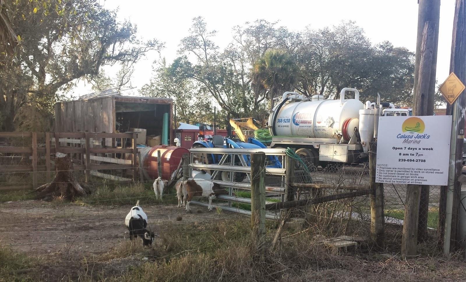
Now that we've moved inland from the coastal metropolises of Cape Coral and Fort Myers, we are entering what the tourism brochures like to call "the real Florida" and where old-time Floridians would say the crackers live. Long-time readers will know we've spent a good deal of time in this area in the bus. In addition to live chickens, we found a herd of goats here on the property, and just down the road can be found the kinds of back-country lots that might as well be a hundred miles from Fort Myers.

In the morning we will get an early start, with our first lock just 20 minutes eastward. We have two locks to Moore Haven, at the edge of the lake, where we hope to find spots at the city dock. Another lock will take us to lake level in the morning. If the city dock is full, we'll have to press on through the lock and southeast to Clewiston.

Caloosahatchee

We are anchored in Glover Bight, a small basin off the Caloosahatchee River in Cape Coral, Florida (map). We are a stone's throw from the Westin Hotel and the Tarpon Point Marina, where Blossom is tied up. Tarpon Point is also the home marina for our mutual friends Brad and Lorraine, who have a Nordhavn 55, Adventure, which is similar to Blossom.


View from our deck of Glover Bight and the Westin. We met the couple on the blue ketch; they painted their steel hull with Rustoleum, which looks fine to our eye.

We had a nice cruise yesterday from Useppa Island, which started out very serene. We passed tony Captiva and Sanibel Islands, rounding the southern end of Pine Island and making our way across San Carlos Bay to the mouth of the Caloosahatchee.

As we entered the dredged cut across San Carlos Bay, however, we were suddenly inundated with a flood of boats heading in the other direction. It seems all of the Fort Myers area gets in their boats Friday afternoon and heads out to the various island destinations in the bay. Our draft mandates we stay more or less in the center of the channel, and oncoming boats were passing to both sides of us. It was, honestly, quite nerve-wracking. I had to get on the radio more than once to warn an approaching boat that we could not veer off, and all of these guys were going great guns to get out of town.

It did not help that in the middle of this, the computer that runs the chartplotter had a BSoD. I could not take my eyes off the "road" even for an instant, and poor Louise had to reach around me to resuscitate the machine and restart the plotter. Fortunately, we always have a fully separate and redundant backup running at Louise's station on the pilothouse settee.


Sunset from the dock.

We had a very nice dinner aboard Blossom with Martin, Steph, Brad, and Lorraine. We learned that the stretch where we encountered all the boats is known locally as the Miserable Mile, and Brad gave us some current information about the Okeechobee Waterway, since they just came through in the other direction a couple of months ago,

In a short while we will continue east and north, through Fort Myers and into the Okeechobee Waterway.  It will be a short day, stopping at Calusa Jack's Marina, the last stop which can accommodate both our boats, for certain, before Moore Haven at the lake.

Friday, January 30, 2015

Exclusive island retreat

We are anchored just off Useppa Island in Pine Island Sound, Florida. Across the ICW channel from us is Cabbage Key, where Martin and Steph treated us to dinner for my birthday at the Cabbage Key Inn on the island. The place was deserted; we were one of only three dinner parties, and the island's marina was empty.


There's a restaurant on Useppa Island, too, but the island is so exclusive that one needs an invitation from a member to dine there. While Cabbage Key gets tourists from a daily ferry, Useppa is completely private and lined with high-end cottages.

We arrived here yesterday afternoon after an interesting cruise which was, unfortunately, not totally uneventful. We left Sarasota at dawn, which proved to have been a tad too early, and we arrived at the first trouble spot, across from Venice Inlet, at the lower of the two daily high tides. We would have had a bit more water a few hours later. We made it through without incident, but I did see the depth sounder register 6.6' at one point, and Blossom touched bottom there.

The route yesterday involved a half dozen or so bridges that had to be opened. There were two bridges that we squeaked under but still needed to open for Blossom. As we were on the radio listening to the first pair of bridges, we heard a disturbing report -- the Boca Grande bridge, our final for the day, was closed for repairs from 1000-1400. Our plotter said we'd be there before 1300, giving us an hour wait with no good options for anchoring.

When we heard this news, we slowed down to steerage speed, putting along at just over four knots. That still gave us an arrival time of 1345, leaving us with having to station-keep among a pack of waiting boats in a narrow channel. I opted to pull out of the main ICW channel instead at the last spot where my chart showed acceptable depths off-channel, so we could sit without doing as much fiddling with the controls.

That proved to be a mistake.  Even though the chart showed depths of six to 12 feet, we promptly ran into a five foot hump of silt and mud, and I spent the next five minutes extricating the boat from the soft grounding, sending giant plumes of stirred-up mud in every direction. We did manage to get off unassisted, and proceeded the mile to the bridge at idle speed, where we ended up waiting for ten minutes.

Somewhere in all the maneuvering in the mud, we must have powered some mud back up the shaft tube and into the packing glad, because one the next engine room check, Louise reporting the stuffing box temperature had skyrocketed to unacceptable levels. We ended up circling around in the open water of Charlotte Harbor, shifting between ahead and astern. to try to clear it all out.  Today we will need to keep a close eye on the temperature under way.

All's well that ends well, and we had a lovely dinner last night and a very pleasant and quiet anchorage.  In a few minutes we will weigh anchor and proceed to Cape Coral, where we will reconnect with friends Brad and Lorraine on Adventure.

Thursday, January 29, 2015

Happy Birthday, Captain Sean

Not a bad way to spend the day, cruising in the sunshine.

Wednesday, January 28, 2015

The "other" ICW

We are tied to a mooring ball outside Marina Jack, in Sarasota, Florida (map). Tonight will be our third night here, and we will drop lines at dawn to continue south to Charlotte Harbor and beyond. It's been a great stay, but all too brief -- there's lots more to see here than we had time for, so we'll be back.


Sunset over Sarasota Bay.

As I wrote here at the end of my last post, we spent our final night Sunday in St. Petersburg secured to a mooring ball in the north basin. We tendered ashore for a final meal with Martin and Steph after relocating and getting squared away.

Monday morning I picked up our good friends Karen and Ben in the tender after they parked their car at the marina lot. Karen took some shots of Vector in the yacht basin from the tender before we got them and their gear aboard, and I headed back to drop off the gate keys. By 10:30 we had the dinghy hoisted back on deck and we were dropping lines to head out into Tampa Bay.

Blossom made an early start from their slip, anticipating progressively building winds, and so they were ahead of us for the first half of our bay cruise; we passed them shortly before the Sunshine Skyway Bridge so that we could lead the way through the skinnier sections to come. Winds were on the beam in the bay, and the stabilizers were maxed out trying to keep us upright for the duration.

Once we made the turn southward into the ICW, winds were from astern and the ride got much more pleasant. Long-time readers are, by now, used to me writing "ICW" here and know that this stands for "Intra-Coastal Waterway," but there are actually several intracoastal waterways in the US, each with different characteristics.

Heretofore, when I have talked about the ICW I have been referring to the Atlantic Intracoastal Waterway, which in official documents is actually abbreviated AIWW. That waterway starts in Norfolk/Portsmouth Virginia (Mile 0) and runs some 1,280 statute miles all the way to Key West. We've done most of that waterway from Mile 0 to about Mile 1,112, off Elliott Key in Biscayne Bay. The final 170 miles, south of Biscayne Bay, are too shallow for Vector.

There is a separate ICW in New Jersey, from Manasquan Inlet to Cape May, which is also too shallow for Vector. There are additional connecting waterways from Cape May to Norfolk, including the Delaware River, the C&D Canal, Chesapeake Bay, and the Elizabeth River, which permit vessels of moderate draft to transit the entire east coast from Delaware Bay to Biscayne Bay without venturing out into the ocean.

There are also two long sections of ICW here in the Gulf of Mexico, known as the Gulf Intracoastal Waterway and officially abbreviated GIWW. One section runs from Brownsville, Texas all the way to Carabelle, Florida, and a second section runs from Tarpon Springs, Florida to Fort Myers, Florida. It is this second part of the GIWW that we've been traversing since leaving Tampa Bay.

Whereas the AIWW, at least from Biscayne Bay north, has a "controlling depth" of 12 feet, the controlling depth in this section of the GIWW is only nine feet. Controlling Depth is a fancy way to say that the Army Corps of Engineers is tasked with maintaining a navigable waterway with at least that amount of depth at low tide. They have varying degrees of success, and regular readers have heard me talk here of sections of the AIWW where we could only pass at high tide, because the channel at low tide had shoaled to depths below our six foot draft.

With a nominal controlling depth of just nine feet, there is a lot less wiggle room here on the GIWW. We knew there was a trouble spot across from an inlet known as Longboat Pass, which separates Anna Maria Island to the north from Longboat Key to the south. The GIWW passes just behind Jewfish Key, a small island just inside the inlet, through a dredged cut. Currents from the inlet are constantly depositing sand into the cut, and there is one section where the Corps has moved the buoys marking the channel so close together that there is not even room for two boats to pass each other.

We wanted to arrive at this section as close to slack current and high tide as we could come, and so after transiting the two lift bridges along Anna Maria Sound, we dropped the hook for an hour in a convenient spot to wait on the tide. We probably did not need the wait, but Blossom draws a full eight inches more than Vector.

We made it through the cut at Jewfish Key without drama, steering by hand and relaying our soundings back to Blossom as she followed us. The lowest sounding we saw was 8.6', which meant Bossom still had two full feet under her keel.  We had a foot and a half of tide in our favor, though -- at low tide they'd have been holding their breath.

That put us into Sarasota Bay in plenty of time to make the anchorage here in the daylight. Unfortunately, we arrived in high winds, over 20 knots steady and gusting above that. Picking up a mooring ball in those conditions was quite a challenge, and I don't think we could have done it had not Ben been available to help Louise on the foredeck while I jockeyed the boat around. Several people on neighboring boats came out to watch the festivities and wonder who the crazy people were who would try to moor in 20 knot winds.


Vector on her mooring, in calmer seas.

As if mooring was not crazy enough, we also had to splash the tender and make our way ashore. We loaded all of Ben and Karen's expensive camera gear into a big plastic bag to protect it from spray and wrapped everyone up in artificial fleece blankets, but we made it to the dinghy dock without incident. We had cocktails aboard Blossom at the dock, meeting some of Martin's extended family from the area, before Ben treated us to a very nice dinner at the restaurant right there in the marina. Karen and Ben made their way back to their car by way of Uber, and I was impressed by how quickly they got a ride and made it home.


Sarasota by night, from our upper deck.

Yesterday we spent the morning getting some chores done around the house. In the afternoon we strolled around the lovely waterfront parkland here in Sarasota, enjoyed cocktails at O'Leary's Tiki Bar right on the beach, and had a nice dinner with Martin and Steph downtown. Today we took the marina shuttle over to the Mote Marine Lab and Aquarium and the adjacent bird rescue and sanctuary before ending up back downtown for dinner again. We loaded the dinghy when we arrived back at Vector.

Sometime in the morning I will complete another orbit of the sun while we are under way. If all goes well, we'll be celebrating that fact with Martin and Steph on Cabbage Key, near Cayo Costa, south of Charlotte Harbor. Between here and there are a few dozen more miles of shallow GIWW, which means highly focused helmsmanship. I'll have earned my birthday libations.

Sunday, January 25, 2015

splash? SPLASH!


We are docked at the St. Petersburg Municipal Marina in St. Petersburg, Florida (map).  We've been here for a little over a week now, and we've really enjoyed being right downtown in the thick of things.  St. Pete is a vibrant town, and we'll be back this way someday to spend a little more time.

We arrived here a little after noon last Thursday, after a very brief stay of just a half hour on a mooring ball, our first ever, at the north basin just a short way from here.  We had called the marina after we landed in Tampa Bay last Wednesday, but as luck would have it, Blossom got the last slip, owing to a blues festival in town last weekend.  We asked to be put on a wait list and reserved a ball instead.

No sooner had we picked up the ball, got secured, and shut everything down, than the marina called to say they had a cancellation and could put us in a slip.  We thought about staying put, but with a cold front moving in and a decent weekly rate, we decided to move over to a slip with power, on the same dock as Blossom.  We're both in the more permanent section of the marina, as the transient docks were full up due to the aforementioned festival.  Ironically, we are docked right next to the second boat we ever looked at, a Selene 43 now called Off the Grid but then known as Live Wire II.  They wanted too much money at the time.


Vector behind Off the Grid. We ended up with a larger, more comfortable, newer, and more capable boat for less.

We spent our first night in Tampa Bay anchored just southwest of the Sunshine Skyway Bridge, in the lee of the south causeway (map).  It would have been easy enough, mid-day Tuesday, to just continue here, but after a long overnight passage from the Dry Tortugas, neither crew felt up to navigating into a harbor and docking, particularly considering we made landfall in fairly high winds.

The causeway provided good protection and we had a pleasant night there, although we could hear the bridge traffic.  We left with the flood in the morning to have a fair tide all the way here.  The Sunshine Skyway Bridge, by the way, is famous for having been knocked into the water by a wayward ship; when they built the replacement, they surrounded the central portion, near the ship channel, with large fenders to prevent this sort of thing from ever happening again.  We passed well south of the fenders, as we had no need of the central span's height.

With a full week booked at the dock here, we had our mail forwarded and also ordered quite a few items to be delivered by Amazon Prime to complete a number of projects that have languished.  I also ordered a replacement for the GPS that failed on our way out of Key West, a critical system that I wanted to repair before we left the dock.  Not eligible for prime, so I spent extra to have it overnighted from GPS City.

Even though we've been here longer than a week now, we've barely scratched the surface of the downtown dining and entertainment options even within walking distance.  We've also reconnected with several friends who are also staying in the area.  Lastly, I was able to get a much-overdue dental appointment for an exam and cleaning.

This last item, which happened on Thursday, the very last day of our week-long reservation, necessitated a return visit Friday morning for some drilling and filling.  Since I needed the scooter to get to their office, about 20 miles away in Clearwater, we extended our dock stay by a couple of days, to today.  The route to Clearwater goes through our old stomping grounds of Pinellas Park, where I was sad (but not surprised) to learn the Elks Lodge where we used to park Odyssey when in the Tampa Bay area has closed.

As long as we had the scooter down, we got all our provisioning done for the next couple of weeks, and I also stopped by a tax collector to get the new Florida plates for the scooters (the office in Key West had run out of motorcycle plates).  I also made a stop at Radio Shack and West Marine for parts for the GPS install.

The big excitement around here, though, happened Tuesday.  For anyone who does not follow my Twitter or Facebook feeds, where this has already been posted, the cat and I both ended up swimming in the marina first thing in the morning.

Ever since George passed away, Angel has been asking each morning to be let outside.  I open the door, and she patrols the deck for a few minutes, making two or three laps and then asking to come back in.  If it's nice out, she'll sometimes lie in the sun on the aft deck for a while first.  Up till now, she has never left the boat.

Over the previous couple of days I  had caught her on the dock just outside the boarding gate a couple of times -- the tide here is such that the dock is an easy step for her at low tide, rather than a leap. On this morning I would guess she made it perhaps as far as the end of the finger pier.  That might have been the end of it, if not for a passing dog that had some words for her.  Even though the dog was leashed, Angel got spooked and probably took off down the main dock.

There's really no way to be sure what happened next, but our guess is that in her panic she tried to jump onto another boat and missed.  I heard her crying and popped outside.  At first I thought she was just on deck someplace in some kind of distress, but then I realized she was not on the boat.  As I walked down the dock calling for her, she answered each call with a cry that could only be interpreted as "Help!"


The piling to which Angel was clinging.  Hard to see the oysters in this photo.  We have no idea how far she swam to reach it.

Thinking she was on another boat, I passed her a couple of times before realizing she was in the water between two boats, clinging to an oyster-encrusted piling.  There was no way to reach her from the dock or even the boats, so I ran back to Vector to get the pole-mounted fishing net that we keep explicitly as a cat-rescue device.  I also knocked on the hull to alert Louise that I needed help.


It looks like a fishing net, but this is our Water Rescue Emergency Cat and Kitten Extraction Device (WRECKED).

It took the two of us, with Louise on a sailboat with the net, and me on the adjacent power boat with a boat pole, to dislodge her from the piling, into the net, and get her on the deck of the sailboat.  And then there she was, cold, wet, and crying on the deck of an unfamiliar boat.  I came around to the sailboat and volunteered to get my clothes wet carrying her back onto the dock and back to Vector.

Getting back onto the dock involved crossing a fairly large gap past fiddly sailboat rigging, and I held Angel tightly to my chest with one arm while I reached for a 4x4 fender post affixed to the dock with my other hand.  We have these same posts on our dock and they are firmly attached.


Mind the gap.  The post with the angled top was loose.

This one was not.  One of the bolts was missing and the other loose, and it was vertical only courtesy of the 20 pounds or so of oysters clinging to the bottom.  As I grabbed it, it began rotating toward the water, and me with it.  I don't know how I did it, but I managed to get the cat onto the dock before I fell, in slow motion, the six or so feet to the water -- it was lower low tide.


Taken at another low tide, you can see the oysters high and dry on the loose fender post.

Louise brought the cat back to Vector while I swam, as best I could, to the swim step of a nearby power boat and extricated myself from the water.  When I went in, my training told me to kick off my shoes, but they were nearly brand new and the only decent pair I own, so I kept them on.  I was glad, at least, that my cell phone was still back aboard Vector.

With my clothes soaked in salt water I ended up stripping  to my skivvies on deck and coming in through the pilothouse door closest to the stairs, so I could head straight down to the shower.  At least the water and air temperatures were both in the 60s -- it might have been much worse.


Wet clothes outside the starboard pilothouse door.

In the meantime, to add insult to injury, the first thing Louise had to do with the cat was to rinse her in fresh water.  She spent the rest of the day grooming, and would have gotten sick if we didn't get the salt off.


One wet cat.  This is after the rinse with warm fresh water -- not a happy camper.

When I fell in I soaked not only my clothes, shoes, belt, and jacket, but also my wallet and its full contents, along with everything else in my pockets.  After a rinse we had cash, cards, and other items spread around the house to dry for hours.  I'm happy to report that other than a couple of paper items in the wallet, everything recovered after a thorough wash, including the shoes, although they are a slight shade darker now.

Installing the new GPS proved nearly as traumatic as the cat rescue, with the boat fighting me at every turn.  It started with a complete re-wire of the NMEA junctions and multiplexers, due to the new GPS running at a higher data rate than the old one.  I tried several different configurations before settling on adding a switch so that the primary and backup GPS units can share a single input port.

As long as I had to run a whole new cable for the new unit, I also opted to mount it to the mast, whereas the old one was mounted to the frame for the flybridge soft top.  It's been a long-term goal to extricate all the permanent wiring that connects the mast to the soft top, preventing us from lowering the mast if needed.  I didn't want to add yet another cable that would have to be relocated later.


The new GPS on the mast spreader, between the GPS antenna for the AIS on the left, and a VHF antenna on the right.

That meant drilling holes for a new mount and the cable into the starboard mast spreader and fishing the cable down the mast.  The design of the mast forced me to disassemble yet more of the soft top to access the underside of the radar to finish fishing the cable.

That turned out to be fortuitous, as I discovered that the radar cable passes through a sharp hole without benefit of chafe protection.  The cable was abraded but not chafed through, and I added some chafe protection before closing it all back up.


Radar cable lacking chafe protection.  My new pull-line is zip-tied to it.

It took a full two and a half days, but the new antenna is installed and working.  We now have much more accurate position fixes and they are updated more rapidly than before.  The new unit, a Garmin, can receive not only the US GPS satellites, but also the Russian GLONASS system.

I also installed a much-needed indicator for the transformer circuit feeding the induction cooktop, and wrapped up assembly of our "hookah" dive compressor system for underwater boat maintenance and shallow-water diving.  We did all the paperwork to renew our boat documentation and insurance, and I ordered the parts to fix the Northstar plotter.

On the more pleasant side of things, we've been enjoying the great dining opportunities downtown, eating out most nights and also a couple of brunches.  We made it to the Saturday Market right across the street from the marina both weekends, and we took the little trolley tour of downtown for 50 cents apiece.  We also walked to the Dali museum with Martin and Steph.


The fancy roof of the Dali museum.  Today's cover photo is our part of the marina looking through some of these windows.

In a few minutes we will shove off from the dock here and head back over to the mooring field.  We're expecting a good deal of wind in the morning, and we'd rather not have to deal with getting off the dock in those conditions.  It's also a good deal less expensive.  The plan is to head down to Sarasota tomorrow via the ICW; we'll have good friends Ben and Karen aboard for the ride, and Blossom will follow us.