Wednesday, September 10, 2014

Cradle of Liberty


We had a nice two-day visit to Philadelphia, where we docked right at Penn's Landing Sunday mid-day.  We had such a good push up the river on the flood that we arrived well before our planned slack-tide arrival, so I overshot the marina to approach from down-current.  Once in the basin there was very little current and we had no trouble tying up.


PPL Park.

It was an interesting cruise upriver, with a few sights to see.  We passed PPL Park (the soccer venue) as well as Lincoln Financial Stadium, where the Eagles were playing as we went by, as evidenced by numerous banner-flying airplanes and the Met Life blimp circling overhead.  We also passed Harrah's Casino, attached to a horse track, where we once stayed in the bus.


Eagles Stadium.


Harrah's racetrack casino, in Chester.

We then passed the retired aircraft carrier USS John F. Kennedy, the last non-nuclear US carrier built, now at the reserve base awaiting a worthy organization to make a museum of it.  Next up was the graceful but tired-looking SS United States, the fastest ocean liner ever built.  It, too, awaits refurbishment.  Finally, on the Camden, NJ side, we have the battleship USS New Jersey, now a museum.


John F. Kennedy, looking a bit worn.


The majestic SS United States.


Battleship New Jersey.

We were in a museum of sorts ourselves, with Commodore Dewey's flagship from the Spanish-American War, the protected cruiser USS Olympia, immediately astern of us.  Behind it is the WWII-era submarine USS Becuna. Immediately ahead of us across the pier was the century-old tug boat Jupiter. Finally, the barque Moshulu, now a restaurant, adjacent to the Olympia across the basin from us.


The Olympia behind us.  Top of the Customs House is to the right.

Upon hearing we were en route to Philly, Louise's cousin and her husband made arrangements to come out from the Manayunk neighborhood for a visit.  They met us at Penn's Landing Sunday afternoon, and took us on a nice tour of the city and its neighborhoods before heading off to a nice dinner at an Italian place near their house.  It was a wonderful evening and it was great catching up.

Monday, Louise caught up on the laundry -- six loads' worth -- given that this is our first marina stay in over a month.  We have our own washer/dryer, but running it without access to a city water supply is problematic, as it will quickly empty our 500-gallon tank.  We did get a load done just before filling the tank in Greenport, and, in hindsight, we probably should have stayed and done some in Yonkers while we had access to a hose at the free dock there.  We'd have to run the genny, but that's cheap compared to marina power.

Meanwhile, I headed off to visit the aforementioned historic ships, the Olympia and Becuna, both very interesting and a bargain at just $10 with AAA discount. That included admission to the Independence Seaport Museum, but the museum itself was shop-worn and uninteresting.  I often do these sorts of walking museum tours stag, because they are very hard on Louise's feet, and she prefers to save her limited walking time for things more interesting to her.


View of Vector from the Olympia.  Tug Jupiter across the pier, and the battleship across the river.

Monday evening we walked to the City Tavern, where we enjoyed colonial-style draft beer and some colonial-era menu items served by wait staff in period attire. The food was quite good, thanks to an award-winning chef, and the National Park Service did an excellent job with the building, basically a ground-up re-creation of the original.

After dinner we hoofed it to the nearest grocery store to re-stock the now-empty larder.  Between two backpacks and our folding hand-truck we managed to get everything we needed back to the boat, though it was a long hike.

Yesterday we had a half day in town, as we did not want to shove off before high tide, around 2:30.  We walked around the historic district briefly, until Louise's poor feet could take no more, and returned to the boat in time to see Jupiter depart upriver for its winter berth.  Labor Day is really the last hurrah for Penn's Landing; while we were there they also took the pedal swan rental boats out of the water.

It was a very busy stop and I never found time to post to the blog -- these posts take me one to two hours, closer to the latter when there are photos involved. Neither did I have time yesterday after we left, as we ended up going further than planned.

The forecast for the upper Delaware yesterday was foreboding, with 25-knot wind gusts and 2-3 foot waves.  We figured to plough downriver a few miles and take shelter behind Tilicum Island or one of the very few coves.  Two feet turned out to be less than a half foot, though, and with a good current behind us, we decided to press on all the way to dinner time.  Ironically, that put us at the exact same spot where we had anchored on the way north (map), but at least we knew the holding was good and we had a 4G signal. I fired up the electric BBQ while we were still underway, taking advantage of an excess of alternator power, and grilled lamb chops for dinner after we dropped the hook.


Delaware Memorial Bridges at night.

At this writing, we are anchored on a "lunch hook" just outside the eastern entrance to the Chesapeake & Delaware (C&D) Canal (map).  We weighed anchor this morning before we even finished our first coffee, to take advantage of the last of the morning ebb.  I ended up pushing against the flood for the last 20 minutes of the run, but we had a good push for the first hour and a half.  The current in the C&D can be wicked, so we are waiting here until it starts in the westbound direction, which is considered the ebb on the canal.

There is one other boat here with us in the anchorage, a sailing catamaran.   I am hoping it will be just the two of us at the head of the line when the ebb starts, because we'd like to get a spot at the free dock in Chesapeake City.  The dock is only 200' long, room for just three or four boats.  Otherwise, we will likely be anchored in that same basin.

By this time tomorrow, we will be in the upper Chesapeake.  Our friends Martin and Steph aboard Blossom are working their way north and we hope to meet up before the week is over.  We'll cruise the Chesapeake for a few days, and then join them in Baltimore for the start of Trawler Fest.

Saturday, September 6, 2014

Coals to Newcastle

This morning found us anchored in the Delaware River, off Townsend, Delaware (map).  We had a very nice cruise yesterday through the Cape May Canal and up Delaware Bay.  Transiting the canal at low tide, however, made for some tense moments, when the depth sounder registered just over seven feet of water.  We heard a Coast Guard announcement later in the day about dredging in that area later this month; apparently we are just a couple of weeks early.

Interestingly, we caught up to a number of sailboats in the bay that had spent the night with us in the anchorage, even though they left a couple of hours ahead of us.  There is a 55' fixed bridge on the canal route, so apparently all the sailboats go around, even though we had 60' of clearance when we went through at low tide.  We later heard one sailboat say his mast was between 55' and 58'.

Thus on the bay portion of the day's cruise, we were in the thick of "the migration," where boats that have been in the northeast for the summer begin heading to warmer climes for the winter.  Even though we were all heading north in the bay, this section is actually part of the southbound inside route, which starts at Cape May, proceeds up Delaware Bay, and crossed to the Chesapeake on the C&D Canal.  We'll be rejoining that route later in our cruise.  Yesterday we saw perhaps a dozen boats all heading along that same general path.


Brandywine Shoal Light

To a landlubber, Delaware Bay looks like a wide, navigable expanse of water.  Just under the surface, though, is a labyrinth of shoals, the typical river "delta" deposits spread far and wide through the fan of the bay.  We actually had to make a southerly turn out of the canal before turning back north along the deeper section of the bay, wherein lies the marked ship channel.


Miah Maull Shoal Light

Thus has it ever been, and so Delaware Bay is dotted with centuries-old lighthouses, or what remains of them.  Many appear out of nowhere, sticking straight up from the water.  All that remains of some are the caissons that formed their bases, topped in modern times with skeleton towers or just a bare light on a short pole.


Ruined base of old Cross Ledge light, and one of the many sailboats in our "pack."


"Elbow of Cross Ledge" light, a skeleton tower on an old lighthouse caisson.


Ship John Shoal Light

We timed our departure to take advantage of a favorable tide, getting a push up the bay from the flood.  Even though we transited the Cape May Canal at low tide, the calculus of currents in the bay gave us a southerly push as we headed that way from the exit, and we had slack or maybe even a bit against us as we first started our northward push.  By mid-cruise, however, we had over a knot with us, and that got even stronger as the river narrowed.  We were still riding a good flood when we arrived at the spot I had chosen for an anchorage, and we continued another hour and a half upriver.

We finally dropped the hook not because we had run out of flood, but, rather, because it was dinner time, and we knew if we went further we'd be punchy while we were trying to get anchored.  As it was, we ended up having to dance around a sea of crab pots to find a spot to drop the hook, so we were glad to finally be settled in.


Our bucolic view of Delaware, near Townsend.

We chose a spot on the Delaware side because winds were from the south and west, and we were very comfortable.  Our view of Delaware was actually rather bucolic; so much so that I needed to use the cell amplifier to get online.  Across the river in New Jersey, however, our view was of a three-unit nuclear power station.  Fortunately, it was not unduly illuminated, and it was a fair distance from us.


The not-so-bucolic view across the river to New Jersey.

When we first arrived, I had figured we'd be there not only overnight, but also until around 2:30 today, which is when my tables said it would be low tide there.  I had figured that only an hour or two of usable flood in the morning was not worth getting under way for, and we'd instead get perhaps four hours this afternoon.

That plan changed when we saw what time Vector actually turned around with the tide change.  It turns out that slack current actually lags high or low tide there by nearly two hours.  If we had waited this morning, we'd have been there another night, because the flood did not start until nearly 5pm.

Instead, we weighed anchor right after our first coffee this morning, getting under way mid-flood.  We rode the flood all the way here, to a spot just south of the Delaware Memorial Bridge near Newcastle, Delaware (map), and dropped the hook before lunch time.  We probably could have ridden it another hour upriver, but there did not appear to be any good places to anchor along the next few miles north of the bridge.


Fort Delaware on Pea Patch Island, which we passed this morning.

That made it a short day today, but the flood did not return until nearly 6pm, at which point we were in the midst of a thunderstorm with 34+ knot winds.  We still have 26 nautical miles to go to reach our reserved berth in Philadelphia tomorrow, but the timing is again favorable, and if we leave just after low slack in the morning, we should arrive just before high slack in the afternoon, and get a good push upriver the whole day.


OSG Horizon, an articulated tug/barge, passes us close aboard yesterday.

This morning we passed the entrance to the C&D, so we've left "the pack" for a few days.  We're also now in the narrower part of the river, and mostly we are passing commercial traffic, from giant freighters to smaller tugs and barges.  Our routing has us crossing the ship channel every time the river bends a different direction -- we cut the insides of all the turns much closer than the deep-draft ships can.  Rarely does this conflict with any traffic, but today I had to alter course for the OSG Horizon articulated tug/barge coming down river.  Ironically, I had to alter course for the exact same vessel overtaking us upriver yesterday, the only two times I've had to do so since entering the Delaware.


OSG Horizon passes us in the other direction this morning.

This is not a serene anchorage by any measure.  Across the river are industrial terminals, and on this side are business parks.  The pair of identical bridges, while majestic, carry the Interstate across the river and the road noise is constant.  But the depths and holding were good and it was in the right place at the right time.  Plus, I have a good 4G signal on my cell phone.


Hazy ppproach to the Delaware Memorial Bridges.  We are now anchored just this side of the abutment on the left.

As long as I had all afternoon to myself here at anchor, I knocked off a couple of projects.  Not that I really had a choice about the first one, which was repairing the anchor roller for the umpteenth time.  When we weighed anchor this morning, at max flood, the anchor jammed in the roller, and it turned out that one of the roller bolts had worked its way loose. just waiting to be munged by the powerful windlass, cramming the roller in place with the anchor shank.

I ended up spending the first hour or so of our stay here hanging over the bulwark in my climbing harness, fighting with the roller bolts.  We really need to replace this roller with something more robust.  I bought extra bolts the last time this happened, so we were able to get it all back together after a few tense moments with the Vice-grips trying to coax the wedged bolt out of the axle.

Since I was already in my work duds and covered with roller grot, I decided to make it a double and tackle the installation of the hard start kit on the fridge.  Getting the fridge out of its "built in" cabinet was a good part of the battle, and then working on the compressor in its tiny cubby hole at the very bottom of the unit would have been much easier for a ten-inch-tall person.


The guts of the fridge, with some extra parts that don't really fit in that tiny space.

I did manage, with much swearing, to get it all changed and fitted and tested and the whole mess back in the cabinet just before beer o'clock.  The details of the hard start kit and its installation will have to wait for a different post.

In the morning we will weigh anchor, which will NOT jam in the roller, and head under the bridge and upriver past Wilmington to Philly.  We've booked two nights at the dock there, which should give us some time to take in a few sights, as well as knock out three weeks worth of accumulated laundry while we have dock water and power.

Friday, September 5, 2014

Back on the inside


We are anchored in the small harbor area near the Coast Guard station in Cape May, New Jersey (map).  The anchorage here is very small, and when we arrived there were already a half dozen sailboats here; by the time I turned in, there were a half dozen more.

The remainder of yesterday's cruise was nearly as calm as it started, with just a small turbulent section as we drove into the inlet with a strong current behind us.  I usually turn the stabilizers off running inlets, because they fight the steering and can make it hard to control the boat, but we left them on this time because the turbulence was so bad.  I had plenty of sea room so I was not worried that they would steer me into a shoal.

We dropped the hook around 2pm, which gave me plenty of time to get the tender in the water and go ashore to pick up a friend from the bus conversion community for a tour of the boat.  Nick owns a refrigeration service company in town, and generously offered to drop off a hard start kit that I've been needing for the new fridge, a story unto itself.

After getting the hard start kit, giving Nick the nickle tour, and spending some time chatting, all three of us piled into the tender to head back to the Harbor View marina and restaurant.   Nick headed home and we headed into the restaurant for dinner.  We also made a quick stop at the marina office to pick up some more two-stroke oil for the outboard.

Dinner was tasty and we had a lovely view of the harbor, with Vector front and center.  It was happy hour in the bar when we walked in, so we sat there first, enjoying $2 drafts.  They had bowls of ruffled potato chips coated in Old Bay seasoning out on the bar.  Potato chips are not on our provisions list, for good reason, and I tend to overindulge when they're set in front of me... if happy hour hadn't ended promptly Louise might have had to drag me upstairs to the dining room by my ear.

Coast Guard Station Cape May is a training base, and all day long we hear the recruits shouting during their calisthenics and other exercises.  And there are far more patrol boats flitting around the harbor than would be necessary for such a small place.  At one point in the afternoon one of the boats came along the anchorage and asked pretty much every boat to move 20-50' closer to shore, a ridiculous exercise absolutely unnecessary for maritime safety (nor dictated by the Nav Rules).

Our speculation is that yesterday was the day when some instructor said "OK, trainees, today we are going to learn how to approach anchored vessels, speak with the skippers, and have them move."  The little 21-footer looked like a clown car, packed to its operational limit with men and women who looked to us to be about 15 years old.  It's never a good idea to argue with the coasties unnecessarily, so I wasn't about to lecture these youngsters on the technicalities of the CFRs.  We just moved the anchor a boat length closer to shore and tightened up our scope to compensate.

Nick was aboard at the time, so he got more of a tour than he bargained for.  We noticed a couple of boats leave the anchorage during this drill; like a game of musical chairs, when the music stopped, not every boat could fit where the CG wanted them.  Of course, this was at slack, when the boats which had been so neatly lined up closer to shore to begin with were beginning to swing to the other side, which put their sterns a few feet further towards mid-channel (but still not obstructing it).  In just a half hour, we'd all be again neatly lined up in the other direction.  Perhaps they had not yet covered tidal currents in the classroom portion of the training.

Today we will leave with the flood, transiting the Cape May canal and emerging into Delaware Bay, where we will continue north to the Delaware River.  We have now left the Atlantic behind, at least until November sometime when we head south from the Chesapeake.  We ran the water make one last time yesterday, and also pumped out and backflushed our waste tanks.  We should be in Philadelphia by Sunday.

Thursday, September 4, 2014

Spa day


Put your makeup on, fix your hair up pretty
and meet me tonight in Atlantic City

-the boss

This morning found us anchored in Atlantic City, in our old spot off the Golden Nugget casino hotel (map).  That's a view from our anchorage, above, of Harrah's casino hotel (no dock, unfortunately).  We arrived Tuesday evening after a very long and somewhat uncomfortable day.  Yesterday's forecast was even more uncomfortable, which we knew ahead of time, and we sat it out right there.  I had expected to post an update here, but we found better things to do, and I knew I'd have plenty of time and good Internet access today at sea.

We knew Tuesday would not be the most comfortable ride -- seas were forecast 2'-4' with a 7-second period, which was upgraded from an earlier 6-second forecast.  Our rule of thumb is that we want a period of at least twice the wave height, so for a 2'-4' forecast we'd have liked to see at least 8 seconds.  We did not want to be pinned down in Sandy Hook until today, though, which would also pin us down in Atlantic city until after the weekend.

I had also figured on a 13-hour trip, but it ended up being 14 after two turn-arounds.  We were underway by 5:20am, which had me driving from the flybridge after weighing anchor so I could see the water (and any pot buoys) in the first bit of twilight.  We rounded the hook before dawn, with a favorable current still behind us.


Sunrise over the North Atlantic, off Sandy Hook.

Unfortunately, my plotted course down the False Hook Channel turned out to be a poor choice.  We had depths in the high teens, heading for charted mid-20s, but instead the depth sounder registered 16, 15, 14, 13, and when it hit in the 12s I turned around and headed back the way we came.  There might have been more water (counter-intuitively) closer to shore, but from the helm we looked mighty close already.  With three feet of swell already bouncing us up and down, we decided to play it safe rather than hunt around for a channel that, post-Sandy, might no longer exist.


Our track is the dashed line.  Sandy Hook is on the left.  "False Hook" is the shoal on the right; there is a channel charted as 24' in between the shore and the shoal, but it's either moved or disappeared entirely.

Of course, the current was against us as we made our way back to the ship channel, and between the extra distance, the delicate U-turn, and the counter-current, the detour cost us a good twenty minutes, plus the route around via the ship channel added a few miles as well.

We had a choppy ride for the first few hours, but things smoothed out quite a bit mid-day.  As we passed Barnegat Inlet, a sailboat drawing 5.5' called for advice coming in there, and he got lots of good information from a local, also heading in, with a 7.5' draft.  I've been avoiding Barnegat Inlet because the Coast Pilot, the official US Government publication which informs mariners of such things, lists the channel depth as only 5.2 feet:
Barnegat Inlet Channel and Oyster Creek Channel are subject to continual change due to severe shoaling. The buoys marking these channels are shifted frequently to mark the best water and therefore are not charted. In August 2006, the controlling depth was 4.4 feet (5.2 feet at midchannel) in the entrance channel between the jetties; greater depths could be carried with local knowledge.
It's good to know that we can get in there in the future if we need it.  Had I known this ahead of time, we might have done Sandy Hook to Barnegat Tuesday, for a much shorter and possibly more comfortable day, and then Barnegat all the way to Cape May today, when conditions are perfect.  The only other inlet we can use along that stretch is Manasquan, where we stopped on the northbound segment, but that's too far north to have made it all the way to the Cape today.  Also, there are no anchorages there, only very expensive marinas.

The ride got lumpy again as the day wore on, and we had four foot seas by the time we reached Absecon Inlet.  It was also very nearly low tide, which is a bad combination.  Once again I had plotted a course through 17s and 16s around the end of a 12-foot shoal, but when the depth sounder registered 12 where the chart said 17, I turned back out to sea, but not before we saw numbers below 11 feet.


The track with the S-curve in it was Tuesday's entry.  The other track to the right was our exit last month, and you can see I had to work my way back to that track, bottom center, where I knew the depths were good.  Track to the left was our departure this morning.

To add insult to injury, and another fifteen minutes on the clock, when we finally reached our intended anchor spot, the chain jammed in the locker while Louise was paying it out.  We had to bring it back aboard and maneuver out into more open water so I could get into the locker and untangle it before we could anchor.

We ended up eating our dinner under way before reaching the inlet, and we managed to get secured for the night just before sunset, so our first adult beverages of the day were literally sundowners. Even though driving the boat is mostly a lot of sitting around, we were both exhausted from the early start time, and we were in bed shortly thereafter.  I mostly slept through the storm that hit in the night, complete with 40-knot winds (we had secured all the deck items and windows ahead of time).

Atlantic city is a different place than when we left a month ago.  For starters, Labor Day marks the end of the summer concert and outdoor event season in town (along with many other places in the northeast), as well as the end of boating season for many.  The parks and beaches were empty, and the marinas are starting to empty out.  But this Labor Day weekend also marked the closing, permanently, of two major casino hotels in town.  The newest and largest, Revel, went belly-up completely, and the venerable Showboat, which is part of the Harrah's/Caesars portfolio, was closed down by that corporation to bolster their other three properties in town, which are newer and larger.  Lots more people are out of work this year than just the seasonal employees.


Revel is the gleaming tower on the left.  Showboat is just behind the nicely restored Absecon Lighthouse.  I took this shot from the Absecon Inlet channel on our way out this morning.

Yesterday I got a couple of things done in the morning, including again repairing the dinghy propeller after banging it up some more in Southold.  I  have a new prop to install, but I am holding off until we get out of the propeller-eating northeast.  I also spent a good deal of time nailing down dates and marinas for our stays in Philly, Baltimore, and Yorktown, so that, among other things, we can start having some items shipped there.

We decided in the morning that, as long as we were going to splash the tender and go to dinner, we'd make a day of it and have a spa day.  The September special at the spa in the Golden Nugget was $20 off massage treatments, and we each booked massages for the afternoon.  We spent more than two hours in the spa, between the massages, the Jacuzzi, and hot showers with an endless water supply.  We then spent a half hour or so in the "Wine and WiFi" lounge, where we did not opt to imbibe, but we both got our cell phone apps updated.

We ended our shore stay with dinner from the very competitive happy hour menu at the Chart House overlooking the marina.  Happy hour runs to 7 in the lounge and may just be the secret dining deal of the whole hotel, which is owned by the Landry's corporation and sports quite of few of their branded restaurants, most of which are very pricey.

The massages were great, and I was overdue.  The technician wisely talked me out of the Swedish and into the therapeutic to help my endlessly knotted shoulder.  The Jacuzzi also helped.  We took advantage of the mini-mart in the hotel to partly restock our depleted beer supply on our way back to the tender.  All in all, a great stop.


Our view from a very calm Atlantic Ocean this morning, after turning south from Absecon Inlet.

This morning we weighed anchor at 8:30 to have a good push back out the inlet from the tide.  In marked contrast to Tuesday, it's been almost glassy out here today.  So far, no detours, either.  We should be in Cape May this afternoon, anchored across from the Coast Guard station.

Monday, September 1, 2014

Labor Day downtime


We are anchored in Sandy Hook Bay, just north of Atlantic Highlands, New Jersey and west of the spit of land also called Sandy Hook (map).  That's tonight's sunset over the nearby marina, above.  The protection behind Sandy Hook is a classical stop for cruisers heading in either direction up the coast of New Jersey, but we arrived here in a very non-traditional way.  I'll get to that later in the post.  First, let's catch up on our final moments in New York City.

As I wrote here last post, we ended up waiting an extra day in the city, because tomorrow (Tuesday) was really the earliest weather window for the outside run down to Absecon Inlet.  We might have stayed even yet another day, except the forecast for today was for storms, so we made the run here yesterday instead.

The extra city day was Saturday, and Louise decided she'd make the pilgrimage to the quilt shop downtown, in search of new fabric and some ribbon for a specialty quilt she is making.  If the quilt shop did not have ribbon (likely), the garment district was just a few blocks north. There, ribbon, and any other trim you can imagine, is available by the truckload.  Since she was going to be out and about all day, I decided to tag along as far as Times Square, and then go off in my own direction to, umm, relive my past.

From the Times Square subway station I took the shuttle (also a subway train) over to Grand Central terminal.  I've passed through this iconic train station myriad times over many years, but my last visit there was well before the city restored the station in 1998 or so.  I'd seen pictures, and I wanted to see it in person.

Wow.  Words do not do it justice.  Grand Central was a dreary place in my day, and only those embarking on (or disembarking from) a rail journey passed through it.  I remember the cavernous main hall mostly devoid of people, except those clustering around the remaining few operable ticket windows waiting for service.


Today the place is chock-a-block with people.  Many are tourists (as, I suppose, I was on this occasion), strolling the terminal and taking pictures with their cell phones (guilty, your honor).  A few are locals, hanging out at one of the eateries waiting on someone, or because it is now hip to do so.


What hit me most, though, is how bright the place is.  My cell phone, even with its wide-angle lens, could not capture the entire ceiling, but it is stunningly beautiful and bright.  In my day, it was, in a word, black, all from the tar and nicotine of four decades of smokers (really).  I snapped this photo of a small part of the ceiling, at one end of the station.  If you look right in the middle you can see a small dark rectangle (for scale, that spot is perhaps 6" by 8").  That is the tiny section that the restoration crew deliberately left untouched, so that future visitors could see the difference.  It's hard to spot in the vast expanse of the room, but I knew where to look.


I remember the go-to eatery in Grand Central was the Oyster Bar, often packed with commuters having a beer before heading home.  I'm happy to say it is still here, although it was closed for the holiday weekend.  The lower level, though, which was broken up by a host of partitioned-off sundry shops and fast food stands back then, has been completely opened up and restored, with an open-plan food court livening up the space and offering station patrons a wide variety of cuisines.


The scant few double-sided benches in the food court are all that's left of the waiting room seating, however.  Amtrak patrons have access to a ticketed-only waiting room, but the expansive station areas once given over to seating have been cleared of any vestiges thereof, the price to be paid for the progress of cleaning up the station and turning it into a tourist destination.  The staircase balconies on either end now host a pair of high-end eateries on one side, and an Apple store on the other.  All are wide open to the station interior; presumably, Apple pays someone to watch their space when they are not open.


The "dining concourse" on the lower level, with access to the lower tracks beyond.

After I had my fill of Grand Central, I walked through the lobby of the attached Met Life building, which I remember as the Pan Am building, complete with passenger heliport on the roof (the heliport closed for good after a chopper crashed, killing four on the roof and raining debris down on midtown Manhattan, killing a woman on Madison Avenue).  I then marched up Lexington, past the back of the Waldorf Astoria and the Intercontinental and finally ending up at what used to be Citicorp Center, the building with the angled roof.

Once upon a time I worked for Citibank, in their main headquarters across the street at 399 Park Avenue.  I often spent my lunch breaks in the mini-mall at the base of Citicorp Center.  On this holiday weekend, most of the stores were closed, save for Barnes & Noble which has taken over most of two floors.  Instead, the atrium, with its food-court tables, felt like a library -- quiet, with nearly every table full.  People were taking advantage of the free WiFi, with laptops and tablets in front of them.  One pair, though, had a small chess set instead.  The building felt like a ghost of its former self.


The view down Park Avenue from my old office.  That's the Met Life building in the middle, looming above the Helmsley Building just in front of it.

I walked out to Park and sat for quite a while at the fountains just a block south of my old office.  After a time, Louise texted me that she was done in the garment district, and I decided to hoof it down there to meet up for a beer before heading home.  It's a long walk from 52nd and Park to 38th and 7th, and I zig-zagged based solely on the timing of traffic signals.  By chance, that took me right past Rockefeller Center and through Times Square.


The concourse at Rockefeller Center.

This latter venue was a mistake on a holiday weekend; I was still in nostalgia mode, wherein Times Square was definitely not a tourist destination.  The place was packed to the gills, and I passed within inches of The Naked Cowboy as well as every conceivable trademark-violation Disney and Marvel costume.  I did finally make it to the garment district, which is nowadays marked by a statue of a giant button being sewn by a needle, along with one of a garment worker at his sewing machine.

After a refreshing libation at the District Tap Room, we headed back to the upper west side on the 3 train.  We had a final dinner at a sidewalk restaurant before picking up some last minute groceries on the way back to the tender, which we hoisted on deck after arriving at Vector.  We were home in time to hear the last hour and a half of the free concert on Pier-i, which was at least acceptable if a bit loud.

After Louise turned in, I spent some time going back over the route and perusing the Local Notices to Mariners (LNM), wherein I found this little tidbit:
NY/NJ – HUDSON RIVER – PIER 79 – PIER 84 - MANHATTAN – Tugboat Race
Mariners are advised that a Tugboat Race is scheduled to be held in the Hudson River from 9:30 a.m. to 2:00 p.m. on August 31, 2014. Approximately 15 tugboats and safety boats will gather at 79th Street Boat Basin around 9:30 a.m., form a parade, and race south to Pier 84 from 10:30 a.m. to 12:00 p.m. Chart 12335. LNM 34/14 (CGD1)
I had figured to weigh anchor at 10am, to take advantage of a favorable current all the way to Raritan Bay.  With these boats marshaling right at our anchorage, that was going to be difficult if not impossible.  But who can resist a tug boat race?  We decided to just sit tight and watch the festivities.


Lined up for the start, just abreast of us.

Little did we know what ring-side seats we'd have.  We were literally at the east end of the starting line, as you can see in this photo taken from our flybridge.  There turned out to actually be 22 tugs, as is fitting for the 22nd annual running of the event.  I could not capture all of them at the start line in a single photo.


And they're off!


Churning up the water just a tad...

I'm very glad we were right at the start line, rather than just a little bit downriver of it, because as soon as the race started, these monsters turned the river into a roiling mess, with mighty clouds of diesel exhaust to go along with it.  It was quite the spectacle.  We missed the finish, of course, which was downriver of us a good ways, but we heard over the radio that the Robert McAllister won.  We did catch up with the fleet a short while later, after hurriedly weighing anchor so as not to have too much flood against us, and I caught the Robert M going head-to-head in a push-off contest with the biggest boat in the race, the U.S. Army's Anthony Wayne.


Anthony Wayne (right) and Robert McAllister have a pushing contest.

We had a blast, and I'm really glad we caught it.  I'm even more glad that we were not under way halfway downriver as the race passed us, which is where we may well have been had I not checked the LNMs.  It cost us a bit of fuel, as we lost the favorable tide and had to push against the current down river and into the Kill van Kull, but hey, we didn't have to pay the $25 a head that the Circle Line charged folks to watch the race from the water.


Distant shot of the "line toss" event.  Norwegian Breakaway is in the background, back from its one-week cruise.  The Circle Line tug race tour boat is at left.

Just before the race started, I looked upriver and saw the replica Hudson River sloop Clearwater, which we had noticed at the docks the day before.  I think it was on one of its many educational day sails.  The sloop belonged to singer Pete Seeger, who founded the nonprofit that runs it.


After we left the tug boat race in our wake, I snapped another couple of photos of some landmarks we had passed earlier, but at a greater distance or less attractive angle.


9/11 memorial at Port Imperial, Weehawken, consisting of a pair of support "tridents" from the tower facades.  I'd recognize these anywhere.


Immigration building at Ellis Island.  We anchored just to the right of this photo a week ago.


Lady Liberty on a clear day.  If you zoom in, you can see the huddled masses, who just disembarked the ferry...

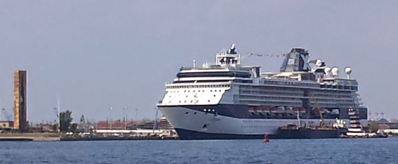
After passing the Statue of Liberty, we wended our way through a commercial barge anchorage colloquially known as "Jersey Flats" but technically Anchorage 20F, which took us past Newark's cruise terminal, Cape Liberty (which is actually in Bayonne).  The Celebrity Summit was in port, making ready to depart on a 7-day Bermuda Cruise.  On the left side of the photo is the "Russian Tear" 9/11 memorial.


Oddly, there was a newly-overturned barge in the anchorage, with a tug maneuvering nearby; today I heard the Coast Guard announce that "salvage operations" would be conducted there.  There's a story there that I would love to hear.  Shortly after clearing past the barges we made the turn into the Kill Van Kull.  Guarding the entrance to the Kill and marking a shoal to its north is what remains of the Robbins Reef Light.  The structure to its right is a circa-1915 sewer outfall for the Passaic Valley.


Across the channel from Robbins Reef is St. George, where one finds the southern terminal of the Staten Island Ferry.  In the background is the west end of the Verrazano-Narrows Bridge.


The Kill van Kull proceeds under the Bayonne Bridge to Newark Bay and the Port of Newark, the busiest container terminal on the east coast.  You can see work ongoing on the bridge; after years of allisions, they are raising the deck to provide a few more feet of clearance for today's larger container ships.


We briefly considered turning north into Newark Bay and anchoring there, because the morning forecast had called for thunderstorms to hit by 3pm.  By the time we were approaching Shooters Island, however, the forecast had changed to show the storm hitting instead around 7pm.  As it turned out, it never really hit us at all, but we would have been slammed if we had remained at 79th street, and small craft advisories were issued for many now-familiar places along Long Island Sound.


Leaving the Goethals behind us.

Instead we turned south, as planned, into the Arthur Kill.  Together the Arthur Kill and the Kill van Kull separate Staten Island from New Jersey, and if you look at a map, New Jersey more or less envelopes the island.  After passing under the Goethals Bridge and the railroad lift bridge just north of it, the industrial waterfront of Staten Island gives way to marshland, fronting the massive and now mostly shuttered Fresh Kills landfill.  On the New Jersey side, industrial waterfront continues until the Kill meets Raritan Bay at Perth Amboy.  These are mostly chemical and petroleum terminals; you see the other side of them from the New Jersey Turnpike (I-95).


The Outerbridge Crossing is the southernmost bridge connecting New York and New Jersey.  I did not realize that it is nicely lit at night until I noticed it in the distance from our aft deck after sunset.  Finally, the Great Beds Light heralds our arrival into Raritan Bay.


On this holiday weekend, we crossed paths with few commercial tows.  In the Arthur Kill we saw only a single other pleasure boat until we reached Tottenville on the southwest end of the island, where there is a marina.  Once we were in the bay, though, there were sailboats everywhere -- I did not realize Raritan Bay was such a sailing mecca.

Our plan had been to cross the bay and anchor just inside Sandy Hook itself.  However, winds when we arrived yesterday, and all day today, were from the south and west, so we opted to come down here instead.  Here we have great protection from the south afforded by the hills of Highlands, and good protection from the west afforded by the Atlantic Highlands Yacht Basin and breakwater.  It's been very calm here since we arrived, except for the occasional wake from the Seastreak high-speed ferries whisking people to and from the financial district in lower Manhattan.

From here we have a nice view of Manhattan in the distance, showcasing the the new revolving beacon atop One World Trade Center, along with the festively lit Verrazano-Narrows bridge and Outerbridge Crossing.  To the west, beyond the boat basin, the view is dominated by the enormous munitions pier for the US Naval Weapons Station Earle, extending nearly three miles into the bay -- we had to skirt around it and its security zone to get here.  To the east we have the historic Fort Hancock, Sandy Hook Light, and the coast guard station, all within the Gateway National Recreation Area on Sandy Hook.

Diverting here means we will have a extra three miles tomorrow, about half an hour.  In order to have the most favorable tide, we will weigh anchor at nautical twilight, about 5:15am, which should put us in Atlantic City by dinner time.  The forecast is for two to four feet with a seven second period -- less comfortable than we'd like, but if we don't make a run for it now, we'll be pinned down by weather for another week.  As it stands, we will have to sit Wednesday out in Atlantic City -- it will be too snotty outside -- and use the last remaining good-weather day, Thursday, to make the final outside hop to Cape May.

I used my day of downtime here to get some work done around the boat.  The forward anchor roller is not rotating and thus wearing out, so I replaced it with an old one until we can get the carriage out of the roller assembly and straighten it all back out again.  I also adjusted the generator oil level (I had overfilled it a bit at the last change), and replaced all the watermaker filters so we can make some water under way tomorrow.

5:15 is pretty early, and Louise has already turned in.  She'll get a chance to review this in the morning, and I expect the post will actually get uploaded under way off the New Jersey coast.  I'll try to post again from Atlantic City, where we will have another day of downtime as we wait for weather to pass.