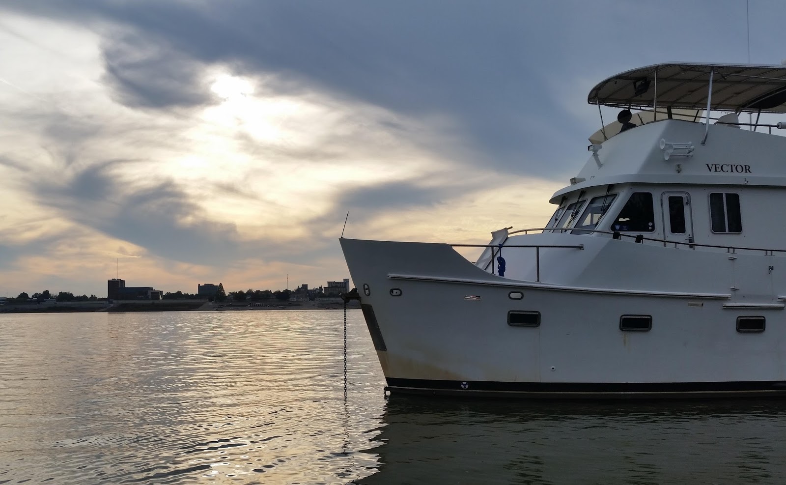
Vector, with Paducah in the background, as seen from Illinois.
This is as close as we can get to Paducah. The south bank, as well as both sides of nearby Owens Island, are lined with berths, terminal facilities, or barge fleeting areas. We have a half mile tender ride across the river to get ashore. Even though we are anchored outside the fleeting areas, giant tows regularly push up against the shore here to wait for various conditions; this morning we woke to an enormous towboat just 400' from us, his loaded 15-barge tow nosed to the shore, taking on fuel from another tug and barge rafted up to him.

Our morning view. I almost called to ask what they were serving for breakfast. The smaller towboat to the right of the 184' Mountain State is attached to a fuel barge, just the other side of Mountain State.

Here's their 15-barge tow, pushed up against shore directly ahead of us.
Yesterday's cruise was uneventful and even uninteresting right up till we reached the Ohio, where it's been towboats akimbo. We locked down through Barkley Lock just a few minutes after weighing anchor; the lock was empty save for us, and no one was waiting on either side. Below the dam the river was fairly narrow, and with a knot behind us I had to steer on heading mode because Otto could not keep us centered, wandering all over the river like a drunken sailor.

Approaching Barkley Lock, all alone.
We felt very small in this 1000' long chamber. Here we're near the bottom, looking back toward the upstream gates.
The channel looked more or less the same for nearly the whole 30 miles, except for a short stretch full of gravel plants and towboats. We had to squeak past one huge tow that was finishing up his loading right in the middle of the river.

Squeaking past a floating gravel loading operation.

Another milestone, the I-24 bridge over the Cumberland. We'll cross I-24 again tomorrow.
Right around lunch time we were passing Cumberland Island and heading into the Ohio, where we immediately had to dance around four tows that were biding their time waiting for the Smithland lock just upstream. Between the locks just upstream and downstream of Paducah, the confluence of the Cumberland, Tennessee, and Ohio Rivers, and a passel of shore-side terminal facilities, this is a very busy stretch of river; at one point we could see over a dozen towboats working just from our pilothouse, and the AIS was tracking more like three dozen.

We passed these turtles sunning themselves on a rock, normally submerged, on the Cumberland.
The Ohio is quite wide here, with good depth most of the width, and so avoiding the tows was not an issue at all. When we came abreast of downtown Paducah, we checked in with the couple of towboats against the north shore before dropping our hook. We dropped as close to shore as we could, just to keep well clear of any tow operations.

One of the numerous towboats we passed. The shirtless guy on deck is working out on a treadmill. This boat has a pilothouse that can be lowered for low bridges.

We passed this old paddlewheel riverboat being dismantled along the shore.
We had the hook down by 1:30, which was plenty of time to splash the dinghy, fuel it up, and get it ready to go ashore. This, too, is something of a challenge here in Paducah; the city sometimes has a floating courtesy dock in the river, but it's seasonal and the season is over. The downtown waterfront is, instead, a long, wide concrete ramp leading down into the river, which is used by the locals as an enormous boat ramp. We could land the dinghy here (although I'd rather not beach onto concrete), but then there is nothing to which to tie it.

The Paducah "waterfront" -- really just a huge concrete ramp.
Instead we landed about 50' upriver of the concrete ramp, onto a gravel shore. Here I pounded into the ground one of the enormous stakes we keep in the dinghy for beaching and tied the painter off to it. I tied a separate safety line to a shrub on shore. Getting out of the tender with dry feet meant wearing our high galoshes, but once we dragged the boat onto the beach a ways we could change into street shoes and leave the galoshes behind.

Our tender on the "beach" with lines leading ashore.
We went ashore just a bit after 4pm; sunset is 4:40 and we wanted to do all this in the daylight for our first attempt. That gave us an hour to wander around downtown before finding some dinner. There were lots and lots of people milling about, which turned out to be the tail end of the crowd from the Rivers Edge International Film Festival which was just wrapping up. It's an old-fashioned historic downtown with a nice mix of shops and restaurants.

Illinois Central locomotive and cars just inside the flood wall. Part of a mural at left.
Sadly, neither of the well-rated Italian joints was open on a Sunday (and the nicer of the two is closed today as well), and we ended up eating at one of the newest establishments, Shandie's. They had fantastic burgers -- I had the Sicilian and Louise had the herb-butter version -- and a nice selection of draft beers and wines by the glass.

Vector looking rather small over on the Illinois side.
Our plan for today had been to return ashore and visit the National Quilt Museum, just two blocks from the waterfront. Unfortunately, Louise has come down with a full-blown cold, and is too miserable for a museum visit. She's hoping to at least be able to get off the boat for dinner, with the help of plenty of meds.

Maritime education center run the the Seaman's Church, designed to look like a towboat.

There's a historical plaque on every block, but I had to include this one for our many Red Cross friends -- the first Disaster Relief Operation.
Instead I went ashore stag, stopping in at the Dollar General a few blocks from downtown to replenish the strategic Kleenex reserve -- Louise is going through them at a prodigious rate. I strolled down Broadway, the main drag, again, marveling at the way Paducah's downtown is almost frozen in time, somewhere in the first half of the 20th century.

Some of many downtown buildings frozen in time, with minor updates.
There is something of an urban renewal in progress, with many historic buildings being repurposed, but it's barely halfway there. Just as there are pilings in place for a new marina, but no progress seems to be ongoing on that project. I did marvel at the lack of vandalism; murals on the floodwall done in the 90s are still pristine, as are long-closed storefronts.

Just a few of the many murals on the floodwall depicting scenes of Paducah's past.

This theater, long closed, is still nearly pristine on the facade.
If Louise is up to it, we'll return ashore one final time this evening for a nice meal. In the morning we will continue downriver to Lock 52, where we will undoubtedly have to wait in line for lockage. If her skipper agrees we can lock through with a tow -- there is plenty of room between the towboat itself, centered across the three-barge width of the tow, and the lock wall. Otherwise, the rule is that tows have priority over recreational craft, and the lock can cycle tows three times before they have to let us through.

While I was ashore Louise texted to say we got a new neighbor, and I shot this from the floodwall.
There is one more lock downstream, Lock 53, but last we heard it is not operating at the current river level and vessels can proceed straight through. We'll then pass the new Olmstead Lock, still under construction, which will replace both locks 52 and 53. After that, the river continues unimpeded by locks and dams all the way to the Gulf of Mexico some thousand miles from here. Depending on cell coverage downriver, this may be my last post here for a while, and email responses may be delayed.

Gratuitous sunrise photo, from our anchorage on Double Creek yesterday. Lock wall is to the left, in the mist.
No comments:
Post a Comment
Share your comments on this post! We currently allow anyone to comment without registering. If you choose to use the "anonymous" option, please add your name or nickname to the bottom of your comment, within the main comment box. Getting feedback signed simply "anonymous" is kind of like having strangers shout things at us on the street: a bit disconcerting. Thanks!