We are under way southbound in the ICW, on a very short run from Cocoa to Palm Bay, Florida. The last few days have required a lot of attention to the helm cruising inland, and this is my first chance to update since we were offshore en route to St. Simons Sound. I actually started this post yesterday, but that, too, was a short cruise and I only got halfway through.
Immediately after I posted here, we were outside the 3nm limit, and we started to discharge our waste. Within less than a minute I realized nothing was pumping at all, which is never good. With the tanks nearly full, we'd have to make a beeline for a marina with a pumpout as soon as we arrived. Usually followed by a very unpleasant changing of the pump.
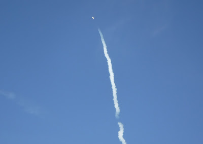 |
| Falcon-9 launch as seen from Mosquito Lagoon. Best my little Fuji could do. |
The pump did not sound broken, so on a hunch, I got out my 3-pound engineer hammer and gave a few taps on the check valve in the engine room, the couple of 90s in the pipe, and the through-hull, and I also operated the through-hull valve a couple of times. That did the trick and we were back in business; perhaps the divers in Little River inadvertently wedged some barnacles in the outlet when they were cleaning the hull.
Just as I was finishing with the pumpout we drove straight into a dense fog bank and ended up running the horn for an hour or so. In the middle of that we were overtaken by the Nordhavn 50 Grey Goose, a boat we've crossed paths with numerous times. The current owners have only had it a couple of years and we were able to update them a little on some history.
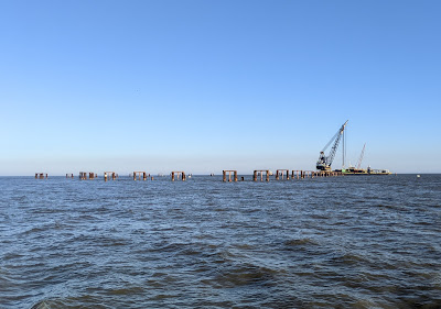 |
| All that remains of the Golden Ray incident. The large crane is removing the environmental barrier. |
Our good friends aboard Barefeet have been in Brunswick for a while, docked at the Brunswick Landing Marina, and we were hoping to connect with them. But our arrival time to the sound meant we'd arrive at the marina after closing and in the dark. The forecast for Sunday was for winds around 20 knots all day (escalating to gale force overnight), which would ace us out of docking then, too. We thought we could anchor in a familiar spot on the Frederica River if they could use the courtesy car to come meet us at the Country Kitchen there, but they turned out to be closed for New Years.
With no way to connect for at least two days and riding out a windstorm in the interim, we reluctantly decided to wave off, and hope to connect further south. Instead we set our sights on an anchorage near where the ICW exits the sound to the south (map), for decent protection from the southerlies. As we came into the harbor we passed the enormous environmental barrier from the Golden Ray salvage, being dismantled by a huge crane.
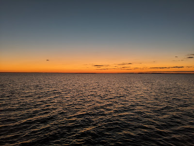 |
| Sunset over St. Simons Sound. |
We got an early start Sunday, both to get ahead of the worst of the winds, and to have a full eight feet of tidal help to get through the shallow section behind Jekyll Island. Not wanting to also cross St. Andrews Sound in high winds (and thus heavy seas), we planned to stop in the diminutive anchorage near the Jekyll Island docks. Perhaps we could even get ashore for dinner or to enjoy some of the island; it's been a very long time since we visited.
While there was a little room for us in the anchorage, there was no protection from the relentless wind, and it was unclear there was enough room for the scope we'd need for storm anchorage. Getting ashore would be dicey, and the nearest restaurant was closed for the holiday. We opted to take our chances with St. Andrews Sound before the wind got any worse, and continued south, with the option to turn around if need be.
 |
| Passing through Kings Bay submarine base. Boomer on left, security boat with 50-cal keeping an eye on us at right. |
The sound turned out to be manageable, and at a very high tide level I was able to cut the big corner and shorten our stay a bit. We then had an uphill trip most of the way to Fernandina Beach. Hoping to have just enough lee to get ashore, we anchored in a new spot south of the mooring field, where we found enough room to put out storm scope (map).
Our choice of anchorage made for a just-tenable dinghy ride to shore, where we paid the $3.99 landing fee and walked through town in search of an outside table. We found one at the Amelia Island Brewing Company and had a pleasant early dinner, in short sleeves for the first time in quite a while. The town was nicely dressed for the holidays.
 |
| Max wind 59mph. 41mph while a new arrival was trying to anchor. |
We returned to Vector through decent chop and left the tender in the water for the night. I was running out of anti-inflammatory meds, and had calls in to the doctor hoping to get them refilled in town on Monday. By 11pm the winds started ramping up into the 30s, but it was clear we were very well set on 7:1 storm scope. I folded all the furniture on the aft deck, and the tender had a bit of a wild ride, but we went to bed without worries. At 5:30am we were awakened by a spotlight shining through the stateroom portlight, and went upstairs to investigate.
The spotlight turned out to be a yacht that was trying to anchor next to us in 40mph of wind. At that hour, we could only imagine they had dragged in another area and came over here in search of better holding. They did not stay, and we never saw them again. But glancing at the anemometer display, we noted that sometime in the previous hour, the winds had reached 59mph. That's storm force, or what used to be called "whole gale." That might explain the itinerant yacht. We did not budge.
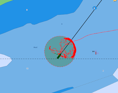 |
| Our plot for our stay in Fernandina. Smile in NE quadrant was the overnight windstorm. |
Monday came and went with no progress on the medication front. It was too rough and chilly to want to bash our way ashore for dinner, so we decked the tender in anticipation of an early start, and had a nice dinner on board. In the morning we weighed anchor, which was well buried in the bottom, and headed south for the St. Augustine area.
We got lucky with the tides, and made it all the way to Vilano Beach in a long day. We dropped the hook in our usual spot (map) and tendered ashore at the public dock to find some dinner and walk to the Publix for more provisions. We ate at old standby 180 Vilano; the town was very quiet. We made a note for the future that Puccini's Pizzeria, right next door to the Publix, has lots of outside tables and serves beer.
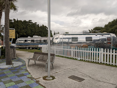 |
| "Airstream Row" office park in Vilano Beach. |
Under way to St. Augustine I finally reached someone in the cardiologist's office to renew my script and send it to the Walgreens in Daytona Beach, within walking distance of the dock. And thus we weighed anchor in time for the 0830 opening at the Bridge of Lions, sailed past downtown St. Augustine, and had a smooth run down the inside to Daytona. Under way I called the Halifax River Yacht Club there and snagged a slip on our reciprocal "one night free" arrangement. We were tied to the dock (map) before the tide dropped enough to make it difficult.
The yacht club had an outside table available on the deck and so we opted to have dinner there instead of walking to town. We were literally the only patrons eating on the deck, despite the dining room being rather busy. There is no mystery why Florida is dark red on the case count map. Now that we are back in the warmth, we'll avoid inside dining altogether. We're also able to slow our pace down a bit; this is the reason we've been rushing to Florida since our visit in Charleston.
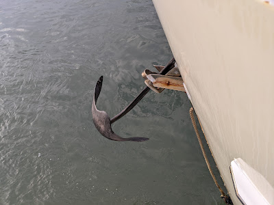 |
| Our anchor came up sideways in Vilano Beach and wedged in the roller. We drove through St. Augustine and beyond like this until I could get a break from the helm to go out and free it. |
I hoofed it to Walgreens and the gas station in the morning, and we were off the dock before noon with enough tide to make the harbor exit easy. With the morning already gone, I figured on a short day to New Smyrna Beach, where there is a free dock, with a decent anchorage for backup. Under way, however, the Coast Guard started making security zone announcements for a rocket launch; a quick check of the schedule revealed a Falcon-9 launch at 4:49. In striking distance of a view of the pad, we decided to pass NSB and continue as far into Mosquito Lagoon as we could get before launch time.
As we passed the NSB anchorage, we spotted Grey Goose, with a dive boat alongside. Captain Mark shared that they had lost their anchor and were hoping the divers could find it. The root cause was side-loading of the stainless anchor swivel. There was a similar swivel aboard Vector when we first got the boat, and long-time readers may recall we removed it early on for exactly this reason. They are a weak link in the ground tackle system, and have a tendency to fail at the worst time. I can only imagine what such a failure would have done in the 59mph winds we experienced just a couple of days earlier.
 |
| Many boats at the yacht club had "dressed ship" for the upcoming change of command ceremony Vector is at left, and Memorial Bridge in the background. |
We have never anchored in the Mosquito Lagoon, because it is almost entirely too shallow for us outside of the marked channel. Motivated by the launch, I pored over our newer, more detailed charts, and found exactly one spot where we could exit the channel in the lagoon. That exit led to a small pocket of deeper water, and we were able to make it there (map) and get the anchor set by 4:30, in plenty of time for the launch.
It was a perfect viewing spot. We could see all the way to the pad and the entirety of the rocket. It lit off right on time and we watched it rise past the tower and head downrange. We could see the burn all the way to MECO, but we were too far away to see the booster return. The shock wave and roar reached us, nearly 18 miles away, a full minute and a half after liftoff.
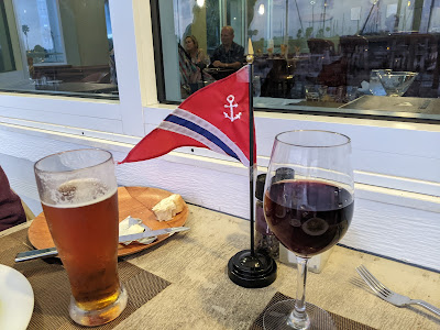 |
| Our home club burgee adorning our table at dinner. Both these glasses are plastic, as was the china, since the deck overlooks the pool. |
Nary a boat passed us all evening or overnight, and we had a dark and quiet night. Well, mostly quiet -- a drum fish under the boat sang the song of its people all evening, serenading us through dinner. We had a short day planned for Friday, just two hours to Titusville, so we had a relaxed morning and a late start. Before we weighed anchor we were passed by Grey Goose, sans anchor. At $225 an hour for the diver, there was only so much searching Mark was willing to buy. Eventually someone anchored in NSB is going to haul up a very expensive stainless Bügel anchor.
We weighed anchor shortly thereafter and headed for Titusville, where we made plans to meet up with good friends Dave and Stacey, who are docked in Sanford but have a car and were willing to make the 45-minute drive. We arranged for a late lunch (really, early dinner) at Pier 220, which has a dinghy dock, and we dropped the hook in a familiar spot just south of the causeway (map). By the time we arrived, winds were N at 15-20, but the causeway afforded us decent protection.
 |
| The little downtown festively decorated. |
That was fine for Vector, but the dock for Pier 220 is on the north side of the causeway, and as we passed the end of the land and rounded the fishing pier, we found ourselves bashing into steep two footers in the dinghy. It was, I think, the roughest tender ride we've ever had. Making matters worse, just as we pulled up near the slips, the engine died, and we soon found ourselves being blown over toward the rip-rap shore, with me paddling like crazy to try to get within reach of something.
A man at the bar (we assume) saw our predicament and came over to help; Louise was able to throw him a line and he pulled us over to the dock, averting disaster. I looked for him later to buy him a beer, but he was gone. A quick check revealed we were out of fuel, however I had put a gallon in while we were in Daytona (hence the gas station stop), and this was the first time we'd used the tender since. Somehow, most of that gallon disappeared over the course of two full days.
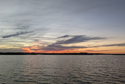 |
| Sunset from a very peaceful Mosquito Lagoon. |
We had a nice long meal over a couple of beers with Stacey and Dave; it was great to catch up with them. Afterwards, they drove us to the gas station so I could put another gallon in the tank, thus preserving our "emergency" gallon we keep in the back of the dink. The seas had laid down a little since we arrived, and we made it back to Vector without too much bashing. However, the tender again died just as we arrived, this time with an overheat warning. I was able to restart it and get alongside before we blew all the way to Cocoa. I disconnected the fuel tank after we decked it, to keep from losing any more fuel.
Sometime after we left the bar, a live band showed up at Pier 220, and that was our evening entertainment. Fortunately, it was music we liked and, at a distance, not unpleasantly loud. I spent much of the evening studying tender manuals and looking at sources for various parts that might need replacing. I found a West Marine on Merritt Island across from Cocoa, with a dock within kayaking distance of an anchorage, and in the morning we weighed anchor for a short three-hour cruise, dropping the hook as close to shore there as depth would allow (map).
I spent the whole afternoon in the tender taking apart the fuel system. I eventually discovered that the fuel filter/water separator cartridge had rusted through, making a pinhole leak. It was leaking enough to empty a gallon over two days, which simply evaporated because there was no evidence it ever left the tender, but not enough to prevent the engine from drawing fuel out of the tank. The overheat alarm on the way home was most likely due to entrained air in the fuel causing the engine to run lean.
 |
| Hall of shame photo. I neglected this filter. I had to remove the entire assembly, mount and all, and take it down to the workbench to get the cartridge off. |
I solved the problem by simply removing the unit from the fuel line. It's an optional accessory; there's a fuel filter on the engine and a screen in the tank. That meant we could again run the tender without worrying about it stranding us, and we went ashore at dinner time to see if West Marine had a replacement (they did not) and find some dinner. Unlike its neighbor Cocoa Village across the bridge, Merritt Island is a dining wasteland. We walked to Carrabba's, which had a half dozen outside tables, but a giant party was taking up the whole patio. We ended up at Tijuana Flats, a counter-service place that at least had two outside tables and three beers on draft.
This morning we weighed anchor and headed south, without a clear idea of where we'd stop. After spending a half hour with Google Maps and the chart, we've set our sights on a spot between two spoil piles across from a waterfront restaurant. Winds are again in the 20s, and we're hoping we can get ashore.
Update: We are anchored in the Indian River, between two spoil piles and across from the Lazy Turtle restaurant in Palm Bay (map). In the morning we will continue south toward Vero Beach and Fort Pierce. There is no weather window for an offshore run for at least a week.
Are you running this route later than usual ?
ReplyDeleteEnjoy your blog. Lots of good info along the way
Warren
Timing has varied quite a bit from year to year, but, yes, this year we were a bit late southing, due in large part to the delays for medical issues.
Delete