We are under way eastbound in the Baie des Chaleurs. At noon today we will advance the ship's clocks one hour to Atlantic Daylight Time, and when we drop the hook this afternoon we will be in the province of New Brunswick. I'll still need to dredge up some French from the dark recesses of my mind, because NB uses both French and English, and at least some of the ports ahead of us are predominantly French-speaking.
 |
| Rocher Percé -- Pierced Rock. The sunny side, astern of us. |
After my last post, conditions got worse before they got better, but even so we passed both of our bail-out options without feeling the need to stop. We had the hook down in the spacious harbor at Rivière-au-Renard (map) just before 6pm, dropping in 25 knots of wind just ahead of two anchored sailboats. We did not feel like bashing our way ashore in that, with no real dining options besides a brew pub, and so we just had a quiet evening aboard.
Winds overnight climbed to 30 knots, which did not move us but had the effect of setting our anchor really well, to the point where we had trouble pulling it out in the morning, in 20 knots of wind. One of the two sailboats had started weighing before us, but as we left the breakwalls they were still struggling to get it out. Caught on a rock, perhaps, or just a wimpy windlass.
 |
| The view from our anchorage, Rivière-au-Renard. |
In just about an hour and a half we were passing Cap des Rosiers, home to the tallest lighthouse in Canada. Stretched out in front of us were the steep cliffs of Cap Gaspé. It's a sheer drop from the top of the cliffs to the briny deep, yet we could see small "beaches" of scree and pulverized rock at the base, and we wondered aloud whether they form by centuries, millennia, or eons. As if the cliffs heard us ask, we spotted a cloud of dust and spray from a piece of cliff that had fallen off right in front of us.
 |
| The view in the other direction at sunset. |
The cliffs are the eastern face of the northeastern most hills in the Appalachian Mountain range, the other end being some 1,500 miles away in Georgia, and the Appalachian Trail ends at the lighthouse on the tip of the cape. Rounding the cape the geology of the hills is revealed, as the forested southwestern side slopes gently to the water. Many tourists made the trek to the lighthouse from the parking lot, and we snapped their photo as they were snapping ours.
 |
| Cap des Rosiers lighthouse, the tallest in Canada at 112'. |
We had contemplated stopping in Gaspé, which is at the head of the protected bay formed by the cape and the mainland. It is considered the birthplace of Canada and there is a park commemorating that, and, as the largest city on the peninsula, it has numerous restaurants, a nice grocery, and other services. But it's a 28 nautical mile detour to the anchorage, and then the dock where we could get ashore is across a very long bridge from the main part of town. We ultimately decided to skip it and just cross the mouth of the Baie de Gaspé.
Passing between Ile de Plate and Pointe Saint-Pierre we could see ahead of us the spectacular scenery of l'Île-Bonaventure-et-du-Rocher-Percé national park, with the namesake Rocher-Percé (pierced rock) directly ahead, and Île Bonaventure off slightly to port. My planned route would take us between them, passing the rock fairly close aboard, but about halfway across La Malbaie we decided to divert around the east end of Bonaventure so we could get a view of the gannet rookery there.
 |
| The spectacular cliffs on the northeast side of Cap Gaspé. That's a tour boat to the left. |
We're glad we did. It was quite spectacular, the rocks and ledges absolutely white with birds, tens of thousands of them. The only ways to see this are from the water, as we did, or after a strenuous 3 mile uphill hike from the tour boat dock on the west side of the island, which was not an option for us. The detour put us a bit further off from Roche Perce, but we still had a fantastic view of it from both sides.
 |
| Le bout du monde -- The end of the world, at the tip of Cap Gaspe Lighthouse mid-frame. |
Proceeding southwest along the southeastern shore of the Gaspe Peninsula, the stark cliffs and rocks of the cape and the park give way to gently sloping terrain, with occasional low escarpment along the shore. Once again towns dot the shoreline every few miles, some with harbors. Few can accommodate Vector, and so we had our sights set on an anchorage behind a breakwall in the community of Chandler.
 |
| Gannet rookery on Bonaventure. Zoom in -- all the white you see on the top and along the cliff face is an endless mass of birds. |
As we approached one of those seaside towns, Grande-Rivière, we spotted a column of dark smoke suddenly rising from the hillside perhaps a couple of miles inland. We watched in horror as a couple of BLEVEs caused enormous fireballs to rise hundred of feet in the air. The smoke persisted for perhaps an hour before finally giving way to clouds of steam as the fire was brought under control. Whatever was burning was behind a stand of trees blocking our view, but we triangulated it to the approximate location of a vehicle dismantler.
 |
| Big fire at Grande-Rivière. |
We arrived to Chandler around 5:30, pulling around into the lee of a curved rail dock, which once served the pulp mill that was here until the end of the century, to drop the hook (map). The rail dock and its causeway jetty provided excellent protection from the relentless easterly seas that had followed us to Chandler and would just get worse overnight. As we came around the corner we were surprised to see a small cruising sailboat tied alongside the defunct pier.
It having been a while since we were off the boat, we splashed the tender and made our way to the marina to get ashore for dinner. Despite it being listed in the guide, we found the office closed and the place looking more like an ancient club dock than a public marina. We tied up in an out-of-the-way spot and went into town, hoping the lock on the gate was as defunct as the place looked.
 |
| Old rail pier at Chandler, making our anchorage calm. It's fenced off but was still covered in fishermen when we arrived. |
We hoofed it to the one and only restaurant in town that had table service and beer and was open on a Monday, a joint called Ô P'tit Café that was in the Motel Chandler. It was surprisingly good and we both enjoyed the local brews on draft from Pit Caribou. Afterward we walked across to the Super-C grocery store for a few provisions before heading home. We found the sailboat that had been tied to the wall anchored in front of us when we returned.
In the morning Louise checked the forecasts for crossing the Baie Chaleurs to New Brunswick. The forecasts were marginal but with acceptable limits, or so we thought, and so we weighed anchor to leave what would have been a very good spot to ride out easterly weather. The folks on the sailboat, whom we judged kindred spirits as they had a motor scooter on deck and had already demonstrated an ability to tie up to weird infrastructure, came on deck to tell us about the weather; we thanked them but departed anyway.
 |
| s/v Juno from Chicago. Zuma scooter on deck. |
The first half hour or so was OK, a little bouncy but not intolerable. I was surfing the Internet in the helm chair and Louise was in a more comfortable spot in the saloon. But by the end of the first hour, seas that had been forecast at three feet had already climbed to four on a short period, with 25 knot winds blowing the tops off. On the port quarter every fourth or fifth wave would roll the boat hard to starboard with more energy than the fins could null.
The boat handles this just fine, and if we had let it, it would have driven itself all the way to Shippagan. The crew, however, had had enough after twenty minutes of this, and we turned to starboard to put them more on the stern and stop the rolling. Returning to Chandler was out of the question, and by this time it was also too late to turn for the next protected harbor of Newport. We had to continue along the coast.
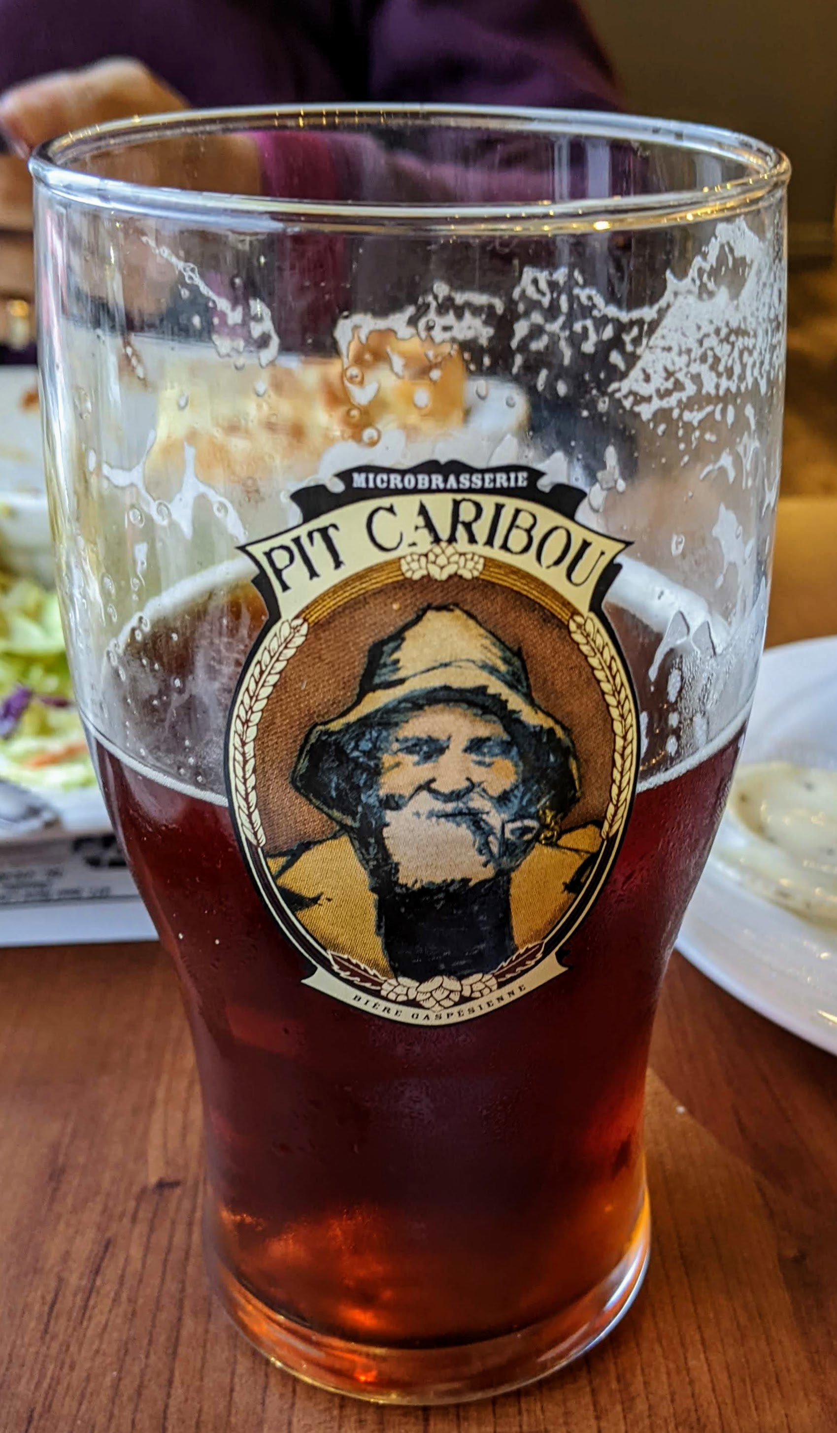 |
| Local brewery. I had the red. We joked their logo is "Le pêcheur Gorton." |
There are a couple of small fishing harbors that we could have bailed out to, had we been in extremis of any kind. But neither one of us wanted to struggle through the language barrier to find a spot to tie up, or spend the night on a fish dock -- or worse, raft to a fishing trawler, which sometimes happens in such cases. So even though it was still a bit uncomfortable, we pressed on to the next protected anchorage, around a sand bar in the town of Paspébiac. We pulled into the harbor to see if there was a spot, and we might have tied to the bulkhead there, but instead we went back out to the cove and dropped the hook (map).
 |
| Much of the harbor area comprises the Paspébiac Historic Site. One building even houses a restaurant, but closed yesterday. |
It was still blowing stink -- we dropped in about 25 knots -- and a swell curling around the spit meant it was a rolly afternoon. Neither one of us wanted to eat dinner on a rolling boat if we could avoid it, and so we splashed the dink and headed ashore, even though there is nothing other than fast food in this town. We ended up with burgers at Maison du (M) Burger, which at least was not a chain. We stopped in the IGA for a couple of things we did not find in Chandler before heading home.
The wind laid down considerably by the time we got back, and seas had dropped to the point that sailboats were going out for day sails. But we found Vector still rolling when we returned, albeit less vigorously. We ended up weighing anchor and moving to the south end of the anchorage, in the crook of the ever-shifting sandbar, where the swell did not reach as much. We had a much more comfortable evening there, with just a bit of roll overnight.
 |
| Sunset from our anchorage in Paspébiac, just before we moved to the other end. |
This morning things were much calmer and we weighed anchor first thing for the crossing. Once again seas built to more than forecast, but this time only three foot rollers on a somewhat longer period, and they were right on the nose so less rolling. Mid-crossing about 6nm from land we discharged our waste per Canadian regulations (SOR/2007-86 §129(e)(ii) for any boaters following along), and changed the ship's clocks. The navigation computers have to be restarted to pick up the new time so they remained on EDT for the rest of the voyage. We did have one whale sighting, a minke about a quarter mile off.
Update: We are anchored in Baie de Shippagan, just off Shippagan, NB (map). Seas got progressively calmer as we got further into the lee of Miscou Island and were flat by the time we turned into the Shippagan Channel. We had about a knot against us all day until turning into the channel. Tonight we'll head ashore for dinner. We'll be right here until we have a good weather window for the run down to Portage Island through the open water of the bay. We've been in Big Water™ since entering the Gulf of St. Lawrence, and the weather forecasts again dictate our movements. Yesterday was a good reminder.
Great trip in waters unfamiliar to me. I'm enjoying following along. Safe travels.
ReplyDeleteThanks, John. The waters are unfamiliar to us, too, and are pushing our boundaries. The boat is inching closer to its birthplace in Nova Scotia.
Delete