Thursday, June 12, 2014

A sound too far

We anchored in Sapelo Sound, Georgia, just north of where Blackbeard Creek divides Sapelo Island from Blackbeard Island (map).  We've passed this way before -- we are less than half a mile from the ICW and just a few miles from where we anchored in the Wahoo River when we came through here on that route back in December.  You may note that this is not Wassaw sound, where I projected we would be when I posted on Tuesday, and, in fact, is only about half way.

While I wrote that we would leave the St. Marys on the ebb and arrive at Wassaw at the end of the flood, when I reviewed my math Tuesday evening I realized that did not leave us enough time to make the full passage at our preferred cruising speed of 6.5 knots and still arrive in the daylight.  We decided to move the departure up a full hour, which meant leaving on the last of the flood.

Running uphill out the fairly narrow inlet, the best I could manage was four knots at normal engine speeds.  A full four miles of that set us back another half hour, which, once we cleared the jetty, could still be made up on the roughly 11-hour northward leg if conditions cooperated.

On the way out the inlet we were passed by the HOS Westwind, a contract vessel for the Military Sealift Command.  We had watched her come in the previous evening, just after dark, with no AIS and minimal lights, with no fewer than five Coast Guard patrol boats closing off the harbor for her passage.  The larger patrol boats had their removable deck guns mounted, and we sat on deck in great anticipation, thinking perhaps a submarine was coming in to base.  When we saw it was a freighter instead, we knew it was probably carrying weapons material, perhaps ballistic missiles or cruise missile "specials" (two of the Ohio-class fleet based at Kings Bay have been converted from ballistic-missile boats to cruise-missile boats).  She left the harbor without escort, having already offloaded her deadly cargo.


HOS Westwind sails into the dawn.  Still no AIS, though.

Figuring speeds, and thus transit times, on the boat is an inexact science.  Thanks to GPS, I can know to a high degree of precision what our Speed Over Ground (SOG) is, but that's only part of the story.  We have no instrument to tell us what our Speed Through Water (STW) is, and, without that, it is very difficult to gauge the effects of wind and current.  Instead, I keep a chart posted on the helm which lists the "expected" STW at various engine RPM, numbers which we derived through averaging several observations in calm conditions.  The numbers are imprecise, and I would estimate an error of +/- 5%.

Those numbers were also derived with a clean hull, having been figured not long after our relaunch with fresh bottom paint at the boatyard.  We did have a diver clean us back up again in Stuart before we headed south, but a full month in the warm, flowing, nutrient-rich waters of the Middle River in Fort Lauderdale had a devastating effect, and we have a very bad barnacle encrustation along the full length of the hull, including both stabilizer fins, and a bit of growth on the propeller as well.  I'm not sure what the exact effect is on fuel consumption and vessel speed at various engine RPM, but I am guessing it is as much as 10%, based on recent observations.

After we turned northward from the St. Marys jetty, I gave the boat a half hour to settle in at 1650 RPM, which my chart shows at 7.2 knots.  I normally run the boat at 1500 RPM, 6.8 knots, but I knew we had to make up some time and we would have to overcome the effects of the growth.  And early in the day, things looked good, with an indicated 6.5 knots SOG.  That showed an arrival time of between 8:00 and 8:30, which would be acceptable with sunset around 8:15.

As the morning wore on, however, the SOG progressively dropped, and when it got down to oscillating between 5.9 and 6.2, with an ETA pushing past 9pm, I cranked it up to just over 1700 RPM to see if we could still make it.  Above 1700 RPM, however, fuel burn becomes excessive for very little incremental gain in speed, and we seldom use these settings for anything other than dealing with challenging conditions such as coming in a narrow channel against high current, or occasionally making a short run at higher speed to make a tight bridge schedule.

I had set a decision point at the St. Simons sea buoy, and after passing the buoy with no real prospect of making the Wassaw anchorage in the daylight without cranking the throttle up above 1800, we conceded defeat and set a new course for our fall-back anchorage.  Fortunately, the entrance buoy to this inlet lies just about a mile west of our plotted course line to Wassaw, and as far south as St. Simons we had only to make a correction of a few degrees west to our existing course.  I also immediately reduced throttle to 1400, both to conserve fuel and to delay our arrival here to at least mid-tide and rising.

It was a stretch to think we could make it all the way to Wassaw in one day at normal cruise speed, and it is really only even possible right at this time of the year, when the days are very long.  It makes no sense to do it at all if we have to exceed cruise speed.  The detour here to Sapelo Sound is about 20 miles round trip, about 12 gallons of fuel at conservative throttle settings.  Increasing speed by 10% on the more direct route burns an additional 15 gallons over normal cruise speed.  One of the many reasons why we often say the worst thing to have on a boat is a schedule.

We updated our float plan with our emergency contacts, and turned on our SPOT tracking device, knowing there was a good chance we could not even send a safe arrival message from here.  It turns out we both have limited cell coverage, and we are eking by on Louise's tiny Verizon data allotment, as my unlimited Sprint phone is out of data coverage here.

Dropping the throttle back to 1400 for a delayed arrival proved to be prescient, because we got hit by a thunderstorm just a few miles from our turn.  It had been a calm and pleasant day, so hot that I was driving from the flybridge when the safety broadcast came in over the radio.  I could see the storm forming to the south and west, and for a brief while we held out hope that it would miss us entirely.  That was not to be, although we only caught the outer edges.  We did put our cell phones and the handheld VHF in the microwave oven (a handy Faraday cage) as a precaution, and battened everything down before it hit, but I was worried that the wind, waves, and visibility issues associated with the storm would make what was already a somewhat challenging inlet into an impassable one.


The gathering storm.

Fortunately, by the time we made our turn at the sea buoy, the worst had passed, and we could see the inlet and markers clearly.  The sea state was calm enough that we were not concerned about being slammed into the bottom or pushed out of the channel, leaving just the normal concerns of navigating the bar before an incoming current.  There was a bit of added drama owing to two of the normal channel markers being off-station, which we knew ahead of time from the LNMs. Another of the major markers was missing entirely, and an unknown off-station marker added some confusion, but the charted depths were mostly correct and we made it over the bar and into deeper water without trouble.

We find it quite beautiful here in its isolation.  We are surrounded by beaches and wooded hammocks, with the only signs of man's presence being a couple of radio towers, the navigational markers, and the occasional shrimp boat.  Even though we are a stone's throw from the ICW, I saw nary a pleasure boat yesterday after we arrived, and this morning I counted a total of three.  As with our southbound transit, we are so far behind the "migration" that we are nearly alone.

Today we have a relaxing morning because tide and current dictate we arrive at the Wassaw entrance no earlier than 5pm.  That will let us run at a low, fuel-efficient RPM all day, and still get a nice push out the inlet here from the outgoing tide.  I will once again be challenged by crossing the bar with the current behind me, but we now have bread crumbs to follow over known-good depths.

Coming in to Wassaw Sound after five means we will again be anchored tonight.  We may end up at either a marina or a yard in the next couple of days to get some errands done and perhaps to have the bottom and running gear cleaned.

Wednesday, June 11, 2014

Sapelo Sound

My first quilt

"Jungle Path" design by Jessica of SewCrafty Jess, made using a fabric line called Bartholo-Meow's Reef. Featuring sea creatures, nautical icons and a cat in a dive helmet.

I've titled it "Dive Plan" and it is a baby gift for my cousin Nathaniel and his lovely wife, Greer. I don't think they read the blog, so it should be a surprise.


Tuesday, June 10, 2014

Nassau

Not the one in the Bahamas, unfortunately, but rather, Nassau County, Florida, where we are anchored in the Amelia River just northwest of the town of Fernandina Beach (map).  While I dithered at the end of my last post, in the calm light of morning yesterday we decided to go back outside while the weather was favorable, and make the relatively short hop to the next inlet north, the St. Marys River.  We decided the 30 miles round trip to Jacksonville was best left to a time when we were ready and able to go further and cruise the St. Johns River south from there, and the inside route north past Sisters Creek was rife with shoaling trouble spots and would only save us a mile or two.

We thus had a very pleasant cruise in the Atlantic, after riding the ebb out the St. Johns, which put us at the St. Marys inlet in time to get a push from the flood.  At one point I looked at the display and we were doing nearly eight knots, despite turning only 1500 rpm.  We were under way a total of five hours.


The oceanside campground at Fort Clinch.

The St. Marys is the dividing line between Florida and Georgia, and today will be our last full day in the state.  Coming in, we had Fort Clinch State Park on our port side, where we could clearly see the campground where we stayed on our first visit here, in Odyssey, nearly a decade ago, and the well-maintained fort itself as we rounded the corner into the Amelia.  The southwestern corner of the park is just across the river from us, as is a nice new Nassau  County public boat ramp, where I've availed myself of the restrooms and trash receptacles (getting the trash off the boat when spending several nights at anchor can be a real challenge).


The fort itself.

I had hoped to be spending part of today on Cumberland Island, a national park just across the St. Marys, but it was just not to be on this pass.  We splashed the tender yesterday afternoon and braved the chop on the river to visit the touristy little downtown of Fernandina Beach, and just walking around town, Louise, who is considered a delicacy in the insect community, was bitten four or five times.  We did have an excellent dinner at Pablo's Mexican Restaurant, and the nice folks at Fernandina Harbor Marina waived their customary $3 fee for landing our dinghy there.  The historic downtown was pleasant, but too much of a tourist trap for our tastes.

Aside from tourism, which presumably comes mostly from high-end condo rentals on the beachfront side of Amelia Island, Fernandina Beach is predominantly a mill town, with the prominent feature here being an enormous pulp mill for megalithic container corporation Rock-Tenn.  Having spent many months in Washington and Oregon around paper mills, we're used to it, but many of the negative comments on this anchorage and the dockage in town concern the smell when the wind blows in that direction.  Fortunately, we've been mostly upwind of the plant since we arrived.  On the plus side, the mill keeps the channel dredged to 50' or so.


Around the corner from here is the small town of St. Marys, Georgia.  Someday we may run upriver and make a stop there, but we've seen the town already, as we have friends who sometimes play music in a club/bar/restaurant there.  Other friends, with a boat similar to ours, have warned us that the marina facilities are inadequate.  In any case, on this pass we are pressing northward instead.

Anchored, as we are, once again at the intersection of the ICW and a major river entrance, we have two choices for that northward progression.  Deceptively, the ICW appears wide and deep, the result of continual dredging of the Cumberland River to support the nearby Kings Bay Submarine Base, home to the Atlantic fleet of ballistic missile submarines, some of the largest in the world.  But Kings Bay is only a few miles from here, and after that the ICW returns to its more usual meandering self, with boat-eating shoals at nearly every turn.  With a 6'-7' tidal swing here, we can certainly do this stretch with careful timing, but that requires meticulous planning and constant vigilance at the helm.  We've done that kind of running before, and it makes for very tiring days interspersed with forced downtime to accommodate the tide.

We are opting instead to again take advantage of very favorable weather on the ocean, and tomorrow morning we will leave on the ebb to arrive at Wassaw Sound, one of the gateways to the Savannah area, on the flood at nearly high tide.  Wassaw has a fairly challenging bar that must be crossed; the megayachts that come in to Thunderbolt Marine just upriver are mandated to have a pilot boat lead them across.  We know the pilot, and I spoke to him today; he allowed we should have no problem with our draft at that tide and current, and gave me some detail on the uncharted markers.

It will be late afternoon when we arrive, and, just as we did here, we will drop the hook in the first usable anchorage.  Afterwards we will move to one of the several marinas in the area for a night or two to visit friends.  We are making good progress, and are on track to be in Long Island Sound in August, which is our goal for this cruise.

Sewing machine extension table

Made from stacked layers of pink foam insulation left over from the old fridge. Having the table level with the sewing machine bed supports the heavy quilt.

Reduce, reuse, recycle.

Monday, June 9, 2014

Helping with the quilting project

Boat deck layout


Scooters and dinghy. Dinghy cover is folded up and stored on my scooter's floorboards.


Hatch to lower deck and life raft can be seen to far left.  It's a tight squeeze between scooters and front of dinghy. Sean can slip through with ease, but he has less junk in his trunk, so to speak.


We're not sure what will eventually end up in that big empty space behind the life ring. Hot tub?

Secret cat lair

George hangs out under our portable plastic boarding stairs. We store them on the upper deck and I think they block the wind.

Upper helm

Less complicated up top. Radar display, handheld vhf radio, auto pilot, depth sounder, main vhf, compass, bow thruster, rudder angle indicator, ipad, and engine monitor gauges (under ipad.) Spotlight and stabilizer controls mounted to far right.

Sunday, June 8, 2014

First overnight safely completed

We are anchored in the St. Johns River, where the ICW crosses it about two miles inland (map), closing the loop from when we stayed just across the channel at Pine Island in December.  We had a very pleasant, if somewhat tiring, overnight passage from Port Canaveral, a journey of some 144 nautical miles.  It was our first real night running, and of course our first overnight cruise, and we did pretty well, all things considered.  Louise "live-tweeted" her night watch, which started at 03:30.  We shoved off from Port Canaveral around 2pm, in order to have a favorable tide here helping us upriver, and that was still plenty of time to avoid the departures of the three cruise ships we found in port when we awoke.


Carnival Liberty, Disney Fantasy, and Carnival Sunshine as seen from our flybridge as we headed down the channel.  This photo makes them look much smaller than they really are.

I expected to learn a few things about the boat last night, and how well set up it is for overnight running, and learn I did.  For example, in order to darken the pilothouse enough to see out the windows, we had to turn off or otherwise, umm, modify some equipment which lacked adequate brightness controls.  In the light of day the blue painters' tape I put over the bilge alarms, water maker display, and Command Mic for the upper VHF looked rather classless, but it worked well over night.  (The tape, which appears opaque, actually only attenuated the lights about 80%, so we could still tell what indicators were lit.  One was so bright I used two layers of tape.)


The biggest offender in this regard is the inexpensive TV/monitor we use for our primary chart display.  The chart program has a "night mode" palette of colors, and the monitor has a "brightness" setting, but neither actually reduces the backlight illumination of the screen, which is LED and thus must be driven at a certain voltage.  The monitor attempts to control brightness by adding black level (LCD pixels) over the bright background.  Great for watching TV, but still way too bright on a darkened bridge.

We solved this problem by turning the monitor off altogether, and displaying the screen instead on our iPad Mini using VNC.  The iPad has a more functional brightness control and we could dim it as much as we needed.  I had actually installed the VNC server on the chart computer a while back, for the purpose of being able to see it from the flybridge with the iPad, and from my bedside table with an old Android phone I had lying around.  It works well for those purposes, too, although even at max brightness the iPad is a bit hard to see on the flybridge in the daytime.

We'll address this issue more permanently by buying a piece of neutral-gray 80% tinted Plexiglas the same size as the monitor, and we will fit this over the screen at nightfall.  That should let us use the brightness and color controls to fine-tune the level as needed.  It's worth noting here that PC monitors are made for this application which have much more dimmable screens, and many also have high-nit (daylight readable) screens and even water resistance for use as marine chart displays.  Depending on features, those displays can run into the thousands of dollars; we paid $99 for our monitor and I might have to cough up another $20 or so for the Plex.  Considering night running will be a tiny percentage of our time under way, it's fine for our purposes.

I spent a good part of my watch on the flybridge, where it was much cooler, and even up there I had to cover a few things with tape.  The display on the VHF radio apparently has no brightness control, nor do the indicators for the stabilizers (although the more elaborate stabilizer panel in the pilothouse has several selectable brightness levels, including off).  I generally did my horizon scans from up there or else dead-center on the Portuguese bridge -- our incredibly bright LED navigation lights actually cast quite a bit of light on either side of the Portuguese.

We did enjoy a nice dinner together in the pilothouse and sunset (without sundowners) from the flybridge before Louise retired about 9pm.  We were just a few miles north of the northern security boundary of the Kennedy Space Center at that point.  I tried to get a photo of the center, showing the old Apollo/Shuttle launch complexes (one of which is now completely dismantled) and the Vehicle Assembly Building, but we were too far offshore, owing to the fact that we had to make a roughly ten-mile circuit around the shoals that extend southeast of the Cape.


Very long turn around Southeast Shoal.  The black dashed line is our track.

That also put us out of cell and Internet range for almost the entire trip; I didn't pick up data coverage until about three hours south of Jacksonville inlet.  Too bad, because 'net access would have made the time on watch go a bit faster.


Our entire track from Port Canaveral to the St. Johns River.  Different scale on this chart results in different depth contour shading.

Early in my watch I took to setting a 20-minute countdown timer on my phone, as a safety measure in case I dozed off or got too absorbed in other tasks to remember to go on deck for my scan.  Both the radar and the AIS have proximity alarms, set to go off a good ten minutes or more before any sort of evasive action would be required.  Still, I routinely scanned the displays every few minutes, and, in fact, looking up AIS targets and/or trying to correlate distant radar returns with visually identified objects is a good way to pass the time (and develop skills).  At eight miles or so offshore, we encountered almost no traffic all night -- that's too close in for most large ships, and too far out for most pleasure boats.  The only traffic of any concern was a giant tug and barge that passed us right after change of watch, but Louise did not have to adjust course or speed.

I struggled from 11:30 or so (my now-usual bed time when moving the boat regularly) to about 1:30, which is when I got my "second wind."  My goal was to go until at least 3am and perhaps a bit longer, and I ended up waking Louise at 3:30.  She had also set an alarm for 4am as a safety, something we learned from this harrowing story.

Now that we're safely anchored, we'll take it easy for the rest of the day, and allow ourselves to wake naturally tomorrow, to get back on track.  From here we're not sure if we will make a quick stop in Jacksonville, several miles further up the river, or continue north either up the ICW or in the ocean.

River meets sea

Interesting color change where the St. Johns river meets the Atlantic. Lots of birds and fishing boats here so it must be nutrient rich.

Friday, June 6, 2014

Space Coast stopover

We are docked at the Ocean Club marina at Port Canaveral, Florida (map).  We had an excellent cruise up from Stuart in the clear waters of the Atlantic, taking a bit more than 14 hours end to end, our longest cruise ever.  In order to arrive before sunset, we weighed anchor this morning before 5:30, and Louise snapped the photo of the New Roosevelt Bridge all lit up just before first light.

Yesterday when I awoke at 6:15 I heard a train going by, and while there has been no real schedule for the trains, I was hoping we'd be ahead of it this morning.  So I was a bit disappointed when I came up to the pilothouse at 5am and saw the bridge was down.  Fortunately, it was a short train, and the bridge was already going back up before we started to weigh anchor.  Once the anchor was aboard we hustled down to the Old Roosevelt bascule bridge and asked for an opening before we'd even rounded the corner; at that hour of the morning they got it right open and we did not even have to slow down.

We coincidentally left on high tide this morning, so once we were through the two drawbridges, we had the current behind us all the way to the ocean.  By the time we hit the inlet we were doing nearly eight knots, the fastest we've been all day.  Alas, I've been bucking a head current ever since, the counter-current from the gulf stream as it curls around below Cape Canaveral.  I had to crank it up to 1700 rpm most of the day just to make the inlet by 7:30, and then we came in on an ebbing tide and had to climb uphill to the marina, at the far west end of the port.

While we were passed by a ton of go-fast fishing boats in the inlet this morning, we saw very few other boats on the open ocean.  At one point mid-day, though, my proximity alarm went off, and I saw a large yacht gaining on us fast, doing 21 knots.  It turned out to be Diva, an 80' custom yacht we'd seen several times in Fort Lauderdale.  She went past us back and forth several times while we were anchored in the Middle River, looking like she was doing sea trials of recent tech work, and we presumed she lived on a dock behind one of the many mansions up the river.  When we tied up this evening, we found her here at the docks.  What took us all day today took her perhaps five hours.

With 14 hours to ourselves on the boat, we each had a nice nap, and three square meals in the pilot house.  I got some computer work done (including hammering out most of this blog post), and trained myself on more of the features of our radar set, upon which we will have to rely shortly for our first overnight run.  Louise spent a good part of the day in the saloon at her sewing machine, which tells you something about how calm it was out there.

Leaving Stuart was bittersweet.  Steph drove Louise around yesterday to stock up the larder and pick up a few other items, including some much-needed 15w-40 oil for our engines, and we had Martin and Steph over to Vector for a farewell dinner of pork tenderloin on the grill.  As I picked them up in the dinghy I was a bit disappointed to learn that the 25-horse Merc can't get the tender up on plane with three of us aboard.  Still, it's the right motor/dinghy combination for just the two of us (where it planes just fine and will do over 20 knots), which is 99% of the time.  When we end up cruising with them, if we want to get someplace fast, we'll go in their dinghy, which is bigger but lighter due to its aluminum hull, and sports a 50-horse outboard which should have no trouble planing with all four of us, dive gear included.

We had a fairly early evening, with our planned pre-dawn start plus their trek to the airport this morning for a visit north.  I wonder if they saw us out the airplane window on their flight from Palm Beach.  The highlight of the evening was not my cooking, but rather the friendly dolphin that came right up to the boat after dinner and circled around us for a bit before wandering off.  We are hoping that we'll see them somewhere between here and New York in August or September.  We hoisted the dinghy back on deck after I dropped them off.

Port Canaveral is a fairly large and busy port.  It is perhaps best known for the handful of cruise ships that call it home, including the Disney ships.  As we were coming north, Royal Caribbean's Enchantment of the Seas set sail and I watched her on AIS, then radar, then in my binoculars as we got progressively closer.  The closest we came was about six miles, and even at that distance, these ships look enormous.  It was good practice with the radar; as a side note, the massive radar reflectors on the buoys marking the ship channel make them look just as big as a cruise ship on the scope.

Tomorrow morning we will sleep in, in preparation for our first overnight, and we will shove off after lunch for the Jacksonville inlet.  That trip will take the best part of a full 24 hours, our first overnight run.  If the weather holds, we will be anchored in the St. Johns river by the same time Sunday.  I am looking forward to seeing the Kennedy Space Center from a different perspective, as we pass by it in the ocean.


Port Canaveral

Helm layout

A few photos of the pilot house helm station. Looking forward, from left to right:


Bilge pumps panels, stabilizer panel, watermaker controls, tank monitors, main dc and ac circuit breaker panels.


Inverter breaker panel and monitor, VHF radio, depth sounder, instruments breaker panel.


Radar display, rudder angle indicator, main engine and generator displays (tachometers, oil temp and pressure, hour meters), autopilot, thruster and spotlight controls, compass.

 
Throttle and transmission controls, chart plotter, AIS, auxillary air horn.

Farewell, Stuart

Wednesday, June 4, 2014

Stuart on the cheap

We are anchored in the north fork of the St. Lucie River in Stuart, Florida (map), just a few hundred feet from the Apex Marine docks where we spent nearly three full months.  It's a different perspective out here, with a slightly better view.  We get the same wakes here from boats passing by on plane that we got at the dock, but they bother us less out here because we are not slamming up against the pilings.

We chose this spot for more or less the same reasons we had chosen Apex -- proximity to the Nordhavn commissioning dock where our friends' boat is being finished up.  We've enjoyed reconnecting with them over the past few days, which we've done by tendering over and tying up to their swim step.  While we were happy to be at Apex on a favorable monthly rate, the daily transient rate at most of the marinas here, Apex included, is around $2/ft plus electric, a total of about $110 per day for us.  At that rate I can run the generator and dinghy all I want and still have money left for taxis, rental cars, or what-have-you.

We arrived here Saturday afternoon after a very pleasant cruise from Palm Beach inlet on the outside.  Seas were light but the period was short, so, while not uncomfortable, the ride was not as smooth as it had been on our last couple of outings.  We left New Port Cove on the 10:30am slack, and had the hook set here before 5pm.  That coincided nicely with Stephanie's return from a quick jaunt north to visit family, and we dropped the tender and met them at Blossom for a tour of all the progress that's been made, before heading off to a nice dinner at a nearby Italian place.  It was great to catch up, and we've dined together each evening since.

Sunday I tendered over to the park south of the mooring field, where the city allows tie-ups of up to four hours per day, so I could walk to the Ace Hardware in town.  I needed parts to finish the great fridge project as well as some other projects around the house.  I was thus in the middle of tackling the correct fitment of the fridge into its cabinet when Martin and Steph arrived at Vector on their tender for a visit before we all adjourned for dinner ashore.  Suffice it to say I did not finish this project on Sunday, but I did at least get the door hinges reversed.

Louise and Steph spent the whole day Monday driving up to Rockledge to shop for quilting supplies, a hobby they now share, which left me alone on the boat with my power tools.  I did take a quick break mid-day to tender over for lunch with Martin while the ladies were out gallivanting.  I made lots and lots of sawdust, enlarging and straightening the opening little by little until I could slide the fridge back far enough for the doors to be flush with the adjacent partition. This gives it all a built-in appearance, with a snug fit that ensures it can't move if we get into anything rough.  I also bolted it down to the floor and made a jack arrangement to hold the front down from the top, so it is now quite secure.  All I need is some cherry edge trim to finish off the opening, which will have to wait until I can get to a lumber yard.

That, along with replacing the pressure gauge on the horn compressor and lubricating the Clark pump on the water maker, took the whole day, and I tendered back to Blossom in time to meet everyone for dinner.  Yesterday, the four of us rented some scuba tanks and hired a dive instructor to meet us at the Blue Heron bridge, ironically just a few hundred feet from New Port Cove, for a gear check and refresher dive.  All of our gear worked well, needing only minor adjustments, and we all felt a lot more comfortable after an hour and a quarter under water.  Depth there runs just 8'-20', which is great for testing new gear, and challenges one's buoyancy control skills.

Between the round trip drive, two hours or so at the dive site, and a stop for a late lunch (diving makes you very hungry), we got very little else done yesterday, and after washing the gear, cleaning up, and napping we all met back at their apartment for a late, light dinner and good conversation.  We synced up on future plans; depending on exactly when they take delivery of the boat, then complete training and shakedown cruises, they will try to come meet us up north, most likely as we are making our way south to the Chesapeake from Long Island Sound.

Today I have what I hope will be my last Lasik follow-up appointment for a few months.  I rescheduled the appointment from the Palm Beach office, which we steamed right past a few days ago, to here in Stuart.  It's a short $1.50 bus ride to the office from the dinghy landing at the park; no rental car required.  I know they will want to see me on a six-month or so follow-up as well (it's been exactly two months today since my surgery), which will have to wait until we come back south again next winter.

If all goes to plan, tomorrow will be our final day here in Stuart.  I've scheduled the pumpout boat, even though we'll be three miles offshore by Friday afternoon, to try to continue to suck out any remaining bits of rubber from the great blow-bag fiasco, and we'll ask Steph to take us on a final provisioning run in their rental car.  At this writing we plan to weigh anchor in the pre-dawn hours on Friday for the long outside run to Port Canaveral.  The forecast is for excellent weather on the outside.


Some of Louise's new stash of quilting fabrics

Saturday, May 31, 2014

Fridgeapalooza

We are tied up at the New Port Cove marina in Riviera Beach, Florida (map), a short distance from Lake Worth inlet.  I am recovering this morning from another kitchen appliance project that kicked my butt, one which necessitated this marina stay.

We had a nice two-day cruise here, if a bit different than we had planned.  Rather than push all the way to Lake Worth in one day, I had picked out a couple of nice anchorages around the Delray Beach area, and, even though we already had the tender loaded and all secured, we spent a very leisurely morning in Fort Lauderdale Wednesday, taking advantage of fast free WiFi, weighing anchor around noon for what was planned to be a four hour or so cruise.

As we approached our first bridge opening, just a mile or two from our anchorage, at the Sunrise Boulevard bridge, we heard a tug behind us with a 130' yacht in tow calling the bridge.  Bridges, like Sunrise, that open only on a schedule, are nevertheless required to open on demand for commercial tugs towing or pushing anything.  So even though we had a few minutes till the scheduled opening, we got to take advantage of the demand opening for the tug.  I did call him on the radio to see if he needed us to clear the channel or if we should just precede him; as he was doing just 3.5 knots to our 6, he suggested we just go ahead.

That gave us plenty of time to make the next bridge, Oakland Park, which also opens on a schedule.  Before the scheduled opening, the tug called to say he'd need an opening, too, and the bridge tender wanted to delay the opening to accommodate both of us in one shot.  From his perspective, that would delay us by a few minutes, but it would cause us to miss the next bridge, and we'd be waiting a half hour.  When the bridge did not open on schedule, I had to call the tender and get a bit insistent; he does not really have the discretion to impede navigation at a scheduled opening except in an emergency (for example, an emergency vehicle needing to cross the bridge).

Fortunately he opened up just in time for us to make the schedule for the following bridge, and he was able to hold it for the tug as well, who by this time was fairly close behind us.  That was the last we saw of the tug and it's 130' charge, Private Lives, for the rest of the day's cruise.  We knew they would pass us at some point, because they were headed to Rybovich Shipyards in Palm Beach.

Just like the old joke about "uphill, both ways," we managed to have the current against us nearly the whole day, and making some of the closely-timed bridge openings was a mad scramble, having me wick it up to 1800-2000 RPM (when not in the numerous no-wake zones) to avoid missing an opening.  Unfortunately, the net effect of a late start, head current, and bridge timing put us in the Delray area at a low tide of negative 0.3'.  At that level, neither of the anchorages I had looked at was accessible to us.  (On the plus side, we squeaked through a couple of bridges that would otherwise have had to open for us.)

We ended up pushing on all the way to the first usable anchorage, in Lake Worth just south of the Southern Boulevard bridge (map).  That made it nearly a seven hour cruise and we dropped the hook just before 7pm.  We ended up having leftovers on deck over a cold beer, but on the plus side it was one of the most peaceful anchorages we've experienced in a long time.  Traffic was minimal, but I did enjoy seeing the tug Jr pulling Private Lives past us around 11:30pm.  Behind the yacht was another small tug facing backwards -- the "brakes" if you will.

On a lark I tuned the VHF, which we normally leave on at all times on channel 16 (the official Hailing and Distress channel), to channel 9, which is used to communicate with bridge tenders here in Florida.  I heard Jr call the Southern Boulevard Bridge for an opening, and the tender asked if he was a tug with a barge.  When the tug responded that, no, he was towing a yacht, the bridge tender told him he'd have to wait until the next scheduled opening, at midnight (this was about 11:45) unless he was "declaring an emergency with the Coast Guard."

The tug skipper was understandably annoyed -- the rules are quite clear that bridges must open for "tugs with tows," irrespective of what is "in tow."  After reminding the tender that he was a commercial tug in tow, the tender finally relented, backpedaling by saying "that's what I meant by a barge."  The entire lash-up did have to slow considerably for the still-closed bridge, with the end result that the bridge had to stay open a lot longer while they got back up to speed.  Considering there was almost no auto traffic at that hour anyway, I'm not sure why the tender got all testy in the first place.  Palm Beach County is the absolute worst when it comes to drawbridges.

We had our own little miscue with this same bridge yesterday morning.  I wanted to arrive here at slack, around 10am.  Given that the Royal Park bridge, about two miles north of Southern Boulevard, only opens once an hour, at quarter past, we decided to try for an 8:30 opening at Southern to make the 9:15 at Royal Park, which would put us here right around 10.  So we were up early and weighed anchor by 8:15 for the five minute run to the bridge.

When I checked the schedules for all these bridges on Active Captain, which is normally up to date with the Local Notices to Mariners, I saw that Southern was restricted from 4pm to 6pm, but saw no morning restriction.  Nevertheless, when I called the bridge to ask for an 8:30 opening, they informed me that they were restricted and the next opening would be at 9:30.  Oops.  We pulled off the channel and dropped the hook to wait it out over a second cup of coffee.  The restriction was right there in my copy of the Notices, but it somehow did not make it to Active Captain (I have since submitted an update).  Lesson learned -- check the Notices anyway.

We made it here by 11am without further incident, in more current than I'd have liked but not enough to keep me from backing Vector into the slip, with a bit of line help from a dockhand.  We were secured alongside and shut down by 11:30, and after I paid the $94 for our slip and power, I called the buyer of our NovaKool refrigerator and Heart inverter, a description of which I posted here on the blog a couple of weeks ago.

In case you missed it, the reason for selling the refrigerator, as fond as I am of the NovaKool products, is that it was just too small for full-time living on a cruising boat.  At 6.8 cubic feet capacity, it was ten percent smaller than the NovaKool we had aboard Odyssey, yet the logistics of getting groceries fairly often in the bus were far simpler than aboard Vector.  As tough as it has been here in the U.S., this problem will only get worse when we finally get offshore, where fresh grocery options are much fewer and further between.

The previous owner had solved this problem by putting a very nice chest fridge on the aft deck, but we wanted to reclaim that space for a table and chairs.  We sold the chest unit, getting mere pennies on the dollar for it, and, in hindsight, we probably should have just relocated it to the boat deck.  Recently, we've been noodling on how to add some capacity, and we've looked at, for example, the slightly larger NovaKool 8 cubic foot unit, which would fit in more or less the same space with just some slight modifications of the opening.  They are spendy, with the AC/DC model in that size setting us back nearly $2,000.

I was strolling through Lowe's in Stuart a couple of months ago when I happened to notice an "apartment size" fridge with 10.3 cubic foot capacity that looked like it might just fit our cabinet with a bit of aggressive modification (think Sawzall).  Better yet, it was under $400.  People who have attended my popular seminars at bus conversion rallies know that I am not normally a fan of household refrigerators for this application, but the combination of 50% more capacity, frost-free operation, and a ridiculously low price gave me pause to reconsider.

This would really not have been an option with our old modified sine wave (MSW) inverter.  Refrigerators need true sine wave power; without it, the both the fridge and the inverter waste additional power (as heat), and it's hard on the compressor, shortening its lifespan.  But when we upgraded the inverter to a 24-volt model (so we could get a bigger engine alternator), we changed to true sine wave output, which will have no trouble powering a household fridge.

The price we will pay is an energy penalty of about 10% when the fridge is running from the batteries, plus whatever power the "frost free" cycle uses.  I might get around eventually to installing a switch to turn off the auto-defrost when we are on batteries, letting it run instead only when the generator (or shore power) is running.  Frankly, we're looking forward to it; living at anchor (where we don't run the air conditioning) in the Florida humidity, the NovaKool was frosting up in just a week or two, and the efficiency and effectiveness drop off precipitously if you don't keep after it.  Since we did not manually defrost nearly as much as we should have, it's possible the auto defrost might even be more efficient.

In any case, I knew we could not even buy such a new fridge until we had a way to dispose of the old one.  Since it was in great condition and working well, within the limitations of its design, I wanted to pass it along to another boater or RVer and get at least a few bucks for it; the equivalent model, new, today sells for around $1,400.  In addition to the "for sale" write-up I did here on the blog, I also posted it on the trawler mailing list and the bus conversion forum.

Last week I got a call from a buyer in Palm Beach who was interested in not only the fridge, but also the Heart inverter we had removed during the upgrade.  We were going right past Palm Beach anyway, so we made plans to stop there and complete the transaction.  The buyer had a van to make the pickup, and I agreed to pay for dockage if the buyer would help me pick up the replacement fridge at the nearby Lowe's.

This dock was the least expensive option that was not too far off our route, and while not, by any means, a resort marina, the docks are adequate, and the staff was pleasant and helpful. They also have a loading zone convenient for making the exchange.  I asked the buyer to come by at 1:30, giving me enough time to get the NovaKool out of the cabinet.


The NovaKool, out of the cabinet and sitting on the galley floor.

We stuffed all the frozen food into our standalone ice maker, and packed what few fresh items we had left into a cooler.  Between undoing the hardwired electrical connections, removing the add-on insulation we had added, and getting a support jack underneath the unit, it took the two of us about a half hour to dismount the old unit and get it on the galley floor.  They buyer brought two strapping young men along who carted it to the back deck where four of us lifted it over the rail and onto the dock.  After they loaded the fridge and inverter into the van we made a round trip to Lowe's to pick up the new one, and the young men helped me get it on the aft deck before they left.


The old fridge on the way to its new home.

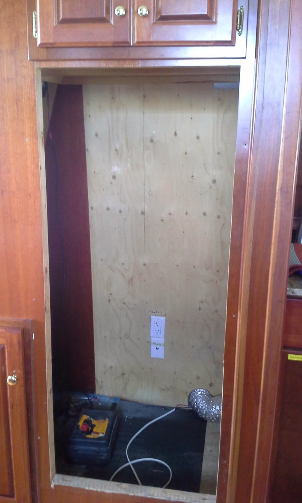
By  this time it was past 3pm, and there we were, with a fridge on the back deck.  We moved it into the salon, in place of my chair, and briefly considered the option of just strapping it to the wall somehow for the passage to Stuart.  I figured that by the time we came up with a way to safely strap it in place, I could mostly have the rough opening enlarged in the cabinet enough to at least slide the fridge into place, making securing it for travel much easier.  And so I set to work tearing into the joinery with the oscillating saw and the reciprocating saw.


The cabinet after removal.  I had to remove the face on the right of the opening all the way to the wall (easy), and cut another half inch from the left side (much harder), as well as remove the bottom panel all the way to the floor.  The space underneath the old fridge was formerly inaccessible and wasted anyway.

Unfortunately, given the tight quarters, I could not get either the circular saw or the jig saw to work here, which is too bad, as both of those tools have edge guides that would let me cut a straight line.  Neither was there room to affix a jig or guide.  So I ended up cutting the left edge with the recip saw freehand, using a line scribed on painter's tape.  The recip saw is more of a demolition tool than a cabinetry tool, but I got a somewhat finer cut by using a fine-tooth metal blade rather than the typical wood blade.  Still, the line was a bit wavy and rough, and the fridge did not slide right in on the first try.

By then we were getting hungry, and even though I had deliberately backed the boat in port-side-to so that we could unload a scooter, we ended up walking to the closest joint for dinner rather than taking the time to do that.  It was a mostly-delivery pizza joint, Romana's, but they have four tables and the food was surprisingly good.  They let us bring our own bottle of wine, and we toasted the new fridge.

I'm not sure a half bottle of wine did any wonders for my ability to re-saw a straight line, but after another hour or so of chipping away at the high spots with the oscillating tool we were finally able to slide the unit into the cabinet, and call it good enough.  Tomorrow in Stuart I will add some height to the subfloor (the galley floor ends just inside the cabinet, and the 1/2" drop-off has the fridge leaning backwards quite a bit), secure the back of the unit to the floor so it can't roll back out, and reverse the door hinges.  While we are in town we will shop around for some trim to surround the cabinet opening for a more finished look.


New fridge mostly in position.  Leveling the floor behind it will bring the doors flush with the divider on the right that separates it from the wet bar.  Some trim along the left side and across the top will finish the job.  Sorry about the poor lighting -- it was very bright today when Louise snapped this photo.

We are already loving the new fridge -- half again as much capacity as the old one makes a huge difference.  I'm glad to have found a good home for the old one, and I am equally happy to have the old inverter out of the engine room, where it has been taking up space for months snug in the shipping box from the new unit (I was expecting to have to ship it someplace).

Today we will shove off at high slack for the six hour cruise to Stuart, where we will anchor close by our old digs so we can visit with our friends for the next week.  It would be nice to have a dock where we can offload a scooter for the week, but it's cheaper to rent a car if we need it than pay for dockage.  We'll tie the dinghy up to our friends' boat when we need to get ashore.

Thursday, May 29, 2014

Turrets on the Ocean Ave. Bridge

Rapunzel, Rapunzel, let down the bridge.

Festive along the ICW

Cheerful chairs and bright paint on a gloomy day.

Wednesday, May 28, 2014

Northbound

We are anchored at our old favorite spot in the Middle River, Fort Lauderdale, Florida (map).  We arrived here after an, umm, "interesting" cruise from Biscayne Bay Sunday, and anchored at the end of a very long day a few hundred yards east of here, a bit further downriver and closer to the ICW (map).  There is a "hump" between the ICW and here, and we thought we'd have better luck in a bit shallower water.

That said, on our first attempt to set the hook, we dragged considerably when I powered astern, and we brought the anchor up for another attempt.  It quickly became obvious why we did not set, as there was a large rock or maybe even old concrete firmly entrenched in the anchor's flukes (Louise already posted a photo).  I had to maneuver the boat to a wide spot in the river and heave to (or maybe that's lie ahull) while we scratched our heads about it.  The anchor could neither be brought into the roller nor successfully deployed with the big rock stuck in it.

We thought about hooking a fluke with a spare grab hook, cleating that off on deck, and then paying out chain to essentially invert the anchor and see if we could dump the rock out that way.  Ultimately what worked was to loop a U of line under a jagged edge of the rock, each of us working from opposite sides of the foredeck, and then hauling upwards to dislodge and tip the rock out.  It landed back in the water with a mighty splash, thankfully missing the paint on the way down.  Fortunately, there was not much current or wind to push us around while we were both on the foredeck, and we were able to finish the task without my having to run back to the helm to jockey the boat.

On the second try we got a good set, shut everything down, and enjoyed a well-deserved cold beer before a dinner of leftovers -- the rock episode put the kibosh on plans to splash the tender and run down to Coconuts.  Once we were all settled in, though, we were disappointed that the WiFi signal that had worked so well where we are now was unusable at that spot, even though it is closer to the signal's origin.  By this time we were done, and certainly not going to move just to get Internet, so we settled for using my cell phone.

Monday morning we splashed the tender and I ran the new-to-us used scuba regulator up to the dive shop to be serviced, with the request that they finish it before tomorrow morning so we can get under way.  Getting the reg serviced was one of the reasons to get here Sunday night. In the evening we made a quick run up to the Publix for much-needed provisions, stopping at Serafina Bistro for a nice dinner along the way.  It was a lovely and pleasant end to the holiday weekend.

The cruise up from Elliott Key was, for the most part, extremely pleasant, with excellent weather, fairly calm seas, and azure water in the ocean.  At one point we were in 500' of water when the depth sounder started squawking that we only had seven feet; I went on the starboard deck to find a pod of dolphins swimming along with us, playing in the bow wave, and, yes, swimming under the depth transducer.  They were easy to see in the crystal clear water, even at that depth, and they swim so gracefully.  Vector, frankly, is not fast enough to keep them entertained very long, though.  Louise managed to capture one of them on a short video.


Getting under way, however, was a bit of a challenge.  After bringing in most of the anchor chain and getting the anchor off the bottom and out of the water (a process which we could actually see from start to finish for the very first time), we noticed that one of the bolts on the anchor roller had worked its way out, and there was no way to bring the anchor all the way into the roller without damage.  I managed to retrieve the loose bolt from where it had lodged in the roller carriage, and we dropped the anchor back to the bottom to work the problem.

Try as I might, I could not get the bolt back in place from inside the boat -- I needed one arm on either side of the roller, with an Allen key in each hand.  We don't have a bosun's chair (or, if you prefer, boatswain's chair) aboard Vector, but we have the next best thing, a "sit harness" designed for mountain climbing.  Ultimately I had to hang over the forward bulwarks in the sit harness to do the work, but, once in position, it was an easy fix.  We spent an extra 45 minutes in the anchorage, with the engine running the whole time in case maneuvering was required (we could not really set the anchor with the roller in that condition, either).

Once under way we had a lovely cruise north through Biscayne Bay, marveling at the sheer number of boats anchored near the sand bars around Elliott and Sand Keys.  We turned east at Stiltsville (also part of Biscayne National park), heading through the Biscayne Channel at slack but very low tide.  There were a couple of spots where the depth sounder registered less than eight feet of water, and in rougher conditions the danger of slamming the keel into the bottom in the surf would have us heading north to the Miami ship channel instead.  We made it through without incident, however, and really enjoyed passing so close to the historic stilt structures.

Once in the ocean we set a course for a point just outside the three-mile limit about halfway between Miami and Fort Lauderdale to macerate our waste, another reason for the Sunday morning departure.  That process went fine, and that should have been the end of it.  That said, we'd noticed the aft head had not been flushing properly, which is common when the aft tank is full to the top; we expected the problem to go away once the tanks were empty, but it did not.  Rather than immediately set course for Port Everglades inlet, we opted to continue another mile or two parallel to the three-mile line, to work on it.

After running quite a bit of clean water through it with the help of a plunger, to no avail, we got out the "big guns," an inflatable bladder affair with a water jet at the end which is Headhunter's recommended method for clearing any problems with these heads.  Not wanting to use any more of our precious fresh water, we connected the hose to the salt water washdown pump, knowing we were just going to empty the tank again anyway.

All well and good, except that rather than clearing the problem, the bladder, which came with the boat and, in hindsight, was probably seven or eight years old, exploded, sending salt water everywhere.  And, of course, since it was in contact with the head, it has to be considered contaminated water, too.  Louise ended up spending a half hour cleaning the bathroom with antiseptic wipes while I minded the helm.  And now, in addition to whatever was causing the problem originally (I am suspecting a sticking check valve), we also have numerous rubber bits from the device stuck in there.  I need to extract those before they find their way into the tank, where they can damage the macerator.

At least we still have one working head on the boat, so I can deal with this as time presents itself.  I am thinking that, as long as I have to take it all out and apart anyway (yuck), now might be the time to replace the head with a more reliable model.  So between the anchor roller bolt, the exploding head-cleaner, and the rock-in-anchor experience, what ought to have been a very relaxing and wonderfully scenic cruise was, shall we say, somewhat more stressful than we'd like.  With dolphins, which made up for a lot.

Lest it seem like we have more than our fair share of problems, monitoring the VHF over the holiday weekend puts it all in perspective for us.  We heard two sinkings, several groundings, a collision, a fire, and numerous medical emergencies, including one offshore that was so serious the Coast Guard had to establish radio silence on Channel 16 for the duration, leaving hundreds of boaters with no easy way to contact marinas, fuel docks, and other resources until the silence was lifted.  We also heard the USCG rebuke a number of boaters for filing false distress reports, and, as usual, we personally heard a number of skippers who clearly don't understand how to properly use their radios.

On another positive note, I was very glad to have some familiarity with the local waters here when we came back through the inlet.  Sunday afternoon was a zoo here, as we expected, and, to a great extent, it was amateur hour.  If I had been coming in this inlet for the first time I would have been much less relaxed, and I might even have believed that some of the locals were heading certain directions based on local knowledge, rather than bad seamanship.  I only ended up giving the five-blast whistle signal once all day (approaching Stiltsville), after having to chop the throttle aggressively to avoid a go-fast on full plane (we were the stand-on vessel).  Their response?  They gave us a thumbs-up as they blew by.  Better than a different finger, I suppose.

Yesterday was a bright spot, with one of the best service experiences I have ever had on the boat or, for that matter, on any other vehicle.  That would be the stabilizer repair that Louise captured on camera in an earlier post.

I met Vic, the global manager of service for Naiad, at the Miami Boat Show in February, staffing the Naiad booth along with a couple of his regional managers (and, of course, the sales team).  We had a good conversation about our stabilizers, wherein I learned, for example, that we could increase from 7.5 square foot to 9 square foot fins (the manual says 7.5 is the largest allowed for our system), and that consequences of many actions are far less dire than we've been warned, such as moving the boat with the system disengaged.

I described a noise that our starboard actuator was making that was troubling us, and Vic suggested that, since he had a tech traveling to Stuart often anyway, that he'd have them drop by and look at it.  I'm sure Vic talked to no fewer than several hundred customers or prospects during the course of that show, so I was not too surprised that no tech ever showed up.  Neither did I follow up, as we had our hands full with other projects.

I ran into Vic again in April at the Palm Beach show and reminded him, and he agreed to get someone over, but we left Stuart before that could happen.  The noise persisted through our cruise to Miami, and, knowing Naiad HQ is right here in Fort Lauderdale, I called Vic last week to see if he could send someone out on a service call.  He asked me to call him when we arrived here.

Yesterday morning I gave him a call and he agreed to meet us at the dock at Las Olas Marina, where I knew we could dock on a "day rate."  That rate is 64 cents a foot and is good till 4pm, so for $35 we had a nice dock for the day.  I was expecting to have to get under way for a "sea trial" of sorts, as we only hear the noise under way, but Vic fiddled with the position sensor and knew immediately what the issue was.  Moving a pair of jumpers in the control box (reducing the gain in the feedback loop) was the ultimate solution, and he showed me how to move the jumpers again if need be.  They are on the second of three possible settings, so I have one more notch before some other component needs to be replaced, likely the feedback pot.

All told, Vic was aboard for about an hour, plus travel, and he would not even let me buy him lunch.  On a seven-year-old product, purchased by someone else and passed along to me, this was service above and beyond expectations, and I am adding Naiad to my very short list of vendors whom I trust to stand behind their products.

As long as we had the dock till 4pm (we tied up at 11:30), we decided to stay and take advantage of the good WiFi.  We also put water in and used the pumpout, in the hopes that the vacuum could do what the pressure device did not (it couldn't), and also to ensure that any rubber bits from the exploded bladder that already made it into the tank were extracted rather than left to go through the macerator.  After shoving off right at 4, we came back here, where we once again have at least a usable WiFi signal.

Tonight we'll have dinner with local friends Steve and Harriett, and possibly pick up the scuba regulator if it is ready.  In the morning we will weigh anchor and continue north along the ICW, hoping to anchor for the night somewhere near Boynton Beach on the two-day run to West Palm.  We've booked a slip for Friday in West Palm Beach, as there is someone local to there interested in buying our old inverter and fridge.

Tuesday, May 27, 2014

Las Olas bridge

Clearance is 24 to 30 feet, depending on tide and whether you're right in the center of the channel or out on the sides.
Big Hatteras needs the bridge open. We can just squeak under with our tallest antennas folded down.

Troubleshooting the stabilizers

Fixing anything requires crawling over, under, or through something else.

The Naiad guy says Vector isn't too bad in this regard.

Sunday, May 25, 2014

Photos from Elliott Key and Biscayne Bay


As I promised in my last post, here are some photos from our two-night stay off Elliott Key in Biscayne Bay.  Ironically I have better connectivity here in the Atlantic a couple miles offshore than we did in the bay.

The top photo is a shot of Vector at anchor.  If you look closely you can actually see the vegetation on the bay floor, some ten feet down.  In this photo, taken from the tender, you can see the davit (crane) in its deployed position, with the scooters on deck just forward of it.  Our sun shades are deployed on the aft deck.  And the blue "lump" on the side of the boat, at the aftmost port light (more or less amidships) is an air scoop that helps keep our stateroom cool at anchor.

Here's the campground and "marina" on Elliott Key, taken from the deck of the visitor center:


One enterprising camper, about mid-photo, has set up his tent right in front of his boat and run an extension cord from his generator to run a couple of fans.

This is what's left of "the spite highway":


Developers in the 50's, in an effort to stave off acquisition and protection of the island from environmentalists, bulldozed a right-of-way for a six lane highway the length of the island, and dredged the cuts north and south of the island from the bay to the ocean.  Their hope was to develop a causeway connecting all the upper keys to Key Biscayne to the north, and thus the mainland, as well as Key Largo to the south and thus the rest of the Keys.  They incorporated the northern keys as the city of Islandia.

Plans were halted when the area was purchased by the federal government as part of Biscayne National Monument (now Park).  The path above is all that remains of the highway, and even that would be fully overgrown by now if not for the fact that the park service uses it as a patrol and service road.

Here's the only place on Elliott Key where it is legal to have a ground fire -- the fire ring at the group camp site.  That happens to be on the eastern shore and this is the Atlantic Ocean in the background.  The ocean beach on the Key is unappealing, however; covered in seaweed and with a fair amount of washed-up flotsam.  Beyond the beach is a tidal flat, and you can see some fishermen poling their boat along, motor raised:


Finally, here is a shot of Vector from the visitor center.  We sure look tiny from 3/4 mile away!


Heavy Burden

Anchor won't hold if it's full of rock.

Feeling hot hot hot

Ambient temperature in engine room.

Stiltsville

Saturday, May 24, 2014

Florida Keys

We are anchored off Elliott Key, in Biscayne Bay (map), the northernmost of the true Florida Keys (Key Biscayne and Virginia Key, north of here, were formed differently, and Virginia Key was actually part of the barrier island that extended north to Hillsboro before they were separated by a hurricane).  While this is as far south as we will get on this pass, we can at least say now that we made it to the Keys.  Elliott Key is part of Biscayne National Park.

It truly is different here.  For one thing, the water is so clear we can now clearly see the bottom.  We've seen our anchor in use for the first time ever, and we can see it right from the boat along with all 75' or so of chain we have out (we are anchored in 7'-9').  We actually went snorkeling right off our swim step, and used the opportunity to clean off some of the incredible amount of marine growth we accumulated over three weeks in Fort Lauderdale.  Unfortunately, my lungs are not up to the task of cleaning the barnacles off the prop without a supply of compressed air, which we do not yet have.  Despite the growth, the hull looks to be in pretty good shape.

We arrived here after a very pleasant but fairly brief cruise from Key Biscayne yesterday afternoon.  By the time we left, the sand bar west of Hurricane Harbor, famous for crowds of party-loving boaters, was starting to fill up with small boats.  Even a Nordhavn came in to our anchorage with a speedboat in tow, possibly to join the holiday weekend festivities.  We did a quick loop of the anchorage, past the old helipad, before heading out into the bay.

The bay from there to here is mostly wide-open area of 8'-12' depths, plenty of room to engage the autopilot, relax, and take in the scenery.  That included the famed Stiltsville, but mostly involved watching other boats, which is always amusing on a holiday weekend.  Holidays weekends in these latitudes carry the added bonus of many boats adorned with eye candy, but the antics of the skippers often steals the show.  Listening to the accompanying rants on the VHF radio is equally entertaining.

There is one short section of narrow, marked channel north of here, part of the ICW, that crosses Featherbed Bank, and with the clear water I opted to drive from the flybridge for this transit to get a better view of the bottom.  Of course, that's when I discovered that the flybridge autopilot control head is still acting up, and I had to have Louise disengage it from the pilothouse helm so that I could steer manually upstairs.  Looks like I will have to rebuild that head a second time, although we are actively looking for a replacement, since this one is iffy after the water damage.

As we passed the north end of the Key, boats were already congregating on the sandbar there, another party hotspot.  I'm pretty sure this sandbar was featured on a Girls Gone Wild video.  Elliot Key is seven miles long, though, so we knew we'd be very distant from any noise (or bad seamanship) associated with the revelry there.  We opted instead to anchor near mid-island, where the little harbor sits to serve the National Park Service visitor center and the campground.

I say "near," but the harbor itself carries depths of only 2'-3' of water, and water deep enough for Vector does not start until a good half mile from shore.  We stopped about 3/4 of a mile away, dropping the hook in charted 8' depths.  At today's low tide we were just a mere foot off the bottom, which is interesting to look at under water.  Our keel was brushing over the sea growth.

Knowing it was buggy ashore, Louise opted to remain aboard while I took the tender in to the park this morning.  By the time I arrived the campground was half full, and I expect it will be completely so by this evening.  The "marina" just reopened last month, having been destroyed by Hurricane Sandy.  The visitor center on the island is still under re-construction.  The restroom and shower facility was working, though.

When we anchored yesterday afternoon, we were a half mile from the nearest boat, but today is a different story.  There are boats in both directions as far as the eye can see.  Our little camera can not do justice to the scale of it from here.  Last night, however, was extremely quiet, dark, and peaceful, and we tried to take advantage of clear, dark skies to view the first-ever Camelopardalids.  I only managed to spot one meteor the whole night, however, which apparently was a common complaint.

Our schedule would permit us to remain here the rest of the weekend, however, our waste tanks are nearly full, and thus we will weigh anchor tomorrow and head back north.  At least we can look forward to slightly less water traffic tomorrow than there was today or will be on Monday, as many of these holiday-weekend boaters will remain anchored, rafted, or moored throughout the weekend.  The radio has been cackling all day with the Coast Guard and the towboat companies responding to numerous emergencies of one sort or another.

I have several photos I took around the boat and ashore at Elliott Key, but our cell-phone Internet connection here is too tenuous to upload them.  I will try to get them posted in the next few days.


Friday, May 23, 2014

"... I am not a crook ..."

We are anchored off Key Biscayne, Florida, just south of the yacht club and just north of what was once the "winter White House," a private residence owned by Richard M. Nixon when he was President (map).  That unassuming house has long since been razed, replaced, like so many of its neighbors, with an 11,000 square foot mansion.  However, the enormous helicopter pad that the Department of Defense built out into Biscayne Bay to land Army One and Marine One on Nixon's 50-some visits to the property remains, now the private dock of another mansion.  Tied up to the dock is the 125' Dorothy Ann, whose tender alone has more than three times the horsepower of Vector.

Once again, we have the same view across the bay as do these $20M+ homes.  They do, however, have better access to services, which, ironically, is why we opted to drop the hook here just four nautical miles from our last spot at Marine Stadium.  We were hoping to go ashore for some essentials and then dinner at the nearby Yacht Club.

Notwithstanding that we are members of a reciprocal club, and several comments on this anchorage and the marina itself said the club allows reciprocal members to use their dinghy dock, we were unable to land there.  Somewhere between 2013 and 2014 the Key Biscayne Yacht Club dropped off our list of reciprocal clubs, and I called the dockmaster to check.  He sounded like he would be more than happy to sell us a slip, but when I asked to used the dinghy dock he literally said "no, we want to make some money."

We were hoping to have dinner at the club, but we wanted to go ashore first, and find out what the dress code and billing procedure would entail.  I'm sure dinner at the club would have been a nice bit of revenue for them, but after the static about the dinghy dock, I hung up the phone and did not even ask to speak to the dining room.  At some point I will update the anchorage and marina listings to warn folks that use of the dinghy dock is not a reciprocal benefit that this club offers.

The thing we really needed to pick up in town was some salad -- our fridge managed to freeze one of our bags and we had to throw it out.  We'll just make do with no fresh veggies for the next few days, so it will be just like cruising the Bahamas.

In a short while we will weigh anchor and head south, with no particular destination in mind.  I'd like to see Elliott Key, but the holiday weekend may make that a bad choice.  It's a really big bay, though, and I'm sure we'll find a beautiful spot for tonight.