Things did not go to plan after my last post here. The rest of our outside passage was calm and uneventful, right up until we were approaching the Winyah Bay entrance channel, maybe a couple of miles out. Seas were inexplicably building into a confused maelstrom of three-footers. At first we thought it was a "rage" -- a sea condition caused by stiff wind in opposition to strong current at an inlet, but the conditions were not right for that.
 |
| The calm after the storm. Last night's sunset in Little River. |
And then we noticed what was happening right in front of us. A giant conga line of big sportfishers, all doing 30 knots, all headed for the Winyah Bay entrance at once. We could not get a count, but we figured by the end of the day there were at least 50 of them, turning the Winyah Bay entrance into a Category 3 storm. With no choice but to plow ahead into the fray, we scrambled to dog everything. Louise managed to get the in-process dinner secured and latched everything above decks, but we could not get the belowdecks portlights dogged in time to avoid a cascade of seawater through every single one.
After wrestling the boat through this nonsense and around the turn into the channel, and once past the end of the south jetty, I was able to engage the autopilot long enough to figure out what just hit us. It turned out to be the 56trh annual Georgetown Blue Marlin tournament, which attracts big-money boats from all over. Louise found the rules online someplace; hooks need to be out of the water at 3pm, and thus all the boats end up arriving at the inlet in perhaps a 20-minute span.
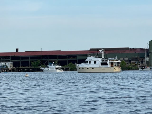
 |
| This picture does not really capture the three-foot waves. It's sportfish all the way down. |
The bulk of them had already passed us by the time we steamed in the inlet a half hour later, and we proceeded into the Western Channel for our planned anchorage. The tournament still had two more days to run, with hooks-in at 7am, so we went right past our first option, protected from the ship channel only by a shoal, and headed all the way to the ICW junction, where a low island would separate us from what we figured to be a 5:30am exodus of the same fleet. We had the hook down in a familiar spot (map) just before 6pm.
In most conditions, this is a comfortable and protected spot. But as we were setting the hook, we realized that the enormous amount of energy generated by 50 sportfishers leaving the bay on full plane could easily make its way past the half mile of protection afforded by the island, making for an unpleasant awakening in the morning. We decided to make this a "dinner hook," not even setting the snubber, so we could eat our dinner in peace and regroup with another plan.
The sportfish were all coming out of Georgetown Landing Marina, on the Pee Dee. Our options to get away from them were either to go a mile or so past them up the Pee Dee, or past the bridge on the Waccamaw, or to roll the dice on finding a spot in Georgetown itself, the closest option at an hour further along. Fortunately, the tide was favorable for us to enter the harbor.
 |
| Vector headed up the Sampit. Photo: Chris & Cherie, Technomadia |
A half hour after we set the anchor we were back under way, headed for Georgetown. Even at a favorable tide, neither one of us was looking forward to picking our way through the narrow and shallow entrance, and then hunting for a spot in a very tight and equally shallow anchorage at the end of the oxbow. So instead we veered left into the Sampit River, where a crowd-sourced database we use for anchorages said there was a good one near the turning basin for the quay at the nearby steel mill.
Normally I do a lot more research on these kinds of anchorages before arrival, because I don't trust crowd-sourced information in the boating world, but we had not expected to be in this spot at this time, and I did not have the wherewithal under way. In my mind the quay at the steel mill was disused and there was not a lot of commercial traffic down the Sampit. The reality was quite different; there was no room at the suggested spot to anchor without swinging out into the federal turning basin, and the quay showed signs of occasional use.
 |
| Y-Not and Vector anchored in Georgetown. Photo: Cheris & Chris, Technomadia |
We continued past the turning basin and under the bridge for better hunting grounds, but what we found was deep river lined with all manner of going commercial wharves with tugboats, crane barges, and the like. We could not tell from looking how far upriver we'd have to go to find a spot to drop the hook, and with over a knot of current behind us, we could well run out of daylight to make the known anchorage in the Georgetown oxbow. We made a quick about-face and cranked up the rpms to get back to the Georgetown entrance.
We got very, very lucky. The anchorage was as empty as we've seen it, and we found a spot with just enough swing room for the night's projected light and uni-directional wind where we set the hook (map), exhausted. Y-Not, who had been waiting nearby on a lunch hook to see where we would end up, came in shortly after us and anchored another hundred yards further along.
 |
| Happy crews at the Georgetown Harborwalk. Photo: Chris Dunphy |
In the morning and fully recovered, we made plans to meet Cherie and Chris for brunch ashore. Our original plan for the day had been to come in and tie Vector up to the courtesy dock, and we briefly thought about weighing anchor and doing just that. Stymied by a center console taking up the only face dock, we instead splashed the tender and we all met up at the dinghy dock. We had a nice brunch at the Thomas Cafe over a lot of catching up and laughter.
After brunch we had just enough time left on the tide for me to get my errands done, and I returned ashore with the e-bike. First stop, CVS, which contains a "UPS Access Point." We learned from friends Erin and Chris that UPS will ship your stuff to one of these Access Points where you can pick it up without charge, unlike many UPS Stores which charge for this service. It worked like a charm; I had emailed a UPS label to the Eau Gallie Yacht Club, where a package I was waiting on missed us by a few days, and it was waiting for me at the CVS. Afterward I rode a mile further to Walmart for a couple of essentials that we get only there.
 |
| I could not resist snapping this syrup pitcher at the Thomas Cafe. |
We made our way out of Georgetown with just enough falling tide to squeak out of the harbor. It would have been perfect just to stay there for the entire holiday weekend, but the forecast was for thunderstorms with 25kt clocking winds overnight, and there is just not enough swing room there for Vector in those conditions. Unfortunately, that put us against the current the rest of the day to go north on the ICW. Absent the Blue Marlin tournament, we would have gone downriver instead to the same place where we had dinner, for an open water passage the next day, but we were again unwilling to risk the 6am tournament wake-up.
With no particular rush and so much adverse current, I ran a slow bell up the Waccamaw, figuring to stop at an early anchorage just five miles upriver, a familiar spot behind Butler Island. That would have been pleasant enough, but we were feeling aced out of a nice restaurant dinner in Georgetown by the weather, and we also wanted to be a little closer to Myrtle Beach in case we got a window to run the gauntlet. Thus I spent some of the time under way to Butler looking at other options further along the Waccamaw.
 |
| CVS manager fiddling with the UPS app to give me my box. |
A nice anchorage we've used before is a short tender ride to the Reserve Harbor Marina, but when I called they told me their restaurant was "members only." A few more miles upriver is the Wacca Wache Marina, whose restaurant has recently changed hands and seems not to be reviewed, but that seemed like a good option, with a nice but tight anchorage across the river. With plenty of daylight we set our sights on that, running a slow bell the whole way.
We arrived to find the entrance bar to Cow House Creek open and available, reports of a permanently moored boat there notwithstanding, and we had the hook down in the very tight space (map) a little after 4. The heavy current kept us fixed in position just 20 yards from the cypress trees ashore.
 |
| Anchored just a boat length from the trees. If we had swung that way we would just miss them. The water is deep right to the edge. |
We splashed the tender to head ashore for dinner just as the live music was starting from the nearby Wachesaw Plantation Club, perhaps for a wedding. We tied up at the marina dock and walked into Walter's on the Waterway for dinner. They had a very nice patio, with a musician playing some light jazz, but it was too hot to want to sit outside. The food was nothing to write home about, but they had a selection of bottled beers, and it's the only game in town. After dinner we strolled the marina and the public boat ramp next door before heading home and decking the tender.
A short while later the predicted storm arrived as forecast, pleasantly dropping the temperature ten degrees. The frontal winds arrived just as the current was reversing, which can be a recipe for the anchor tripping, and I briefly manned the anchor watch until the worst had passed and we were safely set in the other direction. The storm put an abrupt end to the live wedding music. We had a comfortable night, with the loudest sound being the frogs just across from us. Y-Not reported 35 kt clocking winds in Georgetown and they, too, manned an anchor watch; Vector would have been in the mud had we stayed.
 |
| Coming home from dinner, Vector looks like she is steaming out of the creek. |
Yesterday we weighed anchor on the flood to have a fair current upriver to Enterprise Landing, which is where we figured to wait out the holiday craziness in Myrtle Beach before continuing on. There is protection there in a quiet oxbow or a side channel, away from the major traffic of the ICW but still likely seeing some weekend tomfoolery. There is at least a boat ramp where we could get ashore to walk a little bit.
Under way we kept our eye on the weather, hoping for afternoon rain showers that would attenuate the onslaught of jet-skis, pontoon rentals and center consoles that we knew would otherwise clog the waterway. An earlier forecast had at least suggested the possibility. What we found instead was an ever-increasing chance of violent thunderstorms for the evening, with nothing to stave off the afternoon hordes. The prospect of enduring moderate weekend traffic all afternoon and then having a big storm hit in a tight oxbow soured us on the idea of stopping at Enterprise, and by the time we arrived we had girded our loins and determined to run the gauntlet of Myrtle Beach and just get past it.
The early part of the run was just run-of-the-mill Myrtle Beach traffic, with a little pile up waiting for the Socastee Swing bridge. We had the Rock Pile to ourselves, and the craziness did not start in earnest until just a couple miles shy of the Little River swing bridge. And crazy it was. Imagine 5mph bumper-to-bumper traffic on the highway and you will have a pretty close analogy, It tested my boat handling, for sure -- bro dudes in center consoles backing out of boat ramps have no clue what it takes to stop 55 tons of steel moving at five knots. Thankfully we had just a brief wait for the bridge and the conga line started to spread out a mile or so later.
 |
| This is the school bus (really) crossing our path on the Waccamaw. |
With the zoo mostly behind us, we turned outbound on the Little River for the anchorage. We talked about going to the protection of Bird Island, but the anchorage in there can be tight, and we were concerned about swing room for the very storm that had us passing up the tight anchorages at Enterprice Landing. Instead we anchored well off-channel in a familiar wide spot of the river (map), protected from the ocean but not the prodigious wakes of sportfishers, center consoles, tour boats, and the Big M Casino all coming and going via the inlet. We knew that would taper off before bed time, however.
What we did not expect to find was a couple dozen boats partying on the beach right across the river. A pair of Krogens and a big Hatteras that had been gaining on us up the ICW passed us in the river and anchored at Bird Island. We had a nice dinner aboard, and the evening's entertainment was watching the comings and goings, as well as all the beach party boats scrambling to pack up and leave when the thunder started. One big patio boat was so firmly aground on the beach that TowBoat had to pull them off, and a center console fouled its stern anchor on the bottom and was the last boat out, in the pouring rain, as dad kept working at freeing the anchor by standing in the water next to it and worrying it out, which took over an hour.
We thought we'd have the whole anchorage to ourselves, just as we like it in this kind of a blow, but just before the storm hit an express cruiser anchored a hundred yards from us. We watched in horror as they set both bow and stern anchors on a too short a scope, wondering just what they were thinking. Setting a stern anchor can increase the loads on the ground tackle astronomically. The two occupants then retreated below decks, where they remained as the wind hit and dragged them all the way across the anchorage, then across the channel, and up against the shoal on the other side of the river. I called three times on the radio and then sounded the horn to no avail before finally making a Sécurité call to warn other traffic.
 |
| Beer can island. |
It was all over in a couple of hours and then we were alone, in a flat calm anchorage. We had a very calm and restful night, at least up until the fishing boats started going out this morning. Not quite the level of the Blue Marlin tournament, but unpleasant nonetheless. Given the amount of wind we actually saw, in hindsight we would have been better off at Bird Island.
With good conditions on the outside, we were weighing anchor by 7:30 and headed out the inlet before we even decided whether to head for Cape Fear or all the way around the shoal. I spent the first half hour after turning at the sea buoy working on charts, tides, and currents to figure it out. While it's 17 miles longer to get to Wrightsville Beach this way, we avoid a dozen miles against two knots of current in the Cape Fear, plus having to squeeze in to Carolina Beach for a night to wait out the holiday traffic. This will put us into Wrightsville two days earlier and the driving is a lot easier.
As I wrap up typing we've already rounded Frying Pan Shoal via the slue channel and are on a due north heading to Masonboro Inlet. Weather is unfavorable for the outside run from there to Beaufort, so it will be a two-day slog up the inside, through the problematic Onslow Beach Bridge. We don't want to be under way on Memorial Day, so we'll just sit tight in Wrightsville for the day. Just as well -- we need the break.
Story well told, Sean. With no experience on the east coast, i am amazed by what you encounter. I am struck by how interesting the coast is, compared to the west.
ReplyDelete