We are under way northbound in the Atlantic Ocean, offshore of Bull Island as I start typing, bound for Winyah Bay and thence Georgetown, South Carolina. I expect we'll have the anchor down, likely somewhere in the Western Channel, right around dinner time. That means we'll either be eating a little early under way, or a little late after we're fully settled. We won't know until much later in the day, when the plotter will have a better idea of ETA than it does now.
We spent two nights anchored off St. Simons after my last post. In the morning we tendered ashore to the marina, where dinghy access is now a staggering $20 per day, got the gate codes, and walked out to the parking lot, where our good friend John picked us up to run some errands. We dropped off the latest failed attempt at a new monitor at the UPS store for return to Amazon, and stopped in the very nice Harris Teeter store on the island for some fresh provisions. John gave us nice little tour of the island, slow-rolling a bit to wait out a torrential rain storm. We made it back to Vector without getting wet.
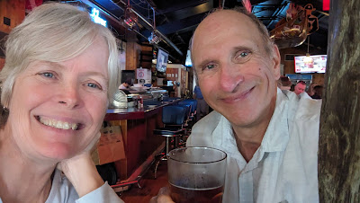
In the evening we met John and Laura Lee at the same spot in the parking lot and drove out to Certified Burgers & Beverage for dinner. I don't know who certifies anything there, but the burgers were good and they had an excellent selection of drafts. More importantly, we really enjoyed catching up with them over dinner and drinks. It's easier to visit them here in their new location, a stone's throw from the ICW.
 |
| We passed this spiffy new compact buoy tender north of Beaufort, SC. |
We found there is a new coffee place next to marina, in addition to our old dinner stand-by the Coastal Kitchen, and contemplated going ashore for breakfast, as our dinghy fee was good for 24 hours. Neither one of us was in a breakfast mood in the morning, so we just decked the tender and weighed anchor with the ebb. We'll try the coffee place next visit.
 |
| Not sure what these two sailboats though of having this crane swinging overhead at the Charleston City Marina this morning. |
With calm conditions on the outside, we headed right back out into the ocean and turned for St. Catherines Sound, the last inlet north that we could comfortably make in the daylight. We had a mostly calm passage, but as we got closer to the inlet, increasingly urgent thunderstorm warnings were arriving on our weather receiver. I increased rpms and we made it over the shallow (10') bar at the entrance just before the storms hit.
 |
| This year's theme, so far. This was on our way in to St. Catherines. |
That bar is still some 5 nautical miles offshore of the actual opening in the coastline, and so we still had most of an hour in open water before we could reach protection. The storm hit with a vengeance, with winds ramping up to 50 mph, about 45 knots, just forward of the starboard beam. Seas picked up to 3-4' and we bashed our way in, leaning heavily to port, the stabilizers pegged trying to compensate. Things got much more comfortable on the inside, and by the time we dropped the hook an hour later in a familiar spot on Cane Patch Creek (map), it was all over. Just one other boat was in the anchorage, an older Krogen a good distance away, and we had a quiet and comfortable night.
 |
| Our friend Ted hailed us on the radio as we were steaming up Calibogue Sound. He snapped this from his home. Photo: Ted Arisaka |
In the morning we left on the ebb and made it through the notoriously shallow Hell Gate without incident on a falling tide. That put us against the current for most of the day, and it was a long slog through Savannah to Hilton Head Island. We made it to a familiar spot on Skull Creek (map) just before dinner time, and tendered ashore to the Skull Creek Boathouse for dinner. All three waterfront joints were packed for a Monday, with tourist season now in full swing. We strolled the shared parking lot and saw mostly out-of-state plates. We found the Boathouse a little more pleasant than Hudsons next door, at a slightly higher price.
 |
| Skull Creek Boathouse. |
In the morning we once again left on the ebb, which gave us a fair tide crossing a very choppy Port Royal Sound, but then worked against us most of the day. We had so much adverse current passing Beaufort, SC, that I fell back on my river tactics for much of the passage, cutting the insides of all the turns just far enough off to keep our fins from dragging the bottom. We ended up at the Ashepoo-Coosaw cutoff, another notorious shallow section, at dead low tide. They were dredging it our last time through, and so we pressed on. We made it just fine, albeit with less than a foot under our keel in a few spots.
 |
| New sign near the Charleston City Marina dinghy dock (still $5/day). |
We finally had a fair tide again after turning off Fenwick Cut into the South Edisto River, and we had the hook down in a familiar spot near the Prospect Hill Plantation (map) just in time for a scheduled 4pm phone call. We took the bald eagle on the piling of a small dock we passed as a good omen. We grilled steaks for dinner, but the greenhead flies were so numerous we could not enjoy the otherwise pleasant weather outdoors, and I had quite the challenge keeping them out of the boat while I was grilling. We fell asleep to the cacophony of frogs in the nearby marsh.
 |
| Rental e-bikes throughout Charleston. These are at Salty Mikes at the marina. |
We awoke yesterday morning to fairly dense fog. Fortunately it thinned out just enough for us to get underway at 8:30 to catch high tide at Watts Cut. We had a fair tide to the North Edisto and then it was against us all the way to the Stono. We whizzed through Elliott Cut with a bit over a knot behind us, and were tied up on the "Megadock" at the Charleston City Marina (map) by 2pm. The marina is installing a massive new floating dock system and is a bit chaotic during the transition.
 |
| Drinking the Kool-Aid: the first Apple device aboard in eons. (OK, it's not real Kool-Aid in the cup.) |
There is now an Amazon locker right at the marina, and I had three orders to pick up, including a new 8" tablet for the helm, to replace the old Lenovo that has too little memory to support the current revisions of our navigation apps. This is a never-ending escalation; the Lenovo had been the replacement for an earlier tablet when it, too, ran out of steam to support the ever more resource-intensive navigation apps.
 |
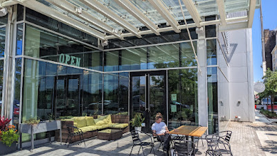
| New restaurant next to the Publix at Westledge, a short walk from the Brittlebank dinghy dock. |
I also offloaded the e-bike and made a pilgrimage to the nearby Publix for provisions and to replenish the beer supply. We have driven out of Cigar City Maduro Brown Ale territory, but into Holy City Pluff Mud Porter territory, so I picked up a couple of six-packs. A new restaurant has opened up next to the Publix, useful to know for the next time we dinghy in to the park dock there.
 |
| Looks fine from the outside. I did not go in. |
In the evening we took the marina shuttle into town for dinner. We ate at the bar at Halls Chop House, one of our long-time favorites, which has a little-known and reasonably-priced bar-only menu. Afterward we strolled around town a bit on a gorgeous evening before calling for a return shuttle to the marina. It was a nice stop, and quite luxurious, if a bit spendy, to stay at the dock for a change. We, of course, took advantage of the marina to top up our water and offload our recycling and trash.
 |
| Halls Chophouse. My sandwich is already gone. |
After Louise turned in last night, I went out on deck to see if I could catch a glimpse of the evening's Starlink satellite launch atop a Falcon-9 from Cape Canaveral. I had low expectations; the sky was quite hazy, with only a few stars visible, and there was a full moon on top of the light pollution all around the harbor. We are also a full 250 nautical miles north of the cape. I was pleasantly surprised to see the rocket exhaust quite clearly through my binoculars; at this distance it appears quite red compared to the yellow-orange glow closer up. The second stage was harder to see, and I lost it briefly after main-engine cutout. A few minutes later I heard the Coast Guard answering someone reporting a flare sighting; the red exhaust and sharp cutoff does look a lot like a flare.
 |
| The first Fort Sumter tour of the day. They came right up next to us from astern before turning to their dock. |
This morning we dropped lines just as the ebb was starting, for a nice push all the way out of the harbor. Traffic was light, but I did need to alter my course to meet a towboat with a light barge on a short wire coming in from sea. It's a gorgeous day, and I am happy to be out here bypassing three very shallow stretches of ICW that require timing the tide. It also gives me this opportunity to catch up on the blog.
 |
| I had to adjust course for this empty mud scow on a short wire. |
Our friends Cherie and Chris aboard Y-Not are somewhere on the ICW to our west even as I type, and it looks as if our paths will converge tomorrow near Georgetown. I think they are headed someplace quiet to escape the holiday crowds, whereas we will be continuing north, so we are going to connect tomorrow morning before I need to get to UPS and Walmart for my errands. I have no idea where we will end up tomorrow night.


Thanks for photo of compact buoy tender.
ReplyDelete