Friday, March 24, 2006

Red Cross Under Fire

A number of our loyal readers have called our attention to a front-page article in today's New York Times regarding allegations of fraud, waste, and possible criminal activity during the Katrina/Rita relief operation. I've read the article, and absolutely nothing in it is a surprise to us. We actually met several of the people named in the article. I can not comment here on any of the specific allegations, because there is an ongoing investigation and we may yet be interviewed or asked to testify in the matter. However, I would like to speak to the general perception being generated.

The scope of this operation was unprecedented in American Red Cross (ARC) history. With close to a quarter million volunteers involved across the duration of the operation (which, our regular readers will know, is still ongoing after nearly seven months), it was absolutely inevitable that there would be some bad apples and that some things would get out of control.

Remember that, in the aftermath of a major civic disaster, among the first priorities must be to provide shelter, food, and supplies to those affected. There will, unavoidably, be circumstances where the urgency of this goal precludes the possibility of, for example, absolute verification that each recipient was, in fact, a person actually displaced or impacted by the disaster. Imagine, if you even can, what things would be like if each person in the food line was required to show a driver license or other ID, and then someone had to check the address on that ID against a list of destroyed residences, etc.. I am sure you can see what might ensue from such an endeavor (and what kind of black eye the ARC would take over that strategy).

So in a major disaster response, and especially in the early stages, the presumption is made that the people receiving the services are, in fact, the ones who need them. You can extrapolate this same principle across a broad range of relief activities. Slidell needs 1,000 cots? Send 1,000 cots -- don't spend six hours determining if they really need 1,000, or maybe only 500, or is the guy running the Slidell shelter experienced enough to know, or is he maybe planning to sell them later for $10 apiece. The people who really need those cots need them tonight, not tomorrow, or after some Red Cross full-time bean counter in DC determines the legitimacy of the request. This is the very nature of disaster response -- get the resources out now, and we'll sort out the logistics mess later. To do otherwise would be criminally negligent -- just look at the fire FEMA has come under for doing, essentially, exactly this.

During the twelve weeks we spent in Louisiana, on the ARC's largest disaster response operation ever, we heard from volunteers who were absolutely amazed at what we had achieved, and marveled at how the Red Cross was able to pull it off in the face of so many obstacles. We also heard from volunteers who were fed up and sickened by what they saw happening in the field with ARC resources. We, ourselves, had at times both sets of feelings. By and large, the veterans of many disasters were the ones amazed by the success, and the neophytes (idealists?) were the ones distressed. Newcomers, like the general public at large, have little grasp of just what is involved, and the massive challenges posed by running a major operation with three-week volunteers.

In the end, we, too, were amazed at the success. We have seen how the sausage is made, and it's not pretty -- but still good to eat. At the height of the operation, there were some 30,000 volunteers in the disaster area. That would constitute a good-sized company in the corporate world. Now imagine trying to run a company of that magnitude under the following conditions:
  • Almost every employee comes with some basic training, but only spends three weeks on the job. You have to re-fill that position every three weeks with a new person who has the same basic training, but not the experience of being in your company before.
  • Few employees have telephones, email, or any other means of communication, but almost none works in headquarters.
  • You have 80 branch offices. Each branch manager is also a three-week employee.
  • You have a logistics system, a fleet of trucks, and warehouses, but all are straining, from day one, under what, in most companies, would be the end-of-fiscal-quarter madhouse rush. Again, all the employees are on three-week stints.
  • Like any major company, you have phones, faxes, computers, servers, and a network, all of which had to be installed, wired, tested, assigned, and made operational in the span of two days.
  • You have tracking systems for cars, phones, computers, trucks, food, and materiel, but all of them were designed for a company involving, perhaps, 5,000 employees, and you now have six times that many.
The list goes on and on -- it's really quite daunting. It is not difficult at all to see how some materials got lost, how some volunteers slipped past the background check process, and how some unscrupulous people (some volunteers, but many more people posing as clients) were able to take advantage of the chaos inherent in a disaster to manipulate the system to their own personal advantage.

I am not saying that all things are rosy, or that the ARC does not have room for improvement (in some aspects, significant improvement). Surely there will be many lessons learned from this response that will feed back into how the organization responds to future disasters. But, to Senator Grassley and others with jaundiced views of the American Red Cross and its response to hurricanes Katrina and Rita I say this: Put down your pens, keyboards, and news-media microphones, and volunteer for a three-week deployment in a disaster area. (There is a task or job in a disaster for adults of every ability, education, and age.) After you have spent three weeks on the front lines, you will have earned the right to criticize what we do out here. Until then, your words are just so much political BS. Show me you can do it better, or shut up and get out of my way.

There, I got it off my chest, and I feel better already.

A lengthy update from Austin, Texas

We are at the Elks Lodge in Austin, Texas (map). This is a great location, for a variety of reasons:
  • It is just a block away from a bus stop with access to a variety of routes covering the city. Day passes are just $2, so we can explore Austin without moving.
  • It is on a bluff just south of downtown, and we have a skyline view from our deck. The skyline is also visible through the treetops from our living room.
  • Several restaurants are within walking distance, including Austin icon Threadgill's.
  • The lodge parking lot is discreet and quiet. We are the only ones here.
We arrived here Wednesday night, after stopping at the Red Cross technology maintenance center to scope out parking spaces, and the local Lowe's to repair our water valve (more on this later). Yesterday was a much-needed day of downtime -- we didn't leave the house, except to walk to Threadgill's for dinner (and many thanks to our good friend and former Austinian, Charles, who sent us a list of restaurants and activities here in Austin). We did spent a couple hours completing an on-line "Defensive Driving" class from the National Safety Council, since the certificate from that is a prerequisite for our upcoming Emergency Communications Response Vehicle (ECRV) training.

Our Schedule

One of the things I was able to do in our day of downtime yesterday was to go through the calendar, clean some things up, and nail down (insofar as possible) our schedule for the rest of this year. There are vast tracts of open, undecided time, which is the way we like it, but some of the endpoints are fixed and you can presume that the time in the middle is spent getting from point A to point B in some fashion. We've given this same schedule to the Red Cross, so any open times are subject to preemption by disaster response. Without further ado, we will be:
  • Here in Austin through April 9, when our technology training class ends.
  • In Gridley, California April 16-22 for ECRV training.
  • Either in Chico, California for the Escapade or in San Jose, California for a visit April 22-29
  • In Gridley again for more Red Cross Training April 29 to May 2
  • Unscheduled from May 2 through June 20
  • In Saint Louis, Missouri June 21-27 for UUGA
  • Unscheduled June 28 through August 24
  • In San Jose, California August 25-27 for our friend Carolyn's wedding.
  • Unscheduled August 28 to October 9
  • In Mexico October 10 through November 16, on an RV caravan. We enter Mexico at El Paso, Texas, and exit at San Diego, California
As we fill in the blanks for the "unscheduled" periods, I will post the updates here.

Wednesday, March 22, 2006

Bastrop, TX

We are parked at the Wal-Mart in Bastrop, Texas (map). We had actually intended to be at the state park just a mile or so east of here, but low trees hampered our approach, and we gave up rather than bushwhack our way in just to spend the night without satellite access (the entire park is treed).

We ended up spending Monday night still in Houston. Sometime during our mad get-out-of-town scramble, Louise realized she was off by a week in her estimation of when she needed to be in Austin for her flight to San Jose, and we thus find ourselves with a bit more time on our hands. I needed to go to Fry's, and we have several clubs in Houston (though only one that offers dinner), so we made a loop through the western half of the city, getting our shopping done at the south Houston Fry's, then overnighting in the Wal-Mart on Westheimer (map), where it was a quick $1.00 bus ride over to the Galleria mall and our club for a nice dinner.

While at Fry's, Louise bought a delicious bar of dark chocolate in the impulse rack. We ate about a third of it, then completely forgot about it on the center console. When we returned to Odyssey from our evening out, Opal had eaten the remainder, and there were little bits of the foil wrapper all over the cockpit. Chocolate is quite toxic to dogs, and, mindful of Opal's near-death experience a few months back from unknown toxins, we were very concerned.

The all-knowing Internet told us to induce vomiting by administering one tablespoon of 3% hydrogen peroxide per ten pounds of dog (sounds like a cooking recipe, doesn't it?), so we crammed two tablespoons into her with a turkey baster (see, it is a recipe). We were actually out of hydrogen peroxide, but the Wal-Mart we were parked at was the all-night variety. Within a few minutes, she spit up several ounces of undigested dark chocolate. While she spent a miserable night in her kennel from the combined effects of caffeine, sugar, and whatever it is about chocolate that is toxic, by morning she was mostly back to normal. Lesson learned -- remember to stow the chocolate.

Today we will spend some time at the Home Depot a few blocks from here, working on a leaking hot-water recirculation valve, after which we will head in to Austin. We have quite a bit of time before Louise flies out, which we will likely spend at the Elks lodge, which has good access to transit.

Tuesday, March 21, 2006

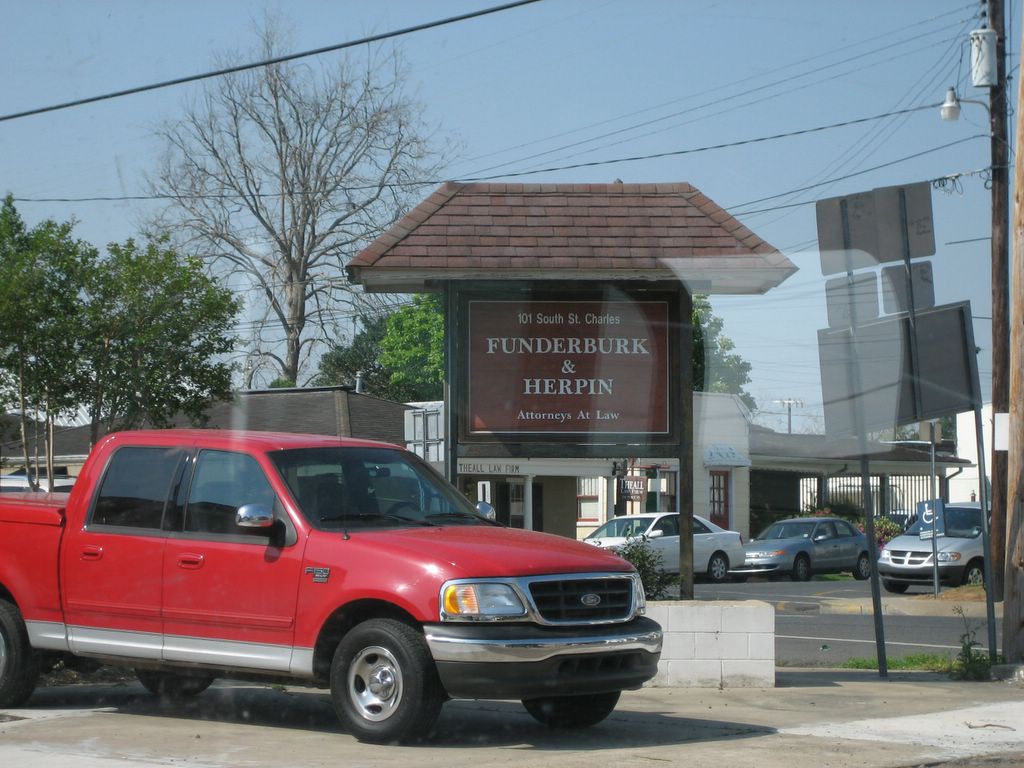
A little comic relief. I just thought the names of the law partners were funny. Not at all typical Cajun names!
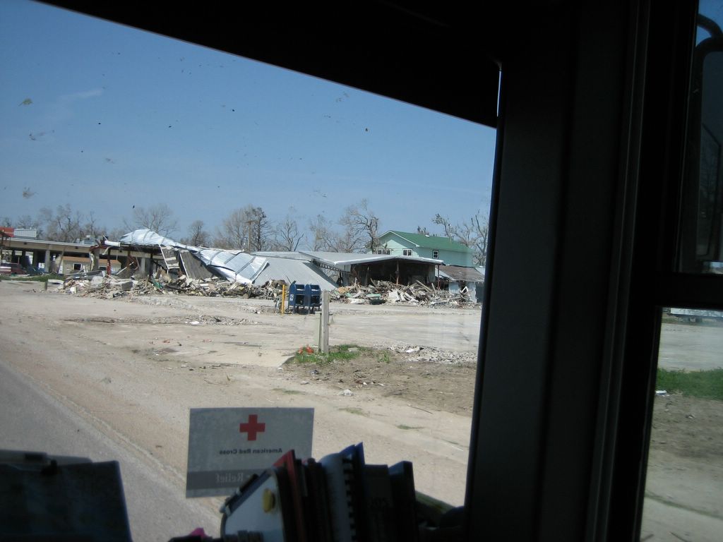
Cameron parish. This house seems to have floated near, then crashed into, the road. It is one of the few structures we saw that was relatively intact.
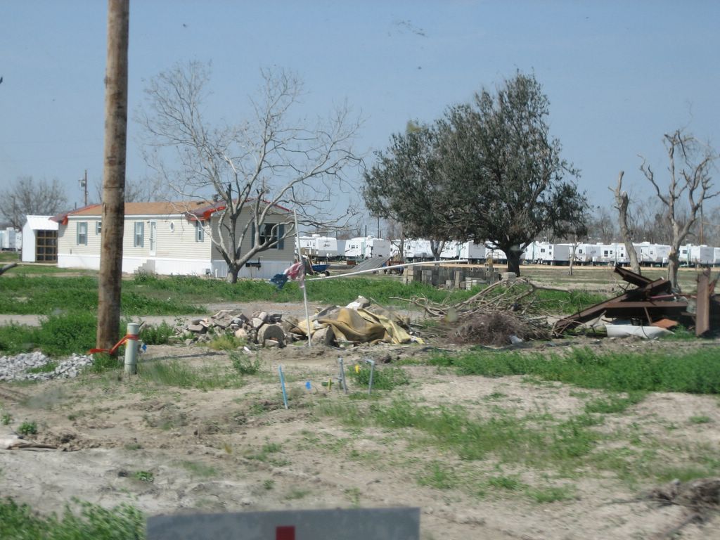
FEMA trailer encampment.
One of three landfills marked "RITA dump site" in Cameron parish along Hwy 82. The amount of debris is staggering. Downed trees seem to be taken elsewhere and we saw a number of deliberate debris fires. This part of the parish only housed about 6000 people, max. Imagine the dump sites near New Orleans.
Odd to see nothing but a sign. The business is completely gone. Whoever built the sign did a hurricane-proof job.
We think this was a school.
Signs of life in Cameron: a cafe in a trailer.
Houston traffic is baaaaaaad. The major east-west freeway, I10, seems to always be backed-up and the construction doesn't help. We took this HOV lane without knowing when it would merge back into the snarled main lanes to our right. Fortunately, the lane ended at our exit and we bypassed about 10 miles of stop-and-go in favor of smooth sailing in our (almost completely) private lane. Considering how often we make wrong turns in our travels, finding the lowest trees and wimpiest bridges, it is nice to occasionally choose just the right route.

Monday, March 20, 2006

Wet in Houston

We are parked at the Peace Community Church, on the western edge of Houston (map). Yesterday morning, Louise's brother, David, was ordained as pastor here, and we attended the ceremony. David is in the process of moving his family here from British Columbia, and we had a nice visit with them as well as Louise's dad and stepmom, who flew in for the occasion.

A line of thunderstorms has just passed through here, and things are very wet. Also, Opal (who hates thunder) is nervous. We have a little break in the weather right now, and we are preparing to get under way. We have been in this spot since Friday evening, but we've been too busy with family to post.

Friday we drove through Cameron Parish, LA, and had a chance to see the progress since our last visit late last year. For anyone who is not familiar with the story, here is a quick checklist of Cameron Parish communities and facilities:

  • Grand Chenier: Obliterated. Hard to tell there was a town here at all.
  • Creole: Obliterated. Part of a church is the only thing standing.
  • Cameron: The oil facilities show signs of life. The courthouse still stands and houses the entire parish government, in the form of an EOC. A couple of enterprising folks have hauled trailers into town and opened restaurants in them, which were doing a very brisk business with the contractors when we passed through at lunch time.
  • Cameron Ferry: Fully operational. No fares are being collected.
  • Holly Beach: Gone. Only the water tower remains. Many residents have cleared their properties, but no rebuilding is happening yet.
  • Ocean View Beach: This small cluster of stilt homes was completely gone in December. On this pass, two structures had been completely rebuilt (perhaps with modular construction) and were occupied.
  • Johnson's Bayou: Part of a church survived the storm. Other structures were still in various states of destruction. Many folks seem to be living in trailers on the oil production property near town.
Like a forest after a fire, small signs of life are sprouting along the gulf coast, and the hardy people who live here will come back and rebuild. It is going to be a long, long road.

Today we will be leaving Houston in the general direction of Austin.

Friday, March 17, 2006

Back in Cajun country

We are at the Wal-Mart in Abbeville, LA (map). This stop is familiar to us, since we were here last January, on more or less the same route. We are, again, heading for the Cameron ferry. We came through Cameron Parish in December in a Red Cross car, looking for antenna sites. The entire parish was destroyed by Rita, and recovery has been very slow. We are hoping to see some signs of progress as we drive through today.

We wrapped up our work with the Red Cross in Metairie yesterday, and hit the road around lunch time. It was a rewarding couple of weeks, and we were made to feel valued and welcome. We will be seeing some of the same people in our training class that begins just two weeks from now.

A number of people have written in to note that the Datastorm Users map has showed us in the middle of Lake Ponchartrain for the last few days. (In contrast, the map link I posted on the blog was a generic one for Metairie, LA). I want to reassure you that we are still quite dry, and did not run off the causeway into the lake! The weird position location was an artifact of how the DSLocator software, which updates our map position, handles "approximate" locations.

You may recall that the locations of the Red Cross facilities we have been working at, while not state secrets, have not been public information (for the simple reason that we did not have any client support activities there, and clients will swarm to anything labeled Red Cross). Consequently, we have been careful not to disclose those locations through our map links. DSLocator normally uplinks a highly accurate position -- so accurate, that readers of this site have shown up, unannounced, on our doorstep by following the maps. It has an option, instead, to uplink an "approximate" location. It does this by rounding the decimal latitude and longitude coordinates to the nearest tenth of a degree. In the case of our location in Metairie, that rounding put our icon in the lake.

Today we will drive the Louisiana gulf coast along the Creole Nature Trail, cross the Sabine Pass into Texas, and head directly to Houston.
Angel in her pillow fort. It has been too long since I posted a cute cat picture for our younger readers.

Sunday, March 12, 2006

Hard times in the Big Easy

We are in Metairie, Louisiana (generic map). After successfully moving the Red Cross Baton Rouge headquarters from a church to a union hall, we were winding down our visit and getting ready to move on down the road, when our supervisor asked if we could stay a few days longer to support the joint relief operation here in Metairie with the Southeast Louisiana chapter. We are sharing temporary space here in a commercial building, since the chapter offices in New Orleans were destroyed in the storm.

We don't really need to be in Houston until the 17th or so, so we agreed to come down here until then. We spent Wednesday night parked at the church in Baton Rouge, tending the pre-move server backup, which ran until 5am and required tape changes every couple hours. Then we moved to the union hall, where we thought we'd be staying for a couple days, and staked out a nice spot with a 20-amp outlet. We were barely plugged in when the decision was made to come here, and we set out from Baton Rouge that evening in the still-horrendous post-Katrina rush hour.

We have a nice spot in a gravel lot just two blocks from the Metairie office. The Red Cross has arranged for this space to park trucks and overflow cars, but, frankly, there are trailers parked on every block in this town, and we probably could get away with parking anywhere. The nearby K-Mart has a half-dozen FEMA trailers in it, hooked up with semi-permanent water, sewer, and electric connections.

Being down here has allowed us to pop over to New Orleans for dinner the past two nights. We also spent a good chunk of today downtown, and we noted, over cafe-au-lait and beignets at Cafe du Monde, that tourism is back in nearly full-force. The FEMA encampment that had been such a prominent feature next to the Jax brewery in December is gone, and everywhere in the quarter things seem very close to routine. Outside of the quarter and the CBD, of course, the city is still very much a disaster area.

We are committed to being here through Tuesday, the thought being that we would be back in Baton Rouge for the traditional Tuesday steak dinner. It looks, though, like we are needed beyond that, so we will have to see how things play out. We have our supervisor's car while he is away from the operation for a few days, and we need to get that back to him Tuesday night in any case.

Thursday, March 9, 2006

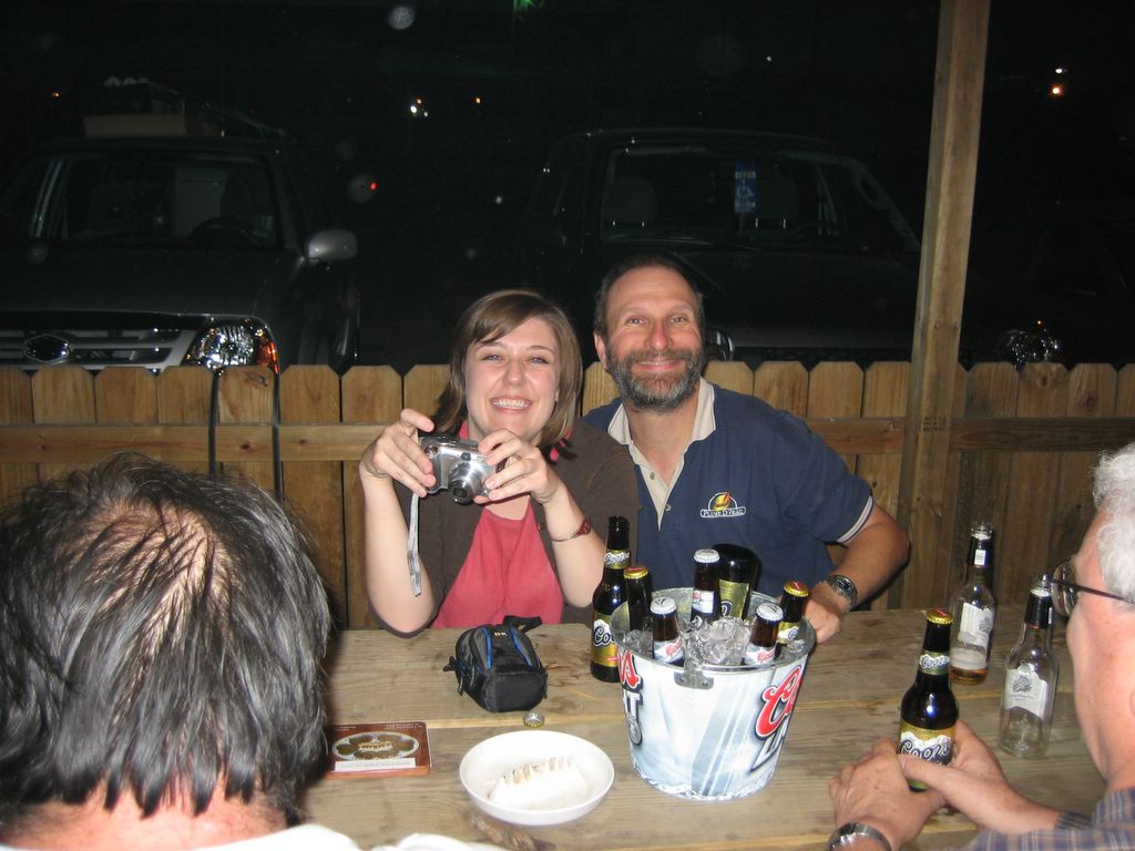
Sean and our lovely friend Anne at Tuesday night steak dinner, a Baton Rouge RTT tradition. This ratty local bar has a BBQ grill on the back patio, and on Tuesday nights they serve a most excellent ribeye steak dinner. 15 bucks for a huge steak, baked potato, green salad and a roll. Beer is extra, but not much extra...if I recall correctly, a bucket of 6 beers is about $10. The bar used to grill the steaks only on Tuesdays during the summer, but since 10 to 30 Red Cross people started showing up each week, they extended the dinners through the winter. Our favorite waitress, Michele, knows everyone's name and so this nondescript tavern in a dark industrial area has become our "Cheers." It is such sacred tradition that RTT people have been known to change their flights home for one final "Steak Night," and when our boss told us we would be working all night Tuesday to move HQ to a new location, he said, "Of course, we'll have steak night first, then move headquarters." Fortunately, the moved ended up happening Wednesday so we could enjoy our dinner with no worries about working afterwards. By the way, the bar is walking distance to Odyssey's parking space, so don't worry about those beers, Mom.
Our Red Cross digs this visit. Because the temporary new headquarters were so small, the RTT warehouse was housed in this building on a piece of property owned by a local trucking company. The parking lot was completely surrounded by a chainlink fence, so for a short time we lived in this lovely gated community.

Sunday, March 5, 2006

Just like home -- Baton Rouge

We are once again in Baton Rouge, stationed at a Red Cross logistics warehouse that is serving as the technology service center. Once again, I am not posting our exact location either here or on the DataStorm site. In contrast to our previous digs, we have access to a 20-amp electrical outlet here.

We arrived Friday afternoon and got signed in, and by Saturday morning I was already out in the field, moving phone lines around in a warehouse in Reserve. We are really here, though, because the entire operation will be moving (again) into a different HQ this week, and moves need an all-hands effort. We will be here for about a week, just enough to help move and maybe a few other things,, before family commitments have us en route to Houston.

It feels almost like coming home. Part of that is because we do feel a sense of family with the Red Cross, and part is that, having spent ten weeks here, Baton Rouge is the single place where we have spent the most time since we hit the road in Odyssey 18 months ago.

I suspect, now that we are working full hours, that I will not be updating the blog much until we leave here.

Friday, March 3, 2006

Recovery encampment, Pass Christian

As Louise has already documented with a photo, we are parked at a destroyed Wal-Mart in Pass Christian, Mississippi, less than a hundred yards from the Gulf of Mexico (map). We have a beautiful panoramic view of the gulf out our front window.

This store was brand spanking new when we passed through here last January. My recollection is that overnight parking, as well as parking for the beach, was not allowed. Now it is home to perhaps a dozen recovery contractors in camps scattered throughout the expansive parking lot. Many are sleeping in their trucks, a few are in tents (and what a curious sight that is, in the asphalt lot), and a lucky handful have small travel trailers or motor homes. One is even living in a school bus, still yellow but with curtains over the windows.

Wal-Mart has done a good job cleaning the property up -- the store is empty of debris and fenced off with a temporary cyclone fence (and isn't that an ironic name for it?), the parking lot is swept clean, and the dead trees have been removed. It is eerily familiar, with the hulk of the store in the background, but the complete absence of light in the parking lot (the immense parking lot lights survived the storm, but the power is off), the ghostly remains of the gas station, and the utter absence of patrons' cars combine with the small circled encampments to give the place the feel of one of those B-grade after-the-holocaust films. Not far from the truth, I guess.

A block to the west can be seen a pair of circus-sized tents surrounded by travel trailers, box vans, and generators, a loosely organized grass-roots feeding operation known as God's Katrina Kitchen. On the horizon to the south we can make out the silhouette of Cat Island.

Yesterday afternoon we walked around the block, which took us half a mile inland as the ground rises gently from the beach. No structures are standing within the first thousand feet from the highway, but as one climbs further a line of partially-destroyed houses slowly gives way to mostly intact structures and then some with either minimal damage or fully repaired. From the highway, though, the scene is endless, utter, and complete destruction. There is not a single intact structure from Gulfport to Pass Christian.

The pictures and video from this area do not adequately convey the enormity of the situation. To the casual observer, it looks as if the storm came through here yesterday, though it has been over six months. Few casual observers will see this, though -- we are on a stretch of highway between two closed bridges (one between Ocean Springs and Biloxi, the other between Pass Christian and Bay St. Louis), the road decks ripped off their piers by the storm. Mississippi has elected not to repair them, waiting, instead, for federal funding to replace them with more modern structures.

Just as well that few people travel this stretch -- there are no services whatsoever. US90 has been mostly repaired and reopened, but the dozens of traffic signals on the route are gone, the empty stanchions a grim reminder of how much infrastructure remains to be fixed. Missing storm drain grates and manhole covers make a stroll down the street a less-than-casual affair. Street lights are working now on the side streets, and there appears to be a network of temporary water mains serving the inland buildings that are habitable.

We saw Mardi Gras beads littering the highway yesterday, and signs prohibiting parking during the parade. We would guess that the celebration here was bittersweet, but clearly well attended. (Which reminds me that our visit to Mobile on Ash Wednesday revealed the scope of the celebration there -- forget New Orleans, I want to go to Mobile for Mardi Gras!)

All in all, a very sobering visit to this part of the gulf coast. It makes us glad that we will be checking in with the Red Cross this afternoon for another, albeit brief, stint.

Thursday, March 2, 2006

Welcome to the Gulf Coast in Mississippi. It is broken. Please send money.
Without the sign, how would you know what had ever been here? On other piles of rubble we saw spray painted identification: restaurants, motels, private homes, churches. No street signs, no landmarks, but amazingly intact oak trees. I suppose a local resident might recognize individual trees and feel some relief that these old friends had survived.
I'm glad that the businesses are trying to rebuild, but overwhelmed by how daunting the task is.
Had enough yet? Think how the residents feel; this damage goes for miles and miles and miles and miles. While the mainstream media has moved on to other news, lives here are not normal in any sense of the word.
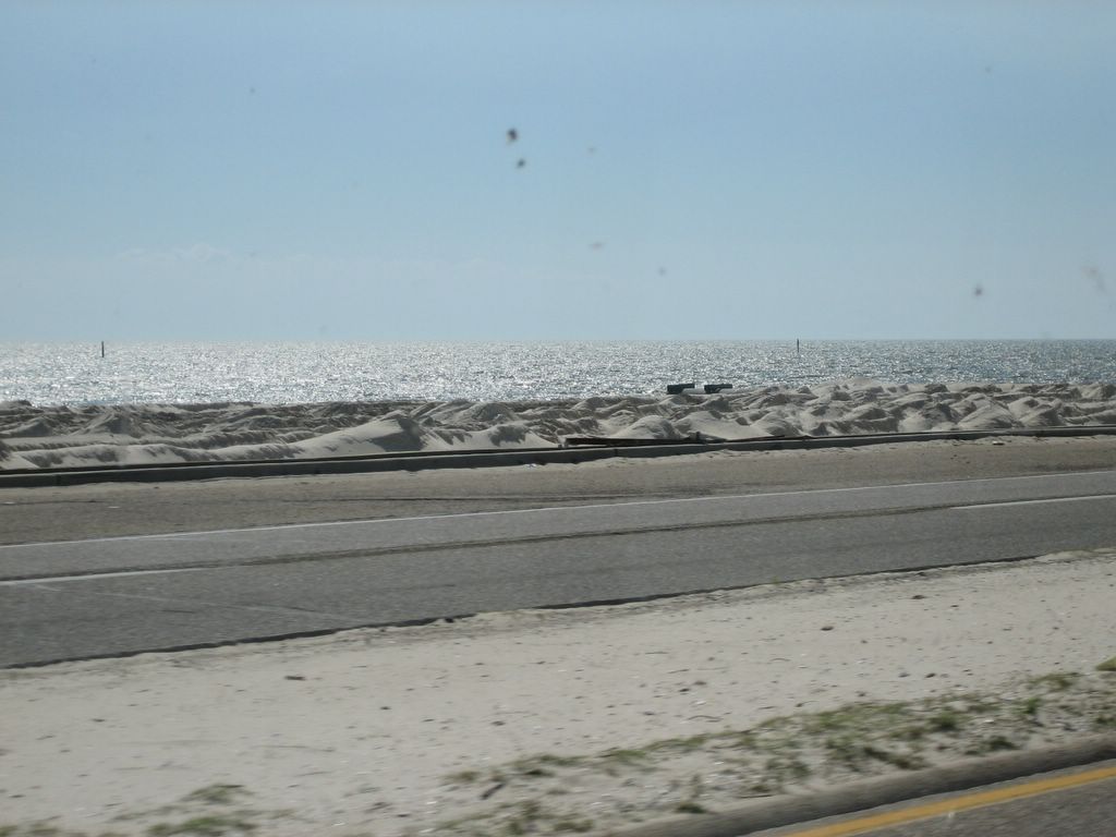
The mounds on the beach are the result of a cleaning process. From what we can tell, heavy machinery is used to sift and filter the sand to remove debris, then dumped in piles. The wind is slowly flattening the small dunes, and a high tide or moderate storm will smooth the rest.
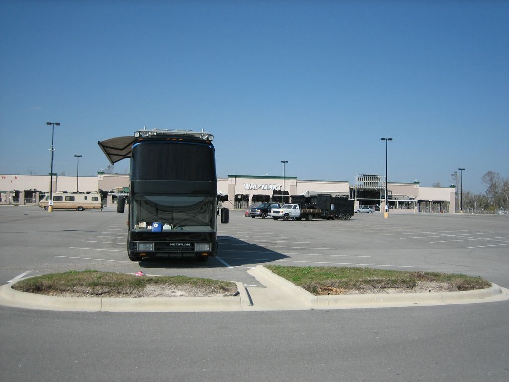
Where else would we stay but our "home park," Wal-Mart? The storm surge destroyed this one, but the parking lot still welcomes travelers.

Damn the torpedoes, full speed ahead!

Yesterday turned out to be a day of some frustration.

After leaving Milton, we had an uneventful drive through Pensacola, and, in fact, US90 runs along the western shore of Escambia Bay, which we found to be quite beautiful. We did notice more and more hurricane damage, though, as we proceeded south and west.

From the western edge of Pensacola, we retraced our route of last January, down to Perdido Key and along the gulf into Gulf Shores, Alabama. Sadly, the scene along there was eerily reminiscent of that earlier transit, over a full year ago. While not yet fully recovered from Ivan, Katrina slammed ashore and undid much of the progress. We did note that many of the damaged structures from a year ago are gone, I am guessing due to the bulldozers I forecast then, although some may have been taken by Katrina's surge. We also noted, in contrast to last year, that enough progress has been made in the area that many buildings are again occupied, and many local businesses are open. Still, though, a sobering drive.

From downtown Gulf Shores we drove the 25 miles or so west down the peninsula to the ferry landing at Fort Morgan State Park. We arrived noonish for a 1:15 ferry, and so spent half an hour or so walking around historic Fort Morgan. Constructed at the beginning of the 19th century as part of the defenses of Mobile Bay, in a style typical of that period, the fort became famous during the civil war. As the last bastion of confederate blockade-running, the union fleet, under command of Admiral D.G. Farragut, pressed a massive attack in 1864. As the fleet approached the fort, USS Tecumseh struck a confederate torpedo (what, today, we would call a mine) sending the ironclad to the bottom and causing the fleet to hesitate. This prompted Farragut to issue the now-famous command with which I have titled this post.

What I did not know, before arriving at the fort, was that it was refortified at the dawn of the 20th century as part of the US coastal defenses. The newer batteries for the large rifled guns are built in, around, and sometimes through the earlier fortifications. It is a weird and stark contrast, concrete bunkers inside of a brick-and-earthen pentagonal fort. Even the modern fortifications had been abandoned by WWII.

Nervous about getting a spot on the ferry, we cut short our tour and lined up at the ferry landing a good half hour before departure. And there we were, in the middle of the line, when the ferry pulled up to the dock and we realized, to our great disappointment, that there was no way Odyssey could embark the ferry -- the ramp was at too steep an angle, and she would certainly low-center on it, thus sidelining both us and the ferry until a tow truck could be summoned.

As we watched the ferry sail away, we consulted our trusty GPS and it's built-in tide tables to see if, perhaps, by waiting for a later ferry, the tide would come in enough to flatten the ramp to the point we could embark. Unfortunately, we discovered that, notwithstanding a high-water mark a good two feet above the waterline, all the rest of the day's ferries would be at even lower levels. Reluctantly, we left Fort Morgan and backtracked all the way to Gulf Shores.

We did stop in at the Gulf State Park, which claimed to have a few spaces left. The campground is in the middle of a huge recovery effort, and they are making good progress. That being said, we found it, in its current condition, to be rather unappealing, and, since it was only 2:00, we decided to press on to Mobile.

As it turns out, we have a club in Mobile, so we decided to find some nearby parking and have dinner there. We called the club and got some directions and the low-down on the parking situation, and headed into downtown. After driving around for 15 minutes or so looking for stealth boondocking locations, we decided to put Odyssey into a pair of metered spaces, where $0.75 bought us the last two hours before meter enforcement ended. At which point we called the ClubLine for our dinner reservations, only to be told that there is no dining at this club until Thursday night. Why, we wondered, did the club not tell us there was no dining when we called for directions? We told them we were coming for dinner!

We still had our paid-up time on the meters, and the dish was up and on-line, so we spent some time tracking down Wal-Marts and restaurants in Mobile, finally settling on an Olive Garden with a Sam's Club nearby. As it turned out when we arrived at the Olive Garden, it is in a shopping center that is maybe a 70%-30% mix of going concerns and for-lease stores. We parked in the back behind one of these latter items, and here we are still this morning (map). Urban stealth camping at its finest -- dark, quiet, undisturbed, and stumbling distance from a restaurant. Louise couldn't resist spending an hour or two in the stores after dinner, though, and came home with some new bedding.

I'd love to tell you what our plan is today, but my prediction track record over the past few days has been poor. I'll just say we are going to try to stay near the gulf, starting maybe near Pascagoula. We're not going to try to see Dauphin Island, chalking that up to a casualty of the ferry fiasco, and we did the loop south of here and into Bayou La Batre last year.
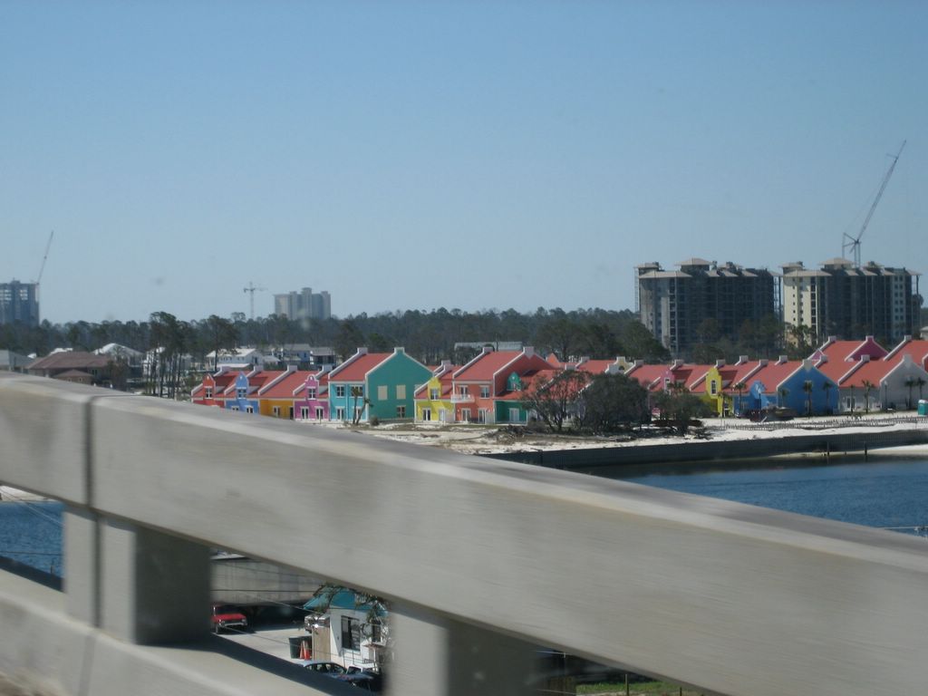
New construction in Perdido Key, FL. This riot of color would fit right in on Jamaica's shores, but is alarming here. The rest of the key's buildings are typical Florida beach bland: cream, grey, an occasional soft rose or pale blue.
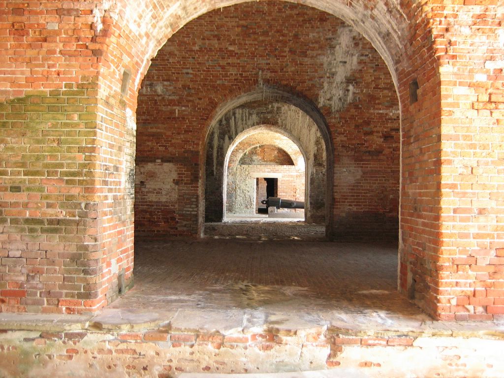
Fort Morgan, AL. We were surprised at how extensive the ruins are. In several places, rain water seeps through the ceilings, forming thin stalactites and wide stalagmites that look like piles of cream cheese frosting.

Tuesday, February 28, 2006

Laissez les bon temps rouler!

Notwithstanding yesterday's post, which I only just uploaded a few minutes ago, we did not make it as far as the gulf coast today. We are, instead, spending our Mardi Gras at the Wal-Mart in Milton, Florida (map), just east of Pensacola.

When we have no internet access to deliver our morning newspapers and comics, or email to catch up on, etc., we tend to get an earlier start. Today, however, we did not get far from the campground before our first stop -- the visitor center and cave entrance. We signed up for a 10:00 tour, and were the only two patrons. The ranger was tickled pink to have a small tour with a pair of cave veterans, and we got the full monty, with views of formations that, with larger groups, she bypasses. For that reason, our 45-minute tour stretched to nearly an hour, and then we took a 15-minute nature trail afterwards through the hardwood hammock.

I have to say that we were quite surprised by the beauty of this cave. It is tempting to think, at some level, that if you've seen a couple each of dry and wet caves, that you've seen them all, but, really, each cave is unique. Today we saw many examples of a type of formation that we had never seen before -- rimstone pools. Fascinating and beautiful at the same time. In any case, between the tour and the walk, it was nearly noon by the time we rolled out of the park.

As is usual for us, we elected to stay on US90, shunning the nearby I-10. Slow going through the handful of towns, and, to top it off, we got snoozy around 2ish, and stopped at a lovely city park in Crestview for an hour or so.

The last Mobile Ferry we wanted to take was the 4:15. There is a 5:45, but it would put us on Dauphin Island in the dark. So we spent some time during our rest stop scoping out stopping places shy of the ferry. Our first choice was Alabama's Gulf State Park, which, remarkably, is open for camping (and is not full of FEMA trailers). However, unsurprisingly, they were fully booked tonight when I called. Our second choice, Gulf Islands National Seashore, has no operating campgrounds. What wasn't already closed indefinitely from Ivan was wiped out by Katrina.

That left us with urban camping in Pensacola, or trying to get in to one of the handful of commercial parks along Gulf Shores. The traffic heading in to Pensacola made the decision for us, and we stopped here. Our Mardi Gras celebration will, thus, have to be limited to dining and drinks at the Ruby Tuesday across the parking lot. I'm wearing my beads anyway, in case a fais do-do breaks out.

Yesterday someone posted the following question in the comments:
Odyssey, while a magnificent "beast," seems to require a lot of compromises as to where you can go, and frustrations as to where you can stay. That, along with the engine problems and other glitches, would make a large diesel-pusher daunting to we less intrepid travelers. If you had it all to do over again, would you still elect to go the Odyssey route, or would you choose a somewhat smaller RV?

I'd like to answer here, because I don't think many people go to the comments, but probably several folks would like to hear the answer. The answer is a resounding "hell yes" we would do Odyssey all over again. At some point, I intend to post a post-deployment analysis on our main web site of what specific things in Odyssey are perfect and what things need improvement or we would have done differently. Until I get around to that, though, I can tell you that we feel it is mostly perfect and only a couple of really minor details would be changed if we could.

Also, I want to clarify that, mostly, we don't have to compromise about where we go and are not frustrated by limitations on where we stay. It is inevitable that, here in the blog, you will hear me grouse about things like getting stuck, low clearances, and the like. What you don't hear me say often, but is the truth, is that we go pretty much wherever we want and we are able to stay most of the places we want to stay. The sorts of problems that we have tend to stem more from our preferences (for example, in favor of state and national parks and against commercial RV parks) and our refusal to plan trips in the exacting detail required to make advance reservations. We would have these same issues in a Class-B van conversion, with, really, only a small handful of additional sites opening up for us in a smaller rig.

Also, bear in mind that Odyssey is our home full-time. There is no back-up home someplace where we can retreat or even keep things. While it seems large for an RV (but it is by no means the largest thing out there -- 45' coaches abound, as do immense 5th wheels which combine with tow rigs to exceed 60'), it is incredibly small for a house. Every full-timer makes compromises between living space, storage capacity, weight, maneuverability, and operating expense. We are very, very happy with how well Odyssey fits in to our own ideal place on the continuum.

In other words, to give a shorter answer: I don't think a smaller coach could have met our needs, and I am certain beyond doubt that anything ready-made and off-the-shelf would not deliver the boondocking features and performance that we require and that Odyssey delivers in spades.

Monday, February 27, 2006

Florida Caverns

We are at Florida Caverns State Park (map), near Marianna. We are under heavy tree cover here, so we are off-line and I am posting to a text file until we can deploy the dish.

Today's drive took us out of the music park and due west on county road 132, which intersects with US90 at the Suwannee River State Park. We crossed the river on US90 and left the Suwannee behind. 90 took us all the way to Tallahassee, which we skirted around on I-10 to avoid the downtown slog, picking 90 back up west of the city. From there, 90 swings up to just about touch the Georgia state line in Chattahoochee, where we passed just south of the Corps of Engineers dam impounding Lake Seminole. Another 20 minutes or so brought us here at the end of the day, though we have crossed the time zone boundary and we were off the road by 4:00 Central.

Somewhere during the drive along the Suwannee valley, Louise mentioned that my last post, wherein I said the Suwannee was "otherwise unremarkable" may have come across as somehow disrespectful. Lest we offend anyone, especially our good friends whose hospitality we enjoyed along the river, let me just say that we love the river (and blackwater rivers in general) and that we thoroughly enjoyed it both times we visited. Also, we feel the Suwannee is a beautiful river and an important resource. My statement was, of course, just plain wrong, since I myself have now "remarked" about the river several times. I only meant to point out that it was the song that brought the river some fame and notoriety, all for want of a nicely flowing lyric, rather than that the river itself was previously well-known and therefore inspired the song. Also, I was looking for an opportunity to point out the irony in Florida's honoring an individual who had never even visited the state.

It is, of course, very easy to trip up in this kind of forum and type something that makes perfect sense to oneself at the time, but is open to misinterpretation in a wide variety of ways by people who were not inside your head while you were typing. While we were in Key West, I wrote here that most of the other campers at Boyd's were "not our demographic." What I was thinking, and what I meant, was that they were not our "age group." Why I did not just type that, I don't know (perhaps I did not want to sound ageist). In any case, that remark was, apparently, widely misinterpreted, and, between that and my rant about getting no privacy in Odyssey, a discussion went back and forth in another forum about how snooty we must be.

Fortunately, a couple of folks who actually know us stepped in to calm things down, and I tracked the discussion down and posted some, ahem, "clarifications." I am trying, now, to strike a balance between being somewhat careful in choosing my words when I post, and just getting the post out in any kind of timely way. I suspect that whenever it starts seeming like an impossible burden to triple-check every post for possible misinterpretations, political incorrectness, or the remote possibility of offending someone I have not even met, I will lose the motivation to post at all.

Something I forgot to mention in yesterday's post is that, on our way from Hernando to Live Oak, we passed through the city of Williston. There, heading east through town on 41-north/27A-south, we had to pull over for a Florida Highway Patrol car with lights flashing and siren blaring heading the other way. The car was moving very slowly, and, at first, I thought it may be a funeral procession. On second glance, though, the car was escorting a convoy of three chartered MCI buses, with another lit-up patrol car bringing up the rear. The coaches were full of soldiers in camo fatigues, many of them snoozing with their heads against the windows. We never did figure out what it was all about.

Tomorrow we will head west through Pensacola and over toward the Mobile Bay Ferry, part of the gulf coast route that we had to bypass last January because the ferry fell victim to hurricane Ivan. Even though the gulf coast was hit hard by Katrina, which, you may recall, sent a drilling platform into the US90 bridge at Mobile, the ferry is again operational, and we are eager to see Mobile Bay and how the recovery is progressing along the coast. Tomorrow is also Mardi Gras, and we are hoping to see some celebrating along the coast.

Way down upon the Suwannee River...

We are at the Spirit of the Suwannee Music Park (map), an outdoor festival and event venue with a generous amount of camping around the property's 800 acres. We are here visiting our friends Charles and Vicky, whose family owns the property.

The Suwannee, a blackwater river, originates in the Okefenokee Swamp in Georgia and empties into the Gulf of Mexico, neatly slicing the Florida panhandle from the rest of the state. Last January, we stopped off at Fanning Springs, closer to the river's mouth, where it crosses FL19, and swam in the crystal clear waters. The river makes a bend through the park here, and a concessionaire rents canoes, though we decided to postpone any river activities to a future visit at a time when the water is warmer.

The river, made famous by the 1851 Stephen Foster song (whose actual title is Old Folks at Home), is otherwise unremarkable. Nevertheless, as the inspiration for Florida's controversial state song, the river valley sports a number of parks and museums which honor Foster, who, ironically, picked the name from an atlas and never visited the state himself. We passed several of these monuments on our route here yesterday.

We had a pleasant visit with our friends last night, though we felt a bit guilty for pulling them away from the never-ending list of chores that goes with running a place like this. We agreed to return some time when an interesting festival is happening, and they've promised to set us up with a good spot.

Today we will head west, following US90 through the panhandle.

Saturday, February 25, 2006

Finished with the west coast of Florida

After leaving the Cape Coral Elks, we headed due west as far as we could, then due north, intersecting with US41, the Tamiami Trail, just south of Punta Gorda. After crossing the Peace River, we curled around to the west and southwest, crossing the Myakka and coming just up to the Boca Grande Causeway at Placida before turning north up the coast. We had previously decided to forego Boca Grande due to maneuvering and parking concerns, and no point in paying the causeway toll if we were just going to turn right around.

In Englewood, we turned west onto the Beach Road out to Manasota Key, keeping with our barrier-island travel theme. As Louise has already posted, complete with photographic evidence, Manasota Key turned out to be a bad choice, as we ended up running a gauntlet of low branches. It was quite lovely, though, as far as we could see through our nervousness.

We crossed back over the Gulf Intracoastal Waterway in Manasota Beach, and headed north to meet up with 41 again in Venice. My plan had been to again turn west on Casey Key after crossing Little Sarasota Bay, but our experience on Manasota coupled with a "winding road, trucks not recommended" sign persuaded us otherwise, and we bypassed Casey Key and we continued north on 41. Siesta Key, just south of Sarasota, though a much shorter stretch, proved more hospitable to Odyssey. Unfortunately, we made the mistake of traversing on the intracoastal side, where the main highway was, whereas the beach road was probably more interesting and would have shown us more of the town.

That pretty much finished off the day, and we turned inland to find the Sarasota South Elks Lodge (map) for a pleasant night's stay. The lodge had a large, grassy parking area (as shown in Louise's photo) and 30-amp electric hookups. I took advantage of the early stop to install mounts for a new market umbrella for our rooftop deck that we picked up at Home Depot along the way. While I was up there I inspected for any damage from the deadly Manasota Key tree canopy. It turns out that our rear roof air conditioner had quite a bash in it, though that damage was more likely from a low tree elsewhere, as the canopy was a straight shot, and whatever made this dent would have caught the center AC as well as the kitchen vent, so I surmise we did this in a tight-turn situation while maneuvering out of yet another low-clearance hazard.

In any case, the bottom pan of the unit was bashed in, and the shroud was cracked right at the left-front attachment screw. It took me twenty minutes with an engineer hammer and a Gorilla BarTM to get the pan back to a shape where I could properly secure the shroud. The shroud patched up OK with duct tape, which, fortunately, is almost the same color as the silver we had the sides of the shrouds painted. I drilled a new, slightly offset hole for the attachment screw in an undamaged section of the shroud, and put the whole shebang back together. From the ground, it's impossible to tell anything is amiss.

At some point, Louise will get a shot of the new market umbrella, which is much larger than the old one, and also a color scheme more in keeping with Odyssey, complementing the pattern on the Girard awnings.

From the Sarasota South lodge, we headed due west and, once again, out to the barrier islands, passing first through the ocean-front part of Sarasota proper, which was chock-a-block with restaurants, shops, and pedestrians (many of whom gawked as we passed), then north onto Longboat Key. The drive along this island on the west side of Sarasota Bay was quite pleasant, though we found the endless string of resorts and condos, with little else in the way of services, less appealing than the thriving downtown-like atmosphere of Sarasota. That brought us into Bradenton Beach, where we again crossed the waterway into Bradenton and followed along the east shore of Tampa Bay and arriving into Tampa via the US41 causeway and through the historic district of Ybor City.

In Tampa our overnight was at the Wal-Mart (map), principally because we have a club in Tampa and Wal-Mart was only two miles away. We did first make an effort to secure parking at the mall immediately adjacent to the club, but they mumbled something about post-9/11 security issues and refused (after first making us run around the mall from customer service to the security office and, finally, the management office). I guess we must look like terrorists in Odyssey, because even Wal-Mart asked us to move further away from the building (when the night shift came on, after we had already been parked for several hours with the blessing of both the day manager and the roving security patrol -- go figure). The refusal at the mall marks one of the very few times we have been actively turned down when we asked permission to park.

We still wanted to eat at the club, and we did not want to drive either Odyssey or Aquarius, so we called a cab. I don't know what it is about cab drivers in Florida, but this is the third time we've gotten a cabbie that knew the area even less well than we did, and we ended up having to give turn-by-turn directions. Fortunately, the driver for the return trip was not as green.

From Tampa this morning we took I-275 across Old Tampa Bay and into Saint Petersburg, bailing off just before the toll bridge south across the bay. We then headed west across Boca Ciega Bay and into St. Pete Beach. We would very much have liked to go south on the Pinellas Bayway into Fort Desoto Park for a couple pleasant nights of camping, but, not unexpectedly, the park was full for the weekend. We opted to bypass it altogether, since it was likely crowded, and stuck to the through-route, taking the Gulf Boulevard all the way north to Clearwater Beach, through myriad beach-front towns in between. Good people-watching the whole way, and we found several of the towns quite pleasant.

Clearwater Beach marks the northern end of the barrier island route, and we crossed the bridge into Clearwater and continued north on US19-A through Dunedin, Palm Harbor, and Tarpon Springs, where we joined US19. That carried us north through Holiday and Port Richey and eventually to Weeki Wachee, home of the "Mermaids." Weeki Wachee is where we first came to the gulf coast of Florida back in January of last year, on our way around the gulf, and thus we have "closed the loop," finally completing our coastal circuit of the state. So from there we headed east on 50 to connect back with US41 in Brooksville.

US41 brought us here to Hernando, just north of Inverness, and another beautiful camp spot at the Inverness Elks Lodge on Tsala Apopka Lake (map). I have to say that the Elks and the many RV-friendly lodges has really made this whole high-season Florida expedition possible.

I am hoping to hear from our friends Charles and Vicky who are associated with the Spirit of the Suwannee music park and campground near Live Oak. If they are available, we will head there tomorrow for a brief visit before heading west into the panhandle. We have now left the gulf coast behind, at least until we reach Alabama.
Another day in paradise. Our overnight spot at the Inverness Elks Lodge, overlooking Lake Tsala Apopka (an Indian name meaning "many waters.") Certainly they serve many strong fire waters in the bar.


The current weather in Hernando, FL:

Thursday, February 23, 2006

Tonight's Elks Lodge camping. Ah, wide open spaces. Note: no low hanging trees. Just beyond the edge of the field is a small pond and a tangerine tree full of fruit.
No, we did not turn around. This warning sign was posted at either end of several miles of a barrier island road marked "Canopy Route-Trees Protected by County Ordinance." Of course it wasn't marked near the mainland when we could have done something productive such as choose a different route. No, the sign appeared suddenly. At the south entrance to this little house of low branch horrors, there was no possible way to turn around: the road had no shoulders and the narrow driveways only led into yet lower trees. So we soldiered on with Sean driving and me sitting upstairs shouting out clearances. "This one's okay! Swerve left! Prepare for scraping, ooh, ouch!" We stopped to catch our breath at this end and I had a chance to snap a picture. Fortunately, we were clearly not the first tall vehicle to run the gauntlet. The branches were more like 12ft 9in and many were visibly scarred by passing rooftops.

Cape Coral

We are parked adjacent to the Elks Lodge in Cape Coral, Florida (map), just a couple blocks from the Caloosahatchee River. This is the first lodge we have seen with an outdoor bar, which was quite busy when we arrived around 7ish.

After leaving Monument Lake yesterday morning, we proceeded to Everglades City and the park service visitor center there. A concessionaire operates boat tours from the center (and there are also myriad private operations in Everglades City and the surrounding area), but we just missed a tour as we were pulling in. After viewing the exhibits, we decided to drive the three miles south to Chokoloskee Island, to see if there might be some decent camping there. The whole place was rather unappealing, notwithstanding the purportedly high-end Outdoor Resorts park there. We returned to Everglades City and picked up a few groceries at the miniscule market there, and headed back to the visitor center to catch the 2:30 ranger-led boat tour.

The tour was interesting, but it stayed in open water and did not venture too near the mangroves, a bit of a disappointment for us (one needs to take an airboat tour further east in the park to cruise over the sawgrass prairie, the canonical image of the Everglades). Nevertheless, we did see several kinds of birds, and more dolphins than I have ever seen before in one place. The dolphins were quite playful, swimming in our bow wave and porpoising along our wake. At one point, we even saw a mother-child pair swimming together alongside us.

The late tour had us leaving after 4, and we headed north and west along US41, the Tamiami Trail, to Collier-Seminole State Park, where we hoped to camp. No such luck, as the park was full. At this point we had no choice but to drive on through Naples. Moving in to the highly developed and very popular resort areas of the Florida west coast, the stealth overnight opportunities remain very rare. None of the Wal-Marts or other big-box outfits in Naples permits overnights, and so we proceeded a few miles north to the Elks Lodge in Bonita Springs, right off 41 at the turnoff for the resort area of Coconut (map). The lodge was packed, and there was already a rig in the "designated" part of the parking lot, so we had a bit of a squeeze, but it was a comfortable spot. We were able to walk to a nice dinner at the most excellent Chops City Grill, a traditional steakhouse with a fusion twist.

The lodge was empty and quiet this morning, and we took the opportunity to catch up on paperwork. Louise got our taxes prepared and off to our accountant, and I caught up on some emails. It was after 3 by the time we packed up and got back on the road.

From the lodge we backtracked south to Bonita Beach Road, which brought us out to the barrier islands, continuing our theme of closest-to-the-ocean roads. That was a lovely drive, through the state park at Lover's Key (no camping, though) and into the resort town of Fort Myers Beach. It was slow going through town -- we crawled along at less than a walking pace, but we enjoyed seeing the place. My plan, heading north into Fort Myers, was to swing west and head over the causeway to Sanibel and Captiva islands. I had been to Sanibel years ago and found it very lovely, and wanted another look (and to see the changes post-04 and -05 hurricane seasons), but research led me to abandon the idea after discovering that maneuvering and parking Odyssey would be nearly impossible. Parking on the beach is permitted right along the (toll) causeway, but overnight is disallowed. Once on the islands, though, most parking is by permit only, and oversize vehicles are restricted to just a couple of lots that are not convenient to anything.

Instead, we continued north through Fort Myers and crossed the Caloosahatchee into Cape Coral. No big-box parking here either (we asked), so we ended up here at the Elks. Once again a nice restaurant was an easy walk, this time Iguana Mia, a mexican place with great margaritas.

I've scratched Boca Grande from the itinerary for reasons similar to Sanibel, but tomorrow we will head north up the other west coast barrier islands after curling around Charlotte Harbor. We keep hoping an on-the-beach camping opportunity will jump out at us, and, if it does, we will settle in someplace for a couple of days.

We learned today that we have been accepted into Response Technology training for the Red Cross in Austin, Texas the first week in April, so that has become our new target. We should be someplace along the gulf coast for Mardi Gras, which should be entertaining (as well as a parking challenge), and we will probably stop in our old haunt in Baton Rouge to check in with everyone and maybe lend a hand for a few days (they had to move facilities on the 20th, and will do so again on March 8th).

Wednesday, February 22, 2006

We stayed at this Elks lodge on Tuesday, February 21. How did they know I was coming? And am I obliged to return this weekend?

Monday, February 20, 2006

The Everglades

We are at the park service's Monument campground along US41, in the Big Cypress National Preserve (map). This 729,000 acre preserve, the first in the National Park system, is really something of an adjunct to the Everglades National Park immediately to the south, although somewhat less restrictive in terms of human activities and impact. Earlier today we attempted to stop at the Shark Valley visitor center in the Everglades Park, about 20 miles east of here, but the Presidents' Day weekend crowd made it impossible -- the parking lot was full to overflowing, and the ranger at the gate informed us there was no room for us. We could have parked in a large lot about a mile west of the entrance and ridden our bikes back, but we decided that the huge crowd would mean a long wait for the interpretive tour/tram ride out to the observation tower, and we just did not want to fight the crowds.

We did stop in at the interpretive center for Big Cypress five miles east of here, and found it quite informative. They also called ahead for us and found out that there were only six campsites open here, so we came right over and were off the road before 2pm. As we were leaving the visitor center, three giant tour buses were disgorging their passengers.

We left Key West yesterday morning right at checkout time, 11am. It took most of the morning to get loaded up, and we took the opportunity to dump our tanks on the way out of Boyd's. I did, finally, get a chance to jump in the pool just before we left, and it was actually quite pleasant. I think Boyd's could be a very nice place (as far as commercial parks go) if the spaces were not quite so tightly packed. We scoped out a few of the nicer water-front sites, in case we end up going back there.

Apparently, my last blog post left many readers with the impression that we did not care for Key West. The place did grow on us, and, ironically, the Conch Tour Train ride was actually quite informative and helped us to ferret out some of the simpler charms of Old Town. (We have found, actually, that the Old Town Trolley tours, who operate the Conch Train, have been very informative and pleasant in several cities where we have taken them -- one of the few "tourist" activities which we now actively seek out.) We certainly would not have made the effort to come to Key West if we did not think some of what it offers would be interesting to us, and we were not disappointed. My rant on Saturday was really a lament that so many places that are otherwise beautiful and interesting on their own merits have fallen victim to the relentless envelopment of generic commercial enterprise. It is hard for us to imagine how, for example, a place like Key West is made better by the addition of a Hard Rock Cafe, a Coach store, or an Outback Steak House.

Saturday night we did manage to make the bus schedules work for us and took the Orange route into town for a most excellent dinner at Antonia's, a white-tablecloth Italian place that came well recommended. Our observation on Duval street both Friday and Saturday nights was that, to really savor Key West, one needs to be quartered within walking distance, and this is our other lament about Boyd's and also the overcrowding that has caused the keys to legislate RV's into tiny corners of the islands. We definitely would like to return to Key West, perhaps some October for Fantasy Fest, but we need to figure out how to get Odyssey within walking distance of Duval Street. So any conchs reading this with 39' of driveway near Old Town, drop me a note. We'll gladly give you the money we'd be forking over to Boyd's.

Our plan called for us to spend Sunday night at the Elks Lodge in Tavernier, just outside of Key Largo. On our way out to the keys, we saw the lodge and noticed that the dozen or so camp sites were in the back of the lodge, right on the water, and thought that would make a lovely stay, especially for the $20 they wanted per night, which included water and electricity. We were even thinking of extending for a night or two, if they had room. On our arrival, though, they showed us the only space they had left, which was behind a wooden gate on the side of the lodge, nose-to-tail with another rig, and facing the highway. On top of that, we would have to squeeze in under a low tree, which also would block our satellite access. We quickly decided that $20 for electricity we didn't need on an otherwise crappy site was not worth it, so we said no thanks and pressed on back to the mainland.

We returned from Key Largo via the Card Sound Causeway, which assessed us a $1.50 toll, but was a less crowded and more pleasant drive than US1, and afforded us a view of a very different type of key, much more wooded than the others. We turned off Card Sound Road onto US1 for barely a block when we then turned onto Florida 997, which heads due north. We briefly toyed with the idea of turning west into the main entrance of the Everglades, where we knew there were two park service campgrounds. However, we could not reach anyone to tell us if they were full or not, and I knew that hurricane Katrina had done a lot of damage in Flamingo, the community in the park at the end of the road. In hindsight, seeing how crowded the park was at the much smaller Shark Valley area, I am glad we did not drive that way, as I am sure the campgrounds were full, especially now knowing that the Flamingo campground is open only to part of its normal capacity.

Instead we continued due north to the intersection with US41, where the Miccosukee indian tribe operates a casino (map), listed in our Casino Camping directory. A brief stop at the security desk yielded a free overnight parking pass, and we slipped in between a couple of power-line boom trucks that were lined up with a dozen of their brethren from around the country, part of the ongoing hurricane recovery operation. There were a good number of other rigs in the "raccoon" lot (the northwest lot where the tribe wants large vehicles to park), but the boom trucks gave us quite a bit of privacy and anonymity for the night, at least until they fired up at 5:30 in the morning to start their day. Hurricanes, and their concomitant recovery operations, do not respect federal holidays.

The casino, like many other recreational opportunities in south Florida, was absolutely packed for the holiday weekend. At one point, we scanned the floor to see if we could spot even a single available slot machine, and none was to be found. We don't game, so this was not an issue for us, but the crowd also meant that the nice white-tablecloth restaurant had a one-hour waiting list, even as early as 6:30. We were too hungry to wait, so we did the buffet instead, which was passable, and remarkably uncrowded.

Since our big plan to visit the Everglades today was foiled, we will make another attempt at the Gulf Coast visitor center tomorrow, at the northwest corner of the park near Everglades City. We consider ourselves lucky to have found this nice spot to overnight and wait out the crowds, since there are no park service campgrounds at the Gulf Coast entrance, and I am guessing the commercial parks are full up tonight. Also, Louise is feeling crummy, possibly coming down with a cold, so an early stop today was in order. Assuming she feels better in the morning, we will continue west and drop in to the Everglades from there.
The view from our campsite in Big Cypress National Preserve. That dark spot right in the middle of the lake is a rather large alligator. I think it was drawn toward the sound of our neighbor's two yapping Pomeranian dogs; but alas, they were not eaten.
We rode a tram out to Pigeon Key, a small island south of Marathon. During the building of Flagler's railroad to Key West, Pigeon Key served as headquarters and lodging for the construction workers. Most of the buildings are open and one has been turned into a nice museum. In this photo, the new Overseas Highway is in the far left. The guard railings of the old highway were made from the iron rails of the old, hurricane-destroyed railroad.
Sean at Pigeon Key. Many people choose to walk the 2.2 miles out across the old road in the sun to the island and save the trolley fare. At $8.50 and including a nice volunteer-led talk, we thought the trolley was well worth the price.

Sunday, February 19, 2006

We took a narrated trolley tour of the island which was quite informative. As we passed the "southernmost point" marker, I was able to snap a picture of these random tourists. Yesterday as we rode by on the bikes, it was too much trouble to get the photo.
This is the entrance to the REAL southernmost point on Key West, not accessible to civilians.
A reader asked if there was much hurricane damage in Key West. We saw some construction that was repairing storm surge damage, but very little evidence of high winds. Most of the island looked clean and serene, like this lovely beach access.
I like this custom RV paint job. Much more interesting and personal than the typical factory stripes and swooshes. Incidentally, we have seen several new coaches painted with (gasp!) flames. I'd hate to see our idea become common practise.

Saturday, February 18, 2006

Boyd's Campground, as seen from Odyssey's roof. Crowded, noisy, smoky. Yuck.
At least George and Angel like it here.

Key West

We are at Boyd's Campground on Stock Island, part of Key West (map). There are three commercial campgrounds clustered close by here, and they are purported to be the closest camping to downtown Key West, about five miles from here. I say purported because we passed something claiming to be an RV resort on our way into town yesterday, but I can find no reference to it in any guides or on the 'net. Today we will stop in to investigate.

Boyd's is representative of everything we absolutely detest about commercial parks. The sites are crammed together -- we have only about ten feet between us and another coach on either side, and less than five feet from the coach behind us. Unless we ascend to our rooftop deck, we have a view only of other rigs -- we could just as easily be in Arizona as in the Florida Keys. We have no privacy -- dozens of people have wandered by to check Odyssey out, and they ask endless questions if we are anywhere in view. (When we are not in view, we often get to overhear them talking about us.) No one bothers to first read the FAQ we have posted prominently in the front window. Mostly, the other guests are not our demographic. Furthermore, as is common here in the southeast, there are a good number of smokers (including cigar smokers), and the proximity of the sites means that some of the smoke comes in to our home. For all this we have the privilege of paying $95 per night, plus tax.

Yesterday we rode the motorcycles in to downtown. To its credit, Key West provides specifically marked, close-in motorcycle parking, which is free to boot (the car spaces, in contrast, are metered). We spent the afternoon cruising Duval Street. Like Bourbon Street in New Orleans, the atmosphere of Key West's main drag has the effect of making the city into a caricature of itself. Whatever eclectic charms the city held in the years when it was relatively undiscovered and difficult to reach have now been eclipsed by an endless array of cheesy T-shirt shops, major tourist-trap restaurant chains, and big-name boutiques that are anything but unique to Key West.

After sampling some of the shopping, lunch at a local restaurant, and some good people-watching, we rode around some of the other districts, and came back home along the Atlantic beaches, with the obligatory ride-by of the "southernmost point" monument. Much hoopla is made of the southernmost designation, for reasons not clear to me considering:
  1. The actual southernmost point in the United States is on the big island of Hawaii, a full 4.5 degrees more southerly in latitude (in contrast, Key West has the tip of the Florida peninsula beat by only half a degree, or the tip of Texas by about a degree).
  2. The marker isn't even on the southernmost point on Key West. That point lies behind a locked gate on the Truman Annex of the Naval Air Station reservation.
  3. Since Key West is, itself, an island, technically it can't even claim southernmost point on the continental land mass of the US.
I suppose what they really mean is "southernmost point to which a civilian can drive from any of the 49 continental states." A feat only possible, of course, since the development of the overseas highway.

We came home in the early evening, thinking we would try to take a city bus to dinner, but the bus ride would be an hour each way -- hardly worth it for the ability to have an extra drink or two. We instead rode back downtown and had dinner at one of the old-time local establishments, the A&B Lobster House. The food was tasty, but, like many things in this town, a bit overpriced.

I will say that the weather here has been fabulous, with daytime highs around 80 under clear skies. The sea temperature, though, being still below 70, is not conducive to sampling the snorkeling or other local water sports.

Today we will spend some more time downtown, possibly taking one of the tram tours to save our feet and our clutch hands. We are wait-listed for a sunset diner cruise tonight, but I am not holding out much hope. Perhaps, instead, we will have another local restaurant meal and take a sunset cocktail cruise. Tonight is our last on-island. We checkout by 11 tomorrow, and tomorrow night we will be at the Elks Lodge in Tavernier, between Islamorada and Key Largo.

Thursday, February 16, 2006

Odyssey on the Overseas Highway (US 1 to Key West)
The view from our WalMart parking space, along the Intracoastal Waterway.

On the Intracoastal, Hallandale Beach

We are parked at what has to be one of the all-time best urban stealth boondocking locations: at the Wal-Mart in Hallandale Beach (map). I say this because the Wal-Mart property actually fronts the Intracoastal Waterway, and we are parked almost right at the water's edge, with only a strip of grass separating us. Considering the waterway here is otherwise lined with multi-million dollar homes and high-end condo projects, we are living in high style (well, as high as it gets for Wal-Mart).

The property here is also adjacent to one of the handful of bridges that cross the Intracoastal, and a sidewalk connects us to the barrier island and the public beach, just a few blocks from the renowned Diplomat resort. We also found a most excellent Italian restaurant, Nando, just across the boulevard, and had a nice dinner over a bottle of Chianti.

Unfortunately, we will be unable to take more advantage of this nice location, since we are due in Key West this evening, and we must get started here in a few minutes.

Yesterday I spent most of the afternoon parked at Delray Motorsports, who were able to get both motorcycles done before closing. My bike needed a new rear tire, and Louise's needed rear brakes. They both also got full scheduled maintenance routines. The shop was done by 3:30 or so, which gave me plenty of time to load them back up and get the garage squared away before heading to the airport.

Notwithstanding a 25 minute flight delay, we got out of the airport in good time and headed south on I-95. Slow going in spots, due to construction and rush hour, but we got far enough to be comfortable for today. Our first attempt at a stop was at the Seminole Casino in Hollywood, a few miles north of here. Our "Casino Camping" guide said there was RV parking at the south end of the lot. When we pulled in, though, security came over to us and informed us that due to "an incident," about which they refused to elaborate, RV parking was no longer permitted. Harumph. We had already passed the last Elks lodge with parking (in Delray Beach, just a few blocks from the Suzuki dealer), so our attention turned to the Wal-Mart directory and our cheat sheet of "Wal-Marts that do not allow overnight parking." This latter guide is full of beach communities, but Hallandale Beach was not among them.

From here we will head across the Intracoastal and south on A1A, continuing a coastal journey that we started last November but broke off just before New Year's. We will come back to the mainland in Miami, and pick up US1 into the keys.

Tuesday, February 14, 2006

Missing my Valentine...

Well, I am still at John Prince County Park. Louise, who was supposed to arrive this evening, had to extend her stay for a day. Fortunately, the space I am in just happened to be available tonight, so I did not have to pack up and move. The extra time did give me the opportunity to finally finish fixing the satellite dish -- I never got to it on Saturday due to the compressor fiasco, and the weather has been too crummy the past two days to want to be up on the roof.

Speaking of the compressor, the karma we generated by stopping to help Ed Way last Tuesday came back to me Saturday. My neighbor, Bill (from Massachusetts), noticed me struggling to load the darn thing on the Suzuki, and immediately offered to drive me to Lowe's in his truck. That was an hour out of his day, for someone whom he had not yet even met. Thanks, Bill!

Lowe's exchanged the compressor without question when I told them what was wrong. Since I only brought in the unit and not the accessories, I ended up with another accessory kit, which I gave to Bill. The replacement unit is working like a charm. It was also a pleasure meeting Bill and his wife, Fran.

Keeping the karmic trend going, one of the folks I met at the Friday soiree told me her husband had incorrectly installed new batteries in their coach, and now, after correcting the problem, the coach would not start. On Saturday evening I went over to look at it, and tracked the problem down to something wrong with the Allison transmission computer. A bit of internet sleuthing that night suggested where I might look, and Sunday morning I opened up the Vehicle Interface Module to find a blown fuse. Replacing the fuse cured the transmission problem, and the Allison then graciously allowed the engine to start. Jim and Loane, who had been looking at a possibly expensive road service call, were so grateful that they dropped by yesterday with a bottle of wine and a card. Apparently, some number of other folks around the campground had tried their best to revive the coach to no avail. I have to say, Monaco Coach was not only unhelpful in all this, but even gave Jim just enough incorrect information to send pretty much everyone on a wild goose chase.

I spent the rest of Sunday and most of yesterday working indoors, as it became unseasonably cold here, with winds gusting to 30 or so. With the warmer weather today, I got the dish taken care of and also installed my fancy new high-flow air filter, made of oil-impregnated cotton, on the main engine, along with a little filter cleaning indicator (basically a vacuum gauge).

Tomorrow morning I will check out as early as I can and get the motorcycles down to Del Ray Beach. I am hoping they can take care of them while I wait, but, if not, we will stick with the original plan of picking them up en route. Louise gets in at 5:30, and I will pick her up in Odyssey and we will get as far south as time, motorcycle pick-ups, and other circumstances permit. We should, then, still be able to make our Thursday night reservations in Key West, though we will have to drive straight through, and save sightseeing the rest of the Keys for the return drive.

I have exhausted my supply of dinner fixin's, so tonight I think I will go out, assuming I can get in anyplace on Valentine's Day.

Saturday, February 11, 2006

Downtime for maintenance

Thursday morning I dropped Louise off at the airport. I called ahead to find out where I should go to avoid overhead clearance problems, and I had to speak to three different departments. Ultimately, it was the sheriff's office that instructed me to use the commercial bus lane on the departure level. As it turns out, the clearance pretty much everywhere else is 13'-0", so we could have made it, but the bus lane was another two or three feet taller, which was a much more comfortable fit.

From the airport, I came straight here, to John Prince County Park, in Lake Worth (map). The campground here is adjacent to Lantana Field, which is Palm Beach County's civil aviation airport -- I've been watching helicopter lessons for two days.

When I booked this spot, I took the only site they had available. The woman at check-in, after seeing me drive up, thought I wouldn't fit. The space, it turns out, is plenty big enough for Odyssey. It's a crappy space though, less than ten feet from neighbors on three sides, and hemmed in by a palm tree and a telephone pole. The palm keeps me from opening the awning more than a couple feet, and the phone pole supports a street light that shines right into the bedroom and remains on all night. Nevertheless, I was able to get the satellite on-line, and the motorcycle bay doors open, and I'm happy to have a space in what is normally a sold-out park.

This park permits stays up to 100 days, and, although there are some sites designated as 14-day maximum (mostly along the lake), I am in the long-term area. Unsurprisingly, I am surrounded by people who have been here since sometime in January and are staying until March or so. Many of them are Quebecois. It is a convivial group, with ongoing socializing and parties well into the evenings. After watching me working all day yesterday, someone invited me to drop by the big Friday night get-together, so I showered and spent an hour or so socializing. I'm afraid the number of new names exceeded my capacity to recall them here.

Thursday afternoon I got the bikes unloaded, pressure-washed, chain-lubed, and mine started. The battery on Louise's bike was flat dead, a condition it has bee progressing towards for months. Since the bikes haven't been out of the bay since before our ten weeks in Baton Rouge, I opted to simply run over to Wal-Mart and buy a battery rather than try to eek out enough from the old one to get the bike to the local Suzuki dealer.

Yesterday was spent installing the new battery and getting Louise's bike running, and going through all the miscellaneous motorcycle bits that have been kicking around the bays. I finally installed a couple of accessories on my bike that have been languishing, including the power cord for the GPS unit, the lack of which has been a source of much frustration as we navigate around unfamiliar places.

Today's main project was intended to be the repair of the upper cables for the satellite dish, a project left unfinished in the bitter cold of the northeast. I may yet get to that, but around 8am the auxiliary air compressor came on and never shut off, so I now have another project on my list. It seems, sometimes, like I can never catch up. Also, why do these things always have to crop up before I've even had my first cup of coffee?

My first thought about the compressor was that one of our air leaks has finally gotten so bad that it has completely overwhelmed the compressor, or maybe the short hose that runs from the compressor to the coach, which is subjected to a lot of motion stress, sprung a leak. It appears, though, to be a problem with the compressor itself. After completely disconnecting it from the coach, I switched it on to discover that pressure builds to about 120psi, then never gets above that. Since the cut-out is pre-set at 150psi, the thing just runs and runs. I'm mystified, since spraying soap solution on all the fittings does not reveal any leaks. The thing is less than two months old, so it looks like I will just bring it back to Lowes (if I can find the receipt). That ought to be interesting, strapped to the back seat of the Suzuki.

I've made arrangements with the Suzuki dealer in Del Ray Beach, a few miles south of here, to completely service both bikes Tuesday afternoon. I will load them back onto Odyssey before checking out, take Odyssey down to Del Ray and drop them off, and then head up to the airport. Louise's flight does not get in until close to midnight, so I am figuring to just park in the remote parking lot (which Palm Beach calls a "park-and-ride" lot -- "long term parking" is actually adjacent to the terminal, one of the joys of smaller airports) and hang out there until her flight arrives. With luck, we will be able to just stealthily spend the rest of the night in the lot, since I will end up paying for 24 hours anyway. Actually, at $5 per day, the airport park-and-ride lot may be an underground urban-stealth-camping discovery. If we get shooed out, the Elks lodge is just a few blocks away.

On Wednesday morning, we'll drive to Del Ray Beach and load the bikes back up, on our way down the coast. We have reservations Wednesday night on Tavernier, between Key Largo and Islamorada.

Thursday, February 9, 2006

West Palm Beach

Tonight is our second night at the West Palm Beach Elks (map). They have three spots with hookups here, but they were full, so we are just parked in the lot. It's a straight 4-mile shot to the airport from here, so I have an easy drive in the morning to drop Louise off.

Yesterday we left Sebring on US98, which brought us along the eastern shore of Lake Okeechobee, after passing through the eponymous city just to the north. We peeled away from the lake along the St. Lucie canal, the Intracoastal Waterway shortcut across Florida. FL710 brought us the rest of the way.

As we drove through the town of Okeechobee, we spotted a self-converted bus, recognizable to us as an Eagle model that had been operated by New Jersey Transit, popular starting points for home converters. It was parked in the lot of an abandoned K-Mart, and the owner was clearly in the midst of a major project, involving most of the bays being open with tools strewn about. Our guts told us this was a breakdown, not just spring cleaning, so we pulled in to the lot to have a look and a chat.

It turned out to be fellow bus enthusiast Ed Way, who goes by the handle Tailfeathers in bus conversion circles. He did, indeed, have a problem, which was that his charging system was inoperative, and most of the electrics on the coach were not working.

We stuck around for two hours or so, during which time I was able to help him rule out the alternator and regulator as problems, and to trace the problem to some defective circuit, probably a short, emanating from the front J-box. I was also able to show him how to jury-rig the regulator so his batteries would charge anyway. Unfortunately, not being conversant with Eagles myself, and having no schematic, finding the problem circuit was going to run into multiple hours, time we did not have given our schedule. I think I got him half way to where he needed to be, though. I also posted about his plight on the bus conversion forums on the 'net last night, so more help may be forthcoming. Good luck to you, Ed, and glad to have met you.

Tomorrow morning I will drop Louise off at PBIA and head down to John Prince Park in Lake Worth. I booked the only site they had available, and the satellite photo shows that it is in the trees, so there is a chance I will not be able to get on-line there. In which case, this will be my last post for a while. Stay tuned...

Tuesday, February 7, 2006

On Jackson Lake, Sebring, FL

We are at the Sebring Elks Lodge in Sebring, Florida (map). The property fronts on Jackson Lake, and we have a lakefront parking spot, which is actually quite picturesque.

Yesterday morning found us in the parking lot of a Sam's Club in Jacksonville (map). After leaving Monck's Corner, we continued along Alt-US17 and onto US17, which mostly follows I-95 within a mile or two either side. That provided us an opportunity to fuel up before leaving South Carolina, where fuel is considerably cheaper than either Florida or Georgia.

We popped onto I-95 briefly to bypass the sprawl of Savannah. On our last trip through, we had a very nice stop there with some good friends, but our timing was off for a visit this time, with firm flight reservations from PBIA. Just south of the city, we again reconnected with US17, which took us all the way through Georgia. We again picked up I-95 coming in to Florida and the Jacksonville sprawl, which we hit at the end of our travel day. The Sam's Club was within walking distance of an Olive Garden, which our regular readers recognize as one of our opiates.

Yesterday's drive continued on US17, along the west bank of the St. Johns River, which, south of Jacksonville, is really more like a lake (though it is, indeed, the St. Johns estuary). It was a very pretty drive, but, as we hit the outskirts of Orlando, we again opted for a freeway route, this time on I-4. We picked up US27 in Winter Haven, which brought us here to Sebring.

Today we will end up somewhere in the West Palm Beach area, within striking distance of the airport. This will give Louise an entire day to get ready for her trip -- laundry needs to be done, and packing, and I have at least one project that needs her assistance before she leaves.
Sunset over Lake Jackson. I was too lazy to take down our temporary curtains...
Sebring Elks Lodge camping

Sunday, February 5, 2006

Monck's Corner

We are at the Wal-Mart in Monck's Corner, SC (map). We had intended to spend last night somewhere other than a Wal-Mart, but circumstances conspired against us. The first place we tried to stop was at an alleged city park with boondocking in Georgetown, just south of Myrtle Beach, and supposedly right on the water of Winyah Bay. We made it halfway to the waterfront under decreasingly low oak trees until, finally, Odyssey could go no further, and we had to turn around.

Resuming our southerly route, now along Alt-US17, we passed through the entire breadth of the Francis Marion National Forest, our backup choice. There is at least one developed campground in the forest, and dispersed camping is allowed, however, all the roads are dirt, and, after the last few days of rain, they looked to be quite muddy, and we really did not want to get stuck at this point in our journey (plus, I had just washed the coach). Reluctantly, we pressed on, knowing a Wal-Mart was just a few miles down the road.

We are once again on a schedule, as Louise will be attending a conference in California in a week. We decided, rather than scramble all the way back there in Odyssey, that she would fly to California, spend a few days, and fly back. We knew we were heading, generally, to Florida, so we spent some time searching air fares out of various Florida airports, and found, somewhat to our surprise, that the best round trip fares to be had depart from West Palm Beach. So we are now en route to PBIA for her February 9th departure. I will be bach'ing it, staying with Odyssey at the John Prince County Park in nearby Lake Worth until she returns on the 14th.

Saturday, February 4, 2006

More suburban stealth camping

We are at the Wal-Mart in Wilmington, NC (map). We had planned to be all the way through Wilmington, but we got a very late start yesterday.

Since we were on a roll with the projects, I spent yesterday morning installing mounting hooks in the cockpit for the defibrillator, then pressure-washing the coach. It was already early afternoon by the time that was done, and the pressure washing used up the last little bit of water we had in the tanks. The water was off at the dump station, so we had to move Odyssey to a different campsite to fill the tank from one of the handful of freeze-protected hydrants. A stop at the dump station took us right up to the 2pm checkout time.

We had a pleasant drive south, including passing through Camp Lejeune, the USMC base. I think our approach to the sentry post alarmed the MPs, as one slung his automatic rifle before coming out to speak with us. Through traffic on state highway 172 is permitted, though, so they waved us through.

As we rolled into Wilmington, the thought of a pleasant restaurant meal drew us here to Wal-Mart for the night. We had our choice among Outback, Carraba's, O'Charley's, and three or four other sit-down places. I made steak Thursday, so we headed for Carraba's, which, ironically, is owned by Outback.

This morning we've been taking care of some business and making phone calls, so it looks like another late start, but we should be heading out in the next hour.

Weather Underground

We use a weather website called Weather Underground to check the forecast. It is easy to use and the information seems to be pretty accurate. I use it often enough that I decided to upgrade to their "premium" service which costs $10 a year. After I upgraded, the site asked if I wanted to give free upgraded memberships to my friends and family. Well, heck, yeah!

The access code for this upgrade is 3ATPE and there doesn't seem to be a limit on how many folks I can offer it to. How does it work? Go to the link above and sign up for a new account by clicking "Sign Up Today" in the left column. When you get to the payment page, enter this code rather than your credit card or paypal info.

Since many of our readers are also RV and travel enthusiasts, I thought I'd put it here on the blog. If you're interested, give it a try. You do have to give them your email address; if that makes you nervous, pretend we never had this conversation. (BTW, I don't get anything from this; I just like the site and recommend it.) If you get some sort of error, please let me know in the comments. Otherwise, enjoy your free, no strings attached upgrade to this useful site.
Sean installs insulation in the bays.