Sunday, April 29, 2018

Skinny dipping

We are anchored off Six Hills Cays on the Caicos Bank (map), part of the Admiral Cockburn National Park. Yesterday morning we weighed anchor around 9:30 after a leisurely coffee, bound for Long Cay on the edge of the bank. But adverse current, heavy chop, and a stiff wind had us doing just 5.3 knots at our usual 1500 rpm, and the plotter said we would arrive at 7pm, just before sunset.


Sunset from our aft deck, as we dined. This never gets old.

We ended up increasing to 1600 rpm to get our speed up, and set our end-of-day sights here instead, about three miles short, and the first lee available on our route. It turned out to be an excellent choice; with the wind a bit south of east, we have excellent protection here, in calm water with just a bit of swell circling around the cays.


Crossing the bank. This is the view to the horizon in all directions. We're in 16' here and we could see every coral on the bottom, and a pair of sea turtles, too.

This is also some of the clearest water we've been in. We can clearly see the bottom some dozen feet below us, and our underwater light illuminated it as well. The water here is now 84°, and with no current pushing us away from the boat here in the lee, we went for a nice swim after we arrived. We have the place entirely to ourselves; the nearest soul is six miles away in South Caicos, so no swimsuits required.

This is a sharp contrast to Sapodilla Bay, where, while clean, the water was murky enough that we could barely make out bottom features, I think due to some kind of suspended fine sediment. Even in Grace Bay I had a hard time finding my reading glasses on the bottom, 15' down, after dropping them while working on the tender. I did go fetch them once I spotted them.


The beach at Sapodilla Bay, just before we left. It's a long way; this is as close as we can get.

The tender work, by the way, which I neglected to mention in my last post, was to jury-rig the shift linkage, which broke on our way home from our massage in Grace Bay. Fortunately it gave up just as I was trying to maneuver alongside Vector, and it broke in neutral rather than in gear. I grabbed the painter, jumped off the dinghy, and swam us back to the big boat before we could drift too far away. It's now held together with a pair of zip ties; a proper repair will have to wait until I can get parts.

We had the hook down here just in time for cocktail hour, and had a lovely dinner on deck in this beautiful location. From here we can make out the buildings (and lights) of Cockburn Harbour on South Caicos, about six nautical miles distant, and we have an excellent cell signal from there as well. Six Hills Cays themselves are uninhabited, and the only sound we hear is the surf battering the rock shore of the cays.


Approaching the Six Hills Cays. Three hills are on the closer cay, dead ahead, where we anchored, and the other three are on the cay at left, separated by a narrow cut.

This afternoon we will weigh anchor and cruise off the bank into the Turks Passage, turn north, and come back onto the back at Cockburn Harbour. We had discussed making the crossing to Grand Turk, but the anchorage there is good only in settled weather, and we need to hunker down for a few days as this storm system passes. We'll do that in the greater protection afforded at South Caicos.

Friday, April 27, 2018

Cruising the TCI

We are under way from Grace Bay, Providenciales, bound for the Caicos Bank. We'll end our day just six nautical miles from where we started it, but it's a 31 nm cruise around the west end of the island. We've been under way just a half hour as I am typing this paragraph, yet we're already in water thousands of feet deep. Soon after clearing the reef the bottom falls off into a wall, and the edge of the shelf is lined with dive boat moorings for the spectacular wall diving here.

It's been two weeks since my last post and I have quite a bit to report. For starters, we are still here in the Turks & Caicos after arriving three weeks ago, and we are very much enjoying our time here. Not long after I last posted, we took a long, hard look at weather and conditions east of here and made the decision to end our Caribbean cruise here in the TCI rather than press on east, just to have to quickly turn around and head back.


Vector at anchor in Grace Bay, off Seven Stars resort. Tender is tied to the remains of the pier at left.

The remainder of our first week passed very quickly. I enjoyed my massage on the beach, and we had a nice dinner that Saturday evening also on the beach, at Hemingway's Restaurant in the Sands resort. Over the weekend we also rode the scooters out to the southwest corner of the island, passing the government docks and taking in the turquoise views over Chalk Sound. On the way back we stopped for gas at $5.25 a gallon, the going rate here.


Massage area with the blue curtains to the left, from Rickie's. Pier belongs to Club Med for their dive and snorkel boats.

By Sunday evening the weather forecast was still not showing us a good window to Puerto Rico, and we resigned ourselves to dropping the $300 for a TCI cruising permit. That would give us a lot more breathing room on departure, and a chance to see some of the other islands in the TCI.


Da Conch Shack, the local tourist trap on this end of the island.

Monday we rode out to the northwest corner of the island. Well, at least to where the pavement ended. An unpaved road continues several miles to the Northwest Point Resort, but that's the only thing out there, and it's closed until June due to hurricane damage. On the return ride we stopped at Da Conch Shack on the beach for a beer, then headed "downtown" towards the airport for a traditional thin-crust pizza at Mother's, a decidedly local joint.


Cocktails at Da Conch Shack. Those are conch shells piled off the beach behind us. Off-frame is a vendor selling numerous conch-shell art and craft items.

Tuesday morning rolled around and I met up with the Customs officer to buy our cruising permit. What I got from that meeting was that he would gladly have extended our temporary permit as long as needed to clear the weather, but that would have limited our ability to cruise the other islands, so I went ahead and bought the permit. I also took another week at the marina.

That evening we met up with the crew of Bumfuzzle, Ali, Pat, Ouest, and Lowe, meeting aboard Vector and then walking over to Shark Bite for drinks and dinner. We really enjoyed meeting them and comparing cruising (and RVing) notes. With two little kids it was a fairly early evening, and we were back aboard Vector shortly after sunset.

And so it was that were were relaxing in the saloon, Louise surfing the net and I watching some old TV episodes on my hard drive, when there was a knock on the hull around 9:30 in the evening. It turned out to be our good friends from the Boston area, Ken, Jean, and daughter May. It was clear out of the blue, and so out of context it took a moment for it to register in my consciousness.


Sunset over the Club Med dive boat, from Rickie's.

Apparently they vacation in Provo annually at this time, staying a couple of miles east, near Grace Bay. They had come down to Turtle Cove to eat at one of their favorite places, The Tiki Hut, but it's been closed since the storms and we've been watching the excavators tear down most of it while we've been here. So instead they walked next door to Mango Reef, right at the marina, and after dinner decided to stroll around looking at the boats.

That's when they ran right smack into us. Apparently, we were out of context for them, too, because it took them a while to agree that this is really the boat they had been on back in Boston Harbor three years ago. We enjoyed a brief conversation on deck before they had to leave, as it was May's bedtime, but we agreed to meet for dinner the next day, and we had a lovely time catching up over several hours at Baci, a short walk from the marina.

The marina's Internet connection went to pot sometime Wednesday, and knowing how "island time" affects repair schedules, Thursday I went over to the office of Flow, the local phone company, to buy a SIM card and some LTE airtime, which we were going to need anyway once we shoved off. They have an office inside the very nice IGA grocery store, which we had visited earlier in the week. This store rivals anything you might find in a mid-sized suburb in the US, just with somewhat higher prices. They even have a large section of the usual beach-town items like snorkel sets, umbrellas, boogie-boards, and the like, again at reasonable prices.


Beach toy aisle at Graceway IGA.

Digital data, unfortunately, is not one of the reasonably priced things in this country, and I dropped $50 on just 5gb of pre-paid LTE data. That ought to get us through our whole stay if we are conservative, and as soon as the marina network came back online we switched back to it. By contrast, 15gb in the Bahamas is just $35, and in the US, prepaid customers typically get 10gb for $45.

Thursday evening we rode our scooters over to nearby Bight Park for the weekly "fish fry." This event, popular with tourists and locals alike, is roughly akin to many street festivals in the US such as art and wine fests or even farmers' markets. The parking lot is closed off and filled with food trucks and stands of every description, and artists and craftsmen selling their wares. A stage is rigged at one end and there is live music. Most of the restaurants on the island are represented in the food area. We grabbed some jerk pork and tacos from one of the stands and a couple of local drafts from the beer truck, and we again ran into Ken, Jean, May, Ali, Pat, Ouest, and Lowe. It was an enjoyable evening and I am sorry we did not also go the week before.


Sunset from "The Deck" at Seven Stars.

Friday evening we ended up back at the Seven Stars resort, this time to dine at their beach bar, The Deck. It was very pleasant, and we could see a boat in the anchorage, making us pine to be out of the marina. Saturday we rode out to the east end of the island, checking out the Blue Haven marina on the Leeward Going Through channel, and hoping for a light meal in their bar and grill. It was inexplicably closed, and we went instead to Rickie's Flamingo, on the beach, where the massage shack is located.


Rickie's Flamingo. Prototypical beach bar.

It was raining Sunday evening and so we just strolled across the parking lot to Mango Reef, for the second Sunday in a row. But we hatched a plan, after I spent a good part of the day researching it, to visit North Caicos and Middle Caicos Islands on Monday, which we hoped would be our last day in the marina.

Monday morning we rode our scooters east on the main highway to the end of the island and Walkin's Marina, where we caught the 9:30 ferry to North Caicos. "Ferry" perhaps conjures the wrong image, as this is really a speedboat powered by three huge outboards and holding perhaps two dozen passengers. We made arrangements with the ferry company, before departure, to rent one of their cars at the other end.

The ferry does 30 knots for much of the 25-minute trip. While a boat ride is something of a busman's holiday for us, the water around North and Middle Caicos is much too shallow for Vector, and we got a kick out of traveling at five times our usual speed. Even our dinghy goes only half that fast. The rental cars are staged at the landing, and within a few minutes we had our right-hand-drive Honda Fit, a pregnant roller skate unFit for sale in the US.


Honda Fit. The other side is covered with scratches from hitting numerous bushes that encroach on the road; I added a few myself.

While Provo is very much in the first world -- the restaurants, stores, and resorts are nearly indistinguishable from, say, the Florida Keys -- North and Middle Caicos are much more reminiscent of the Bahamas. The combined population of the two islands is just over 2,000, or one tenth that of Provo, even though both these islands are larger in area. A single road runs the length of both islands, which are connected by a causeway.

We spent the entire day driving the length of the islands. We had lunch overlooking the Atlantic Ocean at the Mudjin Bar and Grill on the grounds of the lovely Dragon Cay Resort on Middle Caicos. And we drove the dirt road all the way to the southeast end of the island (map) in hopes of a deserted beach, but it was covered in washed-up vegetation and unappealing. We had brought our snorkel gear just in case.


Mudjin Bar and Grill. We ate on the deck; it's quite windy here on the windward side.

We visited every settlement on the two islands before making our way back to the landing for the 4pm return ferry, opting not to wait for the final 5:30 departure. We had a light dinner at home after a very full day.

Tuesday morning we deemed the weather acceptable to try to make our way back out the reef. We prepped the boat, offloaded trash, decked the scooters, and checked out of the marina after a two week stay. Once again high tide was late afternoon, and so we did not drop lines until 3pm, when the pilot boat again guided us out.


Bambarra Beach on Middle Caicos. It's shallow a long way out.

Just after clearing the reef at Sellars Cut, we proceeded east along the reef to the much wider, deeper, and easier to manage Stubbs Cut leading to Grace Bay. This is where we had intended to come in two weeks earlier to anchor after our passage, until we were waved off by DEMA. In the interim we did more research, and asked around, to learn that no permit is needed for vessels under 18 meters in length. We navigated through the deepwater channel toward the beach, and dropped the hook in 15' of water off the beach at Club Med (map).

Once anchored we began to feel much more like real cruisers again, and we enjoyed a nice dinner on the aft deck for the first time since the Bahamas. We had a lovely view of the beach and the bustling water sport activities, and even enjoyed some pleasant music coming from one of the beachfront restaurants. We inflated our giant pretzel (the one on Louise's blog header) and swam off the back of the boat. We also became something of an emergency rest stop for a couple on paddleboards who had managed to be swept a bit further out than planned; we enjoyed meeting Roberta and George as they rested by holding on to a line we dropped to them.


Dinner on deck, our first in weeks.

It was blissful, or even sublime. Right up until around 11pm, when the open-air disco at Club Med ramped up for the evening. It's a good thing that it was "our" kind of music, because it went unabated to 2am. Louise had to put her earplugs in when she retired right after it started. I was watching videos most of the evening with headphones on and so was not greatly disturbed.

We did not want to put ourselves through that another night, so Wednesday morning we weighed anchor and moved a half mile west and a bit closer to the beach, dropping the hook off Seven Stars resort (map). This proved to be a much quieter but also calmer spot, and we enjoyed another couple of nights. This was also close to the remains of a pier that we could use to land the tender, a much more comfortable option than beaching it, even if it meant walking the narrow beams back to shore.


The local brew, Turks Head. Louise prefered the lager, I-Ain-Ga-Lie, and I liked the amber, Gon-Ta-Nort.

Wednesday evening we went ashore for dinner, walking through Seven Stars to the street and over to Bella Luna, a nice Italian place in town. Afterwards we walked to the Graceway Gourmet grocery store, a smaller, more upscale cousin to the IGA out on the highway. They had everything we needed and then some.

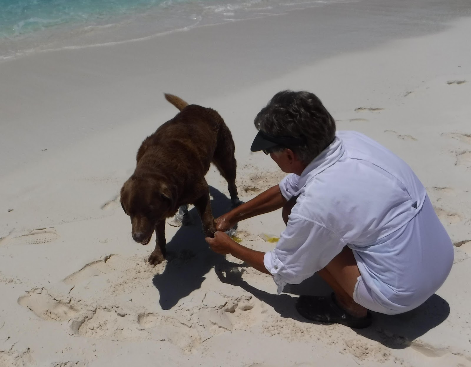
Yesterday we tendered back over past Club Med to Rickie's Flamingo and the massage shack, where we had both booked 1pm sessions. The massage place is on island time and our massages actually happened at 2pm, but we were able to enjoy a drink at Rickie's while we waited and I even went for a swim at the beach.


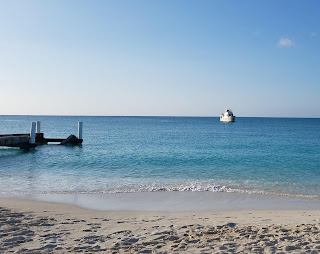
Grace Bay beach from our anchorage.

We had our final meal in Grace Bay at The Deck, this time with Vector as a backdrop. It was a very pleasant visit, and if we ever return to Provo I would head straight for this anchorage and spend the whole time here off the beach. With groceries and a dozen restaurants an easy walk or tender ride, it's hard to beat.

As I wrap up my typing we are just about to make our turn east into the Sandbore Channel leading to the Caicos Bank. Tonight we will be anchored in the Sapodilla Bay area, just across the island from where we've been since arriving. In the morning we will weigh anchor and explore the bank. We found the cell coverage on Middle Caicos to be spotty, so I am not sure when we will next have coverage.

Update: We are anchored in Sapodilla Bay off Provo, on the bank side (map). We are just seven miles from where we started this morning, and four miles from the marina where we spent two weeks. There is a bit of swell here, as our draft prevents us from tucking in behind the point, but we are comfortable.


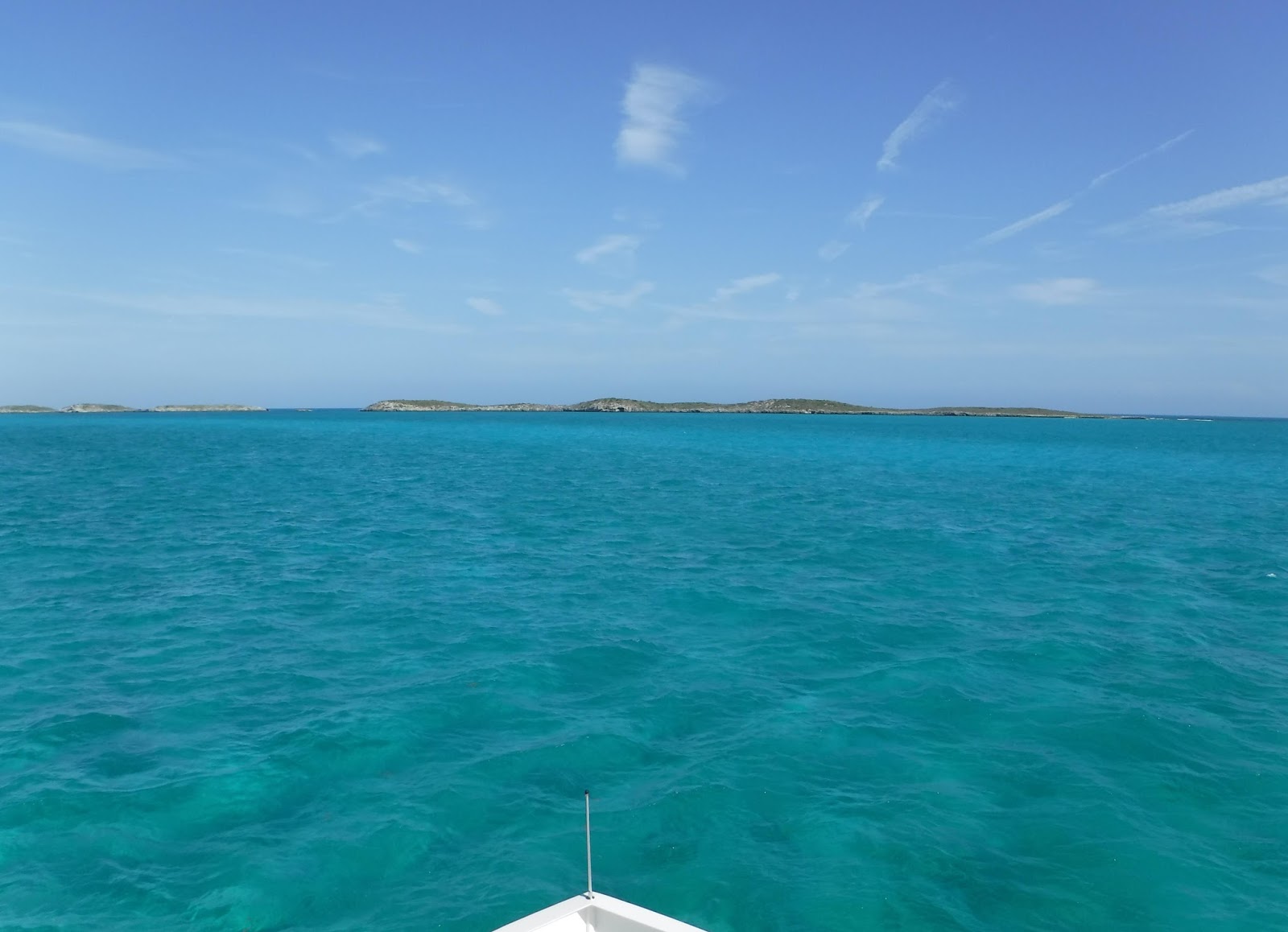
The transition from the deep blue ocean to the turquoise bank is abrupt. The photo does not do it justice.

Crossing on to the bank was mesmerizing; the water went from hundreds of feet deep (our sounder only reads to 300 or so) to thirty feet deep in the span of a football field. Deep blue to turqoise in the blink of an eye; I tried to capture it but the camera does not do it justice. Right there at the crossing, on the north end of West Caicos, are the 30-odd buildings of what was to be the Ritz Carlton resort.


The never-completed Ritz Carlton Molasses Reef Resort on West Caicos.

The entire project ground to a halt in 2008 with the collapse of Lehman Brothers, who was financing the project. New developers would like to take over, but the ravages of a decade mean the buildings will likely have to be razed first. The island is otherwise uninhabited, mostly a national park.

It's too rolly here for us to want to stay more than one night. In the morning we will continue on the bank in hopes of finding a lee someplace.

Friday, April 13, 2018

Provo

We are docked at the Turtle Cove Marina, on The Bight of Grace Bay in Providenciales (map). Providenciales, locally shortened to "Provo," is the name of both the community and the island it inhabits, on the Caicos Bank. It is the northwesternmost  and most populous island of the Turks & Caicos Islands (TCI).

When last I posted, we were passing along the north coast of Crooked Island, and things were a bit smoother and also faster as we continued along to Acklins Island. But as soon as we passed the islands and made our turn towards the southern tip of the Plana Cays we were again in steep head seas, with lots of pitching and a loss of a half knot or so of forward way.

The Plana Cays are uninhabited and unlit, and even though we passed within a mile of the shore I could barely make out a land mass through my glasses. The moon had not yet risen, and all I could see were stars, a handful of lights on Acklins Island astern in the distance, and an offshore tug well to starboard steaming back from San Juan. Even this close to the cays, we were still in thousands of feet of water.


Our digs in Provo, as seen from the Magnolia. Vector is just right of center frame, and the reef is just below the horizon.

We changed watch between the Plana Cays and Mayaguana. Louise had the advantage of a little moonlight on her watch; moonlight considerably lessens the number of trips out onto the deck to scan the horizon. She also got a little Internet from Mayaguana as we passed, and I caught the last of it in the morning after waking up.

By midday the seas had lessened somewhat, and there was a steady improvement as we approached the Caicos Bank. By the time we crossed the territorial limit it looked like we could safely traverse the reef, and we opted to continue to the north side of Provo rather than circle around to come in on the bank. It's more protected there, and the water is prettier, but we would have no choice but to anchor, and the town is really on this side of the island.

Using all the resources available to us (while we still had Internet), we had selected a couple of marked anchorages inside the reef that could be safely navigated without use of a pilot. As we came in radio range, we made the mandatory call on the VHF to Provo Radio, who provides clearance to enter the country and the harbor.

Provo Radio took our details and asked for our destination, and when we gave them the anchorage they notified us we would need a permit to anchor from the Department of Environment and Maritime Affairs (DEMA). I presume this is because the anchorages within the reef on this side are all within the boundaries of the Princess Alexandra National Park. Nothing we had read to this point had warned us about this, including the comprehensive cruising guide in our chart book and the several anchorage markers on the Active Captain database.

To get the permit one calls a marina, and the marina put us in touch with the DEMA representative. He informed us that the permit would cost $100 and we would need to go to the marina to get it. Our plan to drop the hook for a night was falling apart in the last ten miles of our passage.

We always anchor after an overnight passage, even if our ultimate destination is a marina. This allows us to get some decent rest and sleep on a mostly unmoving and quiet boat before having to negotiate possibly tricky entrance channels and execute the most complex evolution we ever undergo: docking the boat. By contrast, dropping the anchor is a walk in the park. It also allows us to defer negotiating possibly shallow channels until the tide is favorable, if it is not upon arrival.

With the only uncomplicated anchoring being offshore and outside the protection of the reef, we instead accelerated our inquiry to the marina. While almost everything here in TCI is expensive, marina rates seem to be the one exception, with our guide saying this one was $1.05 per foot, with a discount for stays of a week. We had already contemplated taking a slip here so that we could offload the scooters to get around town, and also to be in the more protected basin during this unsettled weather.

By a complete accident of timing, we were arriving at the reef just an hour before high tide and an hour before the marina closed. They confirmed what we knew about the rates and that they had space, and we asked them to send the pilot boat out to escort us through the very tricky reef entrance. As it turned out we arrived a few minutes ahead of the pilot and had to circle offshore in the swell.


Following the pilot boat. You can't make out the breakers on the reef in this shot.

The transit through the reef was something of a nail-biting experience, starting with "surfing" the swell into the very narrow opening in the reef, which is immediately followed by a sharp turn to starboard. Our depth sounder indicated just seven feet of water at numerous spots, and this is at nearly high tide. At one point it registered six, which is our draft, but nothing touched and it's possible it was reading the top of some grass. The two men in the pilot boat kept a sharp eye on us the whole time and gave hand signals and radio instructions as needed.

We were at the dock and tied up a little after four with the Quarantine flag flying. I walked to the marina office with our papers and cleared us in with Immigration and then Customs. It was a painless process and we have a seven-day temporary permit for $50. If we stay longer we will need to buy the 90-day permit for $300. In the chaos of the day I forgot to ask about the scooters and I had to call Customs back the next day. They granted permission to offload them so long as we took them with us when we left.

We had been prepared to grill something for dinner in the anchorage, but after adding two hours and the hair-raising reef transit to our passage, and another half hour clearing in, we just stumbled across the parking lot to the Mango Reef restaurant for dinner, which was quite good. We washed it down with drafts from the local Turks Head Brewery.


The festively lit Mango Reef bar and restaurant, on the marina property.

Wednesday we did ... nothing. It always takes us a day to recuperate from overnight passages, especially uncomfortable ones. We tidied up the boat a bit and surfed the Internet on the marina's rather limited WiFi. We did not even offload the scooters. We did leave the compound, though, walking down the block to upscale Italian restaurant Baci, which overlooks the marina from the island side.

While the TCI is geologically and perhaps even geographically an extension of the out islands of the Bahamas chain, culturally and economically it is a world apart. Restaurants here, while having a distinctly tropical flair and a generous proportion of al fresco seating, could easily be mistaken for restaurants in, say, Miami, with western menus and ingredients. And there is no shortage of them, with four restaurants just within walking distance of the marina.

Yesterday we offloaded the scooters, and I spent some time getting them prepped for use after a month sitting on deck. Our plan was to ride into "town," by which I mean the main tourist district of Grace Bay, in the afternoon and then have dinner someplace there. By the time we were ready to leave, though, storm clouds had rolled in and rain was threatening, and we opted instead to again walk to dinner, at the Shark Bite Grill right next door to Baci.

Having missed our chance yesterday, this morning we rolled out fairly early to explore Grace Bay. We proceeded carefully, as it takes some time for the brain to fully register driving on the opposite side of the road, especially on two wheels. We made it as far as Rickie's Flamingo Cafe, on the beach past the main tourist district.

We arrived before opening time and walked out to the beach. I had read a tip on Trip Advisor about an obscure massage shack on the beach next to Rickie's, and we eventually found the proprietor. I booked a massage for tomorrow morning; at $65 for an hour it is less than half the going rate at the numerous resort spas dotting the island.

Returning back through town we pulled into the luxurious Seven Stars resort, perhaps the grand dame of Provo beach resorts, and after being waved through the gate we found our way to the restaurant for a sumptuous buffet breakfast. Afterwards we walked around the resort to see what $490 per night buys you here. The grounds are beautiful and I am sure the service is impeccable, but we were happy to return to our $47 per night marina slip, less than a tenth the price, and counted ourselves fortunate to have escaped with a bill of $30pp for breakfast.


Louise on the immaculately groomed grounds of the Seven Stars. The difference in water color between the pool and the bay behind it is subtle.

We made that our big meal of the day, and this evening we walked up the hill to the Magnolia Wine Bar and Restaurant for cocktails and a light bite on the deck in their bar, with a sweeping view over the marina and out to the bay and reef beyond.

We were the only transient boat when we arrived, but Thursday the somewhat famous Bumfuzzle pulled in, and today the enormous live-aboard dive boat Aggressor II is at the dock for their turn-around. The marina is still recovering from the effects of Hurricanes Irma and Maria, and there is ongoing construction and repair all around us.

We booked our slip for the full week, since it will be at least that long for the weather to pass, and that got us the reduced rate of 90 cents per foot per night. Power here is 60 cents per kWh but we arrived with full batteries and we've been able to get by without air conditioning thus far. When Tuesday rolls around we will have to decide if we can move along to another country, or if we will need to buy a TCI cruising permit. That would give us time to cruise the other islands on the Caicos Banks, and possibly stop in Grand Turk and Salt Cay before moving on.

The next leg is a big question mark. From here we can proceed to the north coast of the Dominican Republic, or we can bypass the DR and go straight to Puerto Rico. Either of those options has us on the very dicey northern route across the Mona Passage. Alternatively we can steam some 350 miles around the western end of Hispaniola, where we can make no stops in Haiti due to insurance restrictions, to make the south coast of the DR for a more comfortable ride to Puerto Rico. We'll be gathering weather information and cruising advice over the next few days before making a decision.

Monday, April 9, 2018

Crooked Island Passage

We are under way off the north coast of Crooked Island (map). We weighed anchor at 10:15 this morning and the chart plotter is predicting an arrival in Providenciales, Turks & Caicos between 4 and 5pm tomorrow afternoon.

We dropped the hook yesterday shortly after 6pm in Clarence Town Harbor (map). There were perhaps a half dozen boats in the anchorage, and just three at the marina. We opted to forgo our usual afternoon beer on deck in favor of heading directly ashore for dinner.


Vector in the distance in Clarence Town Harbor, from the government dock.

We splashed the tender and rode the half mile to the government dock, where the mailboat/ferry was offloading. The small boat steps are partly destroyed so we had some acrobatics to get off the boat and get it tied up. It was a short walk to Rowdy Boys Bar and Grill, which, name notwithstanding, is actually a nice white-tablecloth place attached to a hotel. We did have to ask for directions, graciously provided by local farmer Ambrose who was out driving his herd of goats.

Now that we are in the tropics, and spring is here, the temperatures have become, well, tropical. Thus far it has been mostly comfortable on the boat just with the windows open, especially overnight, but now we need a modicum of air conditioning. After dinner we pulled Mr. Roboto, our LG free-standing air conditioner, out of the closet and set it up in its usual place in the master stateroom, and we turned it on as needed throughout the night.


Scalar, our dinghy, tucked under the government dock, dwarfed by the mail boat.

This morning promptly at 9am I tendered ashore with our passports, cruising permit, and immigration cards to clear out. I landed at the Flying Fish Marina, which is where our guide said customs and immigration clearance could be found. The place was deserted save for a construction crew working on a new building, and a lone employee at the marina desk.

The desk clerk informed me that it was not necessary to clear out of the Bahamas. When I asked where immigration was located, she told me they come down from Stella Maris, well up-island, for a charge of $100. I mentioned we had immigration cards from Bimini that needed to be turned in, and she took them from me to hand to Immigration on their next visit.

Fortunately, Turks & Caicos does not require us to present a zarpe to clear in, so after handing in the immigration cards I called it good and headed out, with our cruising permit still intact. When we come back through the Bahamas on our return we'll check in with Immigration and, if needed, have Customs extend our existing cruising permit. It's good till June 15th, and we may be in-country just a bit longer than that.

After leaving Flying Fish I headed back to the government dock to offload ship's trash before heading back to Vector. If we come back through Clarence Town, the government dock is suitable for us to offload scooters to explore this very large island.


Trash run. The steps are hanging loose at the bottom.

By the time we weighed anchor, half the other boats in the anchorage had already departed, with an excellent travel forecast today. Other than a little swell, we, too, had very benign conditions for our cruise southeast along the Long Island coast.

Between Long Island and Crooked Island lies the Crooked Island Passage, a very deep (8,000') channel that connects the Atlantic Ocean to the Old Bahama Channel that runs along the north coast of Cuba to meet the Strait of Florida at the Cay Sal Bank. The current in the Crooked Island Passage runs north and is quite swift. Since departing the protection of Long Island we've been crabbing an average of 15°, steering a heading of 132°M to yield a Course-over-Ground of 117°M.

Today's wind is partly opposing this current, and we've had steeper-than-forecast seas in the Passage. For the past several hours we've been slamming over them. It's nothing dangerous, just tedious, making it difficult to move around the boat and even uncomfortable at times just to sit still.

As we continue to enter the shadow of Crooked Island, we are hoping this current will ease off somewhat, reducing the crabbing for more speed-made-good and also perhaps some less steep seas. (Update: we are now mid-island and we're still crabbing, but only by 10° now, and the head seas are not as bad.)

We are still on track for an arrival mid-afternoon tomorrow. We may have a bit of Internet in the morning as we pass south side of Mayaguana, but then we will be off-line until we clear in and find some way to get Internet. It seems none of our phones are compatible with the LTE on-island. Also, data there is very expensive if we could even make it work.

Sunday, April 8, 2018

Finally in the tropics

We are underway to Clarence Town, Long Island, from our lovely anchorage at Conception Island. Rum Cay is off the port quarter by ten miles or so, and central Long Island is to starboard; the water here is over 8,000 feet deep. We're within range of a cell tower after three days offline, and I am taking advantage to post the blog.


Our incredibly calm passage to Conception Thursday. The ocean is so flat you can see the clouds reflected. That's Long Island in the distance.

A short while ago we crossed the Tropic of Cancer and so we are finally officially in the tropics. I'm pretty sure this is Vector's first foray, having stopped just short, in Georgetown, on the last skipper's watch. As I type, Holland America's Nieuw Amsterdam is rapidly gaining on us and will pass us about two miles off our port side, her passengers also celebrating their arrival in the tropics.


Vector and Maerin at Conception Island.

We had a lovely three days at Conception. We got within two miles of the anchorage before the last of our cell signal faded, not really to be seen again until just a few minutes ago. By leaving my phone on the flybridge, I could get text email daily as the phone would briefly pick up enough 2g signal to retrieve a message or two. That let us get the daily marine forecasts without having to fire up the sat phone.


The ocean side of the island is littered with plastic that washed ashore. At one point I found a doll that may well have come from the El Faro sinking.

Maerin left Georgetown 40 minutes ahead of us, but made a last-minute detour before arriving, in hopes of landing a fish for dinner by cruising outside the park boundary. No such luck, though, and they pulled into the anchorage just a few minute ahead of us. One megayacht and a half dozen sailboats were already anchored. We dropped the hook in 12' between some coral and the beach (map).

We were still in the middle of launching the dinghy when one of the sailboaters zipped by on his tender announcing that there would be a gathering for cocktails on the beach at 4pm. We agreed to wave off our plan for sundowners on Vector with Barb and Steve in favor of going ashore for the gathering.


Party on the beach.

We had a nice time on the beach and enjoyed meeting Maryvonne and Shane from Gem, Josh and Lea from Peacemaker, Dave and Peggy from Cattitude (we had briefly met Dave in Charleston on his way to effect repairs from a lightning strike), Mary and Pete from Last Call, Robin from Endangered Species, Isabelle from Wasabi, and several more names and boats that I can't recall because I exhausted my name capacity by the second beer. Also, I may have mixed up some of the names above, but you get the idea.


The dogs all got along and relaxed on the beach during cocktail hour.

Friday we joined Barb and Steve on a dinghy excursion up the creek to the middle of the island. The creek is only navigable near high tide, and to avoid getting trapped we left considerably ahead of that. We made it about half way before we ran out of depth, so we anchored the dinghy and rode instead with Steve and Barb, whose tender draws a few inches less. The creek is a turtle haven and we saw quite a few large examples, all of whom defied my efforts to snap a photo.


Turtle swimming. Sound is the dinghy motor; we were under way.

Later in the afternoon I joined Barb and Steve for snorkeling while Louise remained on Vector. This was my first real chance to try out my new waterproof camera; sadly I found it very difficult to see the screen while framing the shots. I more or less just had to point the camera in the general direction of what I was trying to shoot. We stopped at three different patch reefs before heading home.


I snapped this grouper checking me out.

I found the reefs here to be in very bad condition. They look to me to be suffering from coral bleaching, but I am by no means educated on the subject. At least one person I spoke with allowed that some damage was being done by illegal lobster fishing (the park itself is a no-take zone). Still, we saw quite a few fish and at least a few of my photos came out OK.


This photo of a handful of small fish clearly shows coral covered in white.

The four of us enjoyed cocktails and dinner aboard Vector, and I finished off the night with a movie on DVD. We are now out of coverage of DirecTV, which we lost before Georgetown, and the broadcast stations out of Georgetown, which include ABC, NBC, and CBS repeated from southeast Florida.


Molly gets her makeshift booties removed by mom.

Yesterday we rode with them to the northern neck of the island, where we walked the short trail across to the ocean-side beach (we anchored on the Sound side). Molly, their dog, had to wear little booties on the trail to keep the brambles off her paws. Conditions here are very different, with good surf on the beach, and numerous coral heads immediately offshore. We walked the beach all the way down to a small cliff, where I snapped a nice photo of the coral heads.


Ocean-side bay. From 20' up you can clearly see the coral dotting the bay.

In the afternoon all four of us went snorkeling, stopping at three different reefs, with more or less the same results as the previous day. In the evening we joined them aboard Maerin for a nice dinner followed by a long game of dominoes; it was a late night.


The rope used to scale the cliff, Batman-style.

The combination of walking, sun, swimming, beer, and a late night took its toll on Louise, who went to bed with a migraine. And so it was that we did not get a chance to discuss the weather, or the plan for the next few days, until coffee this morning.


Louise, Barb, Steve, and Molly in front of the small cliff. To the right the cliff has been eaten away by the surf, which is making a new cut through the island here.

As it turns out, we have excellent passage weather today and tomorrow, deteriorating on Tuesday. Starting Wednesday, we will likely be pinned down for a week, wherever we happen to be. Between here and the Turks & Caicos, there are really no all-weather ports. Clarence Town, where we'll be tonight, has mostly all-around protection if we pick our spot well and/or move around the harbor as needed. But there's not much there, although we should at least have Internet.


These tiny fish preferred to hang out in the shallow little channel being formed by the new cut.

After some quick math and some less quick discussion, we decided instead to make a run for it, stopping tonight in Clarence Town, then clearing out of the Bahamas when Customs opens in the morning, and weighing anchor directly for Providenciales in the Caicos, an overnight trip. The last-minute decision made for a late start, and we're having to run at 1650rpm to arrive in decent daylight, around 6pm, burning an extra gallon an hour.

If our weather window holds, that should put us in the anchorage there mid-day Tuesday, before things get too bad in the Atlantic. If we have any problem going the distance, there are two bail-out options in the Bahamas, but we'll have already cleared out, so all we could do is anchor with our Quarantine Flag flying, or try to clear back in.


I could not capture how incredibly blue this guy was. Coral is to the right, a stark contrast from the ubiquitous sand.

We'll make a final go/no-go decision in the morning after checking the weather. If we go, we'll be leaving the harbor around 10am or so. I expect to have Internet coverage tonight and for perhaps two hours after departure. After that we'll likely be off-line until we clear in to Turks & Caicos sometime Tuesday afternoon or evening. I will post status updates to Vector's Twitter stream until we are back in coverage.

Thursday, April 5, 2018

Sudden departure

I'm making a quick blog post here, under way out of Elizabeth Harbor, because we will likely be offline for the foreseeable future. As always, status updates will then be on Vector's Twitter stream.

We were hoping to spend a week or so in Georgetown, and we've only spent three nights. But weather today is absolutely perfect for crossing to Conception Island, and we have a buddy boat, so we decided to seize the opportunity. As a testament to how good the weather is, we are in a parade of over a dozen boats leaving the harbor for Long Island or Conception Island.


Our anchorage, from the deck at the Lumina resort.

We enjoyed our brief stay, making a stop at the Exuma Market for provisions and having dinner at the brand new Lumina Resort on Stocking Island. We also enjoyed cocktails with friends Bill and Gayle aboard Spiraserpula and with Steve and Barb aboard Maerin.

While having cocktails we learned that Steve and Barb were thinking of heading east to Conception Island. While we had our sights set on the somewhat closer and more developed Long Island, we decided to join them for a few days instead.

Conception Island is remote, undeveloped, and a National Park, and I am pretty sure we will not have any signal there. Long Island is more developed and does have a tower; it's possible we will get some email and a quick weather check as we pass by within a few miles later today.

I'll be saving my blog posts to a text file from now on and will upload the next chance I get.

Sunday, April 1, 2018

Chicken Harbor

We are anchored in Elizabeth Harbor off Sand Dollar Beach, near Georgetown (map). It's good to be back here after an absence of three years. We're already aware of two friends' boats here in the harbor, and we'll more than likely run into another few people we know during the course of our stay.

Yesterday morning we weighed anchor a half hour ahead of high tide and headed out to Cave Cut. But as we approached the cut, we saw ahead of us all the hallmarks of a "rage" -- washing-machine conditions in the inlet caused by wind and surf opposing tidal current. We simply misjudged slack, which apparently leads high by considerably more than half an hour. The tidal current was already running out, causing the rage.

Rather than subject ourselves needlessly to these sort of conditions, we turned around before reaching the cut, and proceeded instead back to our fairly comfortable anchorage to wait another day. As a side benefit, conditions on Exuma Sound today were forecast to be better than yesterday anyway. We resolved to take the dinghy out to the cut ahead of the evening high to see if we could learn something about slack timing.

We had a mostly comfortable day at home, albeit a little rolly from the surge coming around Cave Cay. I got some projects done, including starting to disassemble the old generator raw water pump that I replaced back in December and which needs to be rebuilt.

Before dinner we splashed the tender and rode out to the cut, a full two hours before high tide. At that time the tide was still coming in, rather copiously, and the inlet was relatively calm. From the amount of inrushing current we surmised that there was still as much as an hour before the turn. On our way back we stopped at the Krogen, Lili, and chatted briefly with her owner, Betty, and visiting crew, Jill. We had dinner and a nice sunset on the aft deck.

Sunset over the bank from Cave Cay

This morning we weighed anchor promptly at 8:30, two hours before high tide. We made the inlet at 8:45 with nearly two knots against us. There was no rage, but about 4' of swell which we bounced over until we were well offshore. Unfortunately, the forecast two-foot seas were more like three feet on a four-second period, on the port bow, and made for a very uncomfortable, pitching ride.

The cat announced her displeasure and then retreated to her cube for the entire trip. The humans just suffered through it, but we were basically confined to our chairs except for engine room checks. We had Internet signal most of the way so I caught up on email and social media and got most of this blog post pre-loaded.

There are perhaps 250 boats with us here in the harbor, and I expect we'll be here at least a week. This is the end of the line for many cruisers; some by plan, and others because traveling further south and east from here involves a much larger degree of self-reliance than is required to this point. Many well-laid Caribbean cruising plans get shelved here, earning it the nickname "Chicken Harbor."

If you followed along with us three years ago you may recall that the cruising community is well-connected here, with a daily radio net in the morning and an unending schedule of events and activities, from snorkeling to beach volleyball, pig roasts to rake-and-scrape music and dancing. I expect we'll partake in some of those activities as we reconnect with old friends and make some new ones. We'll also take advantage of the most well-stocked stores we will see in quite a while to top up our provisions.